

Surf Forecasts:

Colombus surf forecast from 3 Aug 2026:
- Most powerful swell: Saturday 8 Aug, 5PM (local time) - 3.5ft (1.1m), 6s period, NE swell with 76 kJ wave energy.
Best Forecast Surf Conditions for Colombus this week:
The most powerful waves expected at Colombus in the next 16 days are 1.1m 6s and forecast to arrive on Saturday (Aug 08) at 5PM. Winds are predicted to be cross-shore at the time the swell arrives. The largest open ocean swell (not directed at the beach) is 1.3m 6s period and expected on Saturday (Aug 08) at 8PM.
| Wave Type | Time (AST) & Date | Wave Height & Period |
|---|---|---|
| Next good surf (1 star+) | - | - |
| Best Surf | - | - |
| Most Powerful | 5PM (Sat 8th Aug) | 3.5ft (1.1m) 6s |
Table - best surf conditions forecast for Colombus over the next 16 days.
The Lowdown
Alright, let's have a look at what's on the table for the coming weeks around Colombus.
First thing to say, folks, it's a quiet run. The water's sitting at a warm 84° right now, which is bang on average for the time of year – no surprises there. But the surf? It's pretty much a no-show for the entire 16-day window. We're talking day after day of tiny, weak waves with poor surf conditions flagged right through. The combined swell energy barely cracks double digits for most of it, and when it does get into the 50s or 80s on a couple of afternoons, the swell height is still under 3 feet. It's just not doing anything.
Now, there is one spot here, Colombus, a reef break that's fairly consistent and fairly exposed. It likes swell from the NW. But the problem is, the entire forecast is delivering tiny NE windswell. The direction is all wrong, and the size is marginal at best. The best morning – and I'm stretching here – is probably Saturday the 8th of August morning. You've got a glassy session with 2ft from the NNE, but that's a 6-second period, combined energy of just 35, and it's still marked as "poor surf conditions." It's a reef, so that short period won't wrap in with any punch.
Thursday the 6th of August afternoon gives you 3ft from the NE, a little more energy (50), but the wind is a cross-offshore breeze so it'll be clean enough. Still, the period is only 6 seconds, so it's going to be a bumpy, weak little wave. Not one to get excited about.
For the rest of the run, it's a long, drawn-out lull. From the 10th of August right through to the 18th, we're looking at swell heights mostly under 1ft, with periods that touch 12 seconds on the 14th and 15th, but the size is just too small to do anything with. The combined energy numbers are in the single digits or low teens – that's barely a ripple.
Honestly, if you're looking to paddle surf, there's nothing here worth chasing. The combination of tiny swell, poor direction, and weak energy means the waves just aren't going to form. This stretch looks far more interesting for kite surfing than paddle surfing, given the consistent cross-off winds and clean conditions, but for a surfer? Leave the board at home. The forecast can change, but for now, it's a blank run.
Rusty.
Short Range ForecastModerate rain (total 11mm), heaviest on Wed afternoon. Warm (max 29°C on Mon morning, min 26°C on Mon night). Wind will be generally light. | Days 4-6 Weather SummaryLight rain (total 4mm), mostly falling on Thu afternoon. Warm (max 29°C on Thu afternoon, min 25°C on Thu night). Wind will be generally light. | ||||||||||||||||||||
Monday 3 | Tuesday 4 | Wednesday 5 | Thursday 6 | Friday 7 | Saturday 8 | Sunday 9 | |||||||||||||||
AM | PM | Night | AM | PM | Night | AM | PM | Night | AM | PM | Night | AM | PM | Night | AM | PM | Night | AM | PM | Night | |
Swell Height Map |  |  |  | 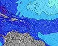 | 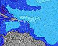 | 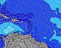 | 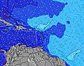 | ||||||||||||||
Wave Height (m) Direction Period (s) | NE 6 | NNE 4 | NE 6 | NE 5 | ENE 4 | NE 5 | NE 5 | NE 5 | NE 6 | NE 6 | NE 6 | NE 6 | NE 8 | NE 6 | NE 6 | NNE 6 | NE 6 | NE 6 | NE 6 | NE 9 | NE 9 |
Wave Graph | |||||||||||||||||||||
23 | 4 | 23 | 10 | 0 | 0 | 10 | 14 | 20 | 19 | 46 | 39 | 57 | 30 | 46 | 27 | 76 | 59 | 26 | 12 | 12 | |
Wind (km/h) | |||||||||||||||||||||
Wind State on-shore cross-onshore cross-shore cross-offshore off-shore glassy | glassy | cross-off | cross-off | cross | cross-off | cross-off | glassy | glassy | cross-off | glassy | cross-off | cross-off | cross-off | cross-off | cross-off | glassy | cross | cross-off | glassy | cross-off | cross-off |
High Tide | 11:36AM0.42m | 11:34PM0.40m | 12:29PM0.44m | 00:10AM0.36m | 1:26PM0.46m | 00:54AM0.31m | 2:30PM0.47m | 1:49AM0.28m | 3:36PM0.49m | 2:55AM0.27m | 4:42PM0.51m | 4:06AM0.27m | 5:46PM0.53m | ||||||||
Low Tide | 5:45PM0.15m | 5:57AM0.08m | 6:47PM0.17m | 6:34AM0.06m | 7:56PM0.18m | 7:20AM0.04m | 9:11PM0.18m | 8:16AM0.02m | 10:26PM0.18m | 9:21AM0.00m | 11:36PM0.17m | 10:28AM-0.01m | 00:35AM0.16m | ||||||||
6:07 | — | — | 6:07 | — | — | 6:07 | — | — | 6:07 | — | — | 6:07 | — | — | 6:07 | — | — | 6:07 | — | — | |
— | 7:01 | — | — | 7:01 | — | — | 7:00 | — | — | 7:00 | — | — | 7:00 | — | — | 7:00 | — | — | 6:59 | — | |
mm | — | — | — | — | 4 | 1 | — | 5 | 1 | — | 2 | — | — | — | — | 1 | — | 1 | — | 1 | — |
Temp °C | 29 | 29 | 28 | 29 | 29 | 27 | 28 | 28 | 27 | 28 | 29 | 28 | 28 | 28 | 27 | 29 | 29 | 28 | 29 | 29 | 28 |
Feels °C | 33 | 31 | 30 | 32 | 32 | 28 | 32 | 31 | 29 | 32 | 32 | 31 | 31 | 31 | 28 | 33 | 31 | 30 | 33 | 31 | 29 |
Swell 1 Height (m) Direction Period (s) | NE 6 | S 5 | NE 6 | S 5 | S 5 | S 5 | S 5 | S 5 | NE 6 | NE 6 | S 6 | NE 6 | NE 8 | NE 8 | NE 9 | NNE 6 | S 5 | NNE 9 | NNE 9 | NE 9 | NE 9 |
23 | 2 | 23 | 2 | 2 | 2 | 2 | 2 | 20 | 19 | 2 | 39 | 57 | 20 | 12 | 27 | 1 | 8 | 7 | 12 | 12 | |
Swell 2 Height (m) Direction Period (s) | S 6 | NNE 4 | S 5 | — | S 9 | — | N 9 | N 9 | S 5 | S 5 | NE 10 | NNE 9 | S 8 | NNE 9 | S 6 | NNE 9 | S 8 | S 5 | — | — | S 5 |
2 | 4 | 2 | — | 2 | — | 2 | 2 | 2 | 2 | 4 | 8 | 5 | 8 | 2 | 8 | 1 | 2 | — | — | 2 | |
Swell 3 Height (m) Direction Period (s) | — | — | — | S 8 | S 8 | SSE 6 | SE 6 | N 11 | NE 8 | NE 10 | S 8 | S 5 | — | S 8 | S 8 | S 5 | NNE 6 | S 8 | N 12 | S 9 | S 9 |
— | — | — | 1 | 1 | 4 | 1 | 3 | 3 | 4 | 1 | 2 | — | 5 | 1 | 2 | 4 | 1 | 3 | 2 | 2 | |
Wind waves Height (m) Direction Period (s) | — | NE 6 | — | NE 5 | ENE 4 | NE 5 | NE 5 | NE 5 | — | — | NE 6 | — | — | NE 6 | NE 6 | — | NE 6 | NE 6 | NE 6 | NE 5 | NE 5 |
— | 43 | — | 10 | 22 | 17 | 10 | 14 | — | — | 46 | — | — | 30 | 46 | — | 76 | 59 | 26 | 51 | 35 | |
Nearest Offshore or Glassy | |||||||||||||||||||||
Distance (km) | 13 | 295 | 36 | 467 | 467 | 117 | 295 | 13 | 16 | 13 | 295 | 50 | 6 | 6 | 217 | 13 | 467 | 50 | 13 | 638 | 50 |
Best forecast wave conditions in Puerto Rico | |||||||||||||||||||||
Best forecast wave conditions in Puerto Rico | |||||||||||||||||||||
Header Global | |||||||||||||||||||||
- Map Icons:
 Break
Break Live Wave Height (m)
 Live Wind Speed (km/h)
 Surf Rating (10 Max)
 Ocean Swells (m)
- Wind Speed (km/h)
Latest Updates


FREE! Surf-Forecast.com widget for your website
The surf report / weather widget below is available to embed on third party websites free of charge and provides a summary of our Colombus surf forecast. Simply grab the html code snippet that we provide and paste it into your own site. You can choose your preferred language and metric/imperial units for the surf forecast feed to suit users of your site. Click here to get the code.
Information about the Colombus Surf forecast
The above surf forecast table for Colombus provides essential information for determining whether the surfing conditions will be good over the next 16 days. A general guide to surfing at Colombus can be found by selecting the local surf guide option on the grey menu. Our Colombus surf forecast is unique since it includes wave energy (power) that defines the real feel of the surf rather than just the height or the period. If you surf the same spot (Colombus) regularly then make a mental note of the wave energy from the surf forecast table each time you go. Very soon you may start to choose your surf days based on the wave energy alone combined with our forecast of favourable offshore wind conditions. Our star ratings will help here and of course you will also find the usual wave height and period predictions on our surf forecasts as well as a full break down of the swell components under our advanced users option (to reveal that, click the little Einstein character under the tide times).
Further information to help with frequently asked questions about our surf forecast for Colombus may be found under the help tab on the top menu and also by moving your mouse over the question marks on the surf forecast table itself. Please always bear in mind that the forecast is for near-shore open water and local factors at each surf break influence the actual breaking wave height, such as the beach / reef profile, water depths offshore and shelter.
 Nearest