

Surf Forecasts:

Caballos surf forecast from 2 Aug 2026:
- Most powerful swell: Sunday 9 Aug, 2AM (local time) - 5ft (1.6m), 6s period, E swell with 213 kJ wave energy.
Best Forecast Surf Conditions for Caballos this week:
The most powerful waves expected at Caballos in the next 16 days are 1.6m 6s and forecast to arrive on Sunday (Aug 09) at 2AM. Winds are predicted to be cross-offshore at the time the swell arrives. The largest open ocean swell (not directed at the beach) is 1.2m 6s period and expected on Friday (Aug 07) at 5AM.
| Wave Type | Time (AST) & Date | Wave Height & Period |
|---|---|---|
| Next good surf (1 star+) | - | - |
| Best Surf | - | - |
| Most Powerful | 2AM (Sun 9th Aug) | 5ft (1.6m) 6s |
Table - best surf conditions forecast for Caballos over the next 16 days.
The Lowdown
Alright folks, Rusty here. Let’s have a look at what’s comin’ our way.
Right off the bat, I gotta be straight with you – the next week and a half is lookin’ rough. There’s a big gap of flat, poor surf that stretches from the start of the forecast all the way through to Friday, the 7th of August, with nothing worth paddlin’ out for. The wind is howlin’ cross-off from the east, the swell is weak and short-period, and the wave energy is just pathetic. The water temperature is a balmy 84°, which is about average for the time of year, but that’s about the only thing goin’ right.
The first real flicker of somethin’ happens on Friday morning, the 7th of August, at Caballos (reef). The swell bumps up to 4 ft from the ENE, but the period is still short at 8 seconds. The energy jumps to a moderate 317, and while the rating is still just marginal, it’s the first sign of life. The wind is still a stiff 16 mph cross-off from the east, so it won’t be glassy, but it’s clean. This is a spot for the advanced crew only, and it’s inconsistent, so don’t expect a lot of waves. The best bet is to wait for a set and make it count.
After that, we fall back into a funk of poor surf through the 8th, 9th, and into the 10th. The swell tries to push up to 5 ft on Monday the 10th, but the period is still a short 7 seconds, and the wind is pickin’ up to a fresh 19 mph. The energy is there (218), but with that wind and short period, it’s just a messy, blown-out wall. Honestly, for the beach breaks around here, this setup looks more interestin’ for kite surfers than paddle surfers.
The standouts are few and far between, but the best chance in the whole 16-day window looks like Monday morning, the 17th of August. The swell is 5 ft from the east, still a short 6-second period, but the energy surges to 282. The wind drops back to a moderate 16 mph cross-off. It’s still just a marginal call, but for a spot that’s inconsistent, this is the best we’re gonna get. The swell direction from the east is a solid match for the optimum N direction? No, it’s not ideal, but it’s the best we’ve got. For a reef break, the short period means the waves will be a bit crumbly, but the energy might just push through enough for a few fun ones.
Overall, it’s a lean run. The second week shows a bit more energy, but the wind stays stubbornly onshore-ish. Don’t get your hopes up too high for the long-range stuff; it’s promising but less certain. Keep your eyes peeled for the 17th, but don’t hold your breath.
Rusty.
Short Range ForecastLight rain (total 2mm), mostly falling on Sun morning. Warm (max 30°C on Sun afternoon, min 26°C on Sun night). Wind will be generally light. | Days 4-6 Weather SummaryLight rain (total 2mm), mostly falling on Fri night. Warm (max 30°C on Wed afternoon, min 26°C on Wed night). Wind will be generally light. | ||||||||||||||||||||
Sunday 2 | Monday 3 | Tuesday 4 | Wednesday 5 | Thursday 6 | Friday 7 | Saturday 8 | |||||||||||||||
AM | PM | Night | AM | PM | Night | AM | PM | Night | AM | PM | Night | AM | PM | Night | AM | PM | Night | AM | PM | Night | |
Swell Height Map |  |  |  | 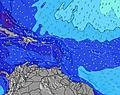 | 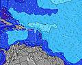 | 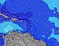 | 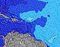 | ||||||||||||||
Wave Height (m) Direction Period (s) | E 7 | E 7 | ENE 7 | ENE 6 | ENE 6 | ENE 6 | ENE 6 | ENE 6 | ENE 6 | ENE 6 | ENE 6 | ENE 6 | ENE 7 | NE 8 | ENE 7 | ENE 8 | ENE 8 | ENE 7 | ENE 6 | ENE 7 | E 6 |
Wave Graph | |||||||||||||||||||||
134 | 120 | 111 | 64 | 68 | 58 | 55 | 48 | 47 | 49 | 48 | 48 | 68 | 35 | 140 | 168 | 117 | 99 | 72 | 99 | 213 | |
Wind (km/h) | |||||||||||||||||||||
Wind State on-shore cross-onshore cross-shore cross-offshore off-shore glassy | cross-off | cross-off | cross-off | cross-off | cross-off | cross-off | cross-off | cross-off | cross-off | cross-off | cross-off | cross-off | cross-off | cross-off | cross-off | cross-off | cross-off | cross-off | cross-off | cross-off | cross-off |
High Tide | 11:51AM0.33m | 00:05AM0.35m | 12:49PM0.36m | 00:32AM0.32m | 1:52PM0.37m | 00:59AM0.29m | 3:03PM0.40m | 1:28AM0.27m | 4:17PM0.42m | 2:04AM0.25m | 5:29PM0.44m | 2:58AM0.24m | 6:34PM0.46m | 4:19AM0.23m | |||||||
Low Tide | 5:55PM0.07m | 6:23AM0.05m | 6:49PM0.11m | 6:59AM0.02m | 7:53PM0.16m | 7:40AM-0.01m | 9:09PM0.20m | 8:29AM-0.04m | 10:43PM0.22m | 9:25AM-0.05m | 00:20AM0.22m | 10:28AM-0.06m | 1:30AM0.21m | ||||||||
6:01 | — | — | 6:01 | — | — | 6:01 | — | — | 6:01 | — | — | 6:03 | — | — | 6:03 | — | — | 6:03 | — | — | |
— | 6:58 | — | — | 6:58 | — | — | 6:57 | — | — | 6:57 | — | — | 6:55 | — | — | 6:55 | — | — | 6:54 | — | |
mm | 1 | — | — | — | — | — | — | — | 1 | — | — | — | — | — | — | — | — | 2 | 1 | 1 | 2 |
Temp °C | 29 | 30 | 27 | 29 | 30 | 28 | 29 | 29 | 28 | 29 | 30 | 27 | 29 | 30 | 27 | 29 | 29 | 27 | 29 | 28 | 27 |
Feels °C | 29 | 30 | 29 | 29 | 29 | 29 | 31 | 29 | 30 | 30 | 30 | 29 | 30 | 30 | 29 | 29 | 29 | 28 | 29 | 28 | 27 |
Swell 1 Height (m) Direction Period (s) | — | — | ENE 7 | — | SE 6 | ENE 6 | ENE 6 | SE 6 | ENE 6 | ENE 6 | N 11 | ENE 6 | E 10 | NE 8 | ENE 7 | NE 8 | NE 9 | ENE 7 | NE 9 | NE 9 | ENE 6 |
— | — | 111 | — | 10 | 58 | 55 | 5 | 47 | 49 | 2 | 48 | 8 | 35 | 96 | 147 | 22 | 99 | 20 | 19 | 161 | |
Swell 2 Height (m) Direction Period (s) | — | — | — | — | — | N 10 | — | — | N 9 | N 9 | N 9 | NE 11 | NE 10 | NE 8 | NE 9 | E 9 | NE 9 | NE 9 | NE 9 | — | NE 9 |
— | — | — | — | — | 2 | — | — | 2 | 2 | 2 | 5 | 4 | 35 | 22 | 2 | 22 | 20 | 20 | — | 12 | |
Swell 3 Height (m) Direction Period (s) | — | — | — | — | — | — | — | — | — | N 12 | E 11 | E 11 | NE 10 | E 10 | E 9 | — | — | — | — | — | NE 12 |
— | — | — | — | — | — | — | — | — | 3 | 2 | 2 | 4 | 2 | 6 | — | — | — | — | — | 6 | |
Wind waves Height (m) Direction Period (s) | E 7 | E 7 | E 6 | ENE 6 | ENE 6 | — | — | ENE 6 | — | — | ENE 6 | — | ENE 7 | ENE 6 | ENE 7 | ENE 8 | ENE 8 | ENE 5 | ENE 6 | ENE 7 | E 6 |
134 | 120 | 89 | 64 | 68 | — | — | 48 | — | — | 48 | — | 68 | 60 | 140 | 168 | 117 | 60 | 72 | 99 | 213 | |
Nearest Offshore or Glassy | |||||||||||||||||||||
Distance (km) | 55 | 845 | 9 | 55 | 344 | 24 | 170 | 875 | 5 | 170 | 114 | 5 | 120 | 141 | 24 | 690 | 845 | 24 | 1348 | 845 | 123 |
Best forecast wave conditions in Puerto Rico | |||||||||||||||||||||
Best forecast wave conditions in Puerto Rico | |||||||||||||||||||||
Header Global | |||||||||||||||||||||
- Map Icons:
 Break
Break Live Wave Height (m)
 Live Wind Speed (km/h)
 Surf Rating (10 Max)
 Ocean Swells (m)
- Wind Speed (km/h)
Latest Updates


FREE! Surf-Forecast.com widget for your website
The surf report / weather widget below is available to embed on third party websites free of charge and provides a summary of our Caballos surf forecast. Simply grab the html code snippet that we provide and paste it into your own site. You can choose your preferred language and metric/imperial units for the surf forecast feed to suit users of your site. Click here to get the code.
Information about the Caballos Surf forecast
The above surf forecast table for Caballos provides essential information for determining whether the surfing conditions will be good over the next 16 days. A general guide to surfing at Caballos can be found by selecting the local surf guide option on the grey menu. Our Caballos surf forecast is unique since it includes wave energy (power) that defines the real feel of the surf rather than just the height or the period. If you surf the same spot (Caballos) regularly then make a mental note of the wave energy from the surf forecast table each time you go. Very soon you may start to choose your surf days based on the wave energy alone combined with our forecast of favourable offshore wind conditions. Our star ratings will help here and of course you will also find the usual wave height and period predictions on our surf forecasts as well as a full break down of the swell components under our advanced users option (to reveal that, click the little Einstein character under the tide times).
Further information to help with frequently asked questions about our surf forecast for Caballos may be found under the help tab on the top menu and also by moving your mouse over the question marks on the surf forecast table itself. Please always bear in mind that the forecast is for near-shore open water and local factors at each surf break influence the actual breaking wave height, such as the beach / reef profile, water depths offshore and shelter.
 Nearest