

Surf Forecasts:

Audierne surf forecast from 2 Aug 2026:
- Best quality surf: Wednesday 5 Aug, 11PM (local time) - 4.5ft (1.3m), 7s period, WNW swell with offshore winds.
- Most powerful swell: Wednesday 5 Aug, 11PM (local time) - 4.5ft (1.3m), 7s period, WNW swell with 181 kJ wave energy.
- Next surfable swell (1★+): Wednesday 5 Aug, 8AM (local time) - 3.5ft (1.1m), 7s period with W swell.
Best Forecast Surf Conditions for Audierne this week:
The surf forecast for Audierne over the next 16 days: The first swell (rated 1 star or higher) is forecast to arrive on Wednesday (Aug 05) at 8AM. The primary swell is predicted to be 1.1m and 7s period with a secondary swell of 0.5m and 6s. The wind is predicted to be cross-offshore as the swell arrives.
The most powerful waves expected at Audierne in the next 16 days are 1.3m 7s and forecast to arrive on Wednesday (Aug 05) at 11PM. Winds are predicted to be offshore at the time the swell arrives. The largest open ocean swell (not directed at the beach) is 1.0m 6s period and expected on Sunday (Aug 09) at 5AM.
| Wave Type | Time (CEST) & Date | Wave Height & Period |
|---|---|---|
| Next good surf (1 star+) | 8AM (Wed 5th Aug) | 3.5ft (1.1m) 7s |
| Best Surf | 11PM (Wed 5th Aug) | 4.5ft (1.3m) 7s |
| Most Powerful | 11PM (Wed 5th Aug) | 4.5ft (1.3m) 7s |
Table - best surf conditions forecast for Audierne over the next 16 days.
The Lowdown
Right then, let’s have a look at what’s on the cards for the Audierne area over the next couple of weeks.
Straight up, I’ll be honest with you: the first ten days or so are a bit of a write-off. We’re looking at a long stretch of poor surf conditions with no real quality on offer. The swell is tiny and weak, with combined energy values stuck below 100 for most of the first week, and the wind is mostly cross or cross-off, keeping things messy. There’s just nothing to get excited about until we get into the second week.
Now, the first real glimmer of hope shows up on Monday, the 12th of August. Early that morning we’ll see a bit of a pulse of energy pushing in from the WSW at about 4ft, with a 9-second period. The combined energy jumps to 211 (moderate), and with a light offshore from the NNE, it’ll be clean. The report calls it “surfable but very ordinary,” and I’d agree – it’s a slight step up, but not a stand-out.
The true standout, the one you’ve been waiting for, arrives on Sunday, the 16th of August. The morning session is the pick of the whole forecast. The swell builds to about 6ft out of the WNW, with a period of 8 seconds. The combined energy hits 380 (moderate to strong) and the wind is a light cross-off from the NW, keeping things clean. It’s a reef break, so it’s experts only, especially with that size. This is the best on offer.
Then, on Monday, the 17th of August, the swell keeps building. The morning shows about 8ft from the west with a 9-second period, and the combined energy is a massive 912 (very strong). The wind is light and cross-off from the NNW. This is heavy, expert-only territory. The report says “very good surf conditions,” and it’s a solid long-range promise, but remember, that’s a week and a half out, so it’s a bit of a tease for now.
The water temperature is about average for this time of year, so nothing wild there.
So, to sum it up: a long, flat start, then one decent morning on the 12th, but the real magic is the morning of the 16th and the solid swell on the 17th. Keep your eye on that.
Rusty.
Short Range ForecastSome drizzle, heaviest during Tue morning. Warm (max 22°C on Sun night, min 15°C on Sun morning). Wind will be generally light. | Days 4-6 Weather SummaryMostly dry. Very mild (max 18°C on Wed morning, min 15°C on Thu night). Mainly fresh winds. | ||||||||||||||||||||
Sunday 2 | Monday 3 | Tuesday 4 | Wednesday 5 | Thursday 6 | Friday 7 | Saturday 8 | |||||||||||||||
AM | PM | Night | AM | PM | Night | AM | PM | Night | AM | PM | Night | AM | PM | Night | AM | PM | Night | AM | PM | Night | |
Swell Height Map |  |  |  |  |  |  | 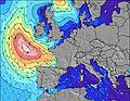 | ||||||||||||||
Wave Height (m) Direction Period (s) | W 8 | WSW 10 | WSW 9 | WSW 8 | WSW 8 | WSW 8 | WSW 7 | SW 7 | SW 6 | WSW 7 | W 7 | NW 7 | WNW 6 | WNW 7 | NW 6 | W 9 | W 9 | W 9 | WNW 9 | WNW 9 | WNW 9 |
Wave Graph | |||||||||||||||||||||
36 | 20 | 58 | 54 | 55 | 90 | 169 | 128 | 68 | 161 | 159 | 71 | 80 | 76 | 37 | 16 | 15 | 15 | 35 | 45 | 29 | |
Wind (km/h) | |||||||||||||||||||||
Wind State on-shore cross-onshore cross-shore cross-offshore off-shore glassy | cross-off | cross-off | off | cross-off | cross-on | cross-on | cross-on | cross-on | cross-on | cross-off | cross-off | off | cross-off | cross-off | off | off | cross-off | off | off | cross-off | off |
High Tide | 7:56PM4.96m | 8:16AM4.70m | 8:31PM4.82m | 8:53AM4.57m | 9:11PM4.62m | 9:37AM4.38m | 9:59PM4.35m | 10:29AM4.15m | 11:00PM4.07m | 11:39AM3.95m | 00:22AM3.88m | 1:08PM3.93m | 1:55AM3.94m | ||||||||
Low Tide | 1:51PM0.55m | 2:14AM0.49m | 2:26PM0.65m | 2:50AM0.62m | 3:05PM0.80m | 3:31AM0.81m | 3:50PM1.00m | 4:20AM1.05m | 4:48PM1.22m | 5:24AM1.29m | 6:03PM1.37m | 6:44AM1.41m | 7:31PM1.34m | ||||||||
6:54 | — | — | 6:56 | — | — | 6:56 | — | — | 6:58 | — | — | 7:00 | — | — | 7:01 | — | — | 7:01 | — | — | |
— | — | 9:52 | — | — | 9:51 | — | — | 9:50 | — | — | 9:47 | — | — | 9:46 | — | — | 9:45 | — | — | 9:44 | |
mm | — | — | — | — | — | — | 1 | — | — | — | — | — | — | — | — | — | — | — | — | — | — |
Temp °C | 19 | 20 | 22 | 18 | 20 | 20 | 20 | 20 | 20 | 18 | 18 | 18 | 17 | 17 | 17 | 16 | 17 | 18 | 18 | 21 | 19 |
Feels °C | 17 | 17 | 19 | 16 | 18 | 19 | 19 | 19 | 19 | 17 | 15 | 14 | 15 | 13 | 13 | 14 | 11 | 12 | 16 | 15 | 13 |
Swell 1 Height (m) Direction Period (s) | W 8 | WSW 8 | WSW 9 | WSW 8 | WSW 8 | WSW 8 | W 9 | W 9 | W 8 | WSW 7 | S 13 | NW 7 | WNW 6 | W 10 | NW 6 | NW 5 | W 9 | W 9 | WNW 9 | WNW 9 | WNW 9 |
36 | 13 | 58 | 54 | 55 | 90 | 14 | 25 | 29 | 161 | 3 | 71 | 80 | 17 | 37 | 14 | 15 | 15 | 35 | 45 | 29 | |
Swell 2 Height (m) Direction Period (s) | NW 7 | WSW 10 | NW 6 | NW 7 | NW 7 | W 6 | — | — | — | S 13 | — | WSW 6 | W 10 | S 12 | W 10 | W 9 | SW 6 | NW 10 | WNW 6 | E 4 | — |
7 | 20 | 6 | 2 | 2 | 1 | — | — | — | 3 | — | 33 | 18 | 3 | 17 | 16 | 1 | 4 | 3 | 2 | — | |
Swell 3 Height (m) Direction Period (s) | — | W 8 | — | — | — | — | — | — | — | — | — | W 10 | S 12 | — | S 12 | — | S 12 | W 6 | W 9 | — | — |
— | 1 | — | — | — | — | — | — | — | — | — | 18 | 3 | — | 3 | — | 3 | 1 | 6 | — | — | |
Wind waves Height (m) Direction Period (s) | E 5 | NW 6 | — | — | WSW 2 | SW 3 | WSW 7 | SW 7 | SW 6 | — | W 7 | — | — | WNW 7 | — | — | NW 4 | NNW 5 | NNW 5 | NNW 4 | NNW 5 |
11 | 10 | — | — | 1 | 3 | 169 | 128 | 68 | — | 159 | — | — | 76 | — | — | 16 | 17 | 13 | 30 | 42 | |
Nearest Offshore or Glassy | |||||||||||||||||||||
Distance (km) | 4 | 245 | 598 | 2 | 2 | 245 | 18 | 25 | 18 | 18 | 18 | 39 | 32 | 2 | 498 | 0 | 2 | 239 | 501 | 21 | 530 |
Best forecast wave conditions in Finistere - Brittany | |||||||||||||||||||||
Best forecast wave conditions in France | |||||||||||||||||||||
Header Global | |||||||||||||||||||||
- Map Icons:
 Break
Break Live Wave Height (m)
 Live Wind Speed (km/h)
 Surf Rating (10 Max)
 Ocean Swells (m)
- Wind Speed (km/h)
Latest Updates


FREE! Surf-Forecast.com widget for your website
The surf report / weather widget below is available to embed on third party websites free of charge and provides a summary of our Audierne surf forecast. Simply grab the html code snippet that we provide and paste it into your own site. You can choose your preferred language and metric/imperial units for the surf forecast feed to suit users of your site. Click here to get the code.
Information about the Audierne Surf forecast
The above surf forecast table for Audierne provides essential information for determining whether the surfing conditions will be good over the next 16 days. A general guide to surfing at Audierne can be found by selecting the local surf guide option on the grey menu. Our Audierne surf forecast is unique since it includes wave energy (power) that defines the real feel of the surf rather than just the height or the period. If you surf the same spot (Audierne) regularly then make a mental note of the wave energy from the surf forecast table each time you go. Very soon you may start to choose your surf days based on the wave energy alone combined with our forecast of favourable offshore wind conditions. Our star ratings will help here and of course you will also find the usual wave height and period predictions on our surf forecasts as well as a full break down of the swell components under our advanced users option (to reveal that, click the little Einstein character under the tide times).
Further information to help with frequently asked questions about our surf forecast for Audierne may be found under the help tab on the top menu and also by moving your mouse over the question marks on the surf forecast table itself. Please always bear in mind that the forecast is for near-shore open water and local factors at each surf break influence the actual breaking wave height, such as the beach / reef profile, water depths offshore and shelter.
Are you planning a holiday in Finistere - Brittany? If you are looking for accommodation near Audierne, camping, hotels and holiday cottages in Finistere - Brittany, consider staying in Douarnenez which is 19 km (12 miles) away. Other places in and around Finistere - Brittany where you can find information about places to rent, and car hire include Camaret-sur-Mer which is 29 km (18 miles) away, Quimper, Loctudy and Brest.
 Nearest