

Surf Forecasts:

Anne Street Reef surf forecast from 3 Aug 2026:
- Best quality surf: Sunday 9 Aug, 1AM (local time) - 4.5ft (1.3m), 9s period, ESE swell with glassy winds.
- Most powerful swell: Sunday 9 Aug, 1AM (local time) - 4.5ft (1.3m), 9s period, ESE swell with 264 kJ wave energy.
- Next surfable swell (1★+): Tuesday 4 Aug, 1AM (local time) - 2.5ft (0.7m), 10s period with SE swell.
Best Forecast Surf Conditions for Anne Street Reef this week:
The surf forecast for Anne Street Reef over the next 16 days: The first swell (rated 1 star or higher) is forecast to arrive on Tuesday (Aug 04) at 1AM. The primary swell is predicted to be 0.7m and 10s period with a secondary swell of 0.6m and 6s. The wind is predicted to be glassy as the swell arrives.
The most powerful waves expected at Anne Street Reef in the next 16 days are 1.3m 9s and forecast to arrive on Sunday (Aug 09) at 1AM. Winds are predicted to be glassy at the time the swell arrives. The largest open ocean swell (not directed at the beach) is 0.4m 3s period and expected on Saturday (Aug 08) at 10AM.
| Wave Type | Time (AEST) & Date | Wave Height & Period |
|---|---|---|
| Next good surf (1 star+) | 1AM (Tue 4th Aug) | 2.5ft (0.7m) 10s |
| Best Surf | 1AM (Sun 9th Aug) | 4.5ft (1.3m) 9s |
| Most Powerful | 1AM (Sun 9th Aug) | 4.5ft (1.3m) 9s |
Table - best surf conditions forecast for Anne Street Reef over the next 16 days.
The Lowdown
Alright, Rusty here, let’s talk about what’s cookin’ at Anne Street Reef.
Alright, look, I’m not gonna sugarcoat it – this is a pretty grim run for the reef. We’ve got a 16-day window here, but it’s full of weak, small surf and mostly average to poor conditions. The water is running a bit colder than normal for this time of year, sitting at 68°.
The first real chance to wet a line comes on Monday the 3rd, but it’s a write-off. We’re looking at a tiny 2ft SE swell with a 11-second period, but the wind is cross-on from the SE at 6 mph, making it choppy and messy. The energy is weak (171). Skip it.
Tuesday the 4th morning is the real tease. It’s glassy, dead calm, with a 2ft SE swell. The period has dropped to 9 seconds, so it’s a bit weak, but the glassy conditions are a major positive. The wave energy is minimal (103), so it’s not going to be a classic, but it’s the only time the wind truly cooperates. The afternoon turns onshore and it’s over.
We get a few mornings with clean conditions and a little more push – Wednesday the 5th morning has a 3ft E swell, 10-second period, with a light cross-offshore wind from the SW at 3 mph. The energy is moderate (170), and it’s clean. Thursday the 6th morning is similar, but the swell drops back to 2ft and the period is a short 8 seconds. Friday the 7th morning is also clean with a 3ft ENE swell, but again, the period is short at 8 seconds.
The weekend of the 8th and 9th is a mixed bag. Saturday the 8th is a total mess with cross-shore winds up to 16 mph and a 3ft to 4ft E swell that’s short-period and messy. The energy jumps up on Saturday afternoon (244), but the wind is just too strong for the reef. Sunday the 9th morning is the best of the whole forecast. The swell is 4ft from the east, 9-second period, with a light cross-offshore wind from the SSW at 3 mph. It’s clean, and the energy is solid (278). This is your standout session if you’re chasing something. The NE wind will ruin it by the afternoon.
After that, it’s a long, slow decline. We get a few more clean mornings (Monday the 10th, Thursday the 13th, Friday the 14th afternoon) but the swell is tiny, never breaking 3ft, and the energy is weak. The period stays around 8-10 seconds, so no real punch. The wind on the 14th does go offshore from the SW at 12 mph, but the swell is only 2ft to 3ft. It’s not worth paddling out for.
From the 15th onward, it’s essentially flat. Swell drops to 2ft, energy is below 100, and the winds are either cross-shore or onshore. There’s a long gap of no real surf from the 15th of August right through to the end of the window.
The only real standout is Sunday morning the 9th of August. Clean, 4ft of east swell, moderate energy, and a light cross-offshore breeze. It’s the best on offer, but it’s far from a classic. For the rest of the time, keep your board in the car and wait for a better forecast.
That’s it from me. Keep your eyes on the horizon.
- Rusty
Short Range ForecastMostly dry. Warm (max 20°C on Wed morning, min 15°C on Mon night). Wind will be generally light. | Days 5-7 Weather SummaryMostly dry. Warm (max 20°C on Sun morning, min 13°C on Thu night). Wind will be generally light. | ||||||||||||||||||
Tuesday 4 | Wednesday 5 | Thursday 6 | Friday 7 | Saturday 8 | Sunday 9 | ||||||||||||||
Night | AM | PM | Night | AM | PM | Night | AM | PM | Night | AM | PM | Night | AM | PM | Night | AM | PM | Night | |
Swell Height Map |  | 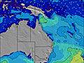 | 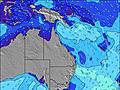 | 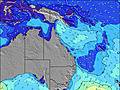 | 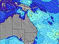 |  |  | ||||||||||||
Wave Height (m) Direction Period (s) | SE 10 | SE 9 | ENE 7 | ESE 9 | E 10 | E 8 | ENE 7 | ENE 7 | ENE 7 | ENE 7 | ENE 7 | ENE 7 | ENE 8 | ENE 8 | E 8 | ESE 9 | E 9 | E 9 | E 9 |
Wave Graph | |||||||||||||||||||
104 | 65 | 35 | 70 | 158 | 113 | 73 | 48 | 48 | 37 | 54 | 67 | 94 | 75 | 58 | 264 | 230 | 239 | 162 | |
Wind (km/h) | |||||||||||||||||||
Wind State on-shore cross-onshore cross-shore cross-offshore off-shore glassy | glassy | cross-off | on | cross-off | cross-off | on | cross-off | cross-off | cross-on | off | cross-off | cross-on | cross-off | cross-off | cross | glassy | glassy | cross-on | cross-off |
High Tide | 11:02PM1.51m | 11:45AM1.43m | 11:44PM1.36m | 12:44PM1.44m | 00:36AM1.21m | 1:57PM1.48m | 1:47AM1.08m | 3:19PM1.55m | 3:19AM1.01m | 4:34PM1.67m | 4:44AM1.03m | 5:37PM1.80m | |||||||
Low Tide | 5:27AM0.28m | 5:50PM0.49m | 6:09AM0.31m | 7:00PM0.58m | 7:01AM0.33m | 8:30PM0.62m | 8:05AM0.34m | 10:05PM0.58m | 9:18AM0.33m | 11:24PM0.49m | 10:30AM0.27m | 00:25AM0.37m | |||||||
— | 6:26 | — | — | 6:24 | — | — | 6:24 | — | — | 6:24 | — | — | 6:22 | — | — | 6:22 | — | — | |
— | — | 5:21 | — | — | 5:21 | — | — | 5:22 | — | — | 5:22 | — | — | 5:22 | — | — | 5:22 | — | |
mm | — | — | — | — | — | — | — | — | — | — | — | — | — | — | — | — | — | — | — |
Temp °C | 17 | 18 | 18 | 17 | 20 | 19 | 17 | 18 | 18 | 17 | 18 | 18 | 16 | 18 | 18 | 16 | 20 | 19 | 17 |
Feels °C | 16 | 16 | 16 | 16 | 17 | 17 | 16 | 15 | 15 | 17 | 16 | 16 | 15 | 15 | 16 | 15 | 19 | 16 | 15 |
Swell 1 Height (m) Direction Period (s) | SE 10 | SE 9 | ENE 7 | ESE 9 | E 10 | E 8 | ENE 7 | ENE 7 | ENE 7 | ENE 7 | ENE 7 | ENE 7 | ENE 8 | ENE 8 | E 8 | E 9 | E 9 | E 9 | E 9 |
104 | 65 | 34 | 70 | 158 | 113 | 61 | 40 | 48 | 37 | 54 | 67 | 94 | 75 | 58 | 181 | 230 | 239 | 162 | |
Swell 2 Height (m) Direction Period (s) | ENE 6 | E 6 | SE 8 | ENE 6 | E 18 | E 18 | ESE 8 | E 8 | E 8 | ESE 8 | ESE 8 | ESE 10 | SE 10 | ESE 10 | NE 7 | NE 9 | NE 8 | NE 8 | NE 8 |
29 | 29 | 35 | 24 | 6 | 6 | 73 | 48 | 33 | 19 | 12 | 19 | 4 | 9 | 18 | 43 | 34 | 33 | 30 | |
Swell 3 Height (m) Direction Period (s) | ESE 13 | ENE 9 | ESE 11 | NE 9 | E 18 | E 18 | E 17 | E 16 | E 16 | NE 9 | E 11 | E 11 | E 15 | SE 10 | SE 10 | SE 10 | E 15 | S 9 | S 9 |
33 | 7 | 23 | 3 | 6 | 6 | 6 | 5 | 5 | 3 | 9 | 2 | 4 | 4 | 4 | 4 | 4 | 2 | 2 | |
Wind waves Height (m) Direction Period (s) | — | — | — | — | — | — | — | — | — | — | SSW 2 | — | — | S 3 | SE 4 | ESE 9 | SSW 2 | — | N 2 |
— | — | — | — | — | — | — | — | — | — | 1 | — | — | 2 | 16 | 264 | 1 | — | 2 | |
Nearest Offshore or Glassy | |||||||||||||||||||
Distance (km) | 11 | 0 | 0 | 17 | 0 | 0 | 17 | 0 | 0 | 11 | 0 | 0 | 45 | 0 | 11 | 45 | 11 | 0 | 17 |
Best forecast wave conditions in Sunshine Coast | |||||||||||||||||||
Best forecast wave conditions in Australia | |||||||||||||||||||
Header Global | |||||||||||||||||||
- Map Icons:
 Break
Break Live Wave Height (m)
 Live Wind Speed (km/h)
 Surf Rating (10 Max)
 Ocean Swells (m)
- Wind Speed (km/h)
Latest Updates


FREE! Surf-Forecast.com widget for your website
The surf report / weather widget below is available to embed on third party websites free of charge and provides a summary of our Anne Street Reef surf forecast. Simply grab the html code snippet that we provide and paste it into your own site. You can choose your preferred language and metric/imperial units for the surf forecast feed to suit users of your site. Click here to get the code.
Information about the Anne Street Reef Surf forecast
The above surf forecast table for Anne Street Reef provides essential information for determining whether the surfing conditions will be good over the next 16 days. A general guide to surfing at Anne Street Reef can be found by selecting the local surf guide option on the grey menu. Our Anne Street Reef surf forecast is unique since it includes wave energy (power) that defines the real feel of the surf rather than just the height or the period. If you surf the same spot (Anne Street Reef) regularly then make a mental note of the wave energy from the surf forecast table each time you go. Very soon you may start to choose your surf days based on the wave energy alone combined with our forecast of favourable offshore wind conditions. Our star ratings will help here and of course you will also find the usual wave height and period predictions on our surf forecasts as well as a full break down of the swell components under our advanced users option (to reveal that, click the little Einstein character under the tide times).
Further information to help with frequently asked questions about our surf forecast for Anne Street Reef may be found under the help tab on the top menu and also by moving your mouse over the question marks on the surf forecast table itself. Please always bear in mind that the forecast is for near-shore open water and local factors at each surf break influence the actual breaking wave height, such as the beach / reef profile, water depths offshore and shelter.
Anne Street Reef is 3 km (2 miles) from Caloundra. If you plan a holiday in Sunshine Coast, look for hotels and other accommodation in Caloundra. Caloundra has rooms for a wide range of budgets as well as car hire and transport links.
 Nearest