

Surf Forecasts:

Voidokoilia surf forecast from 2 Aug 2026:
- Most powerful swell: Sunday 9 Aug, 6AM (local time) - 2ft (0.6m), 5s period, WNW swell with 14 kJ wave energy.
Best Forecast Surf Conditions for Voidokoilia this week:
The most powerful waves expected at Voidokoilia in the next 16 days are 0.6m 5s and forecast to arrive on Sunday (Aug 09) at 6AM. Winds are predicted to be cross-shore at the time the swell arrives.
| Wave Type | Time (EEST) & Date | Wave Height & Period |
|---|---|---|
| Next good surf (1 star+) | - | - |
| Best Surf | - | - |
| Most Powerful | 6AM (Sun 9th Aug) | 2ft (0.6m) 5s |
Table - best surf conditions forecast for Voidokoilia over the next 16 days.
The Lowdown
Alright folks, Rusty here. Gotta be straight with you – the next couple of weeks are looking pretty quiet for waves around here. We’ve got a long stretch of nothing much to get excited about, but there might be a tiny window of something rideable right at the end.
The whole forecast starts flat. From Sunday the 2nd right through to Tuesday the 12th, there’s basically zero wave energy coming in. The water’s a touch warmer than normal for this time of year, sitting at 80°, but that doesn’t do much for the surf. We’re looking at a solid 10-day gap with no real recommendations. If you’re desperate for a paddle, you might find some tiny dribbles on Tuesday the 4th morning with a 1ft NW windswell, but the period is a short 3 seconds and the energy is weak (2). The morning wind is light cross-shore, so it won’t be totally messy, but it’s not worth paddling out for.
The first real standout, and honestly the only one worth mentioning, comes on Friday the 14th. Voidokoilia gets a pulse of NW groundswell. The morning shows a 1ft swell from the W with a period of 7 seconds. That’s a long period, so it should have a bit more push and shape, but being a beach setup, that longer period can make it break a bit straight. The combined energy is moderate (29). Wind is a gentle cross-onshore, so it’ll be a bit bumpy but still surfable. For such a quiet run, this morning window is the best on offer. The afternoon holds similar size but the wind gets stronger and more cross-onshore.
Saturday the 15th morning sees a drop in energy (12) with a 1ft NW swell and a period of 6 seconds. It’ll be small and cross-onshore again – still not great, but at least there’s something tiny to ride. The following Monday the 17th morning offers a clean look with a light cross-offshore wind from the SE, but the swell is only 1ft. It might be the cleanest conditions of the whole run, but the lack of size keeps it from being a standout.
So there you have it. A whole lot of flat with one morning on Friday the 14th offering the best chance for a few grovelly waves. Forecasts can change, but for now, keep your expectations low.
Rusty.
Short Range ForecastMostly dry. Warm (max 30°C on Tue morning, min 24°C on Sun night). Wind will be generally light. | Days 4-6 Weather SummaryMostly dry. Warm (max 31°C on Wed morning, min 25°C on Thu night). Wind will be generally light. | ||||||||||||||||||||
Sunday 2 | Monday 3 | Tuesday 4 | Wednesday 5 | Thursday 6 | Friday 7 | Saturday 8 | |||||||||||||||
AM | PM | Night | AM | PM | Night | AM | PM | Night | AM | PM | Night | AM | PM | Night | AM | PM | Night | AM | PM | Night | |
Swell Height Map | 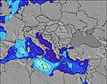 | 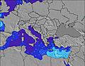 |  | 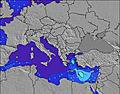 | 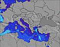 | 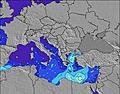 | 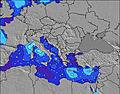 | ||||||||||||||
Wave Height (m) Direction Period (s) | — | SSW 2 | — | — | — | — | NW 3 | NW 3 | WNW 3 | WNW 3 | WNW 3 | WNW 4 | W 4 | WNW 4 | W 4 | W 4 | NW 3 | NW 3 | NW 3 | WNW 3 | WNW 5 |
Wave Graph | |||||||||||||||||||||
0 | 1 | 0 | 0 | 0 | 0 | 2 | 3 | 2 | 2 | 4 | 11 | 5 | 7 | 1 | 1 | 2 | 3 | 2 | 8 | 12 | |
Wind (km/h) | |||||||||||||||||||||
Wind State on-shore cross-onshore cross-shore cross-offshore off-shore glassy | glassy | on | cross | glassy | on | cross | cross | cross-on | cross-on | cross | cross-on | cross | cross-on | on | cross | cross-on | cross-on | cross | cross | cross-on | cross-on |
High Tide | 6:29PM0.12m | 7:16AM0.11m | 7:01PM0.11m | 7:55AM0.11m | 7:40PM0.10m | 8:47AM0.11m | 8:35PM0.08m | 10:08AM0.11m | 10:57PM0.07m | 12:02PM0.11m | 1:30AM0.07m | 1:22PM0.12m | 2:35AM0.09m | ||||||||
Low Tide | 12:41PM0.03m | 1:05AM0.01m | 1:24PM0.04m | 1:35AM0.02m | 2:16PM0.04m | 2:14AM0.03m | 3:29PM0.05m | 3:02AM0.04m | 5:24PM0.05m | 4:22AM0.05m | 7:26PM0.04m | 6:16AM0.05m | 8:34PM0.03m | ||||||||
6:37 | — | — | 6:39 | — | — | 6:39 | — | — | 6:41 | — | — | 6:41 | — | — | 6:43 | — | — | 6:43 | — | — | |
— | 8:38 | — | — | 8:38 | — | — | 8:37 | — | — | 8:37 | — | — | 8:35 | — | — | 8:34 | — | — | 8:32 | — | |
mm | — | — | — | — | — | — | — | — | — | — | — | — | — | — | — | — | — | — | — | — | — |
Temp °C | 29 | 28 | 26 | 29 | 29 | 26 | 30 | 30 | 26 | 31 | 30 | 28 | 31 | 30 | 27 | 30 | 30 | 27 | 31 | 30 | 28 |
Feels °C | 29 | 28 | 28 | 28 | 28 | 26 | 29 | 29 | 28 | 30 | 29 | 29 | 29 | 30 | 28 | 30 | 29 | 29 | 31 | 30 | 30 |
Swell 1 Height (m) Direction Period (s) | — | — | — | — | — | — | — | — | — | WNW 3 | — | W 4 | W 4 | — | W 4 | W 4 | — | — | — | SW 4 | — |
— | — | — | — | — | — | — | — | — | 2 | — | 5 | 5 | — | 1 | 1 | — | — | — | 1 | — | |
Swell 2 Height (m) Direction Period (s) | — | — | — | — | — | — | — | — | — | — | — | — | — | — | — | — | — | — | — | — | — |
— | — | — | — | — | — | — | — | — | — | — | — | — | — | — | — | — | — | — | — | — | |
Swell 3 Height (m) Direction Period (s) | — | — | — | — | — | — | — | — | — | — | — | — | — | — | — | — | — | — | — | — | — |
— | — | — | — | — | — | — | — | — | — | — | — | — | — | — | — | — | — | — | — | — | |
Wind waves Height (m) Direction Period (s) | — | SSW 2 | — | — | — | — | NW 3 | NW 3 | WNW 3 | — | WNW 3 | WNW 4 | — | WNW 4 | NNW 3 | — | NW 3 | NW 3 | NW 3 | WNW 3 | WNW 5 |
— | 1 | — | — | — | — | 2 | 3 | 2 | — | 4 | 11 | — | 7 | 1 | — | 2 | 3 | 2 | 8 | 12 | |
Nearest Offshore or Glassy | |||||||||||||||||||||
Distance (km) | 1247 | 303 | 2110 | 2080 | 2440 | 2088 | 2080 | 2438 | 996 | 2080 | 2289 | 989 | 2087 | 2180 | 2180 | 1196 | 2467 | 1196 | 1196 | 2449 | 1297 |
Best forecast wave conditions in Pelloponisos | |||||||||||||||||||||
Best forecast wave conditions in Greece | |||||||||||||||||||||
Header Global | |||||||||||||||||||||
- Map Icons:
 Break
Break Live Wave Height (m)
 Live Wind Speed (km/h)
 Surf Rating (10 Max)
 Ocean Swells (m)
- Wind Speed (km/h)
Latest Updates


FREE! Surf-Forecast.com widget for your website
The surf report / weather widget below is available to embed on third party websites free of charge and provides a summary of our Voidokoilia surf forecast. Simply grab the html code snippet that we provide and paste it into your own site. You can choose your preferred language and metric/imperial units for the surf forecast feed to suit users of your site. Click here to get the code.
Information about the Voidokoilia Surf forecast
The above surf forecast table for Voidokoilia provides essential information for determining whether the surfing conditions will be good over the next 16 days. A general guide to surfing at Voidokoilia can be found by selecting the local surf guide option on the grey menu. Our Voidokoilia surf forecast is unique since it includes wave energy (power) that defines the real feel of the surf rather than just the height or the period. If you surf the same spot (Voidokoilia) regularly then make a mental note of the wave energy from the surf forecast table each time you go. Very soon you may start to choose your surf days based on the wave energy alone combined with our forecast of favourable offshore wind conditions. Our star ratings will help here and of course you will also find the usual wave height and period predictions on our surf forecasts as well as a full break down of the swell components under our advanced users option (to reveal that, click the little Einstein character under the tide times).
Further information to help with frequently asked questions about our surf forecast for Voidokoilia may be found under the help tab on the top menu and also by moving your mouse over the question marks on the surf forecast table itself. Please always bear in mind that the forecast is for near-shore open water and local factors at each surf break influence the actual breaking wave height, such as the beach / reef profile, water depths offshore and shelter.
Are you planning a holiday in Pelloponisos? If you are looking for accommodation near Voidokoilia, camping, hotels and holiday cottages in Pelloponisos, consider staying in Pylos which is 7 km (4 miles) away. Other places in and around Pelloponisos where you can find information about places to rent, and car hire include Kalamaki which is 24 km (15 miles) away, Kalamata, Andhritsaina and Sparta.
 Nearest