

Surf Forecasts:

Rosarito surf forecast from 3 Aug 2026:
- Best quality surf: Tuesday 4 Aug, 8AM (local time) - 1.5ft (0.5m), 16s period, SW swell with glassy winds.
- Most powerful swell: Saturday 8 Aug, 11PM (local time) - 3ft (0.9m), 16s period, SSW swell with 447 kJ wave energy.
- Next surfable swell (1★+): Tuesday 4 Aug, 8AM (local time) - 1.5ft (0.5m), 16s period with SW swell.
Best Forecast Surf Conditions for Rosarito this week:
The surf forecast for Rosarito over the next 16 days: The first swell (rated 1 star or higher) is forecast to arrive on Tuesday (Aug 04) at 8AM. The primary swell is predicted to be 0.5m and 16s period with a secondary swell of 0.6m and 9s. The wind is predicted to be glassy as the swell arrives.
The most powerful waves expected at Rosarito in the next 16 days are 0.9m 16s and forecast to arrive on Saturday (Aug 08) at 11PM. Winds are predicted to be cross-shore at the time the swell arrives.
| Wave Type | Time (PDT) & Date | Wave Height & Period |
|---|---|---|
| Next good surf (1 star+) | 8AM (Tue 4th Aug) | 1.5ft (0.5m) 16s |
| Best Surf | 8AM (Tue 4th Aug) | 1.5ft (0.5m) 16s |
| Most Powerful | 11PM (Sat 8th Aug) | 3ft (0.9m) 16s |
Table - best surf conditions forecast for Rosarito over the next 16 days.
The Lowdown
Alright, grab a seat, surfers. Rusty here, and I’ve got the lowdown on our local stretch.
Right off the bat, I gotta be straight with you – it’s gonna be a tough couple of weeks for paddle surfing at Rosarito. We’ve got a long, dry spell ahead. The first real glimmer of anything worth paddling out for doesn't show up until Friday, August 7th, and even then, it’s only just creeping into marginal territory.
For the first four days, from Monday, August 3rd through Thursday, August 6th, it’s pretty much a write-off. Swell is tiny, around 2 ft to 2 ft, and while the wind is light and sometimes directly onshore, the surf is just flat and weak. The wave energy is low – just not enough push to get excited about.
Then we hit a bit of a shift. Friday the 7th and Saturday the 8th bring a bit more life. The swell picks up slightly to 2 ft to 3 ft, and crucially, we see a long-period groundswell from the SSW and SW with periods hitting 16 to 19 seconds. That’s proper energy rolling in. The water’s running at 72° which is much warmer than normal for this time of year – a nice surprise.
But here’s the catch. The wind is mostly light and cross-onshore, putting a little bump on the surface. The forecast calls it marginal, and honestly, for a spot like Rosarito that’s exposed to the SW, those long-period swells can sometimes be a bit tricky. They might be better suited for a more defined setup, but for a beach and reef mix, it’s worth a look if you’re desperate. Friday morning looks the best bet with that 2 ft, 19-second groundswell and clean conditions before the wind turns later.
After that brief pulse, it fades again. Sunday the 9th through to Tuesday the 12th of August drops back into the poor category, with small swell and persistent cross-onshore breezes making for messy conditions. Mid-week sees a bit of a bump in energy again, but the wind turns moderate from the NW, creating chop.
The second week, from August 14th onward, is a frustrating mix. Swell stays around 2 ft to 3 ft, but the wind is almost always a cross-onshore from the NW or W. The wave energy is moderate to strong, but the quality just isn’t there for a good paddle. The setup looks more interesting for kite surfing than paddle surfing for most of this period.
Then, on Tuesday, August 18th, we finally get a glimmer of hope. The afternoon shows rain showers and a light cross-offshore breeze from the SSE. The swell is still small at 2 ft, but the conditions are clean. This is the first time in the whole forecast we see “expect good surf conditions.” It’s a long-range call, so keep an eye on it, but if that wind holds, it could be a sneaky little session to end the drought.
Overall, we’ve got a lot of flat, bumpy water to wade through. The standout window, if you can call it that, is Friday, August 7th, morning. The water is warm, the swell has some real grunt, and it’s the cleanest we’ll see for a while. After that, it’s a waiting game until the 18th.
Stay patient.
Rusty.
Short Range ForecastMostly dry. Warm (max 25°C on Mon afternoon, min 21°C on Mon night). Wind will be generally light. | Days 4-6 Weather SummaryMostly dry. Warm (max 24°C on Thu afternoon, min 20°C on Fri night). Wind will be generally light. | ||||||||||||||||||||
Monday 3 | Tuesday 4 | Wednesday 5 | Thursday 6 | Friday 7 | Saturday 8 | Sunday 9 | |||||||||||||||
AM | PM | Night | AM | PM | Night | AM | PM | Night | AM | PM | Night | AM | PM | Night | AM | PM | Night | AM | PM | Night | |
Swell Height Map |  |  |  | 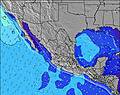 | 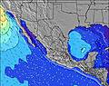 | 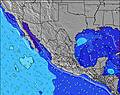 | 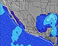 | ||||||||||||||
Wave Height (m) Direction Period (s) | SW 13 | SW 16 | SW 16 | SW 15 | SW 15 | SW 14 | SW 14 | SW 14 | SW 14 | SW 13 | SW 21 | SW 18 | SSW 19 | SSW 18 | SSW 18 | SW 16 | SSW 16 | SSW 16 | SSW 15 | SSW 15 | SSW 14 |
Wave Graph | |||||||||||||||||||||
82 | 127 | 125 | 112 | 107 | 169 | 128 | 125 | 189 | 109 | 138 | 157 | 329 | 218 | 390 | 278 | 326 | 397 | 272 | 272 | 261 | |
Wind (km/h) | |||||||||||||||||||||
Wind State on-shore cross-onshore cross-shore cross-offshore off-shore glassy | on | on | cross-on | on | on | cross-on | on | on | cross-on | on | on | on | on | cross-on | cross-on | cross-on | on | cross | cross-on | cross-on | glassy |
High Tide | 12:51PM1.82m | 00:41AM1.50m | 1:30PM1.87m | 1:56AM1.29m | 2:21PM1.92m | 4:13AM1.17m | 3:29PM1.97m | 6:42AM1.23m | 4:46PM2.07m | 7:45AM1.36m | 5:56PM2.19m | 8:24AM1.48m | 6:57PM2.33m | ||||||||
Low Tide | 7:07PM0.89m | 6:39AM0.76m | 8:27PM0.84m | 7:09AM0.92m | 10:07PM0.74m | 7:52AM1.07m | 11:40PM0.55m | 9:24AM1.19m | 00:46AM0.34m | 11:15AM1.21m | 1:38AM0.15m | 12:34PM1.13m | 2:23AM0.01m | ||||||||
6:03 | — | — | 6:03 | — | — | 6:05 | — | — | 6:05 | — | — | 6:05 | — | — | 6:07 | — | — | 6:07 | — | — | |
— | 7:44 | — | — | 7:43 | — | — | 7:42 | — | — | 7:40 | — | — | 7:40 | — | — | 7:39 | — | — | 7:38 | — | |
mm | — | — | — | — | — | — | — | — | — | — | — | — | — | — | — | — | — | — | — | — | — |
Temp °C | 24 | 25 | 22 | 24 | 24 | 22 | 22 | 24 | 22 | 23 | 24 | 23 | 23 | 24 | 22 | 23 | 24 | 22 | 24 | 24 | 22 |
Feels °C | 24 | 25 | 23 | 25 | 24 | 23 | 23 | 25 | 23 | 24 | 24 | 23 | 24 | 24 | 23 | 23 | 24 | 23 | 24 | 23 | 22 |
Swell 1 Height (m) Direction Period (s) | WNW 9 | SW 13 | W 9 | W 9 | SW 15 | SW 14 | SW 14 | SW 14 | SW 14 | SW 13 | SW 13 | SW 13 | SW 13 | SW 13 | SSW 18 | SW 16 | SSW 16 | SSW 16 | SSW 15 | SSW 15 | SSW 14 |
82 | 80 | 59 | 57 | 107 | 169 | 128 | 125 | 189 | 109 | 138 | 106 | 172 | 132 | 390 | 278 | 326 | 397 | 272 | 272 | 261 | |
Swell 2 Height (m) Direction Period (s) | SW 13 | SW 16 | SW 12 | SW 15 | SSW 13 | W 6 | W 5 | SW 12 | WNW 5 | WNW 5 | SW 21 | SW 18 | SSW 19 | SSW 18 | SW 12 | SSW 12 | SW 12 | SSW 12 | SSW 11 | SSW 11 | WNW 8 |
80 | 127 | 75 | 112 | 64 | 16 | 14 | 37 | 10 | 9 | 108 | 157 | 329 | 218 | 72 | 94 | 116 | 94 | 50 | 49 | 14 | |
Swell 3 Height (m) Direction Period (s) | SW 16 | SSW 11 | SW 16 | SW 12 | WNW 9 | S 11 | SSW 12 | S 9 | S 10 | S 11 | S 11 | WNW 5 | WNW 5 | WNW 5 | WNW 5 | W 5 | W 12 | WNW 5 | W 8 | SW 21 | SSW 11 |
67 | 23 | 125 | 77 | 8 | 9 | 56 | 6 | 8 | 23 | 9 | 9 | 8 | 9 | 5 | 4 | 12 | 2 | 11 | 72 | 24 | |
Wind waves Height (m) Direction Period (s) | — | WNW 9 | — | — | W 6 | — | — | W 5 | — | — | W 5 | — | — | — | — | — | — | — | — | S 7 | — |
— | 84 | — | — | 18 | — | — | 15 | — | — | 14 | — | — | — | — | — | — | — | — | 4 | — | |
Nearest Offshore or Glassy | |||||||||||||||||||||
Distance (km) | 37 | 12 | 12 | 12 | 12 | 12 | 37 | 12 | 12 | 37 | 12 | 11 | 202 | 202 | 11 | 59 | 813 | 11 | 59 | 11 | 0 |
Best forecast wave conditions in Baja Norte | |||||||||||||||||||||
Best forecast wave conditions in Mexico | |||||||||||||||||||||
Header Global | |||||||||||||||||||||
- Map Icons:
 Break
Break Live Wave Height (m)
 Live Wind Speed (km/h)
 Surf Rating (10 Max)
 Ocean Swells (m)
- Wind Speed (km/h)
Latest Updates


FREE! Surf-Forecast.com widget for your website
The surf report / weather widget below is available to embed on third party websites free of charge and provides a summary of our Rosarito surf forecast. Simply grab the html code snippet that we provide and paste it into your own site. You can choose your preferred language and metric/imperial units for the surf forecast feed to suit users of your site. Click here to get the code.
Information about the Rosarito Surf forecast
The above surf forecast table for Rosarito provides essential information for determining whether the surfing conditions will be good over the next 16 days. A general guide to surfing at Rosarito can be found by selecting the local surf guide option on the grey menu. Our Rosarito surf forecast is unique since it includes wave energy (power) that defines the real feel of the surf rather than just the height or the period. If you surf the same spot (Rosarito) regularly then make a mental note of the wave energy from the surf forecast table each time you go. Very soon you may start to choose your surf days based on the wave energy alone combined with our forecast of favourable offshore wind conditions. Our star ratings will help here and of course you will also find the usual wave height and period predictions on our surf forecasts as well as a full break down of the swell components under our advanced users option (to reveal that, click the little Einstein character under the tide times).
Further information to help with frequently asked questions about our surf forecast for Rosarito may be found under the help tab on the top menu and also by moving your mouse over the question marks on the surf forecast table itself. Please always bear in mind that the forecast is for near-shore open water and local factors at each surf break influence the actual breaking wave height, such as the beach / reef profile, water depths offshore and shelter.
Rosarito is 5 km (3 miles) from the very large city of Rosarito. If you plan a holiday in Baja Norte, look for hotels and other accommodation in Rosarito. Rosarito has rooms for a wide range of budgets as well as cheap car hire and transport links.
 Nearest