

Surf Forecasts:

Rapid Bay surf forecast from 27 Jul 2026:
- Most powerful swell: Tuesday 28 Jul, 3PM (local time) - 6ft (1.9m), 6s period, W swell with 273 kJ wave energy.
Best Forecast Surf Conditions for Rapid Bay this week:
The most powerful waves expected at Rapid Bay in the next 16 days are 1.9m 6s and forecast to arrive on Tuesday (Jul 28) at 3PM. Winds are predicted to be cross-onshore at the time the swell arrives. The largest open ocean swell (not directed at the beach) is 2.0m 6s period and expected on Tuesday (Jul 28) at 12AM.
| Wave Type | Time (ACST) & Date | Wave Height & Period |
|---|---|---|
| Next good surf (1 star+) | - | - |
| Best Surf | - | - |
| Most Powerful | 3PM (Tue 28th Jul) | 6ft (1.9m) 6s |
Table - best surf conditions forecast for Rapid Bay over the next 16 days.
The Lowdown
G’day, Rusty here. Well, I’ll be honest with you – it’s gonna be a tough stretch for anyone looking to get wet. The next 16 days are a clean sweep of poor surf conditions at Rapid Bay, with not a single session worth paddling out for. From Monday the 27th of July right through to Tuesday the 11th of August, it’s a long, flat, or messy run. There’s a bit of a spike around the 29th of July and again on the 8th of August, but the winds and conditions kill any hope. Let’s walk through it.
The whole period kicks off with a weak, lumpy NW swell on Monday afternoon the 27th – 4 ft from the NW at a short 5 seconds, but a fresh 19 mph cross-onshore from the NNW just tears it apart. The combined energy is low at 96, and the water’s sitting at 58°, which is about average for the time of year. Don’t even think about it.
Tuesday the 28th sees a slight bump – 5 ft to 6 ft from the W, with the energy creeping up to 273 by the afternoon. But with 19 mph cross-onshore winds, it’s lumpy and messy. Wednesday the 29th drops off quick, down to 3 ft and then 2 ft, still cross-onshore. By Thursday the 30th, we’re down to 1 ft on glassy morning conditions – that’s the best wind all week – but there’s just no energy (16). It’s a flat, clean pond, not surf.
From Friday the 31st into the first week of August, the swell flatlines – 0.7 ft to 0.3 ft most days. A few mornings have light offshore or glassy winds (Monday the 3rd of August is glassy, Tuesday the 4th has a gentle offshore from the E), but there’s nothing to ride. The energy reads 1, 5, 16 – tiny stuff. You’d be better off swimming.
Then on Saturday the 8th of August, we get a shout – a 7 ft NNE swell rolls in for the morning, with a moderate cross-offshore from the NNE and clean conditions. The energy is strong at 267. But the swell period is only 6 seconds, so it’s short-period windswell, and at 7 ft, that’s borderline expert-only territory for a break that’s already inconsistent and sheltered. Worse, the wind is cross-off, so it won’t be holding shape well. The afternoon drops to 3 ft from the W with a longer 9-second period and moderate energy of 106, but then a cross-shore breeze chops it up.
Sunday the 9th of August brings another bump – 6 ft from the W in the morning, energy at 302, but that cross-onshore from the SW at 12-19 mph makes it a total mess. Monday the 10th fades fast, and by Tuesday the 11th we’re back to 1.0 ft and glassy with no power.
Look, Rapid Bay is a sheltered spot that needs a proper W swell and clean winds to fire, and this 16-day window has none of that. The best we get is a couple of days with energy over 200, but the winds are either onshore or cross-off, and the swell is short-period junk. For an inconsistent break like this, a blank run is pretty normal – don’t hold your breath. The forecasts can always change, but right now, this is a total write-off.
Rusty.
Short Range ForecastLight rain (total 3mm), mostly falling on Mon night. Very mild (max 15°C on Mon afternoon, min 10°C on Tue night). Winds decreasing (fresh winds from the SW on Tue afternoon, calm by Thu morning). | Days 5-7 Weather SummarySome drizzle, heaviest during Sun morning. Very mild (max 13°C on Sat afternoon, min 10°C on Thu night). Winds increasing (calm on Thu night, fresh winds from the NNW by Sat night). | |||||||||||||||||||
Mon 27 | Tuesday 28 | Wednesday 29 | Thursday 30 | Friday 31 | Saturday 1 | Sunday 2 | ||||||||||||||
PM | Night | AM | PM | Night | AM | PM | Night | AM | PM | Night | AM | PM | Night | AM | PM | Night | AM | PM | Night | |
Swell Height Map |  | 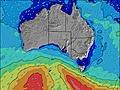 | 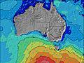 | 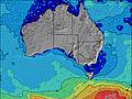 | 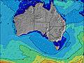 | 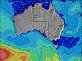 | 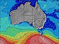 | |||||||||||||
Wave Height (m) Direction Period (s) | NW 5 | SSW 12 | W 6 | W 6 | WSW 5 | WSW 8 | W 8 | W 8 | W 7 | W 7 | W 7 | W 7 | W 7 | W 7 | N 4 | N 4 | NNW 5 | W 6 | W 8 | W 8 |
Wave Graph | ||||||||||||||||||||
96 | 0 | 193 | 273 | 72 | 109 | 44 | 29 | 16 | 8 | 4 | 3 | 3 | 1 | 21 | 16 | 57 | 67 | 63 | 28 | |
Wind (km/h) | ||||||||||||||||||||
Wind State on-shore cross-onshore cross-shore cross-offshore off-shore glassy | cross-on | cross-on | on | cross-on | cross-on | cross-on | cross-on | cross | glassy | cross-on | glassy | cross-off | cross | cross-off | cross | cross | cross | cross-on | cross | cross |
High Tide | 5:08AM0.91m | 3:53PM1.59m | 5:20AM0.99m | 4:26PM1.65m | 5:35AM1.08m | 4:57PM1.72m | 5:53AM1.18m | 5:26PM1.77m | 6:12AM1.31m | 5:54PM1.81m | 6:33AM1.44m | 6:22PM1.80m | ||||||||
Low Tide | 10:57PM0.32m | 9:09AM0.73m | 11:13PM0.19m | 9:57AM0.62m | 11:31PM0.11m | 10:33AM0.53m | 11:50PM0.08m | 11:06AM0.47m | 00:09AM0.10m | 11:37AM0.43m | 00:28AM0.17m | 12:09PM0.44m | 00:48AM0.26m | |||||||
— | — | 7:16 | — | — | 7:16 | — | — | 7:15 | — | — | 7:13 | — | — | 7:13 | — | — | 7:11 | — | — | |
5:30 | — | — | 5:30 | — | — | 5:30 | — | — | 5:31 | — | — | 5:32 | — | — | 5:34 | — | — | 5:34 | — | |
mm | — | 2 | 1 | — | — | — | — | — | — | — | — | — | — | — | — | — | — | 1 | — | — |
Temp °C | 15 | 14 | 13 | 12 | 11 | 12 | 12 | 10 | 11 | 11 | 12 | 11 | 11 | 11 | 11 | 13 | 13 | 13 | 12 | 11 |
Feels °C | 8 | 7 | 7 | 5 | 4 | 7 | 7 | 6 | 9 | 8 | 10 | 7 | 8 | 8 | 5 | 8 | 7 | 8 | 7 | 7 |
Swell 1 Height (m) Direction Period (s) | S 11 | SSW 12 | N 4 | S 15 | SSW 16 | SSW 16 | W 8 | W 8 | W 7 | W 7 | W 7 | W 7 | W 7 | W 7 | S 17 | SSW 18 | W 7 | W 6 | W 8 | W 8 |
2 | 454 | 1 | 5 | 47 | 49 | 44 | 29 | 16 | 8 | 4 | 3 | 3 | 1 | 6 | 32 | 8 | 67 | 63 | 28 | |
Swell 2 Height (m) Direction Period (s) | — | — | S 16 | S 9 | — | — | SSW 15 | SSW 14 | SSW 13 | S 13 | S 13 | S 12 | S 12 | S 12 | W 7 | SSE 8 | SSW 17 | N 5 | N 4 | WSW 15 |
— | — | 5 | 1 | — | — | 21 | 18 | 17 | 3 | 3 | 3 | 3 | 3 | 1 | 6 | 27 | 11 | 3 | 23 | |
Swell 3 Height (m) Direction Period (s) | — | — | — | — | — | — | — | — | — | — | S 23 | S 21 | S 20 | S 18 | — | — | — | SW 16 | SSW 16 | S 15 |
— | — | — | — | — | — | — | — | — | — | 10 | 36 | 7 | 6 | — | — | — | 10 | 24 | 19 | |
Wind waves Height (m) Direction Period (s) | NW 5 | WNW 6 | W 6 | W 6 | WSW 5 | WSW 8 | — | — | — | — | — | — | — | — | N 4 | N 4 | NNW 5 | WSW 3 | — | — |
96 | 320 | 193 | 273 | 72 | 109 | — | — | — | — | — | — | — | — | 21 | 16 | 57 | 8 | — | — | |
Nearest Offshore or Glassy | ||||||||||||||||||||
Distance (km) | 372 | 48 | 920 | 914 | 1069 | 91 | 91 | 91 | 30 | 91 | 20 | 20 | 20 | 20 | 20 | 20 | 44 | 443 | 607 | 42 |
Best forecast wave conditions in Adelaide | ||||||||||||||||||||
Best forecast wave conditions in Australia | ||||||||||||||||||||
Header Global | ||||||||||||||||||||
- Map Icons:
 Break
Break Live Wave Height (m)
 Live Wind Speed (km/h)
 Surf Rating (10 Max)
 Ocean Swells (m)
- Wind Speed (km/h)


FREE! Surf-Forecast.com widget for your website
The surf report / weather widget below is available to embed on third party websites free of charge and provides a summary of our Rapid Bay surf forecast. Simply grab the html code snippet that we provide and paste it into your own site. You can choose your preferred language and metric/imperial units for the surf forecast feed to suit users of your site. Click here to get the code.
Information about the Rapid Bay Surf forecast
The above surf forecast table for Rapid Bay provides essential information for determining whether the surfing conditions will be good over the next 16 days. A general guide to surfing at Rapid Bay can be found by selecting the local surf guide option on the grey menu. Our Rapid Bay surf forecast is unique since it includes wave energy (power) that defines the real feel of the surf rather than just the height or the period. If you surf the same spot (Rapid Bay) regularly then make a mental note of the wave energy from the surf forecast table each time you go. Very soon you may start to choose your surf days based on the wave energy alone combined with our forecast of favourable offshore wind conditions. Our star ratings will help here and of course you will also find the usual wave height and period predictions on our surf forecasts as well as a full break down of the swell components under our advanced users option (to reveal that, click the little Einstein character under the tide times).
Further information to help with frequently asked questions about our surf forecast for Rapid Bay may be found under the help tab on the top menu and also by moving your mouse over the question marks on the surf forecast table itself. Please always bear in mind that the forecast is for near-shore open water and local factors at each surf break influence the actual breaking wave height, such as the beach / reef profile, water depths offshore and shelter.
Are you planning a holiday in Adelaide? If you are looking for accommodation near Rapid Bay, camping, hotels and holiday cottages in Adelaide, consider staying in Rapid Bay which is 2 km (1 miles) away. Other places in and around Adelaide where you can find information about places to rent, and car hire include Kingscote which is 51 km (32 miles) away, Morphett Vale, Adelaide and Port Adelaide.
 Nearest