

Surf Forecasts:

Punta Rocas surf forecast from 25 Jul 2026:
- Best quality surf: Saturday 25 Jul, 7PM (local time) - 4.5ft (1.3m), 12s period, SSW swell with cross-offshore winds.
- Most powerful swell: Monday 27 Jul, 4PM (local time) - 5ft (1.6m), 16s period, SW swell with 1,271 kJ wave energy.
- Next surfable swell (1★+): Saturday 25 Jul, 7AM (local time) - 2.5ft (0.8m), 18s period with SW swell.
Best Forecast Surf Conditions for Punta Rocas this week:
The surf forecast for Punta Rocas over the next 16 days: The first swell (rated 1 star or higher) is forecast to arrive on Saturday (Jul 25) at 7AM. The primary swell is predicted to be 0.8m and 18s period with a secondary swell of 0.9m and 13s. Another secondary swell of 0.8m and 9s is also forecast. The wind is predicted to be glassy as the swell arrives.
The most powerful waves expected at Punta Rocas in the next 16 days are 1.6m 16s and forecast to arrive on Monday (Jul 27) at 4PM. Winds are predicted to be cross-shore at the time the swell arrives.
| Wave Type | Time (-05) & Date | Wave Height & Period |
|---|---|---|
| Next good surf (1 star+) | 7AM (Sat 25th Jul) | 2.5ft (0.8m) 18s |
| Best Surf | 7PM (Sat 25th Jul) | 4.5ft (1.3m) 12s |
| Most Powerful | 4PM (Mon 27th Jul) | 5ft (1.6m) 16s |
Table - best surf conditions forecast for Punta Rocas over the next 16 days.
The Lowdown
Alright folks, Rusty here. Let’s take a look at what Punta Rocas is shaping up to be over the next two weeks.
We’re starting off a little slow. There’s surf on the way, but the first few days are all "marginal," so don’t expect perfection. It’s a classic point break, very consistent, and it really lights up with a SSW swell.
We begin on Saturday, July 25th. The morning brings a clean 3ft of SW swell, but the cross-on wind from the SSW puts a bit of a crinkle on the surface. The water temp is about average for the season. The wave energy is moderate (716). It’s rideable, but not a classic. Saturday afternoon gets a little bigger at 4ft, still cross-shore, and the energy builds (1080). Still just an okay session.
Sunday the 26th is similar. A long-period 20-second groundswell in the morning at 3ft (1064 energy) is a bit of a tease – it’s got the power, but it’s tiny. The cross-shore breeze keeps it a little bumpy. This long-period swell will wrap nicely around the point, but it’s just not got the height yet.
From Monday the 27th through Thursday the 30th, the swell sits between 4ft and 5ft consistently. The energy is solid (moderate to strong, hitting 1350 at one point), and the wind stays light, but it’s almost always cross or cross-on. It’s surfable for a beginner to intermediate, but nothing is lighting the world on fire.
Then we hit a flat spell. The 31st of July and the 1st of August drop under 3ft, and the energy fades. Friday the 31st is a dud. Sunday the 2nd of August is a total "poor" call in the morning, and the next few days are all very low energy and marginal. The surf is pretty quiet.
The good stuff. Things crank up around the 5th of August. Wednesday the 5th has a jump in size. The morning brings 6ft of SW swell with a strong 1696 energy reading, and the afternoon bumps it to 6ft. The wind is light cross-shore – that’s as good as it gets for this break. The combined energy is very strong (1754). This is the best swell of the two weeks – a solid, powerful groundswell. The 6ft is a bit much for total beginners, but perfect for anyone with some time in the water.
Thursday the 6th still holds at 5ft, but the real highlight looks like Saturday the 8th of August. We’ve got a 6ft SW swell in the morning, building to 7ft in the afternoon. The energy is through the roof (2433 and 2479). This is a *big* swell. At 7ft with a 17-second period, this is strictly for the experts. The point break will handle it, but the power is intense. The wind is light cross-shore, keeping it relatively clean. If you’ve got the skills, the 8th is the standout. The 9th of August is still solid at 6ft, but the wind turns cross-on, so it won’t be as clean.
The call: If you can wait, the 5th of August is the best all-around day for size and clean conditions. But for the big, heavy session, the 8th of August is the one to mark on the calendar – just be ready for a serious, powerful swell. The crowds at Punta Rocas can get thick, so expect company on the peak.
Stay stoked.
Rusty.
Short Range ForecastMostly dry. Warm (max 22°C on Sat morning, min 19°C on Fri night). Wind will be generally light. | Days 4-6 Weather SummaryMostly dry. Warm (max 22°C on Tue morning, min 18°C on Mon night). Wind will be generally light. | ||||||||||||||||||||
Saturday 25 | Sunday 26 | Monday 27 | Tuesday 28 | Wednesday 29 | Thursday 30 | Friday 31 | |||||||||||||||
AM | PM | Night | AM | PM | Night | AM | PM | Night | AM | PM | Night | AM | PM | Night | AM | PM | Night | AM | PM | Night | |
Swell Height Map |  |  | 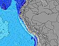 | 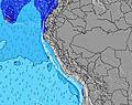 | 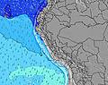 | 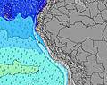 | 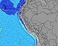 | ||||||||||||||
Wave Height (m) Direction Period (s) | SW 18 | SSW 12 | SSW 11 | SW 20 | SW 18 | SW 18 | SW 17 | SW 16 | SW 16 | SW 15 | SW 15 | SW 14 | SW 13 | SW 13 | SW 13 | SW 12 | SW 12 | SW 13 | SW 12 | SW 12 | SW 12 |
Wave Graph | |||||||||||||||||||||
375 | 429 | 366 | 455 | 409 | 694 | 1062 | 1271 | 1225 | 1062 | 1020 | 886 | 839 | 744 | 591 | 473 | 430 | 459 | 272 | 232 | 134 | |
Wind (km/h) | |||||||||||||||||||||
Wind State on-shore cross-onshore cross-shore cross-offshore off-shore glassy | cross-on | cross | cross-off | cross | cross | cross | cross-on | cross | cross | cross-on | cross-on | cross | cross-on | cross-on | cross | cross | cross | cross-off | cross-on | cross | cross |
High Tide | 4:04AM0.79m | 2:51PM0.47m | 4:43AM0.82m | 3:41PM0.47m | 5:19AM0.85m | 4:24PM0.49m | 5:52AM0.88m | 5:03PM0.50m | 6:23AM0.91m | 5:40PM0.52m | 6:52AM0.92m | 6:18PM0.54m | 7:19AM0.92m | 6:58PM0.55m | |||||||
Low Tide | 10:48AM0.38m | 9:14PM0.16m | 11:25AM0.36m | 9:54PM0.14m | 11:57AM0.34m | 10:32PM0.11m | 12:28PM0.32m | 11:07PM0.10m | 12:58PM0.31m | 11:40PM0.10m | 1:28PM0.30m | 00:13AM0.12m | 1:56PM0.29m | 00:45AM0.16m | |||||||
6:28 | — | — | 6:26 | — | — | 6:26 | — | — | 6:26 | — | — | 6:26 | — | — | 6:26 | — | — | 6:26 | — | — | |
— | 5:59 | — | — | 5:59 | — | — | 5:59 | — | — | 5:59 | — | — | 6:00 | — | — | 6:00 | — | — | 6:00 | — | |
mm | — | — | — | — | — | — | — | — | — | — | — | — | — | — | — | — | — | — | — | — | — |
Temp °C | 22 | 21 | 19 | 22 | 20 | 19 | 22 | 21 | 20 | 22 | 21 | 19 | 21 | 21 | 19 | 22 | 21 | 19 | 23 | 20 | 19 |
Feels °C | 22 | 22 | 20 | 22 | 20 | 20 | 22 | 21 | 21 | 22 | 22 | 20 | 21 | 22 | 20 | 22 | 22 | 20 | 22 | 20 | 20 |
Swell 1 Height (m) Direction Period (s) | SW 13 | SSW 12 | SSW 11 | SSW 11 | SW 15 | SW 18 | SW 17 | SW 16 | SW 16 | SW 15 | SW 15 | SW 14 | SW 13 | SW 13 | SW 13 | SW 12 | SW 12 | SW 13 | SW 12 | SW 12 | SW 12 |
238 | 429 | 323 | 234 | 309 | 694 | 1062 | 1271 | 1225 | 1062 | 1020 | 886 | 839 | 744 | 591 | 473 | 430 | 459 | 272 | 232 | 134 | |
Swell 2 Height (m) Direction Period (s) | SW 18 | SW 17 | SW 16 | SW 15 | SW 18 | SW 14 | S 6 | S 6 | S 6 | S 7 | S 7 | S 7 | S 7 | S 7 | S 7 | S 6 | S 11 | S 11 | S 10 | S 10 | SW 15 |
375 | 427 | 366 | 375 | 409 | 189 | 27 | 39 | 64 | 86 | 92 | 114 | 94 | 76 | 43 | 29 | 88 | 114 | 73 | 50 | 107 | |
Swell 3 Height (m) Direction Period (s) | SSW 9 | SW 21 | SW 20 | SW 20 | SW 10 | SW 10 | SW 10 | WNW 14 | WNW 14 | S 11 | S 11 | S 12 | WNW 13 | WNW 13 | S 12 | S 12 | W 12 | W 9 | SW 16 | SW 17 | S 10 |
103 | 224 | 315 | 455 | 82 | 77 | 45 | 40 | 20 | 22 | 21 | 11 | 17 | 17 | 73 | 103 | 3 | 2 | 10 | 45 | 28 | |
Wind waves Height (m) Direction Period (s) | — | — | S 6 | — | S 6 | — | — | — | — | — | — | — | — | — | — | — | S 6 | S 3 | S 5 | S 5 | S 6 |
— | — | 41 | — | 38 | — | — | — | — | — | — | — | — | — | — | — | 21 | 3 | 21 | 26 | 68 | |
Nearest Offshore or Glassy | |||||||||||||||||||||
Distance (km) | 22 | 22 | 0 | 22 | 22 | 2 | 22 | 9 | 2 | 22 | 22 | 9 | 22 | 22 | 1 | 22 | 22 | 0 | 22 | 9 | 9 |
Best forecast wave conditions in Lima | |||||||||||||||||||||
Best forecast wave conditions in Peru | |||||||||||||||||||||
Header Global | |||||||||||||||||||||
- Map Icons:
 Break
Break Live Wave Height (m)
 Live Wind Speed (km/h)
 Surf Rating (10 Max)
 Ocean Swells (m)
- Wind Speed (km/h)


FREE! Surf-Forecast.com widget for your website
The surf report / weather widget below is available to embed on third party websites free of charge and provides a summary of our Punta Rocas surf forecast. Simply grab the html code snippet that we provide and paste it into your own site. You can choose your preferred language and metric/imperial units for the surf forecast feed to suit users of your site. Click here to get the code.
Information about the Punta Rocas Surf forecast
The above surf forecast table for Punta Rocas provides essential information for determining whether the surfing conditions will be good over the next 16 days. A general guide to surfing at Punta Rocas can be found by selecting the local surf guide option on the grey menu. Our Punta Rocas surf forecast is unique since it includes wave energy (power) that defines the real feel of the surf rather than just the height or the period. If you surf the same spot (Punta Rocas) regularly then make a mental note of the wave energy from the surf forecast table each time you go. Very soon you may start to choose your surf days based on the wave energy alone combined with our forecast of favourable offshore wind conditions. Our star ratings will help here and of course you will also find the usual wave height and period predictions on our surf forecasts as well as a full break down of the swell components under our advanced users option (to reveal that, click the little Einstein character under the tide times).
Further information to help with frequently asked questions about our surf forecast for Punta Rocas may be found under the help tab on the top menu and also by moving your mouse over the question marks on the surf forecast table itself. Please always bear in mind that the forecast is for near-shore open water and local factors at each surf break influence the actual breaking wave height, such as the beach / reef profile, water depths offshore and shelter.
Punta Rocas is 32 km (20 miles) from the very large city of Mala. If you plan a holiday in Lima, look for hotels and other accommodation in Mala. Mala has rooms for a wide range of budgets as well as cheap car hire and transport links.
 Nearest