

Surf Forecasts:

Burros surf forecast from 31 Jul 2026:
- Best quality surf: Friday 31 Jul, 9PM (local time) - 2ft (0.6m), 13s period, SSW swell with offshore winds.
- Most powerful swell: Friday 7 Aug, 3PM (local time) - 2ft (0.6m), 17s period, SSW swell with 197 kJ wave energy.
- Next surfable swell (1★+): Friday 31 Jul, 9PM (local time) - 2ft (0.6m), 13s period with SSW swell.
Best Forecast Surf Conditions for Burros this week:
The surf forecast for Burros over the next 16 days: The first swell (rated 1 star or higher) is forecast to arrive on Friday (Jul 31) at 9PM. The primary swell is predicted to be 0.6m and 13s period with a secondary swell of 0.5m and 9s. The wind is predicted to be offshore as the swell arrives.
The most powerful waves expected at Burros in the next 16 days are 0.6m 17s and forecast to arrive on Friday (Aug 07) at 3PM. Winds are predicted to be cross-offshore at the time the swell arrives. The largest open ocean swell (not directed at the beach) is 0.3m 2s period and expected on Saturday (Aug 01) at 6PM.
| Wave Type | Time (CST) & Date | Wave Height & Period |
|---|---|---|
| Next good surf (1 star+) | 9PM (Fri 31st Jul) | 2ft (0.6m) 13s |
| Best Surf | 9PM (Fri 31st Jul) | 2ft (0.6m) 13s |
| Most Powerful | 3PM (Fri 7th Aug) | 2ft (0.6m) 17s |
Table - best surf conditions forecast for Burros over the next 16 days.
The Lowdown
G’day, Rusty here. Let’s break down what’s on the menu for Punta-Burros.
Right off the bat, it’s a slow burner. The first few days are pretty flat and messy, so don’t expect much. The first real glimmer of hope doesn’t show up until almost a week in, so you’ll need to be patient.
Friday morning, 31 July, has a tiny 2ft SSW swell, but it’s coming from the wrong direction and the energy is weak (206). The water’s a touch warmer than usual at 89°, with a positive anomaly of 3°, so it’s noticeably warmer for this time of year. A light NE breeze keeps it clean, but the swell is just too small.
The next few days are a bust – Saturday through to Thursday morning, 6 August, are all under 2ft, with the swell direction all wrong. The energy is mostly weak, and the winds are all over the place. A few glassy mornings pop up, like Sunday morning, 2 August (2ft, SW, 13s, 114 energy, glassy with an ENE breeze) and Thursday morning, 6 August (2ft, SW, 13s, 104 energy, glassy with an E breeze), but it’s just not enough.
Friday morning, 7 August, things start to change. A 1ft SSW swell, but the period jumps to 18 seconds – that’s a long-period groundswell. The energy is building (220) and the morning’s clean with a light offshore NE breeze. Still small, but quality is there.
Saturday morning, 8 August, is a standout for the early part. Glassy, zero wind, and a 2ft SSW swell with a 16-second period (206 energy). Clean as a whistle, but still modest.
The real action, and the best on offer, kicks off around Tuesday afternoon, 11 August. We’ve got a 2ft SW swell, period 18 seconds, and the energy is strong at 340. The wind is cross-off from the WNW, keeping it clean. Wednesday morning, 12 August, is also a beauty – 2ft SW, 17 seconds, 268 energy, with a light cross-off E breeze. The afternoon keeps it clean too, with a 2ft SW, 16 seconds, 271 energy. These are the days to circle.
The standout of the entire forecast is Friday morning and afternoon, 14 August. We’re looking at 2ft of SW swell, but the period is a solid 18 seconds, and the energy is pumping at 375 (morning) and 376 (afternoon). The morning has a light cross-off NE breeze, and the afternoon is cross-off from the WNW – both clean. This is your best bet for quality waves at Burros. That long period groundswell will really wrap in. The only thing is, with a long period swell, it can be a bit tide-sensitive, but the conditions are all there.
Saturday morning, 15 August, sees the biggest swell of the run at 3ft, also from the SW, with a 16-second period and energy at 391. The morning is clean with a light cross-off E breeze, but the afternoon gets a bit cross-shore. If you can handle the bigger bump, the morning is still a solid option.
So, to sum it up: the first week is mostly a dud. The real window opens from Tuesday, 11 August, through to Saturday, 15 August. The absolute best sessions are the Friday, 14 August, morning and afternoon – clean, solid energy, and that long-period groundswell will make Burros (Punta-Burros) a treat. The Saturday morning, 15 August, also has the biggest swell of the period, so if you want a bit more push, that’s your call.
Stay patient, and when the swell arrives, it’ll be worth the wait.
Rusty
Short Range ForecastLight rain (total 8mm), mostly falling on Sun night. Warm (max 30°C on Fri morning, min 26°C on Fri night). Wind will be generally light. | Days 4-6 Weather SummaryModerate rain (total 14mm), heaviest on Mon night. Warm (max 30°C on Mon afternoon, min 25°C on Wed night). Wind will be generally light. | ||||||||||||||||||||
Friday 31 | Saturday 1 | Sunday 2 | Monday 3 | Tuesday 4 | Wednesday 5 | Thursday 6 | |||||||||||||||
AM | PM | Night | AM | PM | Night | AM | PM | Night | AM | PM | Night | AM | PM | Night | AM | PM | Night | AM | PM | Night | |
Swell Height Map |  |  |  | 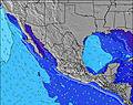 | 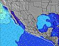 | 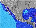 | 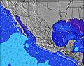 | ||||||||||||||
Wave Height (m) Direction Period (s) | SSW 13 | SSW 13 | SSW 13 | SSW 14 | SW 14 | SW 14 | SW 13 | SW 13 | SW 13 | SW 12 | SW 12 | SW 12 | SW 12 | SW 15 | SW 15 | SW 14 | SW 14 | SW 14 | SW 13 | SW 18 | SW 18 |
Wave Graph | |||||||||||||||||||||
158 | 114 | 95 | 134 | 99 | 91 | 87 | 85 | 59 | 40 | 39 | 37 | 36 | 56 | 54 | 74 | 48 | 51 | 87 | 85 | 84 | |
Wind (km/h) | |||||||||||||||||||||
Wind State on-shore cross-onshore cross-shore cross-offshore off-shore glassy | off | cross | cross | cross-off | cross-off | cross-off | glassy | cross | glassy | glassy | cross-on | glassy | glassy | cross | cross-off | cross-off | cross-off | cross-off | glassy | cross | off |
High Tide | 10:56AM1.25m | 10:09PM1.43m | 11:16AM1.28m | 10:42PM1.35m | 11:37AM1.30m | 11:19PM1.23m | 12:02PM1.31m | 00:03AM1.08m | 12:31PM1.31m | 1:12AM0.92m | 1:11PM1.30m | 2:18PM1.27m | |||||||||
Low Tide | 4:15PM0.64m | 4:48AM0.24m | 4:50PM0.61m | 5:10AM0.34m | 5:30PM0.59m | 5:32AM0.45m | 6:18PM0.58m | 5:52AM0.58m | 7:23PM0.59m | 6:05AM0.71m | 9:13PM0.57m | 11:36PM0.44m | |||||||||
6:35 | — | — | 6:35 | — | — | 6:35 | — | — | 6:35 | — | — | 6:37 | — | — | 6:37 | — | — | 6:37 | — | — | |
— | 7:39 | — | — | 7:39 | — | — | 7:38 | — | — | 7:38 | — | — | 7:37 | — | — | 7:37 | — | — | 7:37 | — | |
mm | — | — | 1 | — | — | 2 | — | — | 5 | — | 2 | 6 | — | 1 | 2 | — | — | 3 | — | 2 | 3 |
Temp °C | 30 | 30 | 29 | 30 | 30 | 29 | 30 | 30 | 28 | 29 | 30 | 29 | 29 | 30 | 28 | 29 | 30 | 29 | 29 | 30 | 29 |
Feels °C | 34 | 32 | 33 | 34 | 32 | 34 | 34 | 33 | 33 | 33 | 33 | 34 | 33 | 33 | 33 | 34 | 33 | 35 | 32 | 33 | 35 |
Swell 1 Height (m) Direction Period (s) | SSW 13 | SSW 13 | SSW 13 | SSW 14 | SW 14 | SW 14 | SW 13 | SW 13 | SW 13 | WNW 5 | SW 12 | WNW 5 | WNW 5 | SW 15 | SW 15 | SW 14 | SW 14 | SW 14 | SW 13 | SW 13 | SW 13 |
158 | 114 | 95 | 134 | 99 | 91 | 87 | 85 | 59 | 10 | 39 | 9 | 10 | 56 | 54 | 74 | 48 | 51 | 87 | 85 | 83 | |
Swell 2 Height (m) Direction Period (s) | W 9 | W 9 | WSW 9 | WSW 8 | WNW 8 | WNW 8 | W 9 | W 9 | WNW 5 | SW 12 | W 7 | SW 12 | SW 12 | WNW 5 | SW 12 | WNW 5 | SSW 11 | SW 13 | WNW 4 | SW 18 | SW 18 |
45 | 41 | 25 | 23 | 22 | 20 | 25 | 24 | 8 | 40 | 10 | 37 | 36 | 5 | 35 | 2 | 12 | 46 | 2 | 81 | 84 | |
Swell 3 Height (m) Direction Period (s) | WNW 5 | — | SW 16 | WNW 5 | SW 20 | SSW 11 | WNW 4 | SW 18 | W 8 | W 8 | SSW 14 | WSW 16 | WSW 16 | SW 12 | WNW 5 | SSW 11 | SSW 15 | SSW 20 | SW 20 | W 11 | — |
3 | — | 40 | 3 | 15 | 12 | 2 | 12 | 21 | 11 | 20 | 25 | 24 | 36 | 5 | 12 | 21 | 37 | 15 | 2 | — | |
Wind waves Height (m) Direction Period (s) | — | WNW 5 | — | — | — | — | — | WNW 4 | — | — | WNW 5 | — | — | — | — | — | WNW 5 | — | — | NW 4 | NNW 6 |
— | 3 | — | — | — | — | — | 4 | — | — | 9 | — | — | — | — | — | 2 | — | — | 1 | 3 | |
Nearest Offshore or Glassy | |||||||||||||||||||||
Distance (km) | 0 | 0 | 2 | 0 | 1202 | 0 | 0 | 0 | 0 | 1 | 498 | 0 | 0 | 942 | 0 | 0 | 0 | 2 | 0 | 4 | 0 |
Best forecast wave conditions in Nayarit | |||||||||||||||||||||
Best forecast wave conditions in Mexico | |||||||||||||||||||||
Header Global | |||||||||||||||||||||
- Map Icons:
 Break
Break Live Wave Height (m)
 Live Wind Speed (km/h)
 Surf Rating (10 Max)
 Ocean Swells (m)
- Wind Speed (km/h)
Latest Updates


FREE! Surf-Forecast.com widget for your website
The surf report / weather widget below is available to embed on third party websites free of charge and provides a summary of our Burros surf forecast. Simply grab the html code snippet that we provide and paste it into your own site. You can choose your preferred language and metric/imperial units for the surf forecast feed to suit users of your site. Click here to get the code.
Information about the Burros Surf forecast
The above surf forecast table for Burros provides essential information for determining whether the surfing conditions will be good over the next 16 days. A general guide to surfing at Burros can be found by selecting the local surf guide option on the grey menu. Our Burros surf forecast is unique since it includes wave energy (power) that defines the real feel of the surf rather than just the height or the period. If you surf the same spot (Burros) regularly then make a mental note of the wave energy from the surf forecast table each time you go. Very soon you may start to choose your surf days based on the wave energy alone combined with our forecast of favourable offshore wind conditions. Our star ratings will help here and of course you will also find the usual wave height and period predictions on our surf forecasts as well as a full break down of the swell components under our advanced users option (to reveal that, click the little Einstein character under the tide times).
Further information to help with frequently asked questions about our surf forecast for Burros may be found under the help tab on the top menu and also by moving your mouse over the question marks on the surf forecast table itself. Please always bear in mind that the forecast is for near-shore open water and local factors at each surf break influence the actual breaking wave height, such as the beach / reef profile, water depths offshore and shelter.
Burros is 27 km (17 miles) from Puerto Vallarta. If you plan a holiday in Nayarit, look for hotels and other accommodation in Puerto Vallarta. Puerto Vallarta has rooms for a wide range of budgets as well as car hire and transport links.
 Nearest