

Surf Forecasts:

Pors Nevez surf forecast from 16 Jul 2026:
- Most powerful swell: Sunday 19 Jul, 11PM (local time) - 4.5ft (1.4m), 6s period, NE swell with 118 kJ wave energy.
Best Forecast Surf Conditions for Pors Nevez this week:
The most powerful waves expected at Pors Nevez in the next 16 days are 1.4m 6s and forecast to arrive on Sunday (Jul 19) at 11PM. Winds are predicted to be cross-onshore at the time the swell arrives. The largest open ocean swell (not directed at the beach) is 0.4m 4s period and expected on Friday (Jul 17) at 5PM.
| Wave Type | Time (CEST) & Date | Wave Height & Period |
|---|---|---|
| Next good surf (1 star+) | - | - |
| Best Surf | - | - |
| Most Powerful | 11PM (Sun 19th Jul) | 4.5ft (1.4m) 6s |
Table - best surf conditions forecast for Pors Nevez over the next 16 days.
The Lowdown
Alright, Rusty here again. Let's break down the same forecast for the imperial crew.
Honestly, it's a grim picture for the next week and a half at Pors Nevez. We're looking at a solid 10-day stretch, from Thursday the 16th through to Saturday the 26th of July, where the surf is practically non-existent. The swell is tiny, the wind is mostly trash, and the wave energy is pathetic – barely cracking 58 on the best of those days. You're better off doing something else.
The only brief flicker of hope in that first week is the morning of Saturday the 26th. We get a cross-offshore wind out of the west at 28 mph with a 2ft swell from the west at 11 seconds. That's a long period for such a small wave, so it might have a bit of shape, but the wind is howling. With those conditions, this beach-and-reef setup starts looking more like a kite-surfing zone than a paddle-surfing one.
The real story, and the only time this forecast gets any blood pumping, is the very end. We get a solid pulse of energy arriving on Tuesday the 29th of July. The morning shows a 7ft swell from the west, with a period of 9 seconds and a combined energy reading of 586. That's a real push of west swell. The wind is light and onshore from the north at 9 mph, which isn't perfect, but the size makes it worth a look. This is a bigger wave, over 5ft, so it's not for beginners. It's pushing into the 7ft range, putting it squarely in the "experienced only" category.
The standout window, as far as the numbers go, is actually the morning of Thursday the 30th of July. We’ve still got a solid 5ft west swell (430 energy), but the wind drops to just 6 mph from the NNW, making it a light cross-onshore. That’s going to be the cleanest the surf looks all period. The swell direction is a bit off the optimum WNW for the spot, but with that amount of water moving and the wind being light, Pors Nevez might actually throw a few fun ones.
The crowds here are listed as "sometimes", so you might have a few others with the same idea, but it won't be a zoo.
To keep it short: the first ten days are a bust. The last few days of July and into August are your only shot. The 29th and 30th are your best bets, with the 30th morning looking like the pick of the fortnight for clean conditions on a decent-sized swell. Keep an eye on it.
Rusty.
Short Range ForecastLight rain (total 6mm), mostly falling on Thu night. Warm (max 23°C on Fri afternoon, min 17°C on Thu morning). Wind will be generally light. | Days 5-7 Weather SummaryMostly dry. Warm (max 22°C on Tue afternoon, min 16°C on Sat night). Mainly fresh winds. | ||||||||||||||||||||
Thursday 16 | Friday 17 | Saturday 18 | Sunday 19 | Monday 20 | Tuesday 21 | Wed 22 | |||||||||||||||
Night | AM | PM | Night | AM | PM | Night | AM | PM | Night | AM | PM | Night | AM | PM | Night | AM | PM | Night | AM | PM | |
Swell Height Map |  |  |  |  |  |  |  | 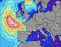 | |||||||||||||
Wave Height (m) Direction Period (s) | NE 5 | NE 5 | NE 5 | NNE 4 | W 8 | W 8 | W 8 | W 9 | W 8 | WNW 8 | NW 5 | NE 4 | ENE 5 | ENE 4 | WNW 12 | WNW 11 | WNW 10 | WNW 10 | WNW 10 | WNW 9 | WNW 9 |
Wave Graph | |||||||||||||||||||||
57 | 45 | 38 | 34 | 14 | 12 | 12 | 13 | 12 | 13 | 11 | 26 | 66 | 17 | 26 | 23 | 35 | 33 | 32 | 29 | 28 | |
Wind (km/h) | |||||||||||||||||||||
Wind State on-shore cross-onshore cross-shore cross-offshore off-shore glassy | cross-on | cross-on | on | on | cross-on | on | cross-off | cross | cross-on | glassy | cross-on | cross-on | cross-on | cross-on | on | glassy | cross-on | cross-on | cross-on | cross-on | cross-on |
High Tide | 8:20PM7.80m | 8:49AM7.52m | 9:06PM7.90m | 9:34AM7.49m | 9:51PM7.79m | 10:18AM7.30m | 10:34PM7.50m | 11:00AM6.99m | 11:16PM7.07m | 11:42AM6.60m | 11:59PM6.55m | 12:26PM6.18m | 00:46AM6.03m | 1:16PM5.78m | |||||||
Low Tide | 2:40AM-0.17m | 2:58PM0.11m | 3:25AM-0.20m | 3:42PM0.18m | 4:09AM-0.01m | 4:25PM0.42m | 4:51AM0.36m | 5:08PM0.81m | 5:33AM0.85m | 5:51PM1.29m | 6:16AM1.40m | 6:37PM1.80m | 7:02AM1.94m | 7:29PM2.26m | |||||||
— | 6:26 | — | — | 6:28 | — | — | 6:28 | — | — | 6:30 | — | — | 6:31 | — | — | 6:31 | — | — | 6:33 | — | |
10:12 | — | — | 10:12 | — | — | 10:10 | — | — | 10:09 | — | — | 10:08 | — | — | 10:07 | — | — | 10:07 | — | 10:05 | |
mm | — | 1 | 2 | 3 | — | — | — | — | — | — | — | — | — | — | — | — | — | — | — | — | — |
Temp °C | 22 | 18 | 20 | 20 | 19 | 23 | 23 | 20 | 21 | 19 | 17 | 19 | 19 | 19 | 20 | 20 | 21 | 22 | 21 | 20 | 21 |
Feels °C | 21 | 18 | 18 | 20 | 17 | 20 | 20 | 18 | 18 | 17 | 11 | 13 | 13 | 15 | 16 | 16 | 17 | 17 | 17 | 15 | 16 |
Swell 1 Height (m) Direction Period (s) | W 9 | W 8 | W 8 | W 9 | NNW 4 | NE 4 | W 8 | NW 4 | W 8 | WNW 8 | NW 5 | NW 4 | WNW 7 | WNW 9 | WNW 12 | WNW 11 | NW 4 | WNW 10 | WNW 10 | WNW 9 | WNW 9 |
14 | 5 | 12 | 14 | 3 | 4 | 12 | 9 | 12 | 13 | 11 | 3 | 5 | 8 | 26 | 23 | 7 | 33 | 32 | 29 | 28 | |
Swell 2 Height (m) Direction Period (s) | W 11 | W 10 | SW 7 | SW 6 | W 8 | W 8 | ENE 5 | W 9 | — | WNW 3 | WNW 8 | WNW 7 | W 9 | WNW 12 | W 8 | NE 4 | WNW 10 | NW 4 | NW 4 | NW 4 | — |
2 | 8 | 2 | 2 | 12 | 12 | 2 | 13 | — | 1 | 11 | 5 | 2 | 14 | 6 | 4 | 35 | 3 | 1 | 1 | — | |
Swell 3 Height (m) Direction Period (s) | — | — | — | — | SW 6 | NE 6 | NW 6 | NE 4 | — | NE 4 | W 11 | W 10 | W 12 | W 9 | NW 5 | W 8 | W 7 | — | — | — | — |
— | — | — | — | 1 | 5 | 1 | 1 | — | 1 | 2 | 2 | 3 | 6 | 1 | 5 | 1 | — | — | — | — | |
Wind waves Height (m) Direction Period (s) | NE 5 | NE 5 | NE 5 | NNE 4 | NE 4 | — | NW 3 | — | NW 4 | — | NE 4 | NE 4 | ENE 5 | ENE 4 | ENE 4 | — | E 4 | ENE 3 | NE 4 | ENE 4 | ENE 3 |
57 | 45 | 38 | 34 | 14 | — | 3 | — | 4 | — | 1 | 26 | 66 | 17 | 11 | — | 1 | 8 | 5 | 3 | 1 | |
Nearest Offshore or Glassy | |||||||||||||||||||||
Distance (km) | 215 | 457 | 451 | 133 | 483 | 483 | 999 | 616 | 605 | 606 | 105 | 214 | 215 | 477 | 556 | 538 | 105 | 212 | 200 | 222 | 215 |
Best forecast wave conditions in Cote d'Armor - Brittany | |||||||||||||||||||||
Best forecast wave conditions in France | |||||||||||||||||||||
Header Global | |||||||||||||||||||||
- Map Icons:
 Break
Break Live Wave Height (m)
 Live Wind Speed (km/h)
 Surf Rating (10 Max)
 Ocean Swells (m)
- Wind Speed (km/h)


FREE! Surf-Forecast.com widget for your website
The surf report / weather widget below is available to embed on third party websites free of charge and provides a summary of our Pors Nevez surf forecast. Simply grab the html code snippet that we provide and paste it into your own site. You can choose your preferred language and metric/imperial units for the surf forecast feed to suit users of your site. Click here to get the code.
Information about the Pors Nevez Surf forecast
The above surf forecast table for Pors Nevez provides essential information for determining whether the surfing conditions will be good over the next 16 days. A general guide to surfing at Pors Nevez can be found by selecting the local surf guide option on the grey menu. Our Pors Nevez surf forecast is unique since it includes wave energy (power) that defines the real feel of the surf rather than just the height or the period. If you surf the same spot (Pors Nevez) regularly then make a mental note of the wave energy from the surf forecast table each time you go. Very soon you may start to choose your surf days based on the wave energy alone combined with our forecast of favourable offshore wind conditions. Our star ratings will help here and of course you will also find the usual wave height and period predictions on our surf forecasts as well as a full break down of the swell components under our advanced users option (to reveal that, click the little Einstein character under the tide times).
Further information to help with frequently asked questions about our surf forecast for Pors Nevez may be found under the help tab on the top menu and also by moving your mouse over the question marks on the surf forecast table itself. Please always bear in mind that the forecast is for near-shore open water and local factors at each surf break influence the actual breaking wave height, such as the beach / reef profile, water depths offshore and shelter.
Are you planning a holiday in Cote d'Armor - Brittany? If you are looking for accommodation near Pors Nevez, camping, hotels and holiday cottages in Cote d'Armor - Brittany, consider staying in Lannion which is 10 km (6 miles) away. Other places in and around Cote d'Armor - Brittany where you can find information about places to rent, and car hire include Treguier which is 16 km (10 miles) away, Paimpol, Morlaix and Roscoff.
 Nearest