

Surf Forecasts:

How big are the waves at Playon today (27 Jun):
- Morning surf: Morning surf (27 Jun, local time) - 8ft (2.5m), 10s period with NE swell.
- Afternoon surf: Afternoon surf (27 Jun, local time) - 10ft (3.0m), 11s period with NE swell.
- Evening surf: Evening surf (27 Jun, local time) - 10ft (3.0m), 10s period with NE swell.
The current surf forecast for Playon at 1AM is: 2.5m 10s primary swell from a Northeast direction (forecast issued at 06:00pm June 26). The wind direction is predicted to be onshore.
| Time (EST) & Date | Wave Height | Wave Period |
|---|---|---|
| Morning (27 Jun) | 8ft (2.5m) | 10s |
| Afternoon (27 Jun) | 10ft (3.0m) | 11s |
| Evening (27 Jun) | 10ft (3.0m) | 10s |
Table - waves today at Playon. (Swell directed towards the surf break)
Updates in hr min s Forecast update imminent
Short Range ForecastLight rain (total 8mm), mostly falling on Mon morning. Warm (max 29°C on Sat morning, min 27°C on Fri afternoon). Wind will be generally light. | ||||||||||||||||||||||||
Fri 26 | Saturday 27 | Sunday 28 | Mon 29 | |||||||||||||||||||||
4 PM | 7 PM | 10 PM | 1 AM | 4 AM | 7 AM | 10 AM | 1 PM | 4 PM | 7 PM | 10 PM | 1 AM | 4 AM | 7 AM | 10 AM | 1 PM | 4 PM | 7 PM | 10 PM | 1 AM | 4 AM | 7 AM | 10 AM | 1 PM | |
Swell Height Map |  |  | 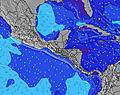 |  |  | 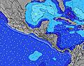 |  |  | 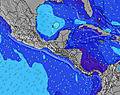 | |||||||||||||||
Wave Height (m) Direction Period (s) | NE 10 | NE 10 | NE 10 | NE 10 | NE 10 | NE 10 | NE 10 | NE 10 | NE 11 | NE 10 | NE 10 | NE 10 | NE 10 | NE 10 | NE 10 | NE 10 | NE 10 | NE 10 | NE 10 | NE 9 | NE 9 | NE 9 | NE 9 | NE 9 |
Wave Graph | ||||||||||||||||||||||||
851 | 1115 | 1300 | 1461 | 1352 | 1259 | 1300 | 1519 | 1814 | 1714 | 1530 | 1391 | 1224 | 1199 | 1297 | 1403 | 1367 | 1261 | 1013 | 872 | 684 | 623 | 567 | 554 | |
Wind (km/h) | ||||||||||||||||||||||||
Wind State on-shore cross-onshore cross-shore cross-offshore off-shore glassy | on | on | on | on | on | on | on | on | on | on | on | on | on | on | on | on | cross-on | cross-on | on | on | on | on | on | cross-on |
High Tide | 10:14PM0.40m | 10:53PM0.39m | 11:33PM0.39m | |||||||||||||||||||||
Low Tide | 1:12PM0.11m | 7:34AM0.03m | 8:14AM0.02m | 8:48AM0.01m | ||||||||||||||||||||
— | — | — | — | 6:00 | — | — | — | — | — | — | — | 6:00 | — | — | — | — | — | — | — | 6:01 | — | — | — | |
6:40 | — | — | — | — | — | — | — | 6:40 | — | — | — | — | — | — | — | 6:40 | — | — | — | — | — | — | 6:42 | |
mm | 1 | — | — | — | — | — | — | — | — | — | — | — | 1 | 1 | 1 | — | — | — | — | — | — | 1 | 2 | 1 |
Temp °C | 28 | 27 | 27 | 27 | 27 | 27 | 28 | 29 | 28 | 27 | 27 | 27 | 27 | 27 | 28 | 28 | 28 | 27 | 27 | 27 | 28 | 28 | 29 | 29 |
Feels °C | 30 | 29 | 29 | 30 | 30 | 29 | 30 | 31 | 30 | 29 | 29 | 28 | 28 | 28 | 29 | 30 | 30 | 29 | 30 | 30 | 31 | 31 | 32 | 33 |
Swell 1 Height (m) Direction Period (s) | NE 10 | NE 10 | NE 10 | NE 10 | NE 10 | NE 10 | NE 10 | NE 10 | NE 11 | NE 10 | NE 10 | NE 10 | NE 10 | NE 10 | NE 10 | NE 10 | NE 10 | NE 10 | NE 10 | NE 9 | NE 9 | NE 9 | NE 9 | NE 9 |
851 | 1115 | 1300 | 1461 | 1352 | 1259 | 1300 | 1519 | 1814 | 1714 | 1530 | 1391 | 1224 | 1199 | 1297 | 1403 | 1367 | 1261 | 1013 | 872 | 684 | 623 | 567 | 554 | |
Swell 2 Height (m) Direction Period (s) | — | — | — | — | — | — | — | — | — | — | — | — | — | — | — | — | — | — | — | — | — | — | — | — |
— | — | — | — | — | — | — | — | — | — | — | — | — | — | — | — | — | — | — | — | — | — | — | — | |
Swell 3 Height (m) Direction Period (s) | — | — | — | — | — | — | — | — | — | — | — | — | — | — | — | — | — | — | — | — | — | — | — | — |
— | — | — | — | — | — | — | — | — | — | — | — | — | — | — | — | — | — | — | — | — | — | — | — | |
Wind waves Height (m) Direction Period (s) | — | — | — | — | — | — | — | — | — | — | — | — | — | — | — | — | — | — | — | — | — | — | — | — |
— | — | — | — | — | — | — | — | — | — | — | — | — | — | — | — | — | — | — | — | — | — | — | — | |
Nearest Offshore or Glassy | ||||||||||||||||||||||||
Distance (km) | 71 | 71 | 71 | 71 | 71 | 71 | 71 | 71 | 71 | 71 | 71 | 71 | 71 | 71 | 71 | 71 | 71 | 71 | 71 | 71 | 71 | 44 | 71 | 1 |
Best forecast wave conditions in Colón Province | ||||||||||||||||||||||||
Best forecast wave conditions in Panama | ||||||||||||||||||||||||
Header Global | ||||||||||||||||||||||||
- Map Icons:
 Break
Break Live Wave Height (m)
 Live Wind Speed (km/h)
 Surf Rating (10 Max)
 Ocean Swells (m)
- Wind Speed (km/h)


FREE! Surf-Forecast.com widget for your website
The surf report / weather widget below is available to embed on third party websites free of charge and provides a summary of our Playon surf forecast. Simply grab the html code snippet that we provide and paste it into your own site. You can choose your preferred language and metric/imperial units for the surf forecast feed to suit users of your site. Click here to get the code.
 Nearest