

Surf Forecasts:

Conchalio surf forecast from 2 Aug 2026:
- Best quality surf: Friday 7 Aug, 9PM (local time) - 3ft (0.9m), 16s period, SSW swell with glassy winds.
- Most powerful swell: Saturday 8 Aug, 3PM (local time) - 4ft (1.2m), 16s period, SSW swell with 641 kJ wave energy.
- Next surfable swell (1★+): Monday 3 Aug, 12AM (local time) - 3ft (0.9m), 13s period with SW swell.
Best Forecast Surf Conditions for Conchalio this week:
The surf forecast for Conchalio over the next 16 days: The first swell (rated 1 star or higher) is forecast to arrive on Monday (Aug 03) at 12AM. The primary swell is predicted to be 0.9m and 13s period with a secondary swell of 0.3m and 3s. The wind is predicted to be cross-offshore as the swell arrives.
The most powerful waves expected at Conchalio in the next 16 days are 1.2m 16s and forecast to arrive on Saturday (Aug 08) at 3PM. Winds are predicted to be cross-onshore at the time the swell arrives. The largest open ocean swell (not directed at the beach) is 1.6m 8s period and expected on Friday (Aug 07) at 6AM.
| Wave Type | Time (CST) & Date | Wave Height & Period |
|---|---|---|
| Next good surf (1 star+) | 12AM (Mon 3rd Aug) | 3ft (0.9m) 13s |
| Best Surf | 9PM (Fri 7th Aug) | 3ft (0.9m) 16s |
| Most Powerful | 3PM (Sat 8th Aug) | 4ft (1.2m) 16s |
Table - best surf conditions forecast for Conchalio over the next 16 days.
The Lowdown
Alright folks, Rusty here. Let’s take a look at what’s coming up for Conchalio. We’ve got a solid run of surf ahead, but it’s all about picking the right windows because the afternoons get messy.
We start off on Sunday morning, August 2nd, with glassy conditions. The swell is a small 2ft from the SW, with a long 12-second period. The water is sitting at 86°, which is about normal for this time of year. It’s a gentle start, good for the beginners.
Monday morning, August 3rd, looks similar – a clean 3ft SW swell with glassy wind. Still small and clean, but nice for a longboard.
The real interest starts to build toward the end of the week. Friday morning, August 7th, sees a little more energy with a 2ft SSW swell, but the period jumps to 18 seconds – that’s proper groundswell. The wind is light offshore from the NNE, so it’ll be clean. The combined energy is moderate at (313). It’s a good sign of things to come.
Now, the standout window. Saturday morning, August 8th, is when it gets good. The swell pushes to 3ft from the SSW, with a 16-second period, and the wind is glassy from the NE. The combined energy climbs to (621) – that’s a noticeable jump in power. This is the best morning of the first week.
The following day, Sunday, August 9th, is another cracker. The swell is up to 4ft from the SSW, period at 14 seconds, and again it’s glassy in the morning. Combined energy is (545). This is a great, clean, long-period swell for a point break setup.
Looking further ahead into the second week, the pattern holds. Saturday morning, August 15th, has a 4ft SW swell with a 16-second period, light offshore cross-off wind from the N, and energy at (580). Sunday morning, August 16th, is also promising with a 3ft SW swell, 15-second period, and glassy conditions – energy at (684). And Monday morning, August 17th, keeps it going with a 4ft SW swell, 16-second period, and clean offshore wind (665).
The best on offer: Saturday morning, August 8th, and Sunday morning, August 9th, are the true standouts. Clean, glassy conditions, solid SW groundswell, and moderate to strong energy. For a more advanced session, Saturday morning, August 15th, also looks promising with a bit more size and a longer period.
Remember, the afternoons almost always get a cross-onshore or onshore wind, so make your move early. The crowds are *sometimes* an issue here, so expect some company on the best days.
Rusty out.
Short Range ForecastModerate rain (total 16mm), heaviest on Mon night. Warm (max 32°C on Sun morning, min 24°C on Mon night). Wind will be generally light. | Days 4-6 Weather SummaryHeavy rain (total 23mm), heaviest during Wed night. Warm (max 32°C on Wed morning, min 25°C on Wed night). Wind will be generally light. | ||||||||||||||||||||
Sunday 2 | Monday 3 | Tuesday 4 | Wednesday 5 | Thursday 6 | Friday 7 | Saturday 8 | |||||||||||||||
AM | PM | Night | AM | PM | Night | AM | PM | Night | AM | PM | Night | AM | PM | Night | AM | PM | Night | AM | PM | Night | |
Swell Height Map |  |  |  | 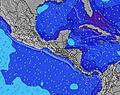 | 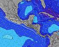 |  | 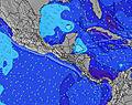 | ||||||||||||||
Wave Height (m) Direction Period (s) | SW 15 | SW 14 | SW 13 | SW 13 | SSW 13 | SSW 13 | SW 13 | SW 16 | SSW 14 | SW 12 | S 8 | SW 14 | SW 14 | SSW 14 | SSW 18 | SSW 18 | SSW 18 | SSW 16 | SSW 16 | SSW 16 | SSW 15 |
Wave Graph | |||||||||||||||||||||
142 | 132 | 257 | 249 | 147 | 98 | 130 | 118 | 77 | 69 | 55 | 73 | 95 | 121 | 221 | 209 | 390 | 407 | 532 | 641 | 443 | |
Wind (km/h) | |||||||||||||||||||||
Wind State on-shore cross-onshore cross-shore cross-offshore off-shore glassy | glassy | on | cross-off | glassy | on | off | off | cross-on | cross-off | glassy | cross-on | cross-off | glassy | on | glassy | off | cross-on | cross-off | glassy | cross-on | cross-off |
High Tide | 5:16PM1.92m | 5:43AM2.02m | 5:54PM1.86m | 6:21AM2.04m | 6:34PM1.80m | 7:02AM2.04m | 7:20PM1.72m | 7:50AM2.03m | 8:12PM1.65m | 8:45AM2.00m | 9:13PM1.60m | 9:48AM1.99m | 10:23PM1.60m | ||||||||
Low Tide | 11:12AM0.36m | 11:25PM0.25m | 11:53AM0.36m | 00:00AM0.27m | 12:36PM0.36m | 00:39AM0.30m | 1:22PM0.38m | 1:22AM0.34m | 2:15PM0.41m | 2:14AM0.38m | 3:16PM0.43m | 3:15AM0.41m | 4:24PM0.42m | ||||||||
5:41 | — | — | 5:41 | — | — | 5:41 | — | — | 5:43 | — | — | 5:43 | — | — | 5:43 | — | — | 5:43 | — | — | |
— | 6:23 | — | — | 6:23 | — | — | 6:23 | — | — | 6:22 | — | — | 6:22 | — | — | 6:22 | — | — | 6:22 | — | |
mm | — | — | — | — | — | 11 | 1 | 2 | 2 | — | 2 | 9 | — | 1 | 9 | — | 1 | 1 | — | 1 | 2 |
Temp °C | 32 | 30 | 27 | 32 | 30 | 26 | 31 | 30 | 25 | 32 | 30 | 26 | 32 | 29 | 28 | 32 | 32 | 27 | 31 | 30 | 26 |
Feels °C | 33 | 32 | 30 | 34 | 33 | 28 | 32 | 34 | 27 | 33 | 33 | 29 | 34 | 32 | 33 | 35 | 34 | 31 | 34 | 32 | 29 |
Swell 1 Height (m) Direction Period (s) | SW 12 | SE 7 | SW 13 | SW 13 | SSW 13 | SSW 8 | SW 13 | SSE 8 | S 8 | S 8 | S 8 | S 8 | S 8 | S 8 | SW 13 | SE 8 | SE 7 | SSW 16 | SSW 16 | SSW 16 | SSW 15 |
142 | 47 | 257 | 249 | 147 | 41 | 130 | 48 | 49 | 55 | 55 | 41 | 46 | 48 | 180 | 247 | 93 | 407 | 532 | 641 | 443 | |
Swell 2 Height (m) Direction Period (s) | SW 15 | SSW 12 | SE 6 | SSE 7 | SSW 16 | SSW 13 | SSE 8 | SSW 10 | SW 9 | SW 12 | SE 7 | SE 6 | SW 14 | SSW 14 | SSW 18 | SSW 18 | SSW 18 | S 12 | SE 8 | SE 7 | SE 6 |
134 | 119 | 24 | 18 | 99 | 98 | 44 | 65 | 41 | 69 | 38 | 13 | 95 | 121 | 221 | 209 | 390 | 98 | 122 | 67 | 23 | |
Swell 3 Height (m) Direction Period (s) | SE 7 | SW 14 | S 7 | SW 15 | SW 13 | S 7 | SSW 10 | SW 16 | SSW 14 | SW 14 | SW 12 | SW 14 | SSW 8 | SE 7 | S 8 | SW 13 | SW 12 | SE 6 | SW 12 | S 11 | S 11 |
16 | 132 | 10 | 54 | 61 | 26 | 38 | 118 | 77 | 54 | 49 | 73 | 25 | 23 | 33 | 104 | 96 | 23 | 89 | 59 | 61 | |
Wind waves Height (m) Direction Period (s) | — | — | WNW 3 | ESE 5 | — | — | ENE 2 | — | — | NNE 2 | SSW 2 | NW 3 | NNE 3 | S 2 | — | — | — | — | — | — | SE 6 |
— | — | 2 | 5 | — | — | 1 | — | — | 1 | 1 | 4 | 2 | 1 | — | — | — | — | — | — | 83 | |
Nearest Offshore or Glassy | |||||||||||||||||||||
Distance (km) | 0 | 338 | 0 | 0 | 338 | 0 | 0 | 9 | 0 | 0 | 313 | 0 | 0 | 471 | 0 | 0 | 159 | 0 | 0 | 137 | 0 |
Best forecast wave conditions in El-Salvador - Costa del Balsamo | |||||||||||||||||||||
Best forecast wave conditions in El Salvador | |||||||||||||||||||||
Header Global | |||||||||||||||||||||
- Map Icons:
 Break
Break Live Wave Height (m)
 Live Wind Speed (km/h)
 Surf Rating (10 Max)
 Ocean Swells (m)
- Wind Speed (km/h)
Latest Updates


FREE! Surf-Forecast.com widget for your website
The surf report / weather widget below is available to embed on third party websites free of charge and provides a summary of our Conchalio surf forecast. Simply grab the html code snippet that we provide and paste it into your own site. You can choose your preferred language and metric/imperial units for the surf forecast feed to suit users of your site. Click here to get the code.
Information about the Conchalio Surf forecast
The above surf forecast table for Conchalio provides essential information for determining whether the surfing conditions will be good over the next 16 days. A general guide to surfing at Conchalio can be found by selecting the local surf guide option on the grey menu. Our Conchalio surf forecast is unique since it includes wave energy (power) that defines the real feel of the surf rather than just the height or the period. If you surf the same spot (Conchalio) regularly then make a mental note of the wave energy from the surf forecast table each time you go. Very soon you may start to choose your surf days based on the wave energy alone combined with our forecast of favourable offshore wind conditions. Our star ratings will help here and of course you will also find the usual wave height and period predictions on our surf forecasts as well as a full break down of the swell components under our advanced users option (to reveal that, click the little Einstein character under the tide times).
Further information to help with frequently asked questions about our surf forecast for Conchalio may be found under the help tab on the top menu and also by moving your mouse over the question marks on the surf forecast table itself. Please always bear in mind that the forecast is for near-shore open water and local factors at each surf break influence the actual breaking wave height, such as the beach / reef profile, water depths offshore and shelter.
Conchalio is 2 km (1 miles) from the city of La Libertad. If you plan a holiday in El-Salvador - Costa del Balsamo, look for hotels and other accommodation in La Libertad. La Libertad has rooms for a wide range of budgets as well as car hire and transport links.
 Nearest