

Surf Forecasts:

How big are the waves at Conchalio today (29 Jul):
- Morning surf: Morning surf (29 Jul, local time) - 5.5ft (1.7m), 16s period with SSW swell.
- Afternoon surf: Afternoon surf (29 Jul, local time) - 5ft (1.5m), 16s period with SSW swell.
- Evening surf: Evening surf (29 Jul, local time) - 5ft (1.5m), 15s period with SSW swell.
The current surf forecast for Conchalio at 4PM is: 1.5m 16s primary swell from a South-southwest direction (forecast issued at 11:00am July 29). An open ocean swell of 0.5m 6s is not directed at the surf break. The wind direction is predicted to be onshore.
| Time (CST) & Date | Wave Height | Wave Period |
|---|---|---|
| Morning (29 Jul) | 5.5ft (1.7m) | 16s |
| Afternoon (29 Jul) | 5ft (1.5m) | 16s |
| Evening (29 Jul) | 5ft (1.5m) | 15s |
Table - waves today at Conchalio. (Swell directed towards the surf break)
Short Range ForecastModerate rain (total 10mm), heaviest on Wed night. Warm (max 33°C on Fri morning, min 26°C on Wed night). Wind will be generally light. | |||||||||||||||||||||
Wed 29 | Thursday 30 | Friday 31 | |||||||||||||||||||
9 AM | 12 PM | 3 PM | 6 PM | 9 PM | 12 AM | 3 AM | 6 AM | 9 AM | 12 PM | 3 PM | 6 PM | 9 PM | 12 AM | 3 AM | 6 AM | 9 AM | 12 PM | 3 PM | 6 PM | 9 PM | |
Swell Height Map | 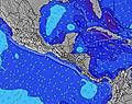 |  |  | 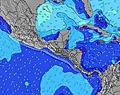 |  |  | 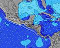 |  | |||||||||||||
Wave Height (m) Direction Period (s) | SSW 16 | SSW 16 | SSW 16 | SSW 16 | SSW 15 | SSW 15 | SSW 15 | SSW 14 | SSW 14 | SSW 14 | SSW 14 | SSW 14 | SSW 14 | SSW 14 | SSW 14 | SSW 14 | SSW 14 | SW 13 | SW 13 | SSW 13 | SSW 13 |
Wave Graph | |||||||||||||||||||||
1373 | 1339 | 1112 | 1112 | 1069 | 1014 | 818 | 796 | 691 | 691 | 682 | 672 | 530 | 515 | 508 | 501 | 493 | 412 | 400 | 357 | 351 | |
Wind (km/h) | |||||||||||||||||||||
Wind State on-shore cross-onshore cross-shore cross-offshore off-shore glassy | glassy | cross-on | on | cross-on | cross | cross-off | cross-off | off | glassy | cross-on | on | cross-on | cross-on | cross-off | cross-off | cross-off | glassy | cross-on | on | cross-on | cross-on |
High Tide | 2:42PM1.93m | 3:16AM1.76m | 3:22PM1.96m | 3:54AM1.85m | 4:01PM1.97m | ||||||||||||||||
Low Tide | 8:28AM0.49m | 9:07PM0.31m | 9:12AM0.44m | 9:43PM0.27m | 9:53AM0.40m | ||||||||||||||||
5:41 | — | — | — | — | — | 5:41 | — | — | — | — | — | — | — | 5:41 | — | — | — | — | — | — | |
— | — | — | 6:25 | — | — | — | — | — | — | — | 6:24 | — | — | — | — | — | — | — | 6:24 | — | |
mm | — | — | — | — | 1 | 2 | 1 | — | — | — | — | — | 1 | — | — | — | — | — | — | 1 | 1 |
Temp °C | 29 | 31 | 30 | 29 | 27 | 27 | 26 | 26 | 30 | 32 | 30 | 30 | 28 | 27 | 27 | 26 | 31 | 33 | 31 | 29 | 28 |
Feels °C | 33 | 33 | 33 | 33 | 31 | 31 | 29 | 29 | 34 | 34 | 33 | 33 | 32 | 31 | 31 | 29 | 35 | 35 | 33 | 33 | 32 |
Swell 1 Height (m) Direction Period (s) | SSW 16 | SSW 16 | SSW 16 | SSW 16 | SSW 15 | SSW 15 | SSW 15 | SSW 14 | SSW 14 | SSW 14 | SSW 14 | SSW 14 | SSW 14 | SSW 14 | SSW 14 | SSW 14 | SSW 14 | SW 13 | SW 13 | SSW 13 | SSW 13 |
1373 | 1339 | 1112 | 1112 | 1069 | 1014 | 818 | 796 | 691 | 691 | 682 | 672 | 530 | 515 | 508 | 501 | 493 | 412 | 400 | 357 | 351 | |
Swell 2 Height (m) Direction Period (s) | SSE 8 | SE 6 | SSE 6 | SE 6 | SE 6 | SE 5 | SE 5 | SE 5 | SSE 7 | SSE 7 | SSE 7 | SE 7 | SE 7 | SE 6 | SE 6 | SE 6 | SE 7 | SE 7 | SE 7 | SE 7 | SE 6 |
24 | 9 | 25 | 16 | 11 | 10 | 4 | 7 | 21 | 20 | 32 | 49 | 36 | 34 | 20 | 9 | 16 | 38 | 71 | 55 | 43 | |
Swell 3 Height (m) Direction Period (s) | S 9 | S 8 | W 10 | W 10 | SSW 10 | SSW 8 | S 7 | S 7 | W 11 | W 11 | W 10 | W 10 | WNW 10 | W 10 | W 10 | W 11 | W 10 | W 10 | W 10 | W 10 | WNW 10 |
2 | 11 | 8 | 8 | 34 | 11 | 10 | 10 | 21 | 21 | 19 | 19 | 37 | 33 | 34 | 35 | 19 | 18 | 17 | 17 | 18 | |
Wind waves Height (m) Direction Period (s) | — | — | — | — | — | — | — | — | ESE 5 | ESE 6 | — | — | — | — | — | — | — | — | — | — | — |
— | — | — | — | — | — | — | — | 10 | 11 | — | — | — | — | — | — | — | — | — | — | — | |
Nearest Offshore or Glassy | |||||||||||||||||||||
Distance (km) | 0 | 313 | 338 | 136 | 1 | 0 | 0 | 0 | 0 | 137 | 498 | 136 | 5 | 0 | 0 | 0 | 0 | 341 | 483 | 136 | 2 |
Best forecast wave conditions in El-Salvador - Costa del Balsamo | |||||||||||||||||||||
Best forecast wave conditions in El Salvador | |||||||||||||||||||||
Header Global | |||||||||||||||||||||
- Map Icons:
 Break
Break Live Wave Height (m)
 Live Wind Speed (km/h)
 Surf Rating (10 Max)
 Ocean Swells (m)
- Wind Speed (km/h)


FREE! Surf-Forecast.com widget for your website
The surf report / weather widget below is available to embed on third party websites free of charge and provides a summary of our Conchalio surf forecast. Simply grab the html code snippet that we provide and paste it into your own site. You can choose your preferred language and metric/imperial units for the surf forecast feed to suit users of your site. Click here to get the code.
 Nearest