

Surf Forecasts:

Playa Bruja surf forecast from 1 Aug 2026:
- Best quality surf: Saturday 1 Aug, 11PM (local time) - 2.5ft (0.7m), 13s period, SW swell with cross-offshore winds.
- Most powerful swell: Saturday 8 Aug, 11AM (local time) - 3.5ft (1.0m), 16s period, SW swell with 496 kJ wave energy.
- Next surfable swell (1★+): Saturday 1 Aug, 11PM (local time) - 2.5ft (0.7m), 13s period with SW swell.
Best Forecast Surf Conditions for Playa Bruja this week:
The surf forecast for Playa Bruja over the next 16 days: The first swell (rated 1 star or higher) is forecast to arrive on Saturday (Aug 01) at 11PM. The primary swell is predicted to be 0.7m and 13s period with a secondary swell of 0.5m and 8s. The wind is predicted to be cross-offshore as the swell arrives.
The most powerful waves expected at Playa Bruja in the next 16 days are 1.0m 16s and forecast to arrive on Saturday (Aug 08) at 11AM. Winds are predicted to be onshore at the time the swell arrives. The largest open ocean swell (not directed at the beach) is 0.3m 2s period and expected on Sunday (Aug 02) at 11PM.
| Wave Type | Time (MST) & Date | Wave Height & Period |
|---|---|---|
| Next good surf (1 star+) | 11PM (Sat 1st Aug) | 2.5ft (0.7m) 13s |
| Best Surf | 11PM (Sat 1st Aug) | 2.5ft (0.7m) 13s |
| Most Powerful | 11AM (Sat 8th Aug) | 3.5ft (1.0m) 16s |
Table - best surf conditions forecast for Playa Bruja over the next 16 days.
The Lowdown
Alright folks, Rusty here. Let’s have a look at what’s on the cards for the next couple of weeks.
Honestly, for the first week and a half, it’s a bit of a struggle. The surf is there, but it’s not clean. We’re looking at a long stretch of poor surf conditions, with a lot of those cross-onshore or onshore winds messing up the shape. The water temperature is sitting at 89°, which is a touch warmer than normal for this time of year, so at least you won’t need a thick wetsuit.
The first real glimmer of hope doesn’t show up until the morning of Saturday, August 8th. That’s where we see the best conditions on offer. Playa Bruja will see a clean 3 ft SW groundswell (period of 16 seconds) with a light offshore wind. That’s a long-period swell, which means it’s got real energy behind it (moderate wave energy at 577) and will produce some nice, lined-up waves. The only catch is that for a spot like this, a long period swell can sometimes be a bit too straight for a beach break, but with offshore wind, it’s going to be the pick of the bunch. Expect a few other surfers in the water, but it’s worth the paddle.
As we push into the second week, the pattern doesn’t change much. The mornings of Friday, August 14th and Saturday, August 15th show some promise. On the 14th morning, we’ve got a 3 ft SW groundswell (period 18 seconds, very long period) with light cross-onshore winds. The combined energy is strong (621), so there’s some punch, but it’s not glassy. The 15th morning is similar, with a 3 ft SW swell, but the winds look a little more favorable. These are still marginal, but they’re your best bets late in the run.
Overall, it’s a waiting game. The first standout is definitely the morning of August 8th. After that, the 14th and 15th are worth a look if you’re desperate for a wave, but nothing is a guarantee. The conditions just aren’t cooperating for a clean, consistent session.
Rusty.
Short Range ForecastHeavy rain (total 28mm), heaviest during Sat night. Warm (max 31°C on Sun afternoon, min 26°C on Sat night). Wind will be generally light. | Days 4-6 Weather SummaryLight rain (total 4mm), mostly falling on Tue morning. Warm (max 30°C on Tue morning, min 26°C on Tue morning). Wind will be generally light. | ||||||||||||||||||||
Saturday 1 | Sunday 2 | Monday 3 | Tuesday 4 | Wednesday 5 | Thursday 6 | Friday 7 | |||||||||||||||
AM | PM | Night | AM | PM | Night | AM | PM | Night | AM | PM | Night | AM | PM | Night | AM | PM | Night | AM | PM | Night | |
Swell Height Map | 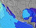 |  | 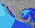 | 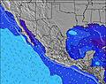 | 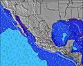 | 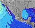 | 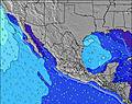 | ||||||||||||||
Wave Height (m) Direction Period (s) | SW 12 | SW 12 | SW 13 | SW 14 | SW 13 | SW 13 | SSW 13 | SSW 13 | SW 16 | SW 16 | SSW 12 | SW 15 | SW 14 | SW 14 | SW 14 | SW 13 | SW 13 | SW 19 | SW 18 | SW 17 | SW 16 |
Wave Graph | |||||||||||||||||||||
223 | 159 | 183 | 64 | 142 | 175 | 111 | 114 | 73 | 88 | 99 | 75 | 103 | 73 | 70 | 113 | 208 | 278 | 249 | 439 | 310 | |
Wind (km/h) | |||||||||||||||||||||
Wind State on-shore cross-onshore cross-shore cross-offshore off-shore glassy | on | cross-on | cross-off | on | cross-on | off | cross | on | cross | cross-on | on | glassy | cross-on | cross-on | cross-off | on | on | glassy | on | cross-on | cross-off |
High Tide | 10:25AM1.46m | 9:52PM1.54m | 10:48AM1.49m | 10:30PM1.41m | 11:13AM1.51m | 11:15PM1.24m | 11:45AM1.52m | 00:22AM1.06m | 12:26PM1.50m | 3:16AM0.93m | 1:33PM1.48m | 3:15PM1.48m | |||||||||
Low Tide | 4:00PM0.67m | 4:21AM0.36m | 4:41PM0.65m | 4:43AM0.49m | 5:30PM0.65m | 5:05AM0.63m | 6:34PM0.65m | 5:23AM0.78m | 8:19PM0.63m | 5:08AM0.93m | 10:34PM0.50m | 11:51PM0.32m | |||||||||
5:35 | — | — | 5:35 | — | — | 5:37 | — | — | 5:37 | — | — | 5:37 | — | — | 5:37 | — | — | 5:37 | — | — | |
— | 6:47 | — | — | 6:47 | — | — | 6:46 | — | — | 6:45 | — | — | 6:45 | — | — | 6:45 | — | — | 6:45 | — | |
mm | — | — | 7 | — | — | 3 | 2 | — | 16 | 2 | — | — | — | — | — | — | 1 | 1 | — | — | 2 |
Temp °C | 30 | 30 | 29 | 29 | 31 | 27 | 30 | 30 | 28 | 30 | 30 | 28 | 29 | 30 | 28 | 30 | 30 | 27 | 30 | 30 | 29 |
Feels °C | 34 | 32 | 34 | 33 | 35 | 30 | 32 | 32 | 34 | 33 | 33 | 32 | 32 | 33 | 32 | 33 | 33 | 31 | 32 | 33 | 33 |
Swell 1 Height (m) Direction Period (s) | SW 12 | SW 12 | SW 13 | SSW 11 | SW 13 | SW 13 | SSW 13 | SSW 13 | SW 12 | SW 16 | SSW 12 | SSW 12 | SW 14 | SW 14 | SW 14 | SW 13 | SW 13 | SW 13 | SW 13 | SW 17 | SW 16 |
223 | 159 | 183 | 49 | 142 | 175 | 111 | 114 | 73 | 88 | 99 | 56 | 103 | 73 | 70 | 113 | 208 | 175 | 164 | 439 | 310 | |
Swell 2 Height (m) Direction Period (s) | WSW 8 | SW 15 | WSW 8 | SW 14 | WSW 5 | W 6 | SW 16 | SW 16 | SW 16 | SW 12 | SW 15 | SW 15 | S 9 | S 9 | S 9 | SSW 9 | SW 18 | SW 19 | SW 18 | SW 12 | SW 12 |
25 | 56 | 11 | 64 | 16 | 16 | 67 | 66 | 66 | 39 | 56 | 75 | 13 | 13 | 14 | 26 | 159 | 278 | 249 | 124 | 116 | |
Swell 3 Height (m) Direction Period (s) | SW 20 | SW 20 | WSW 4 | WSW 8 | SW 18 | SW 18 | WSW 5 | WSW 6 | WSW 5 | SW 12 | WSW 5 | WSW 4 | SSW 12 | SW 11 | SW 11 | SW 20 | SSW 8 | SSW 8 | S 13 | S 12 | S 12 |
15 | 15 | 3 | 22 | 49 | 49 | 5 | 6 | 5 | 22 | 4 | 4 | 14 | 19 | 32 | 60 | 28 | 22 | 3 | 3 | 3 | |
Wind waves Height (m) Direction Period (s) | WSW 4 | W 8 | W 3 | — | — | — | — | — | — | — | — | — | — | WSW 4 | — | — | W 2 | — | — | — | — |
1 | 29 | 6 | — | — | — | — | — | — | — | — | — | — | 3 | — | — | 1 | — | — | — | — | |
Nearest Offshore or Glassy | |||||||||||||||||||||
Distance (km) | 144 | 313 | 0 | 30 | 5 | 0 | 267 | 319 | 19 | 144 | 319 | 0 | 144 | 676 | 0 | 144 | 303 | 0 | 144 | 313 | 0 |
Best forecast wave conditions in Sinaloa | |||||||||||||||||||||
Best forecast wave conditions in Mexico | |||||||||||||||||||||
Header Global | |||||||||||||||||||||
- Map Icons:
 Break
Break Live Wave Height (m)
 Live Wind Speed (km/h)
 Surf Rating (10 Max)
 Ocean Swells (m)
- Wind Speed (km/h)
Latest Updates


FREE! Surf-Forecast.com widget for your website
The surf report / weather widget below is available to embed on third party websites free of charge and provides a summary of our Playa Bruja surf forecast. Simply grab the html code snippet that we provide and paste it into your own site. You can choose your preferred language and metric/imperial units for the surf forecast feed to suit users of your site. Click here to get the code.
Information about the Playa Bruja Surf forecast
The above surf forecast table for Playa Bruja provides essential information for determining whether the surfing conditions will be good over the next 16 days. A general guide to surfing at Playa Bruja can be found by selecting the local surf guide option on the grey menu. Our Playa Bruja surf forecast is unique since it includes wave energy (power) that defines the real feel of the surf rather than just the height or the period. If you surf the same spot (Playa Bruja) regularly then make a mental note of the wave energy from the surf forecast table each time you go. Very soon you may start to choose your surf days based on the wave energy alone combined with our forecast of favourable offshore wind conditions. Our star ratings will help here and of course you will also find the usual wave height and period predictions on our surf forecasts as well as a full break down of the swell components under our advanced users option (to reveal that, click the little Einstein character under the tide times).
Further information to help with frequently asked questions about our surf forecast for Playa Bruja may be found under the help tab on the top menu and also by moving your mouse over the question marks on the surf forecast table itself. Please always bear in mind that the forecast is for near-shore open water and local factors at each surf break influence the actual breaking wave height, such as the beach / reef profile, water depths offshore and shelter.
Are you planning a holiday in Sinaloa? If you are looking for accommodation near Playa Bruja, camping, hotels and holiday cottages in Sinaloa, consider staying in Mazatlan which is 29 km (18 miles) away.
 Nearest