

Surf Forecasts:

Palomino surf forecast from 21 Jul 2026:
- Best quality surf: Saturday 25 Jul, 7PM (local time) - 7ft (2.1m), 8s period, NE swell with glassy winds.
- Most powerful swell: Saturday 25 Jul, 7PM (local time) - 7ft (2.1m), 8s period, NE swell with 481 kJ wave energy.
- Next surfable swell (1★+): Wednesday 22 Jul, 7PM (local time) - 5ft (1.6m), 7s period with NE swell.
Best Forecast Surf Conditions for Palomino this week:
The surf forecast for Palomino over the next 16 days: The first swell (rated 1 star or higher) is forecast to arrive on Wednesday (Jul 22) at 7PM. The primary swell is predicted to be 1.6m and 7s period. The wind is predicted to be glassy as the swell arrives.
The most powerful waves expected at Palomino in the next 16 days are 2.1m 8s and forecast to arrive on Saturday (Jul 25) at 7PM. Winds are predicted to be glassy at the time the swell arrives.
| Wave Type | Time (-05) & Date | Wave Height & Period |
|---|---|---|
| Next good surf (1 star+) | 7PM (Wed 22nd Jul) | 5ft (1.6m) 7s |
| Best Surf | 7PM (Sat 25th Jul) | 7ft (2.1m) 8s |
| Most Powerful | 7PM (Sat 25th Jul) | 7ft (2.1m) 8s |
Table - best surf conditions forecast for Palomino over the next 16 days.
The Lowdown
Alright folks, Rusty here. Let’s have a look at what’s cooking for Palomino over the next couple of weeks.
Right off the bat, the first few days are a bit of a write-off – think Monday 20th through to Wednesday 22nd. We’ve got small, short-period waves from the NE, mostly around 4 ft to 5 ft, but the wind is ugly. It’s cross-on or onshore most of the time, and combined energy is weak (178 to 196) on Monday, dropping even lower Tuesday and Wednesday. The water is a warm 81°F which is about average for the time of year, but honestly, you’re better off waiting. The surf is just messy and ordinary.
Thursday 23rd afternoon sees a small shift. The wind swings offshore from the SW, and the swell drops to 3 ft from the NE. It’s clean, but the energy is weak (67). It’s surfable, but nothing to get excited about.
Friday 24th afternoon is where it starts to get interesting. The wind goes completely glassy, calm, and that 4 ft NE swell at 8 seconds will be clean as a whistle. The energy is moderate (163). It’s a small wave, but it’ll be fun for a beginner-friendly session.
Saturday 25th is the first real standout. The morning is glassy, dead calm, with a 5 ft NE swell at 8 seconds. The combined energy jumps to 352 – that’s solid moderate energy. This is a proper little window of clean, fun waves. The afternoon stays glassy with a 5 ft swell. This is the best bet for the first week, no question. Crowds are possible, so get in early.
The next few days (Sunday 26th to Wednesday 29th) are a mixed bag. The wind is inconsistent, and the swell stays around 4 ft to 5 ft. The combined energy ranges from 126 to 328, but it’s often cross-on or choppy. Nothing to write home about. Wednesday 29th afternoon sees a bigger pulse of 7 ft from the NE, but the wind is onshore and the conditions are unknown.
Now, hold onto your boards. Thursday 30th July is the second standout, and it’s a big one. The morning is glassy, calm, with a 7 ft NE swell at 8 seconds. The combined energy is a massive 588 – that’s strong wave energy. This is a serious step up in size and power. The period is 8 seconds, so it’s a short-period wind swell, but with that much energy and glassy conditions, it’s going to be firing. For experienced surfers, this is the session to aim for. The afternoon bumps up to 8 ft with energy hitting 858, but the wind goes cross-on, so the morning is the clear winner.
The rest of the run into early August has some decent moments. Friday 31st and Saturday 1st are smaller, around 4 ft to 5 ft, with moderate energy. But look at Sunday 2nd August afternoon: a 5 ft NE swell, clean, with a cross-off breeze from the west. That’s good surf. Then Monday 3rd and Tuesday 4th also look promising. Monday afternoon is glassy with a 6 ft swell (energy 382), and Tuesday morning is glassy with a 5 ft swell (energy 496). Tuesday afternoon sees the swell jump to 7 ft with offshore wind from the SSW and energy at 519 – that’s another very good session for the experts.
So, the long story short: the first week is mostly a dud until Saturday 25th. The real juice is on Thursday 30th July with a strong, clean swell, and there are a few good follow-up days in early August. Keep an eye on the sky, and don’t sleep on that Saturday morning.
Rusty.
Short Range ForecastModerate rain (total 19mm), heaviest on Mon afternoon. Warm (max 29°C on Tue morning, min 25°C on Mon night). Wind will be generally light. | Days 5-7 Weather SummaryModerate rain (total 19mm), heaviest on Thu afternoon. Warm (max 28°C on Fri afternoon, min 24°C on Sat night). Wind will be generally light. | |||||||||||||||||||
Mon 20 | Tuesday 21 | Wednesday 22 | Thursday 23 | Friday 24 | Saturday 25 | Sunday 26 | ||||||||||||||
PM | Night | AM | PM | Night | AM | PM | Night | AM | PM | Night | AM | PM | Night | AM | PM | Night | AM | PM | Night | |
Swell Height Map | 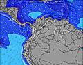 | 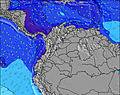 | 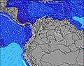 | 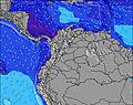 | 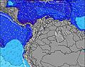 | 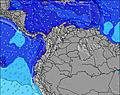 | 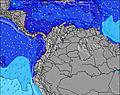 | |||||||||||||
Wave Height (m) Direction Period (s) | NE 7 | NE 7 | NE 7 | NE 6 | NE 7 | NE 6 | NE 6 | NE 7 | NE 6 | NE 7 | NE 7 | NE 8 | NE 8 | NE 8 | NE 8 | NE 7 | NE 7 | NE 7 | NE 7 | NE 7 |
Wave Graph | ||||||||||||||||||||
178 | 164 | 131 | 196 | 221 | 124 | 112 | 206 | 81 | 67 | 203 | 227 | 163 | 274 | 245 | 242 | 241 | 139 | 135 | 181 | |
Wind (km/h) | ||||||||||||||||||||
Wind State on-shore cross-onshore cross-shore cross-offshore off-shore glassy | on | cross | cross-on | cross-on | cross | cross-on | on | cross | on | off | glassy | cross-on | glassy | cross | glassy | glassy | cross | cross-on | glassy | glassy |
High Tide | 5:59PM0.30m | 5:02AM0.14m | 6:37PM0.32m | 6:19AM0.10m | 7:11PM0.32m | 7:31AM0.07m | 7:45PM0.33m | 8:21AM0.05m | 8:18PM0.33m | 8:53AM0.04m | 8:53PM0.33m | 9:14AM0.04m | 9:28PM0.34m | |||||||
Low Tide | 1:37AM0.12m | 10:42AM0.08m | 2:56AM0.09m | 10:54AM0.07m | 3:53AM0.06m | 11:06AM0.06m | 4:38AM0.04m | 5:17AM0.03m | 5:57AM0.02m | |||||||||||
— | — | 5:39 | — | — | 5:39 | — | — | 5:39 | — | — | 5:39 | — | — | 5:39 | — | — | 5:41 | — | — | |
6:21 | — | — | 6:21 | — | — | 6:21 | — | — | 6:20 | — | — | 6:20 | — | — | 6:20 | — | — | 6:20 | — | |
mm | 9 | 5 | 1 | 2 | — | — | 1 | — | 1 | 8 | — | — | 5 | — | — | 4 | 1 | 1 | 8 | — |
Temp °C | 27 | 26 | 29 | 28 | 26 | 28 | 26 | 26 | 27 | 26 | 26 | 27 | 28 | 26 | 28 | 28 | 26 | 27 | 26 | 26 |
Feels °C | 31 | 29 | 31 | 32 | 27 | 31 | 30 | 31 | 31 | 29 | 29 | 30 | 33 | 29 | 31 | 33 | 30 | 30 | 31 | 29 |
Swell 1 Height (m) Direction Period (s) | — | NNE 6 | NE 7 | — | NNE 7 | — | — | NNE 7 | NE 6 | NE 7 | NE 7 | NE 8 | NE 8 | NNE 7 | NE 7 | — | NNE 7 | NE 7 | — | NNE 7 |
— | 74 | 63 | — | 70 | — | — | 93 | 42 | 67 | 91 | 227 | 163 | 81 | 107 | — | 96 | 67 | — | 76 | |
Swell 2 Height (m) Direction Period (s) | — | — | — | — | — | — | — | — | — | — | — | — | — | — | — | — | — | — | — | — |
— | — | — | — | — | — | — | — | — | — | — | — | — | — | — | — | — | — | — | — | |
Swell 3 Height (m) Direction Period (s) | — | — | — | — | — | — | — | — | — | — | — | — | — | — | — | — | — | — | — | — |
— | — | — | — | — | — | — | — | — | — | — | — | — | — | — | — | — | — | — | — | |
Wind waves Height (m) Direction Period (s) | NE 7 | NE 7 | NE 7 | NE 6 | NE 7 | NE 6 | NE 6 | NE 7 | NE 6 | — | NE 7 | — | — | NE 8 | NE 8 | NE 7 | NE 7 | NE 7 | NE 7 | NE 7 |
178 | 164 | 131 | 196 | 221 | 124 | 112 | 206 | 81 | — | 203 | — | — | 274 | 245 | 242 | 241 | 139 | 135 | 181 | |
Nearest Offshore or Glassy | ||||||||||||||||||||
Distance (km) | 16 | 2 | 193 | 594 | 239 | 227 | 594 | 353 | 59 | 0 | 0 | 353 | 0 | 16 | 0 | 0 | 2 | 150 | 0 | 0 |
Best forecast wave conditions in Caribbean Coast | ||||||||||||||||||||
Best forecast wave conditions in Colombia | ||||||||||||||||||||
Header Global | ||||||||||||||||||||
- Map Icons:
 Break
Break Live Wave Height (m)
 Live Wind Speed (km/h)
 Surf Rating (10 Max)
 Ocean Swells (m)
- Wind Speed (km/h)


FREE! Surf-Forecast.com widget for your website
The surf report / weather widget below is available to embed on third party websites free of charge and provides a summary of our Palomino surf forecast. Simply grab the html code snippet that we provide and paste it into your own site. You can choose your preferred language and metric/imperial units for the surf forecast feed to suit users of your site. Click here to get the code.
Information about the Palomino Surf forecast
The above surf forecast table for Palomino provides essential information for determining whether the surfing conditions will be good over the next 16 days. A general guide to surfing at Palomino can be found by selecting the local surf guide option on the grey menu. Our Palomino surf forecast is unique since it includes wave energy (power) that defines the real feel of the surf rather than just the height or the period. If you surf the same spot (Palomino) regularly then make a mental note of the wave energy from the surf forecast table each time you go. Very soon you may start to choose your surf days based on the wave energy alone combined with our forecast of favourable offshore wind conditions. Our star ratings will help here and of course you will also find the usual wave height and period predictions on our surf forecasts as well as a full break down of the swell components under our advanced users option (to reveal that, click the little Einstein character under the tide times).
Further information to help with frequently asked questions about our surf forecast for Palomino may be found under the help tab on the top menu and also by moving your mouse over the question marks on the surf forecast table itself. Please always bear in mind that the forecast is for near-shore open water and local factors at each surf break influence the actual breaking wave height, such as the beach / reef profile, water depths offshore and shelter.
Palomino is 67 km (42 miles) from the city of Santa Marta. If you plan a holiday in Caribbean Coast, look for hotels and other accommodation in Santa Marta. Santa Marta has rooms for a wide range of budgets as well as car hire and transport links.
 Nearest