

Surf Forecasts:

Viento Fresco surf forecast from 28 Jul 2026:
- Best quality surf: Tuesday 28 Jul, 10PM (local time) - 7ft (2.1m), 7s period, NE swell with cross-offshore winds.
- Most powerful swell: Thursday 30 Jul, 7PM (local time) - 10ft (3.0m), 9s period, NE swell with 1,373 kJ wave energy.
- Next surfable swell (1★+): Tuesday 28 Jul, 4PM (local time) - 3.5ft (1.1m), 7s period with NE swell.
Best Forecast Surf Conditions for Viento Fresco this week:
The surf forecast for Viento Fresco over the next 16 days: The first swell (rated 1 star or higher) is forecast to arrive on Tuesday (Jul 28) at 4PM. The primary swell is predicted to be 1.1m and 7s period. The wind is predicted to be glassy as the swell arrives.
The most powerful waves expected at Viento Fresco in the next 16 days are 3.0m 9s and forecast to arrive on Thursday (Jul 30) at 7PM. Winds are predicted to be cross-shore at the time the swell arrives.
| Wave Type | Time (-05) & Date | Wave Height & Period |
|---|---|---|
| Next good surf (1 star+) | 4PM (Tue 28th Jul) | 3.5ft (1.1m) 7s |
| Best Surf | 10PM (Tue 28th Jul) | 7ft (2.1m) 7s |
| Most Powerful | 7PM (Thu 30th Jul) | 10ft (3.0m) 9s |
Table - best surf conditions forecast for Viento Fresco over the next 16 days.
The Lowdown
Alright, Rusty here.
We're looking at a solid run of swell at Viento Fresco, a river/point set-up that's exposed to the NE. The water temp is sitting at 82°, which is pretty much bang on average for this time of year, so no surprises there.
The outlook kicks off Tuesday, July 28th, but it's a bit of a slow start. Morning has a 4ft NE swell with a short 6-second period and a cross-on breeze, so it's not doing much. The afternoon cleans up nicely with glassy conditions and the same 4ft swell, but it's still very ordinary. Wednesday, July 29th, stays messy with a cross-shore breeze and building swell, not worth getting excited about.
Now, Thursday, July 30th is where it starts to get interesting. The morning is glassy with a 7ft NE swell, period stretching to 8 seconds, and the combined energy is solid at 519. That's a real standout window – clean, building swell, and the point should handle it beautifully. The afternoon gets a bit too big for the break though, with the swell hitting 7ft and the energy up to 640, but the wind goes onshore, so morning is the pick.
Friday, July 31st serves up a 8ft NE swell early, but it's a cross-on breeze and with the energy at 853, it's already pushing past the comfort zone for this spot. The afternoon sees a drop in size to 6ft, but there's a risk of thunderstorms and a lot of energy (1041) making it a bit wild.
Saturday, August 1st and Sunday, August 2nd are smaller, with 5ft and 5ft swells, but the winds are mostly cross-on. Sunday afternoon does turn glassy with a 4ft swell, which is a nice little window for a mellow session.
The real standout, and the best on offer in the whole 16-day run, is Monday morning, August 3rd. We're looking at a 6ft NE swell, clean glassy conditions, and the combined energy is a healthy 554. The period is 9 seconds, which will give the waves some punch and shape on that point. It's a very consistent break, so you can expect lines. Just be aware, crowds are possible here sometimes.
The second week from August 4th onwards is a story of too much of a good thing. The swell consistently sits between 7ft and 10ft, and several times the energy hits four-digit figures (like 1069 on August 11th). The forecasts keep saying the swell is too big for the break, and with a lot of those days having onshore or cross-onshore winds, it's going to be a messy, washing-machine affair. For a river/point, that much power and short period (8-9 seconds) will just be a relentless close-out. If you're an expert, maybe, but for most of us, it's a pass.
So, for the whole 16-day run, the clear winner is the glassy morning of Monday, August 3rd. Mark it in your calendar.
Rusty.
Short Range ForecastLight rain (total 6mm), mostly falling on Thu afternoon. Warm (max 31°C on Thu morning, min 25°C on Tue night). Wind will be generally light. | Days 4-6 Weather SummaryLight rain (total 7mm), mostly falling on Fri afternoon. Warm (max 29°C on Fri morning, min 25°C on Fri night). Wind will be generally light. | ||||||||||||||||||||
Tuesday 28 | Wednesday 29 | Thursday 30 | Friday 31 | Saturday 1 | Sunday 2 | Monday 3 | |||||||||||||||
AM | PM | Night | AM | PM | Night | AM | PM | Night | AM | PM | Night | AM | PM | Night | AM | PM | Night | AM | PM | Night | |
Swell Height Map | 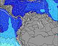 | 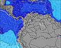 | 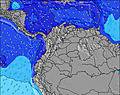 | 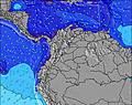 | 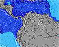 | 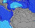 | 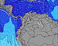 | ||||||||||||||
Wave Height (m) Direction Period (s) | NE 6 | NE 7 | NE 7 | NE 6 | NE 6 | NE 7 | NE 8 | NE 8 | NE 9 | NE 9 | NE 9 | NE 8 | NE 8 | NE 8 | NE 8 | NE 8 | NE 8 | NE 8 | NE 9 | NE 8 | NE 8 |
Wave Graph | |||||||||||||||||||||
94 | 102 | 363 | 230 | 293 | 521 | 519 | 640 | 730 | 853 | 580 | 555 | 319 | 233 | 354 | 251 | 250 | 555 | 554 | 446 | 567 | |
Wind (km/h) | |||||||||||||||||||||
Wind State on-shore cross-onshore cross-shore cross-offshore off-shore glassy | cross-on | glassy | cross-off | cross | on | cross-off | glassy | on | cross | cross-on | on | cross | cross-on | cross-on | cross-off | cross-on | glassy | cross | glassy | on | cross-off |
High Tide | 10:32AM0.05m | 10:37PM0.35m | 11:24AM0.07m | 11:09PM0.34m | 12:28PM0.10m | 11:40PM0.33m | 1:32PM0.14m | 00:09AM0.30m | 2:29PM0.17m | 00:39AM0.27m | 3:14PM0.21m | 1:16AM0.22m | 3:56PM0.25m | 1:57AM0.18m | |||||||
Low Tide | 1:38PM0.04m | 7:30AM0.06m | 2:07PM0.07m | 7:46AM0.07m | 2:45PM0.10m | 8:01AM0.09m | 3:41PM0.13m | 8:11AM0.10m | 5:17PM0.17m | 8:19AM0.10m | 8:05PM0.19m | 8:29AM0.09m | 11:03PM0.17m | ||||||||
5:41 | — | — | 5:41 | — | — | 5:41 | — | — | 5:41 | — | — | 5:41 | — | — | 5:41 | — | — | 5:43 | — | — | |
— | 6:20 | — | — | 6:20 | — | — | 6:20 | — | — | 6:19 | — | — | 6:19 | — | — | 6:19 | — | — | 6:17 | — | |
mm | — | — | — | — | — | — | — | 3 | 3 | — | 5 | — | — | — | — | — | 2 | — | — | 4 | — |
Temp °C | 28 | 28 | 27 | 30 | 29 | 27 | 31 | 29 | 27 | 29 | 29 | 27 | 28 | 27 | 27 | 28 | 27 | 26 | 29 | 29 | 27 |
Feels °C | 32 | 33 | 32 | 34 | 34 | 30 | 35 | 33 | 30 | 33 | 34 | 31 | 33 | 32 | 33 | 32 | 33 | 30 | 33 | 33 | 30 |
Swell 1 Height (m) Direction Period (s) | — | NE 7 | — | — | — | — | — | — | — | — | NE 9 | — | — | NE 8 | NE 8 | NE 8 | NE 8 | — | — | — | — |
— | 102 | — | — | — | — | — | — | — | — | 580 | — | — | 233 | 354 | 187 | 250 | — | — | — | — | |
Swell 2 Height (m) Direction Period (s) | — | — | — | — | — | — | — | — | — | — | — | — | — | — | — | — | — | — | — | — | — |
— | — | — | — | — | — | — | — | — | — | — | — | — | — | — | — | — | — | — | — | — | |
Swell 3 Height (m) Direction Period (s) | — | — | — | — | — | — | — | — | — | — | — | — | — | — | — | — | — | — | — | — | — |
— | — | — | — | — | — | — | — | — | — | — | — | — | — | — | — | — | — | — | — | — | |
Wind waves Height (m) Direction Period (s) | NE 6 | — | NE 7 | NE 6 | NE 6 | NE 7 | NE 8 | NE 8 | NE 9 | NE 9 | NE 9 | NE 8 | NE 8 | — | — | NE 8 | — | NE 8 | NE 9 | NE 8 | NE 8 |
94 | — | 363 | 230 | 293 | 521 | 519 | 640 | 730 | 853 | 461 | 555 | 319 | — | — | 251 | — | 555 | 554 | 446 | 567 | |
Nearest Offshore or Glassy | |||||||||||||||||||||
Distance (km) | 134 | 0 | 0 | 212 | 681 | 600 | 0 | 682 | 212 | 134 | 637 | 610 | 48 | 641 | 0 | 48 | 0 | 600 | 0 | 663 | 15 |
Best forecast wave conditions in Caribbean Coast | |||||||||||||||||||||
Best forecast wave conditions in Colombia | |||||||||||||||||||||
Header Global | |||||||||||||||||||||
- Map Icons:
 Break
Break Live Wave Height (m)
 Live Wind Speed (km/h)
 Surf Rating (10 Max)
 Ocean Swells (m)
- Wind Speed (km/h)


FREE! Surf-Forecast.com widget for your website
The surf report / weather widget below is available to embed on third party websites free of charge and provides a summary of our Viento Fresco surf forecast. Simply grab the html code snippet that we provide and paste it into your own site. You can choose your preferred language and metric/imperial units for the surf forecast feed to suit users of your site. Click here to get the code.
Information about the Viento Fresco Surf forecast
The above surf forecast table for Viento Fresco provides essential information for determining whether the surfing conditions will be good over the next 16 days. A general guide to surfing at Viento Fresco can be found by selecting the local surf guide option on the grey menu. Our Viento Fresco surf forecast is unique since it includes wave energy (power) that defines the real feel of the surf rather than just the height or the period. If you surf the same spot (Viento Fresco) regularly then make a mental note of the wave energy from the surf forecast table each time you go. Very soon you may start to choose your surf days based on the wave energy alone combined with our forecast of favourable offshore wind conditions. Our star ratings will help here and of course you will also find the usual wave height and period predictions on our surf forecasts as well as a full break down of the swell components under our advanced users option (to reveal that, click the little Einstein character under the tide times).
Further information to help with frequently asked questions about our surf forecast for Viento Fresco may be found under the help tab on the top menu and also by moving your mouse over the question marks on the surf forecast table itself. Please always bear in mind that the forecast is for near-shore open water and local factors at each surf break influence the actual breaking wave height, such as the beach / reef profile, water depths offshore and shelter.
Viento Fresco is 51 km (32 miles) from the city of Santa Marta. If you plan a holiday in Caribbean Coast, look for hotels and other accommodation in Santa Marta. Santa Marta has rooms for a wide range of budgets as well as car hire and transport links.
 Nearest