

Surf Forecasts:

Punta Roca surf forecast from 30 Jul 2026:
- Best quality surf: Tuesday 4 Aug, 10PM (local time) - 7ft (2.2m), 9s period, NE swell with cross-offshore winds.
- Most powerful swell: Friday 31 Jul, 1AM (local time) - 10ft (3.0m), 10s period, NNE swell with 1,693 kJ wave energy.
- Next surfable swell (1★+): Saturday 1 Aug, 10AM (local time) - 4.5ft (1.4m), 8s period with NE swell.
Best Forecast Surf Conditions for Punta Roca this week:
The surf forecast for Punta Roca over the next 16 days: The first swell (rated 1 star or higher) is forecast to arrive on Saturday (Aug 01) at 10AM. The primary swell is predicted to be 1.4m and 8s period. The wind is predicted to be offshore as the swell arrives.
The most powerful waves expected at Punta Roca in the next 16 days are 3.0m 10s and forecast to arrive on Friday (Jul 31) at 1AM. Winds are predicted to be cross-offshore at the time the swell arrives.
| Wave Type | Time (-05) & Date | Wave Height & Period |
|---|---|---|
| Next good surf (1 star+) | 10AM (Sat 1st Aug) | 4.5ft (1.4m) 8s |
| Best Surf | 10PM (Tue 4th Aug) | 7ft (2.2m) 9s |
| Most Powerful | 1AM (Fri 31st Jul) | 10ft (3.0m) 10s |
Table - best surf conditions forecast for Punta Roca over the next 16 days.
The Lowdown
Alright folks, Rusty here. Let's have a look at what's shaking for the next couple of weeks at our spot. The forecast is a bit of a slow burn, but there’s a couple of windows where it all comes together.
We start off with a bit of a flat spell, nothing worth paddling out for from Thursday the 30th through Friday the 31st. The waves are there, but the wind is a nightmare. Strong cross-shore breezes up to 25 mph are just tearing the place up, making for messy, choppy junk. Not worth your time.
Things finally start to look up on Saturday, August 1st. The morning brings a light offshore breeze from the southeast, cleaning things right up. We’ve got a 5 ft swell from the NE, with an 8-second period. The water’s sitting pretty at a warm 85°, which is normal for this time of year. The combined energy is moderate at 295, so there’s some push behind it. This is a solid option for the weekend. Saturday afternoon gets a bit choppy again, so make it a dawn patrol mission.
Sunday the 2nd offers a glassy morning with light, variable winds. The swell drops to 3 ft and the energy is weak at 117, so it's small and clean, not a standout but a fun paddle.
Now, the real standout window opens up on Monday, August 3rd through Wednesday, August 5th. Each morning we’re seeing clean conditions with light offshore winds. Swell holds around 4 ft to 5 ft from the NNE, period around 8-9 seconds, and combined energy climbing to 362. Wednesday morning, August 5th, is the pick of the bunch – a gentle offshore breeze from the SSE and clean surf. The swell direction is ticking the box for optimum, too. This is where you want to be. Crowds are possible, so get there early.
We then hit another rough patch from Thursday the 6th onwards to the end of the outlook. The swell picks up, getting over 7 ft by the weekend of August 9th and 10th, but the wind switches back to a strong cross-shore, bringing lumpy, messy conditions. The energy gets strong, hitting 986 on the 8th, but with that wind and a short 9-second period, it’s going to be a washing machine. Not great for paddle surfing – might be more interesting for the kite crew. There are a few mornings with lighter cross-off winds, but the wind state never really cleans up properly during that second week. It stays marginal at best.
So, to sum it up: the first few days are a write-off. Your best bet is the window from Saturday morning, August 1st, through to Wednesday morning, August 5th. For the real gold, aim for the morning sessions, especially Wednesday the 5th.
Rusty.
Short Range ForecastMostly dry. Warm (max 30°C on Sat morning, min 26°C on Fri night). Winds decreasing (strong winds from the NE on Thu night, light winds from the ESE by Sat night). | Days 4-6 Weather SummaryLight rain (total 9mm), mostly falling on Tue afternoon. Warm (max 30°C on Mon morning, min 25°C on Tue night). Winds increasing (calm on Sun morning, fresh winds from the ENE by Mon night). | ||||||||||||||||||||
Thursday 30 | Friday 31 | Saturday 1 | Sunday 2 | Monday 3 | Tuesday 4 | Wednesday 5 | |||||||||||||||
AM | PM | Night | AM | PM | Night | AM | PM | Night | AM | PM | Night | AM | PM | Night | AM | PM | Night | AM | PM | Night | |
Swell Height Map | 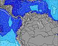 | 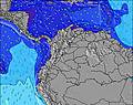 | 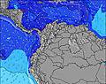 | 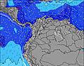 | 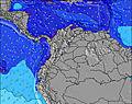 | 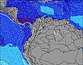 | 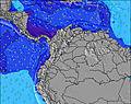 | ||||||||||||||
Wave Height (m) Direction Period (s) | NNE 8 | NE 9 | NNE 10 | NNE 10 | NE 9 | NE 9 | NE 8 | NE 8 | NNE 7 | NNE 8 | NNE 8 | NNE 8 | NNE 8 | NNE 9 | NE 9 | NNE 8 | NNE 8 | NNE 9 | NNE 9 | NE 9 | NE 9 |
Wave Graph | |||||||||||||||||||||
368 | 572 | 1693 | 703 | 673 | 1081 | 295 | 255 | 202 | 117 | 114 | 213 | 241 | 247 | 842 | 224 | 292 | 856 | 362 | 338 | 1011 | |
Wind (km/h) | |||||||||||||||||||||
Wind State on-shore cross-onshore cross-shore cross-offshore off-shore glassy | cross | cross | cross-off | cross | cross | cross-off | off | cross-on | cross | glassy | cross-on | cross | cross-off | cross | cross-off | cross-off | cross | off | off | cross-on | cross-off |
High Tide | 11:57PM0.37m | 00:43AM0.32m | 4:12PM0.18m | 1:35AM0.26m | 4:06PM0.25m | 2:35AM0.21m | 4:24PM0.32m | 3:38AM0.16m | 4:52PM0.40m | 4:39AM0.11m | 5:27PM0.47m | ||||||||||
Low Tide | 8:27AM-0.04m | 8:37AM-0.02m | 7:24PM0.16m | 8:44AM-0.01m | 9:29PM0.13m | 8:55AM-0.01m | 10:52PM0.08m | 9:11AM-0.01m | 11:55PM0.03m | 9:35AM-0.02m | 00:50AM-0.02m | ||||||||||
5:47 | — | — | 5:47 | — | — | 5:47 | — | — | 5:48 | — | — | 5:48 | — | — | 5:48 | — | — | 5:48 | — | — | |
— | 6:23 | — | — | 6:23 | — | — | 6:23 | — | — | 6:22 | — | — | 6:22 | — | — | 6:22 | — | — | 6:22 | — | |
mm | — | — | — | — | — | — | — | — | — | — | 2 | — | — | — | — | 1 | 3 | 3 | — | — | — |
Temp °C | 29 | 29 | 29 | 28 | 28 | 27 | 30 | 28 | 28 | 29 | 27 | 27 | 30 | 28 | 28 | 30 | 28 | 26 | 28 | 28 | 28 |
Feels °C | 31 | 27 | 24 | 28 | 27 | 25 | 33 | 29 | 31 | 34 | 29 | 29 | 34 | 29 | 29 | 33 | 29 | 29 | 29 | 31 | 29 |
Swell 1 Height (m) Direction Period (s) | NNE 8 | — | — | NNE 10 | — | — | NE 8 | — | NNE 7 | NNE 8 | NNE 8 | — | NNE 8 | — | — | NNE 8 | — | NNE 9 | NNE 9 | — | — |
368 | — | — | 703 | — | — | 295 | — | 202 | 117 | 114 | — | 241 | — | — | 224 | — | 856 | 362 | — | — | |
Swell 2 Height (m) Direction Period (s) | — | — | — | — | — | — | — | — | — | — | — | — | — | — | — | — | — | — | — | — | — |
— | — | — | — | — | — | — | — | — | — | — | — | — | — | — | — | — | — | — | — | — | |
Swell 3 Height (m) Direction Period (s) | — | — | — | — | — | — | — | — | — | — | — | — | — | — | — | — | — | — | — | — | — |
— | — | — | — | — | — | — | — | — | — | — | — | — | — | — | — | — | — | — | — | — | |
Wind waves Height (m) Direction Period (s) | — | NE 9 | NNE 10 | — | NE 9 | NE 9 | — | NE 8 | — | — | — | NNE 8 | — | NNE 9 | NE 9 | — | NNE 8 | — | — | NE 9 | NE 9 |
— | 572 | 1693 | — | 673 | 1081 | — | 255 | — | — | — | 213 | — | 247 | 842 | — | 292 | — | — | 338 | 1011 | |
Nearest Offshore or Glassy | |||||||||||||||||||||
Distance (km) | 230 | 551 | 551 | 603 | 692 | 603 | 0 | 127 | 90 | 0 | 509 | 509 | 0 | 530 | 509 | 0 | 118 | 0 | 0 | 127 | 509 |
Best forecast wave conditions in Caribbean Coast | |||||||||||||||||||||
Best forecast wave conditions in Colombia | |||||||||||||||||||||
Header Global | |||||||||||||||||||||
- Map Icons:
 Break
Break Live Wave Height (m)
 Live Wind Speed (km/h)
 Surf Rating (10 Max)
 Ocean Swells (m)
- Wind Speed (km/h)
Latest Updates


FREE! Surf-Forecast.com widget for your website
The surf report / weather widget below is available to embed on third party websites free of charge and provides a summary of our Punta Roca surf forecast. Simply grab the html code snippet that we provide and paste it into your own site. You can choose your preferred language and metric/imperial units for the surf forecast feed to suit users of your site. Click here to get the code.
Information about the Punta Roca Surf forecast
The above surf forecast table for Punta Roca provides essential information for determining whether the surfing conditions will be good over the next 16 days. A general guide to surfing at Punta Roca can be found by selecting the local surf guide option on the grey menu. Our Punta Roca surf forecast is unique since it includes wave energy (power) that defines the real feel of the surf rather than just the height or the period. If you surf the same spot (Punta Roca) regularly then make a mental note of the wave energy from the surf forecast table each time you go. Very soon you may start to choose your surf days based on the wave energy alone combined with our forecast of favourable offshore wind conditions. Our star ratings will help here and of course you will also find the usual wave height and period predictions on our surf forecasts as well as a full break down of the swell components under our advanced users option (to reveal that, click the little Einstein character under the tide times).
Further information to help with frequently asked questions about our surf forecast for Punta Roca may be found under the help tab on the top menu and also by moving your mouse over the question marks on the surf forecast table itself. Please always bear in mind that the forecast is for near-shore open water and local factors at each surf break influence the actual breaking wave height, such as the beach / reef profile, water depths offshore and shelter.
Punta Roca is 8 km (5 miles) from the very large city of Puerto Colombia. If you plan a holiday in Caribbean Coast, look for hotels and other accommodation in Puerto Colombia. Puerto Colombia has rooms for a wide range of budgets as well as cheap car hire and transport links.
 Nearest