

Surf Forecasts:

Siete Olas surf forecast from 31 Jul 2026:
- Best quality surf: Saturday 1 Aug, 10PM (local time) - 6.5ft (2.0m), 8s period, NE swell with glassy winds.
- Most powerful swell: Wednesday 5 Aug, 10PM (local time) - 10ft (3.0m), 9s period, NE swell with 1,580 kJ wave energy.
- Next surfable swell (1★+): Saturday 1 Aug, 10PM (local time) - 6.5ft (2.0m), 8s period with NE swell.
Best Forecast Surf Conditions for Siete Olas this week:
The surf forecast for Siete Olas over the next 16 days: The first swell (rated 1 star or higher) is forecast to arrive on Saturday (Aug 01) at 10PM. The primary swell is predicted to be 2.0m and 8s period. The wind is predicted to be glassy as the swell arrives.
The most powerful waves expected at Siete Olas in the next 16 days are 3.0m 9s and forecast to arrive on Wednesday (Aug 05) at 10PM. Winds are predicted to be cross-onshore at the time the swell arrives.
| Wave Type | Time (-05) & Date | Wave Height & Period |
|---|---|---|
| Next good surf (1 star+) | 10PM (Sat 1st Aug) | 6.5ft (2.0m) 8s |
| Best Surf | 10PM (Sat 1st Aug) | 6.5ft (2.0m) 8s |
| Most Powerful | 10PM (Wed 5th Aug) | 10ft (3.0m) 9s |
Table - best surf conditions forecast for Siete Olas over the next 16 days.
The Lowdown
Alright folks, Rusty here. Let’s have a look at what’s on offer for the next couple of weeks.
To be straight with you, the outlook for Siete Olas is a tough one. We’ve got a solid stretch of swell running through the whole period, but the wind is the big problem. The surf is on the way, but it’s almost constantly battling a cross-on or onshore breeze, which is going to chop it up and make it a real mess. Most of the time, the wave energy is moderate (between 304 and 941), but the conditions are just poor for a decent paddle. The swell is coming from the NE, which is not the optimum direction for this spot.
The one bright spot, and I mean the only real standout, is the morning of Sunday, August 2nd. The wind drops right out to glassy, with a slight air. The swell is 5ft from the NE with an 8-second period, and the combined energy is 239, which is weak. It’s not going to be a huge day, but that glassy morning will make it clean and rideable. Because it’s a sheltered spot, that combination is gold. For a beginner-friendly break that’s very consistent, this is your moment. The water temp is about average for the time of year.
After that, it’s back to the wind. The rest of the first week and into the second week, from August 3rd onwards, sees the swell push up to 8ft, and even 10ft, with moderate cross-onshore winds. The wave energy climbs into the strong range (over 1000) on August 10th, 11th, and 12th, but with the onshore wind, it’s just going to be a choppy, blown-out mess. For a beach and reef setup, that’s more interesting for the kite surfers than the paddle crew. The swell period is short at 8-9 seconds, so it’s windswell, not that clean groundswell we love.
So, to sum it up: if you’re desperate, get out on the morning of Sunday, August 2nd, for that rare glassy window. After that, it’s a long stretch of poor conditions right through to August 15th. It’s a blank run, but this area tends to see these spells, so don’t lose hope—forecasts can change.
Rusty.
Short Range ForecastLight rain (total 9mm), mostly falling on Sat afternoon. Warm (max 30°C on Fri morning, min 26°C on Thu night). Winds decreasing (fresh winds from the E on Thu night, calm by Sun morning). | Days 4-6 Weather SummaryModerate rain (total 10mm), heaviest on Tue afternoon. Warm (max 30°C on Mon morning, min 26°C on Mon night). Wind will be generally light. | ||||||||||||||||||||
Friday 31 | Saturday 1 | Sunday 2 | Monday 3 | Tuesday 4 | Wednesday 5 | Thursday 6 | |||||||||||||||
AM | PM | Night | AM | PM | Night | AM | PM | Night | AM | PM | Night | AM | PM | Night | AM | PM | Night | AM | PM | Night | |
Swell Height Map | 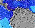 | 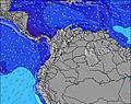 | 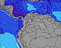 | 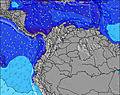 | 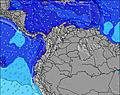 | 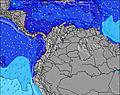 | 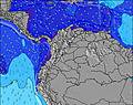 | ||||||||||||||
Wave Height (m) Direction Period (s) | NE 8 | NE 8 | NE 8 | NE 8 | NE 8 | NE 8 | NE 8 | NE 8 | NE 8 | NE 8 | NE 8 | NE 8 | NE 8 | NE 8 | NE 8 | NE 9 | NE 9 | NE 8 | NE 8 | NE 8 | NE 8 |
Wave Graph | |||||||||||||||||||||
941 | 754 | 653 | 406 | 304 | 492 | 239 | 270 | 596 | 511 | 468 | 699 | 452 | 389 | 678 | 720 | 595 | 813 | 760 | 593 | 784 | |
Wind (km/h) | |||||||||||||||||||||
Wind State on-shore cross-onshore cross-shore cross-offshore off-shore glassy | cross-on | on | cross-on | cross-on | on | cross-on | glassy | on | cross-on | on | on | cross-on | on | on | cross-on | cross-on | on | cross-on | cross-on | on | cross-on |
High Tide | 1:42PM0.14m | 00:13AM0.30m | 2:37PM0.18m | 00:44AM0.27m | 3:15PM0.22m | 1:20AM0.22m | 3:56PM0.26m | 2:08AM0.18m | 4:38PM0.29m | 3:17AM0.13m | 5:23PM0.33m | 4:41AM0.10m | 6:11PM0.36m | ||||||||
Low Tide | 8:04AM0.09m | 3:41PM0.13m | 8:16AM0.10m | 5:15PM0.17m | 8:25AM0.10m | 8:21PM0.19m | 8:34AM0.09m | 11:06PM0.17m | 8:50AM0.08m | 00:41AM0.12m | 9:16AM0.06m | 1:42AM0.08m | 9:56AM0.04m | 2:30AM0.05m | |||||||
5:43 | — | — | 5:43 | — | — | 5:43 | — | — | 5:43 | — | — | 5:43 | — | — | 5:43 | — | — | 5:43 | — | — | |
— | 6:21 | — | — | 6:21 | — | — | 6:20 | — | — | 6:20 | — | — | 6:20 | — | — | 6:19 | — | — | 6:19 | — | |
mm | — | — | — | — | 6 | 3 | — | — | — | — | 2 | — | 1 | 3 | — | 1 | 3 | 1 | — | 1 | — |
Temp °C | 30 | 29 | 27 | 30 | 29 | 27 | 29 | 28 | 27 | 30 | 29 | 27 | 29 | 29 | 27 | 28 | 29 | 27 | 30 | 29 | 27 |
Feels °C | 31 | 30 | 27 | 33 | 31 | 31 | 33 | 31 | 30 | 33 | 32 | 29 | 33 | 32 | 29 | 32 | 33 | 28 | 33 | 31 | 27 |
Swell 1 Height (m) Direction Period (s) | — | — | — | — | — | NE 8 | NE 8 | NE 8 | — | — | — | — | — | — | — | — | — | — | — | — | — |
— | — | — | — | — | 492 | 239 | 270 | — | — | — | — | — | — | — | — | — | — | — | — | — | |
Swell 2 Height (m) Direction Period (s) | — | — | — | — | — | — | — | — | — | — | — | — | — | — | — | — | — | — | — | — | — |
— | — | — | — | — | — | — | — | — | — | — | — | — | — | — | — | — | — | — | — | — | |
Swell 3 Height (m) Direction Period (s) | — | — | — | — | — | — | — | — | — | — | — | — | — | — | — | — | — | — | — | — | — |
— | — | — | — | — | — | — | — | — | — | — | — | — | — | — | — | — | — | — | — | — | |
Wind waves Height (m) Direction Period (s) | NE 8 | NE 8 | NE 8 | NE 8 | NE 8 | — | — | — | NE 8 | NE 8 | NE 8 | NE 8 | NE 8 | NE 8 | NE 8 | NE 9 | NE 9 | NE 8 | NE 8 | NE 8 | NE 8 |
941 | 754 | 653 | 406 | 304 | — | — | — | 596 | 511 | 468 | 699 | 452 | 389 | 678 | 720 | 595 | 813 | 760 | 593 | 784 | |
Nearest Offshore or Glassy | |||||||||||||||||||||
Distance (km) | 176 | 643 | 27 | 140 | 603 | 25 | 0 | 25 | 603 | 43 | 626 | 603 | 94 | 27 | 58 | 5 | 22 | 58 | 94 | 653 | 176 |
Best forecast wave conditions in Caribbean Coast | |||||||||||||||||||||
Best forecast wave conditions in Colombia | |||||||||||||||||||||
Header Global | |||||||||||||||||||||
- Map Icons:
 Break
Break Live Wave Height (m)
 Live Wind Speed (km/h)
 Surf Rating (10 Max)
 Ocean Swells (m)
- Wind Speed (km/h)
Latest Updates


FREE! Surf-Forecast.com widget for your website
The surf report / weather widget below is available to embed on third party websites free of charge and provides a summary of our Siete Olas surf forecast. Simply grab the html code snippet that we provide and paste it into your own site. You can choose your preferred language and metric/imperial units for the surf forecast feed to suit users of your site. Click here to get the code.
Information about the Siete Olas Surf forecast
The above surf forecast table for Siete Olas provides essential information for determining whether the surfing conditions will be good over the next 16 days. A general guide to surfing at Siete Olas can be found by selecting the local surf guide option on the grey menu. Our Siete Olas surf forecast is unique since it includes wave energy (power) that defines the real feel of the surf rather than just the height or the period. If you surf the same spot (Siete Olas) regularly then make a mental note of the wave energy from the surf forecast table each time you go. Very soon you may start to choose your surf days based on the wave energy alone combined with our forecast of favourable offshore wind conditions. Our star ratings will help here and of course you will also find the usual wave height and period predictions on our surf forecasts as well as a full break down of the swell components under our advanced users option (to reveal that, click the little Einstein character under the tide times).
Further information to help with frequently asked questions about our surf forecast for Siete Olas may be found under the help tab on the top menu and also by moving your mouse over the question marks on the surf forecast table itself. Please always bear in mind that the forecast is for near-shore open water and local factors at each surf break influence the actual breaking wave height, such as the beach / reef profile, water depths offshore and shelter.
Siete Olas is 8 km (5 miles) from the city of Santa Marta. If you plan a holiday in Caribbean Coast, look for hotels and other accommodation in Santa Marta. Santa Marta has rooms for a wide range of budgets as well as car hire and transport links.
 Nearest