

Surf Forecasts:

Cartagena - Jetty surf forecast from 3 Aug 2026:
- Best quality surf: Monday 3 Aug, 10PM (local time) - 2.5ft (0.8m), 8s period, NNE swell with cross-offshore winds.
- Most powerful swell: Saturday 8 Aug, 4PM (local time) - 3.5ft (1.0m), 10s period, N swell with 200 kJ wave energy.
- Next surfable swell (1★+): Monday 3 Aug, 10PM (local time) - 2.5ft (0.8m), 8s period with NNE swell.
Best Forecast Surf Conditions for Cartagena - Jetty this week:
The surf forecast for Cartagena - Jetty over the next 16 days: The first swell (rated 1 star or higher) is forecast to arrive on Monday (Aug 03) at 10PM. The primary swell is predicted to be 0.8m and 8s period. The wind is predicted to be cross-offshore as the swell arrives.
The most powerful waves expected at Cartagena - Jetty in the next 16 days are 1.0m 10s and forecast to arrive on Saturday (Aug 08) at 4PM. Winds are predicted to be onshore at the time the swell arrives. The largest open ocean swell (not directed at the beach) is 2.1m 9s period and expected on Sunday (Aug 09) at 4AM.
| Wave Type | Time (-05) & Date | Wave Height & Period |
|---|---|---|
| Next good surf (1 star+) | 10PM (Mon 3rd Aug) | 2.5ft (0.8m) 8s |
| Best Surf | 10PM (Mon 3rd Aug) | 2.5ft (0.8m) 8s |
| Most Powerful | 4PM (Sat 8th Aug) | 3.5ft (1.0m) 10s |
Table - best surf conditions forecast for Cartagena - Jetty over the next 16 days.
The Lowdown
Alright folks, Rusty here. Let’s cut to it. Looking at the next 16 days, it’s a bit of a flat spell for the Cartagena - Jetty zone. We're staring at a whole bunch of nothing for a while. The models are showing a pretty dead ocean, and honestly, for most of this window, you can leave the board in the car.
The first real pulse of energy shows up on Saturday the 8th. We’re looking at a small, northerly swell pushing in at about 3ft with a period of 10 seconds. The combined energy is weak (200), so it’s not going to be anything epic, but it might be just enough for a few grovelly ones. The wind that afternoon is going to be straight onshore from the north, so expect it to be a bit messy and blown out.
The next, and honestly only other, shot at a wave comes on Tuesday the 11th. Same story – a small northerly pulse, 4ft at 10 seconds, with the combined energy at 250. Again, right onshore wind in the afternoon will chop it up. If you can get out early on the 12th, there's a light offshore breeze that might keep things a touch cleaner, but the swell will be fading fast.
We’re looking at a long, drawn-out flat spell after that. The water is a warm 85°, which is about normal for this time of year, so it’s not going to be a hooded situation.
This break is a beginner-friendly beach and jetty set-up, and normally it's a bit inconsistent, but this run is looking particularly bleak. For those of you who are just getting started, it’s probably not worth the drive. With the wind and the absence of any real swell, the setup might look more interesting for a kite surfer than for a paddle surfer. Hang tight, folks. There’s nothing here worth chasing.
Rusty
Short Range ForecastModerate rain (total 11mm), heaviest on Tue night. Warm (max 29°C on Sun morning, min 26°C on Mon night). Wind will be generally light. | Days 4-6 Weather SummaryLight rain (total 5mm), mostly falling on Wed night. Warm (max 29°C on Wed morning, min 27°C on Wed morning). Wind will be generally light. | ||||||||||||||||||||
Sunday 2 | Monday 3 | Tuesday 4 | Wednesday 5 | Thursday 6 | Friday 7 | Saturday 8 | |||||||||||||||
AM | PM | Night | AM | PM | Night | AM | PM | Night | AM | PM | Night | AM | PM | Night | AM | PM | Night | AM | PM | Night | |
Swell Height Map | 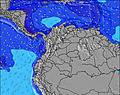 | 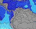 | 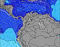 | 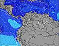 | 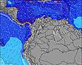 | 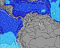 | 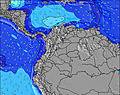 | ||||||||||||||
Wave Height (m) Direction Period (s) | NNE 8 | NNE 8 | N 7 | NNE 9 | WSW 3 | NNE 8 | NNE 8 | NNE 8 | NNE 8 | NNE 9 | NNE 9 | NNE 8 | NNE 9 | NNE 8 | NNE 6 | NNE 9 | NNE 9 | NNE 9 | NNE 10 | N 10 | NNE 8 |
Wave Graph | |||||||||||||||||||||
0 | 0 | 51 | 0 | 1 | 83 | 0 | 0 | 0 | 0 | 0 | 0 | 0 | 0 | 56 | 0 | 0 | 0 | 0 | 200 | 0 | |
Wind (km/h) | |||||||||||||||||||||
Wind State on-shore cross-onshore cross-shore cross-offshore off-shore glassy | cross | cross-on | on | cross-off | cross-on | cross-on | cross-off | on | on | off | on | cross-on | off | on | glassy | cross-off | cross-on | cross-on | cross-off | on | cross-on |
High Tide | 3:42PM0.19m | 2:11AM0.16m | 4:00PM0.25m | 3:14AM0.12m | 4:28PM0.31m | 4:15AM0.09m | 5:03PM0.37m | 5:13AM0.06m | 5:43PM0.41m | 6:07AM0.04m | 6:27PM0.44m | 7:01AM0.03m | 7:15PM0.46m | ||||||||
Low Tide | 9:49PM0.10m | 9:15AM-0.00m | 11:12PM0.06m | 9:31AM-0.01m | 00:15AM0.02m | 9:55AM-0.02m | 1:10AM-0.02m | 10:25AM-0.03m | 2:02AM-0.04m | 11:03AM-0.04m | 2:53AM-0.06m | 11:45AM-0.04m | 3:44AM-0.07m | ||||||||
5:50 | — | — | 5:50 | — | — | 5:50 | — | — | 5:50 | — | — | 5:52 | — | — | 5:52 | — | — | 5:52 | — | — | |
— | 6:24 | — | — | 6:24 | — | — | 6:23 | — | — | 6:23 | — | — | 6:23 | — | — | 6:22 | — | — | 6:22 | — | |
mm | — | — | — | — | 1 | 5 | — | 1 | 4 | — | — | 2 | 2 | 1 | — | — | — | — | — | — | — |
Temp °C | 29 | 29 | 28 | 29 | 29 | 27 | 29 | 29 | 28 | 29 | 28 | 27 | 28 | 28 | 27 | 28 | 28 | 27 | 30 | 28 | 27 |
Feels °C | 34 | 32 | 31 | 32 | 32 | 30 | 32 | 32 | 32 | 32 | 30 | 29 | 31 | 30 | 29 | 32 | 30 | 29 | 33 | 29 | 27 |
Swell 1 Height (m) Direction Period (s) | NNE 8 | NNE 8 | N 7 | NNE 9 | NNE 9 | NNE 8 | NNE 8 | NNE 8 | NNE 8 | NNE 9 | NNE 9 | — | NNE 9 | NNE 8 | NNE 6 | NNE 9 | NNE 9 | NNE 9 | NNE 10 | NNE 9 | — |
138 | 110 | 51 | 346 | 244 | 83 | 212 | 165 | 197 | 233 | 186 | — | 267 | 169 | 56 | 267 | 249 | 324 | 470 | 334 | — | |
Swell 2 Height (m) Direction Period (s) | — | — | — | — | — | — | — | SW 3 | — | — | SSW 4 | — | — | — | — | — | SW 3 | SW 4 | — | — | — |
— | — | — | — | — | — | — | 1 | — | — | 4 | — | — | — | — | — | 2 | 1 | — | — | — | |
Swell 3 Height (m) Direction Period (s) | — | — | — | — | — | — | — | — | — | — | — | — | — | — | — | — | — | — | — | — | — |
— | — | — | — | — | — | — | — | — | — | — | — | — | — | — | — | — | — | — | — | — | |
Wind waves Height (m) Direction Period (s) | — | — | NNE 8 | — | WSW 3 | NNE 8 | — | SW 3 | — | SSE 3 | — | NNE 8 | — | WSW 2 | NNE 8 | — | SW 3 | — | — | N 10 | NNE 8 |
— | — | 157 | — | 1 | 217 | — | 2 | — | 3 | — | 192 | — | 1 | 199 | — | 4 | — | — | 200 | 488 | |
Nearest Offshore or Glassy | |||||||||||||||||||||
Distance (km) | 19 | 443 | 218 | 19 | 729 | 93 | 19 | 208 | 224 | 19 | 187 | 99 | 19 | 208 | 19 | 19 | 421 | 457 | 19 | 457 | 458 |
Best forecast wave conditions in Caribbean Coast | |||||||||||||||||||||
Best forecast wave conditions in Colombia | |||||||||||||||||||||
Header Global | |||||||||||||||||||||
- Map Icons:
 Break
Break Live Wave Height (m)
 Live Wind Speed (km/h)
 Surf Rating (10 Max)
 Ocean Swells (m)
- Wind Speed (km/h)
Latest Updates


FREE! Surf-Forecast.com widget for your website
The surf report / weather widget below is available to embed on third party websites free of charge and provides a summary of our Cartagena - Jetty surf forecast. Simply grab the html code snippet that we provide and paste it into your own site. You can choose your preferred language and metric/imperial units for the surf forecast feed to suit users of your site. Click here to get the code.
Information about the Cartagena - Jetty Surf forecast
The above surf forecast table for Cartagena - Jetty provides essential information for determining whether the surfing conditions will be good over the next 16 days. A general guide to surfing at Cartagena - Jetty can be found by selecting the local surf guide option on the grey menu. Our Cartagena - Jetty surf forecast is unique since it includes wave energy (power) that defines the real feel of the surf rather than just the height or the period. If you surf the same spot (Cartagena - Jetty) regularly then make a mental note of the wave energy from the surf forecast table each time you go. Very soon you may start to choose your surf days based on the wave energy alone combined with our forecast of favourable offshore wind conditions. Our star ratings will help here and of course you will also find the usual wave height and period predictions on our surf forecasts as well as a full break down of the swell components under our advanced users option (to reveal that, click the little Einstein character under the tide times).
Further information to help with frequently asked questions about our surf forecast for Cartagena - Jetty may be found under the help tab on the top menu and also by moving your mouse over the question marks on the surf forecast table itself. Please always bear in mind that the forecast is for near-shore open water and local factors at each surf break influence the actual breaking wave height, such as the beach / reef profile, water depths offshore and shelter.
Cartagena - Jetty is 7 km (4 miles) from the city of Cartagena. If you plan a holiday in Caribbean Coast, look for hotels and other accommodation in Cartagena. Cartagena has rooms for a wide range of budgets as well as car hire and transport links.
 Nearest