

Surf Forecasts:

One Eye surf forecast from 16 Jul 2026:
- Best quality surf: Monday 20 Jul, 10AM (local time) - 5ft (1.6m), 14s period, SW swell with cross-offshore winds.
- Most powerful swell: Monday 20 Jul, 7PM (local time) - 7ft (2.1m), 14s period, SSW swell with 1,662 kJ wave energy.
- Next surfable swell (1★+): Saturday 18 Jul, 7AM (local time) - 4.5ft (1.3m), 14s period with S swell.
Best Forecast Surf Conditions for One Eye this week:
The surf forecast for One Eye over the next 16 days: The first swell (rated 1 star or higher) is forecast to arrive on Saturday (Jul 18) at 7AM. The primary swell is predicted to be 1.3m and 14s period. The wind is predicted to be glassy as the swell arrives.
The most powerful waves expected at One Eye in the next 16 days are 2.1m 14s and forecast to arrive on Monday (Jul 20) at 7PM. Winds are predicted to be glassy at the time the swell arrives. The largest open ocean swell (not directed at the beach) is 1.2m 7s period and expected on Thursday (Jul 23) at 7PM.
| Wave Type | Time (+04) & Date | Wave Height & Period |
|---|---|---|
| Next good surf (1 star+) | 7AM (Sat 18th Jul) | 4.5ft (1.3m) 14s |
| Best Surf | 10AM (Mon 20th Jul) | 5ft (1.6m) 14s |
| Most Powerful | 7PM (Mon 20th Jul) | 7ft (2.1m) 14s |
Table - best surf conditions forecast for One Eye over the next 16 days.
The Lowdown
Alright, Rusty here. Let's have a look at what's on the cards for One Eye over the next couple of weeks.
The first few days are a bit of a write-off, to be honest. Friday the 17th and Saturday the 18th are pretty average with small, messy swell and cross-onshore winds. You'd be fighting a bumpy sea for very little reward. The real action starts to stir on Sunday the 19th. We've got a clean little 2ft to 3ft swell rolling in from the SW with a nice long 16-second period. The combined energy is moderate (331-401), and with light offshore winds, it'll be clean. It's not a standout, but a decent start to the week.
The first real standout hits on Monday the 20th. The swell jumps up to 5ft to 7ft from the SSW, and the period is a solid 14 seconds. The wind goes glassy in the afternoon, zero wind, which is huge. The combined energy is strong (1025-1432). This is a clean, punchy, intermediate-friendly day at One Eye. The water temp is about average for this time of year, so no surprises there.
Tuesday the 21st stays good with glassy morning conditions and 6ft SSW swell, but the wind shifts onshore in the afternoon, messing it up a bit. Wednesday and Thursday the 22nd and 23rd see the swell holding around 6ft to 6ft, and we get moderate offshore winds from the SE. That's solid, clean surf for the experienced crew, with the combined energy staying in the strong range (905-1127). It's not the biggest, but the quality is there.
Then things get a bit skittish. Friday the 24th through Saturday the 25th, the swell drops back to 4ft, and the wind is fresh and offshore, but the energy drops off. It's clean but small. The bigger picture is still okay.
But hold onto your board… the next standout is a monster. On Monday the 27th, we've got a 7ft SW groundswell with a 21-second period. That's a very long period swell, and the combined energy is a massive 6113. This is exceptional, expert-only territory. This swell will wrap in perfectly at this reef, but at that size and period, it's going to be a freight train. It's going to be breaking straight at the beach breaks, but for a reef like One Eye, it'll be a proper, heavy, lined-up wave. The wind is gentle cross-offshore, so it'll be clean. This is the best on offer by a long shot.
The following days, Tuesday the 28th through Thursday the 30th, stay huge, with 8ft to 12ft SSW swell, but the wind gets messy—cross-shore and onshore, with a lot of chop. The energy is still extreme (2594-5314), but the quality drops. It's still only for experts, and the conditions are a bit of a battle. Friday the 31st and into August 1st, the swell stays massive (12ft) and the wind cranks offshore, but the combined energy is through the roof (7721). It's strong offshore and clean, but at that size, it's a serious, serious paddle. Only the most experienced crew should even think about it.
So, the standout is without a doubt Monday the 27th. That's the one you want to circle on the calendar. For the rest of the time, the mid-week around the 20th-23rd offers the best all-round quality for the intermediate crowd.
Rusty.
Short Range ForecastLight rain (total 4mm), mostly falling on Fri night. Warm (max 24°C on Fri morning, min 22°C on Fri night). Wind will be generally light. | Days 5-7 Weather SummaryMostly dry. Warm (max 23°C on Mon morning, min 21°C on Mon night). Wind will be generally light. | ||||||||||||||||||
Friday 17 | Saturday 18 | Sunday 19 | Monday 20 | Tuesday 21 | Wednesday 22 | ||||||||||||||
Night | AM | PM | Night | AM | PM | Night | AM | PM | Night | AM | PM | Night | AM | PM | Night | AM | PM | Night | |
Swell Height Map |  |  |  |  |  | 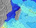 | 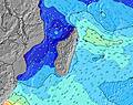 | ||||||||||||
Wave Height (m) Direction Period (s) | SSW 11 | S 17 | S 16 | S 15 | S 13 | S 13 | SSW 11 | SW 16 | SW 15 | SW 14 | SW 14 | SSW 14 | SSW 13 | SSW 12 | SSW 12 | SSW 11 | SSW 13 | SSW 13 | S 12 |
Wave Graph | |||||||||||||||||||
84 | 371 | 853 | 836 | 521 | 395 | 158 | 254 | 322 | 346 | 988 | 1411 | 1520 | 984 | 952 | 631 | 1041 | 1026 | 668 | |
Wind (km/h) | |||||||||||||||||||
Wind State on-shore cross-onshore cross-shore cross-offshore off-shore glassy | cross-on | cross-on | cross-on | cross-on | glassy | cross-on | cross-off | off | cross-off | cross-off | cross-off | glassy | glassy | glassy | cross | off | cross-off | off | off |
High Tide | 2:16AM0.72m | 3:11PM0.63m | 2:52AM0.68m | 3:42PM0.61m | 3:25AM0.62m | 4:11PM0.58m | 3:58AM0.55m | 4:40PM0.56m | 4:35AM0.47m | 5:13PM0.52m | 5:31AM0.41m | 6:08PM0.49m | |||||||
Low Tide | 8:51AM0.03m | 8:55PM0.21m | 9:24AM0.10m | 9:33PM0.24m | 9:54AM0.17m | 10:14PM0.27m | 10:20AM0.23m | 11:03PM0.30m | 10:43AM0.29m | 00:20AM0.32m | 11:06AM0.34m | 2:38AM0.31m | |||||||
— | 6:46 | — | — | 6:46 | — | — | 6:46 | — | — | 6:45 | — | — | 6:45 | — | — | 6:45 | — | — | |
— | — | 5:46 | — | — | 5:46 | — | — | 5:47 | — | — | 5:47 | — | — | 5:47 | — | — | 5:49 | — | |
mm | — | — | — | 4 | — | — | — | — | — | — | — | — | — | — | — | — | — | — | — |
Temp °C | 23 | 24 | 24 | 23 | 23 | 23 | 23 | 22 | 23 | 22 | 23 | 22 | 22 | 22 | 23 | 22 | 22 | 22 | 22 |
Feels °C | 23 | 25 | 24 | 24 | 25 | 25 | 25 | 24 | 24 | 24 | 25 | 24 | 24 | 25 | 23 | 22 | 21 | 20 | 20 |
Swell 1 Height (m) Direction Period (s) | SE 8 | S 17 | S 16 | S 15 | S 13 | S 13 | SSW 11 | SW 16 | SW 15 | SW 14 | SW 14 | SSW 14 | SSW 13 | SSW 12 | SSW 12 | SSW 11 | SSW 13 | SSW 13 | S 12 |
84 | 371 | 853 | 836 | 521 | 395 | 158 | 254 | 322 | 346 | 988 | 1411 | 1520 | 984 | 952 | 631 | 1041 | 1026 | 668 | |
Swell 2 Height (m) Direction Period (s) | SSW 11 | S 12 | SE 8 | ESE 8 | ESE 8 | ESE 8 | SW 18 | SSW 10 | SSW 10 | SSW 15 | S 11 | SSW 8 | E 8 | ESE 9 | E 8 | SSW 14 | SW 11 | SW 10 | SSW 13 |
82 | 134 | 32 | 28 | 23 | 24 | 109 | 77 | 52 | 169 | 37 | 14 | 68 | 8 | 68 | 313 | 30 | 25 | 225 | |
Swell 3 Height (m) Direction Period (s) | S 10 | ESE 8 | ESE 10 | WNW 4 | SSE 6 | SW 5 | ESE 8 | ESE 8 | SSE 12 | SSW 9 | ESE 8 | SSW 8 | — | SSE 10 | SE 10 | E 8 | SW 11 | SW 10 | SW 10 |
50 | 46 | 9 | 6 | 8 | 8 | 24 | 13 | 27 | 34 | 12 | 7 | — | 10 | 4 | 63 | 56 | 37 | 24 | |
Wind waves Height (m) Direction Period (s) | NNW 3 | NW 3 | NW 3 | — | — | — | — | — | — | — | — | — | — | — | — | — | SE 4 | SE 4 | SE 4 |
4 | 4 | 7 | — | — | — | — | — | — | — | — | — | — | — | — | — | 21 | 18 | 14 | |
Nearest Offshore or Glassy | |||||||||||||||||||
Distance (km) | 3 | 3 | 16 | 11 | 0 | 8 | 0 | 0 | 0 | 0 | 0 | 0 | 0 | 0 | 8 | 0 | 8 | 0 | 0 |
Best forecast wave conditions in Mauritius | |||||||||||||||||||
Best forecast wave conditions in Mauritius | |||||||||||||||||||
Header Global | |||||||||||||||||||
- Map Icons:
 Break
Break Live Wave Height (m)
 Live Wind Speed (km/h)
 Surf Rating (10 Max)
 Ocean Swells (m)
- Wind Speed (km/h)


FREE! Surf-Forecast.com widget for your website
The surf report / weather widget below is available to embed on third party websites free of charge and provides a summary of our One Eye surf forecast. Simply grab the html code snippet that we provide and paste it into your own site. You can choose your preferred language and metric/imperial units for the surf forecast feed to suit users of your site. Click here to get the code.
Information about the One Eye Surf forecast
The above surf forecast table for One Eye provides essential information for determining whether the surfing conditions will be good over the next 16 days. A general guide to surfing at One Eye can be found by selecting the local surf guide option on the grey menu. Our One Eye surf forecast is unique since it includes wave energy (power) that defines the real feel of the surf rather than just the height or the period. If you surf the same spot (One Eye) regularly then make a mental note of the wave energy from the surf forecast table each time you go. Very soon you may start to choose your surf days based on the wave energy alone combined with our forecast of favourable offshore wind conditions. Our star ratings will help here and of course you will also find the usual wave height and period predictions on our surf forecasts as well as a full break down of the swell components under our advanced users option (to reveal that, click the little Einstein character under the tide times).
Further information to help with frequently asked questions about our surf forecast for One Eye may be found under the help tab on the top menu and also by moving your mouse over the question marks on the surf forecast table itself. Please always bear in mind that the forecast is for near-shore open water and local factors at each surf break influence the actual breaking wave height, such as the beach / reef profile, water depths offshore and shelter.
Are you planning a holiday in Mauritius? If you are looking for accommodation near One Eye, camping, hotels and holiday cottages in Mauritius, consider staying in Vacoas which is 26 km (16 miles) away. Other places in and around Mauritius where you can find information about places to rent, and car hire include Curepipe which is 28 km (17 miles) away, Quatre Bornes, Beau Bassin and Saint Pierre.
 Nearest