

Surf Forecasts:

Mona Liza Point surf forecast from 8 Jul 2026:
- Most powerful swell: Saturday 11 Jul, 8PM (local time) - 3ft (0.9m), 10s period, N swell with 175 kJ wave energy.
Best Forecast Surf Conditions for Mona Liza Point this week:
The most powerful waves expected at Mona Liza Point in the next 16 days are 0.9m 10s and forecast to arrive on Saturday (Jul 11) at 8PM. Winds are predicted to be cross-offshore at the time the swell arrives. The largest open ocean swell (not directed at the beach) is 3.5m 9s period and expected on Wednesday (Jul 15) at 5AM.
| Wave Type | Time (PST) & Date | Wave Height & Period |
|---|---|---|
| Next good surf (1 star+) | - | - |
| Best Surf | - | - |
| Most Powerful | 8PM (Sat 11th Jul) | 3ft (0.9m) 10s |
Table - best surf conditions forecast for Mona Liza Point over the next 16 days.
Alright folks, Rusty here. Let’s have a look at what’s on the cards for Mona Liza Point.
Honestly, I gotta be straight with you – this is a tough one. The whole 16-day window is looking pretty grim for any decent surf. We’ve got waves, but they’re small, weak, and the wind is almost always messing them up. We’re looking at a long stretch of barely-rideable slop or flat spells.
The water is sitting at a warm 87°, which is a touch warmer than normal for this time of year, so at least the temperature is nice.
Let’s start with Wednesday the 8th and Thursday the 9th. It’s flat. No swell energy to speak of – the combined energy is at zero or just a few points. Wind is cross-on, so don’t even bother.
Friday the 10th is the same story. Tiny 0.7 ft waves with a period of just 4-5 seconds, no energy (1-3 on the combined scale). That’s just wind chop.
Saturday the 11th is the first time we see a pulse. Swell arrives from the north at 3 ft with a 10-second period. The combined energy jumps to 133-143, which is moderate. But the wind is cross-shore, making it choppy. Conditions are still marked as “poor,” so it’s a miss.
Sunday the 12th cleans up a bit. The wind goes cross-offshore, giving us clean conditions in the morning. But the swell drops to 2 ft and then 2 ft, with a short 7-second period. Energy is low at 52. It’s clean, but barely surfable.
From Monday the 13th through to Sunday the 20th, it’s a rough run. Swell heights mostly hang around 0.7 ft to 2 ft, with periods all over the place. The wind is often cross or cross-on, creating choppy, messy conditions. There’s a brief moment of glassy conditions on the afternoon of Tuesday the 14th, but with only 0.7 ft of swell, you’re not going anywhere.
The real kicker might be the end of the run. On Wednesday the 22nd, the combined swell energy hits 138, with a 3 ft northwest swell on an 11-second period. That sounds promising, but the wind is a strong cross-shore at 25 mph, making it a washing machine. That’s a kite-surfing breeze, not a paddle-surfing one.
There is simply no standout session in this 16-day forecast. Not a single day offers a combination of decent size, clean wind, and good quality. It’s a blank run for sure.
Stay tuned, because forecasts can change, but right now, I’d save the wax.
Rusty.
Short Range ForecastHeavy rain (total 34mm), heaviest during Fri night. Warm (max 30°C on Thu afternoon, min 26°C on Wed night). Wind will be generally light. | Days 4-6 Weather SummaryHeavy rain (total 118mm), heaviest during Mon night. Warm (max 28°C on Sat afternoon, min 25°C on Mon night). Wind will be generally light. | ||||||||||||||||||||
Wednesday 8 | Thursday 9 | Friday 10 | Saturday 11 | Sunday 12 | Monday 13 | Tuesday 14 | |||||||||||||||
AM | PM | Night | AM | PM | Night | AM | PM | Night | AM | PM | Night | AM | PM | Night | AM | PM | Night | AM | PM | Night | |
Swell Height Map | 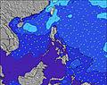 | 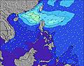 | 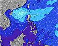 | 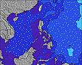 | 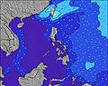 | 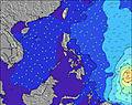 | 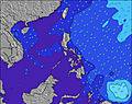 | ||||||||||||||
Wave Height (m) Direction Period (s) | WSW 7 | W 7 | W 7 | W 7 | W 7 | W 7 | W 4 | N 5 | N 6 | N 10 | N 10 | N 10 | NW 7 | NW 7 | WNW 7 | W 11 | WNW 9 | W 8 | WNW 8 | W 11 | WSW 10 |
Wave Graph | |||||||||||||||||||||
0 | 4 | 4 | 4 | 0 | 4 | 1 | 2 | 7 | 117 | 128 | 96 | 38 | 22 | 33 | 21 | 8 | 6 | 13 | 9 | 0 | |
Wind (km/h) | |||||||||||||||||||||
Wind State on-shore cross-onshore cross-shore cross-offshore off-shore glassy | cross-on | cross-on | cross | cross-on | cross-on | glassy | cross-on | cross-on | cross | cross | cross | cross-off | cross-off | cross-off | cross-off | cross-off | cross-off | cross-off | cross | glassy | cross-off |
High Tide | 11:52AM0.50m | 4:31AM0.72m | 4:55AM0.86m | 5:33AM0.99m | 6:19AM1.10m | 7:08AM1.18m | 8:00AM1.22m | ||||||||||||||
Low Tide | 11:24AM0.50m | 8:11PM0.32m | 6:49PM0.31m | 3:29PM0.18m | 4:03PM0.05m | 4:49PM-0.04m | 5:38PM-0.09m | 6:28PM-0.10m | |||||||||||||
5:31 | — | — | 5:31 | — | — | 5:31 | — | — | 5:31 | — | — | 5:31 | — | — | 5:31 | — | — | 5:33 | — | — | |
— | 6:36 | — | — | 6:36 | — | — | 6:36 | — | — | 6:35 | — | — | 6:35 | — | — | 6:35 | — | — | 6:35 | — | |
mm | 3 | 6 | 3 | — | — | 1 | 1 | 7 | 13 | 9 | 10 | 24 | 9 | 10 | 8 | 4 | 3 | 41 | 76 | 81 | 96 |
Temp °C | 29 | 29 | 28 | 29 | 30 | 28 | 29 | 28 | 28 | 27 | 28 | 27 | 27 | 27 | 27 | 27 | 27 | 27 | 26 | 26 | 26 |
Feels °C | 32 | 32 | 32 | 32 | 32 | 32 | 32 | 31 | 32 | 30 | 31 | 30 | 29 | 30 | 30 | 30 | 29 | 31 | 29 | 30 | 31 |
Swell 1 Height (m) Direction Period (s) | WSW 7 | WSW 6 | WSW 6 | W 7 | W 7 | WSW 7 | WSW 7 | WSW 7 | WSW 8 | N 10 | N 10 | WSW 9 | WSW 10 | WSW 10 | WSW 11 | WSW 10 | WSW 10 | WSW 10 | WSW 10 | WSW 10 | — |
15 | 8 | 13 | 23 | 25 | 29 | 57 | 73 | 211 | 117 | 128 | 409 | 430 | 419 | 533 | 435 | 346 | 380 | 360 | 269 | — | |
Swell 2 Height (m) Direction Period (s) | — | W 7 | W 7 | W 7 | — | W 7 | — | N 5 | N 6 | NW 6 | N 20 | N 10 | NW 7 | NW 7 | WNW 7 | W 11 | WNW 9 | W 8 | WNW 8 | W 11 | — |
— | 4 | 4 | 4 | — | 4 | — | 2 | 7 | 9 | 8 | 96 | 38 | 22 | 33 | 21 | 8 | 4 | 13 | 9 | — | |
Swell 3 Height (m) Direction Period (s) | — | — | — | — | — | — | — | W 7 | W 8 | W 10 | W 10 | NNE 14 | N 9 | NNW 8 | N 10 | — | — | WNW 8 | NW 8 | — | — |
— | — | — | — | — | — | — | 1 | 1 | 7 | 7 | 18 | 14 | 6 | 2 | — | — | 6 | 3 | — | — | |
Wind waves Height (m) Direction Period (s) | — | NW 3 | NNW 3 | — | — | — | W 4 | — | SW 2 | WSW 9 | WSW 9 | S 4 | S 3 | SSW 3 | SSE 3 | S 3 | S 2 | S 2 | SSE 2 | S 4 | WSW 10 |
— | 2 | 1 | — | — | — | 1 | — | 2 | 398 | 480 | 15 | 3 | 1 | 2 | 1 | 1 | 1 | 1 | 10 | 763 | |
Nearest Offshore or Glassy | |||||||||||||||||||||
Distance (km) | 158 | 158 | 158 | 158 | 140 | 81 | 158 | 158 | 166 | 166 | 787 | 1 | 793 | 548 | 884 | 81 | 81 | 81 | 590 | 158 | 5 |
Best forecast wave conditions in West Luzon | |||||||||||||||||||||
Best forecast wave conditions in Philippines | |||||||||||||||||||||
Header Global | |||||||||||||||||||||
- Map Icons:
 Break
Break Live Wave Height (m)
 Live Wind Speed (km/h)
 Surf Rating (10 Max)
 Ocean Swells (m)
- Wind Speed (km/h)


FREE! Surf-Forecast.com widget for your website
The surf report / weather widget below is available to embed on third party websites free of charge and provides a summary of our Mona Liza Point surf forecast. Simply grab the html code snippet that we provide and paste it into your own site. You can choose your preferred language and metric/imperial units for the surf forecast feed to suit users of your site. Click here to get the code.
Information about the Mona Liza Point Surf forecast
The above surf forecast table for Mona Liza Point provides essential information for determining whether the surfing conditions will be good over the next 16 days. A general guide to surfing at Mona Liza Point can be found by selecting the local surf guide option on the grey menu. Our Mona Liza Point surf forecast is unique since it includes wave energy (power) that defines the real feel of the surf rather than just the height or the period. If you surf the same spot (Mona Liza Point) regularly then make a mental note of the wave energy from the surf forecast table each time you go. Very soon you may start to choose your surf days based on the wave energy alone combined with our forecast of favourable offshore wind conditions. Our star ratings will help here and of course you will also find the usual wave height and period predictions on our surf forecasts as well as a full break down of the swell components under our advanced users option (to reveal that, click the little Einstein character under the tide times).
Further information to help with frequently asked questions about our surf forecast for Mona Liza Point may be found under the help tab on the top menu and also by moving your mouse over the question marks on the surf forecast table itself. Please always bear in mind that the forecast is for near-shore open water and local factors at each surf break influence the actual breaking wave height, such as the beach / reef profile, water depths offshore and shelter.
Mona Liza Point is 4 km (2 miles) from San Fernando. If you plan a holiday in West Luzon, look for hotels and other accommodation in San Fernando. San Fernando has rooms for a wide range of budgets as well as car hire and transport links.
 Nearest