

Surf Forecasts:

Car-rille surf forecast from 31 Jul 2026:
- Most powerful swell: Saturday 8 Aug, 2AM (local time) - 4ft (1.2m), 11s period, W swell with 326 kJ wave energy.
Best Forecast Surf Conditions for Car-rille this week:
The most powerful waves expected at Car-rille in the next 16 days are 1.2m 11s and forecast to arrive on Saturday (Aug 08) at 2AM. Winds are predicted to be cross-onshore at the time the swell arrives. The largest open ocean swell (not directed at the beach) is 0.4m 4s period and expected on Tuesday (Aug 04) at 8AM.
| Wave Type | Time (PST) & Date | Wave Height & Period |
|---|---|---|
| Next good surf (1 star+) | - | - |
| Best Surf | - | - |
| Most Powerful | 2AM (Sat 8th Aug) | 4ft (1.2m) 11s |
Table - best surf conditions forecast for Car-rille over the next 16 days.
The Lowdown
Alright, Rusty here. Let’s get into it.
Well, I’ve got to be straight with you – the next couple of weeks at Car-rille are looking pretty grim. This is one of those stretches where you’re better off waxing your board for the garage than the water. We’ve got a long, quiet run of flat to tiny, wind-affected dribble to start. There isn’t a single standout session in the whole 16-day window, and honestly, no day here is worth getting excited about.
The first real sniff of anything surfable doesn’t show up until Thursday, August 6th, and even then it’s a mess. Thursday morning brings a weak, short-period 4ft swell from the WSW, with a period of just 4 seconds – that’s windswell mush. The cross-shore wind is moderate and messy (combined energy of all swells directed here is 46). By Thursday afternoon, the swell bumps up to 5ft from the WSW, still with a poor 5-second period, and the cross-shore wind stays moderate. The energy picks up a bit (127), but it’s still a choppy, lumpy affair.
Friday, August 7th turns ugly. The swell sits around 4ft to 5ft from the WSW and W, but the wind howls in at 28 mph from the SW and WSW, creating a strong, messy cross-shore and cross-onshore mess. Combined energy hits 159, but it’s all blown out. This setup looks far more interesting for kite surfing than paddle surfing.
Into the weekend and next week, the size stays small, usually under 3ft, and the wind stays on it from the SW. There’s a long-period swell that shows up on the afternoon of August 8th (5ft from the W at 11 seconds), with a big spike in energy (679), but it’s being hammered by a fresh cross-onshore breeze. The same story repeats on August 9th – a solid 4ft NW groundswell at 11-12 seconds, but again, strong cross-onshore winds ruin it. A point break like Car-rille could handle a long-period groundswell well, but not when the wind is junk.
The last few days, from August 14th onward, finally see some light winds and clean conditions, but the swell is tiny – 1ft at best from the WNW. It’s clean, but you’d be floating. Water temperature is sitting at a balmy 86°, which is a touch warmer than normal for the time of year.
Bottom line: there’s nothing to chase here. A blank run like this is a tough one, but forecasts can change. For now, keep the board in the bag.
- Rusty
Short Range ForecastHeavy rain (total 42mm), heaviest during Sun night. Warm (max 29°C on Sat afternoon, min 25°C on Sun night). Wind will be generally light. | Days 4-6 Weather SummaryHeavy rain (total 93mm), heaviest during Wed night. Warm (max 28°C on Tue morning, min 26°C on Wed afternoon). Winds increasing (calm on Tue morning, fresh winds from the SW by Thu night). | ||||||||||||||||||||
Saturday 1 | Sunday 2 | Monday 3 | Tuesday 4 | Wednesday 5 | Thursday 6 | Friday 7 | |||||||||||||||
AM | PM | Night | AM | PM | Night | AM | PM | Night | AM | PM | Night | AM | PM | Night | AM | PM | Night | AM | PM | Night | |
Swell Height Map | 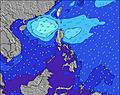 | 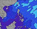 | 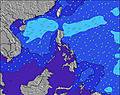 | 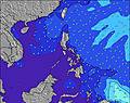 | 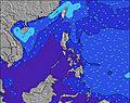 | 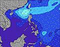 |  | ||||||||||||||
Wave Height (m) Direction Period (s) | W 7 | W 7 | W 7 | NNW 4 | NNW 3 | W 7 | NNW 4 | NNW 4 | NW 4 | NW 4 | W 7 | W 7 | WNW 7 | WNW 7 | SW 4 | WSW 4 | WSW 5 | WSW 5 | WSW 5 | W 5 | W 11 |
Wave Graph | |||||||||||||||||||||
1 | 1 | 1 | 1 | 1 | 1 | 3 | 5 | 6 | 4 | 1 | 4 | 9 | 9 | 27 | 43 | 123 | 78 | 73 | 135 | 326 | |
Wind (km/h) | |||||||||||||||||||||
Wind State on-shore cross-onshore cross-shore cross-offshore off-shore glassy | cross-on | cross-on | cross | on | cross-on | cross | cross-on | cross-on | cross | cross-on | on | cross-off | cross-off | cross | cross-off | cross | cross | cross-on | cross | cross-on | cross-on |
High Tide | 10:01AM0.96m | 10:35AM0.88m | 11:09AM0.77m | 1:52AM0.51m | 11:44AM0.63m | 2:00AM0.62m | 12:12PM0.49m | 2:30AM0.75m | 3:13AM0.87m | 4:05AM0.98m | |||||||||||
Low Tide | 7:22PM0.21m | 7:21PM0.26m | 7:12PM0.32m | 5:16AM0.48m | 6:53PM0.37m | 8:53AM0.47m | 6:13PM0.38m | 4:00PM0.33m | 2:19PM0.20m | ||||||||||||
5:39 | — | — | 5:39 | — | — | 5:39 | — | — | 5:39 | — | — | 5:39 | — | — | 5:39 | — | — | 5:39 | — | — | |
— | 6:30 | — | — | 6:30 | — | — | 6:30 | — | — | 6:30 | — | — | 6:29 | — | — | 6:29 | — | — | 6:28 | — | |
mm | — | 1 | 4 | — | 1 | 18 | — | 9 | 9 | 1 | 3 | 8 | 1 | 12 | 20 | 5 | 18 | 25 | 26 | 90 | 58 |
Temp °C | 28 | 29 | 28 | 28 | 29 | 27 | 28 | 28 | 28 | 28 | 28 | 28 | 28 | 27 | 27 | 28 | 27 | 27 | 27 | 26 | 28 |
Feels °C | 31 | 31 | 31 | 31 | 32 | 31 | 32 | 31 | 31 | 31 | 31 | 31 | 30 | 29 | 30 | 30 | 28 | 29 | 26 | 23 | 28 |
Swell 1 Height (m) Direction Period (s) | W 7 | W 7 | W 7 | W 7 | W 8 | NNW 3 | W 6 | W 7 | W 8 | W 7 | NNW 4 | W 7 | WNW 7 | WNW 7 | WNW 8 | NW 9 | NW 10 | WNW 9 | WNW 9 | NW 8 | NW 8 |
1 | 1 | 1 | 1 | 1 | 1 | 1 | 1 | 1 | 1 | 1 | 4 | 9 | 9 | 21 | 3 | 4 | 78 | 67 | 14 | 111 | |
Swell 2 Height (m) Direction Period (s) | — | — | — | — | W 7 | W 7 | W 7 | — | — | — | W 7 | — | — | — | — | — | — | NW 7 | NW 11 | NW 11 | — |
— | — | — | — | 1 | 1 | 1 | — | — | — | 1 | — | — | — | — | — | — | 2 | 19 | 5 | — | |
Swell 3 Height (m) Direction Period (s) | — | — | — | — | — | — | — | — | — | — | — | — | — | — | — | — | — | — | — | — | — |
— | — | — | — | — | — | — | — | — | — | — | — | — | — | — | — | — | — | — | — | — | |
Wind waves Height (m) Direction Period (s) | — | NNW 2 | N 3 | NNW 4 | NNW 3 | — | NNW 4 | NNW 4 | NW 4 | NW 4 | — | — | — | SW 3 | SW 4 | WSW 4 | WSW 5 | WSW 5 | WSW 5 | W 5 | W 11 |
— | 1 | 1 | 1 | 1 | — | 3 | 5 | 6 | 4 | — | — | — | 4 | 27 | 43 | 123 | 65 | 73 | 135 | 326 | |
Nearest Offshore or Glassy | |||||||||||||||||||||
Distance (km) | 1089 | 2546 | 1985 | 543 | 144 | 160 | 167 | 160 | 23 | 160 | 160 | 160 | 160 | 160 | 85 | 160 | 160 | 160 | 85 | 401 | 167 |
Best forecast wave conditions in West Luzon | |||||||||||||||||||||
Best forecast wave conditions in Philippines | |||||||||||||||||||||
Header Global | |||||||||||||||||||||
- Map Icons:
 Break
Break Live Wave Height (m)
 Live Wind Speed (km/h)
 Surf Rating (10 Max)
 Ocean Swells (m)
- Wind Speed (km/h)
Latest Updates


FREE! Surf-Forecast.com widget for your website
The surf report / weather widget below is available to embed on third party websites free of charge and provides a summary of our Car-rille surf forecast. Simply grab the html code snippet that we provide and paste it into your own site. You can choose your preferred language and metric/imperial units for the surf forecast feed to suit users of your site. Click here to get the code.
Information about the Car-rille Surf forecast
The above surf forecast table for Car-rille provides essential information for determining whether the surfing conditions will be good over the next 16 days. A general guide to surfing at Car-rille can be found by selecting the local surf guide option on the grey menu. Our Car-rille surf forecast is unique since it includes wave energy (power) that defines the real feel of the surf rather than just the height or the period. If you surf the same spot (Car-rille) regularly then make a mental note of the wave energy from the surf forecast table each time you go. Very soon you may start to choose your surf days based on the wave energy alone combined with our forecast of favourable offshore wind conditions. Our star ratings will help here and of course you will also find the usual wave height and period predictions on our surf forecasts as well as a full break down of the swell components under our advanced users option (to reveal that, click the little Einstein character under the tide times).
Further information to help with frequently asked questions about our surf forecast for Car-rille may be found under the help tab on the top menu and also by moving your mouse over the question marks on the surf forecast table itself. Please always bear in mind that the forecast is for near-shore open water and local factors at each surf break influence the actual breaking wave height, such as the beach / reef profile, water depths offshore and shelter.
Car-rille is 4 km (2 miles) from San Fernando. If you plan a holiday in West Luzon, look for hotels and other accommodation in San Fernando. San Fernando has rooms for a wide range of budgets as well as car hire and transport links.
 Nearest