

Surf Forecasts:

How big are the waves at Car-rille today (01 Aug):
- Morning surf: Morning surf (01 Aug, local time) - 0.5ft (0.1m), 7s period with W swell.
- Afternoon surf: Afternoon surf (01 Aug, local time) - 0.5ft (0.1m), 7s period with W swell.
- Evening surf: Evening surf (01 Aug, local time) - 1ft (0.3m), 3s period with N swell.
The current surf forecast for Car-rille at 9AM is: 0.1m 7s primary swell from a West direction (forecast issued at 01:00am August 01). The wind direction is predicted to be cross-shore.
| Time (PST) & Date | Wave Height | Wave Period |
|---|---|---|
| Morning (01 Aug) | 0.5ft (0.1m) | 7s |
| Afternoon (01 Aug) | 0.5ft (0.1m) | 7s |
| Evening (01 Aug) | 1ft (0.3m) | 3s |
Table - waves today at Car-rille. (Swell directed towards the surf break)
Short Range ForecastHeavy rain (total 42mm), heaviest during Sun night. Warm (max 29°C on Sat afternoon, min 25°C on Sun night). Wind will be generally light. | ||||||||||||||||||||||||
Saturday 1 | Sunday 2 | Monday 3 | ||||||||||||||||||||||
2 AM | 5 AM | 8 AM | 11 AM | 2 PM | 5 PM | 8 PM | 11 PM | 2 AM | 5 AM | 8 AM | 11 AM | 2 PM | 5 PM | 8 PM | 11 PM | 2 AM | 5 AM | 8 AM | 11 AM | 2 PM | 5 PM | 8 PM | 11 PM | |
Swell Height Map | 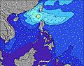 | 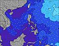 | 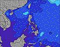 | 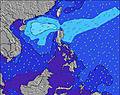 | 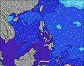 | 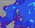 | 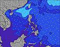 | 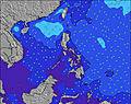 | 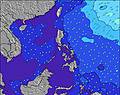 | |||||||||||||||
Wave Height (m) Direction Period (s) | W 8 | W 8 | W 7 | W 7 | W 7 | W 7 | W 7 | W 7 | W 7 | W 7 | W 7 | NNW 4 | NW 4 | NNW 3 | NNW 3 | W 7 | W 7 | W 7 | W 7 | NNW 4 | NNW 4 | NNW 4 | NW 4 | NW 4 |
Wave Graph | ||||||||||||||||||||||||
1 | 1 | 1 | 1 | 1 | 1 | 1 | 1 | 1 | 1 | 1 | 1 | 2 | 1 | 1 | 1 | 1 | 1 | 1 | 3 | 6 | 5 | 3 | 5 | |
Wind (km/h) | ||||||||||||||||||||||||
Wind State on-shore cross-onshore cross-shore cross-offshore off-shore glassy | cross | cross-off | cross | cross-on | cross-on | cross-on | cross | cross-off | cross | cross-off | cross-on | on | on | cross-on | cross-off | off | cross | cross-off | glassy | cross-on | on | cross-on | cross-on | cross |
High Tide | 10:01AM0.96m | 10:35AM0.88m | 11:09AM0.77m | |||||||||||||||||||||
Low Tide | 7:22PM0.21m | 7:21PM0.26m | 7:12PM0.32m | |||||||||||||||||||||
— | 5:39 | — | — | — | — | — | — | — | 5:39 | — | — | — | — | — | — | — | 5:39 | — | — | — | — | — | — | |
— | — | — | — | — | 6:30 | — | — | — | — | — | — | — | 6:30 | — | — | — | — | — | — | — | 6:30 | — | — | |
mm | — | — | — | — | — | 1 | — | 2 | 2 | — | — | — | — | 1 | 7 | 10 | — | 1 | — | — | 4 | 5 | 4 | 3 |
Temp °C | 27 | 27 | 27 | 28 | 28 | 29 | 28 | 26 | 26 | 26 | 27 | 28 | 29 | 29 | 27 | 25 | 26 | 27 | 27 | 28 | 28 | 28 | 28 | 27 |
Feels °C | 30 | 31 | 31 | 31 | 30 | 31 | 31 | 30 | 30 | 29 | 31 | 31 | 32 | 31 | 31 | 29 | 29 | 31 | 32 | 32 | 31 | 31 | 31 | 30 |
Swell 1 Height (m) Direction Period (s) | W 8 | W 8 | W 7 | W 7 | W 7 | W 7 | W 7 | W 7 | W 7 | W 7 | W 7 | W 7 | W 7 | W 8 | W 8 | NNW 3 | NNW 3 | NNW 4 | NNW 4 | W 6 | W 7 | W 7 | W 8 | W 8 |
1 | 1 | 1 | 1 | 1 | 1 | 1 | 1 | 1 | 1 | 1 | 1 | 1 | 1 | 1 | 1 | 1 | 3 | 3 | 1 | 1 | 1 | 1 | 1 | |
Swell 2 Height (m) Direction Period (s) | — | — | — | — | — | — | — | — | — | — | — | — | — | W 7 | — | W 7 | W 7 | W 7 | W 6 | W 7 | — | — | — | — |
— | — | — | — | — | — | — | — | — | — | — | — | — | 1 | — | 1 | 1 | 1 | 1 | 1 | — | — | — | — | |
Swell 3 Height (m) Direction Period (s) | — | — | — | — | — | — | — | — | — | — | — | — | — | — | — | — | — | — | W 7 | — | — | — | — | — |
— | — | — | — | — | — | — | — | — | — | — | — | — | — | — | — | — | — | 1 | — | — | — | — | — | |
Wind waves Height (m) Direction Period (s) | — | — | — | — | — | NNW 2 | NNW 2 | N 3 | N 3 | N 3 | N 3 | NNW 4 | NW 4 | NNW 3 | NNW 3 | — | — | — | — | NNW 4 | NNW 4 | NNW 4 | NW 4 | NW 4 |
— | — | — | — | — | 1 | 1 | 1 | 1 | 1 | 1 | 1 | 2 | 1 | 1 | — | — | — | — | 3 | 6 | 5 | 3 | 5 | |
Nearest Offshore or Glassy | ||||||||||||||||||||||||
Distance (km) | 1089 | 958 | 1089 | 1089 | 2573 | 1985 | 1292 | 1985 | 1300 | 549 | 549 | 543 | 543 | 144 | 160 | 160 | 160 | 160 | 160 | 167 | 160 | 160 | 160 | 85 |
Best forecast wave conditions in West Luzon | ||||||||||||||||||||||||
Best forecast wave conditions in Philippines | ||||||||||||||||||||||||
Header Global | ||||||||||||||||||||||||
- Map Icons:
 Break
Break Live Wave Height (m)
 Live Wind Speed (km/h)
 Surf Rating (10 Max)
 Ocean Swells (m)
- Wind Speed (km/h)
Latest Updates


FREE! Surf-Forecast.com widget for your website
The surf report / weather widget below is available to embed on third party websites free of charge and provides a summary of our Car-rille surf forecast. Simply grab the html code snippet that we provide and paste it into your own site. You can choose your preferred language and metric/imperial units for the surf forecast feed to suit users of your site. Click here to get the code.
 Nearest