

Surf Forecasts:

Riyue Bay (Riyuewan) surf forecast from 2 Aug 2026:
- Best quality surf: Thursday 6 Aug, 8PM (local time) - 3.5ft (1.0m), 18s period, E swell with cross-offshore winds.
- Most powerful swell: Friday 7 Aug, 8AM (local time) - 4ft (1.2m), 18s period, E swell with 940 kJ wave energy.
- Next surfable swell (1★+): Monday 3 Aug, 5AM (local time) - 4ft (1.2m), 6s period with SSE swell.
Best Forecast Surf Conditions for Riyue Bay (Riyuewan) this week:
The surf forecast for Riyue Bay (Riyuewan) over the next 16 days: The first swell (rated 1 star or higher) is forecast to arrive on Monday (Aug 03) at 5AM. The primary swell is predicted to be 1.2m and 6s period with a secondary swell of 0.8m and 6s. Another secondary swell of 0.1m and 8s is also forecast. The wind is predicted to be cross-offshore as the swell arrives.
The most powerful waves expected at Riyue Bay (Riyuewan) in the next 16 days are 1.2m 18s and forecast to arrive on Friday (Aug 07) at 8AM. Winds are predicted to be glassy at the time the swell arrives. The largest open ocean swell (not directed at the beach) is 1.2m 6s period and expected on Thursday (Aug 06) at 8PM.
| Wave Type | Time (CST) & Date | Wave Height & Period |
|---|---|---|
| Next good surf (1 star+) | 5AM (Mon 3rd Aug) | 4ft (1.2m) 6s |
| Best Surf | 8PM (Thu 6th Aug) | 3.5ft (1.0m) 18s |
| Most Powerful | 8AM (Fri 7th Aug) | 4ft (1.2m) 18s |
Table - best surf conditions forecast for Riyue Bay (Riyuewan) over the next 16 days.
The Lowdown
G’day, Rusty here, and I’ve been digging into the 16-day picture for the local waves. It’s a slow start, but there’s a little window of gold if you’re willing to wait. The first couple of days are pretty much a write-off, so don’t bother.
Right now, through Sunday, August 2nd, and Monday, August 3rd, it’s flat and messy. The swell is tiny, under 3 feet, with a weak, short-period SSE energy (combined energy of all swells directed here is only 114). The wind is all cross or cross-on, and the water is 28°, which is a bit cooler than normal for this time of year. Not worth getting wet.
The first real sign of life hits on Wednesday morning, August 5th, at Riyue Bay (Riyuewan). We get a glassy start with a light S breeze, and a 2-foot swell from the east with a 16-second period. That’s real groundswell energy, and the combined energy of all swells directed here jumps to 223. It’s small, but those long-period lines will be clean. By Wednesday afternoon, it builds to 2 feet from the ESE, with a 17-second period, and the wind shifts to a clean cross-off from the west. The combined energy of all swells directed here hits 335. This is the first worthwhile session.
Thursday, August 6th, is better. Morning glass, with a 3-foot, 16-second east swell (combined energy of all swells directed here at 466). By afternoon, the wind drops to dead calm, the swell holds at 3 feet, and the period stretches to 18 seconds. The combined energy of all swells directed here is a solid 586. That’s the kind of glassy, long-period groundswell that makes Riyue Bay’s point setup work beautifully.
The standout—the one you need to plan for—is Friday, August 7th. This is the best on offer. The morning brings a glassy, near-calm sea state with a 4-foot, 18-second east swell. The combined energy of all swells directed here is a strong 831. Afternoon holds onto that 4-foot swell, with the period easing slightly to 17 seconds, and the wind is a clean cross-off from the WSW. The combined energy of all swells directed here is still 792. The east swell direction is right in the sweet spot for Riyue Bay’s optimum from the NE, and with that long period, the point will be offering some long, smooth rides. The crowd profile says “sometimes,” so you might have some company, but it’s worth it.
After that, the swell drops and the wind picks up. Saturday, August 8th, and Sunday, August 9th, are still rideable but messy. By Monday, August 10th, we’re back to marginal conditions with a 3-foot S swell and a weak, 9-second period. The combined energy of all swells directed here is only 192. It’s a stretch of ordinary days until Wednesday, August 12th, when we see a little pulse of 4 feet from the south with a 9-second period, but the cross-off wind keeps it clean. The combined energy of all swells directed here is 360—rideable, but nothing special.
The second week (from August 11th onward) is a mixed bag. There’s south swell, but the periods are short and the wind is often cross. Thursday, August 13th, sees a jump to 6 feet from the SSW, but the period is only 8 seconds and the wind is cross, making for chopped-up, messy waves. That’s more of a kite-surfing setup. There’s a glassy moment on Friday, August 14th, afternoon with 5 feet from the SSW, but it’s short-period and only “surfable.” Nothing to get excited about.
The clear winner is Friday, August 7th, with the morning being the pick. Get down to Riyue Bay early for clean, glassy, long-period east swell. It’s a proper treat.
Rusty.
Short Range ForecastModerate rain (total 13mm), heaviest on Tue night. Warm (max 31°C on Tue morning, min 26°C on Sun night). Wind will be generally light. | Days 4-6 Weather SummaryHeavy rain (total 100mm), heaviest during Wed night. Warm (max 30°C on Fri afternoon, min 25°C on Wed night). Wind will be generally light. | ||||||||||||||||||||
Sunday 2 | Monday 3 | Tuesday 4 | Wednesday 5 | Thursday 6 | Friday 7 | Saturday 8 | |||||||||||||||
AM | PM | Night | AM | PM | Night | AM | PM | Night | AM | PM | Night | AM | PM | Night | AM | PM | Night | AM | PM | Night | |
Swell Height Map | 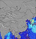 | 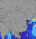 | 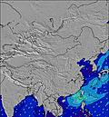 | 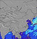 | 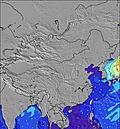 | 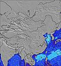 | 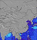 | ||||||||||||||
Wave Height (m) Direction Period (s) | SSE 7 | S 7 | SSE 6 | SSE 6 | SSE 6 | SSE 6 | ESE 16 | ESE 16 | E 16 | E 16 | ESE 17 | ESE 17 | ESE 16 | ESE 18 | E 18 | E 18 | E 17 | E 15 | ESE 18 | S 9 | S 9 |
Wave Graph | |||||||||||||||||||||
111 | 107 | 68 | 82 | 50 | 57 | 50 | 84 | 127 | 193 | 307 | 390 | 448 | 528 | 803 | 919 | 742 | 376 | 107 | 199 | 220 | |
Wind (km/h) | |||||||||||||||||||||
Wind State on-shore cross-onshore cross-shore cross-offshore off-shore glassy | cross | cross | cross | cross-on | cross | cross | cross | cross | glassy | cross-off | cross-off | cross-off | cross | glassy | glassy | cross | glassy | cross-off | cross-off | cross-off | cross-off |
High Tide | 12:01PM1.36m | 2:14AM0.87m | 12:43PM1.22m | 2:24AM0.97m | 1:30PM1.06m | 2:41AM1.09m | 2:32PM0.88m | 3:07AM1.21m | 4:13PM0.70m | 3:43AM1.33m | 4:31AM1.44m | ||||||||||
Low Tide | 7:40PM0.32m | 6:15AM0.73m | 7:53PM0.42m | 7:36AM0.69m | 8:00PM0.51m | 9:04AM0.63m | 7:59PM0.60m | 10:47AM0.53m | 7:36PM0.65m | 12:38PM0.39m | 2:09PM0.24m | ||||||||||
6:16 | — | — | 6:16 | — | — | 6:16 | — | — | 6:16 | — | — | 6:16 | — | — | 6:18 | — | — | 6:18 | — | — | |
— | 7:14 | — | — | 7:13 | — | — | 7:13 | — | — | 7:12 | — | — | 7:12 | — | — | 7:10 | — | — | 7:09 | — | |
mm | — | — | — | — | — | — | — | 4 | 9 | 1 | 16 | 37 | 1 | 9 | 11 | 3 | 13 | 9 | 4 | 6 | — |
Temp °C | 28 | 29 | 27 | 30 | 30 | 28 | 31 | 30 | 28 | 28 | 29 | 26 | 29 | 29 | 28 | 29 | 30 | 28 | 30 | 30 | 28 |
Feels °C | 31 | 32 | 31 | 33 | 32 | 32 | 34 | 33 | 33 | 32 | 34 | 31 | 34 | 34 | 34 | 34 | 35 | 33 | 33 | 32 | 30 |
Swell 1 Height (m) Direction Period (s) | SSE 7 | S 7 | SSE 6 | SSE 6 | E 19 | SSE 6 | SSE 6 | ESE 16 | S 6 | S 6 | ESE 17 | ESE 17 | ESE 16 | ESE 18 | E 18 | E 18 | E 17 | S 8 | S 8 | S 9 | S 9 |
111 | 107 | 68 | 82 | 7 | 57 | 40 | 84 | 40 | 39 | 307 | 390 | 448 | 528 | 803 | 919 | 742 | 171 | 80 | 199 | 220 | |
Swell 2 Height (m) Direction Period (s) | E 6 | E 10 | E 8 | E 9 | E 9 | ESE 17 | ESE 16 | E 9 | E 16 | E 16 | S 6 | S 7 | S 7 | S 6 | S 7 | S 7 | S 7 | E 15 | E 13 | E 12 | E 11 |
1 | 2 | 1 | 1 | 2 | 29 | 50 | 2 | 127 | 193 | 28 | 48 | 45 | 31 | 54 | 44 | 39 | 376 | 88 | 48 | 10 | |
Swell 3 Height (m) Direction Period (s) | E 9 | E 6 | E 5 | E 17 | — | E 9 | E 9 | E 9 | E 9 | WSW 6 | E 9 | SW 6 | E 6 | E 6 | SW 6 | — | — | — | ESE 18 | E 17 | E 16 |
2 | 1 | 1 | 6 | — | 2 | 2 | 2 | 2 | 3 | 1 | 13 | 3 | 3 | 6 | — | — | — | 107 | 53 | 19 | |
Wind waves Height (m) Direction Period (s) | — | — | — | — | SSE 6 | — | — | S 4 | SW 4 | WSW 6 | SW 5 | — | SW 5 | SW 5 | — | SSW 7 | SW 6 | SW 6 | SW 6 | SW 7 | SW 6 |
— | — | — | — | 50 | — | — | 33 | 5 | 18 | 31 | — | 7 | 35 | — | 66 | 89 | 9 | 78 | 132 | 35 | |
Nearest Offshore or Glassy | |||||||||||||||||||||
Distance (km) | 0 | 37 | 37 | 75 | 1157 | 75 | 1183 | 1157 | 0 | 0 | 0 | 0 | 0 | 0 | 0 | 0 | 0 | 0 | 347 | 347 | 347 |
Best forecast wave conditions in Hainan | |||||||||||||||||||||
Best forecast wave conditions in China | |||||||||||||||||||||
Header Global | |||||||||||||||||||||
- Map Icons:
 Break
Break Live Wave Height (m)
 Live Wind Speed (km/h)
 Surf Rating (10 Max)
 Ocean Swells (m)
- Wind Speed (km/h)
Latest Updates


FREE! Surf-Forecast.com widget for your website
The surf report / weather widget below is available to embed on third party websites free of charge and provides a summary of our Riyue Bay (Riyuewan) surf forecast. Simply grab the html code snippet that we provide and paste it into your own site. You can choose your preferred language and metric/imperial units for the surf forecast feed to suit users of your site. Click here to get the code.
Information about the Riyue Bay (Riyuewan) Surf forecast
The above surf forecast table for Riyue Bay (Riyuewan) provides essential information for determining whether the surfing conditions will be good over the next 16 days. A general guide to surfing at Riyue Bay (Riyuewan) can be found by selecting the local surf guide option on the grey menu. Our Riyue Bay (Riyuewan) surf forecast is unique since it includes wave energy (power) that defines the real feel of the surf rather than just the height or the period. If you surf the same spot (Riyue Bay (Riyuewan)) regularly then make a mental note of the wave energy from the surf forecast table each time you go. Very soon you may start to choose your surf days based on the wave energy alone combined with our forecast of favourable offshore wind conditions. Our star ratings will help here and of course you will also find the usual wave height and period predictions on our surf forecasts as well as a full break down of the swell components under our advanced users option (to reveal that, click the little Einstein character under the tide times).
Further information to help with frequently asked questions about our surf forecast for Riyue Bay (Riyuewan) may be found under the help tab on the top menu and also by moving your mouse over the question marks on the surf forecast table itself. Please always bear in mind that the forecast is for near-shore open water and local factors at each surf break influence the actual breaking wave height, such as the beach / reef profile, water depths offshore and shelter.
Are you planning a holiday in Hainan? If you are looking for accommodation near Riyue Bay (Riyuewan), camping, hotels and holiday cottages in Hainan, consider staying in Wanning which is 26 km (16 miles) away. Other places in and around Hainan where you can find information about places to rent, and car hire include Li-an which is 27 km (17 miles) away, Baoding, Bacun and Baimalingcaifachang.
 Nearest