

Surf Forecasts:

Darigayos surf forecast from 3 Aug 2026:
- Most powerful swell: Wednesday 5 Aug, 11AM (local time) - 4ft (1.2m), 7s period, W swell with 152 kJ wave energy.
Best Forecast Surf Conditions for Darigayos this week:
The most powerful waves expected at Darigayos in the next 16 days are 1.2m 7s and forecast to arrive on Wednesday (Aug 05) at 11AM. Winds are predicted to be cross-offshore at the time the swell arrives. The largest open ocean swell (not directed at the beach) is 3.5m 10s period and expected on Saturday (Aug 08) at 11PM.
| Wave Type | Time (PST) & Date | Wave Height & Period |
|---|---|---|
| Next good surf (1 star+) | - | - |
| Best Surf | - | - |
| Most Powerful | 11AM (Wed 5th Aug) | 4ft (1.2m) 7s |
Table - best surf conditions forecast for Darigayos over the next 16 days.
The Lowdown
Alright folks, Rusty here. Got a long look ahead for us, and I gotta be straight with you – this one's a bit of a bummer. We're staring down a 16-day window where the surf is pretty much flatlined. There's a real gap here, with pretty much nothing to get excited about for the first week and a half.
Let's start with the only spot on the menu: Darigayos. It's a consistent reef break, so when there's swell, it usually works. But for the first week of August, it's a ghost town. Monday the 3rd kicks off with a tiny 1ft NNW windswell, period of just 5 seconds, and the wind is a messy cross-off. The wave energy is basically nothing (9). It's a no-go. Tuesday the 4th sees a tiny 2ft N swell, but the wind goes cross, and the energy is still pathetic (21 by Tuesday morn). The first few days are all rain showers, thunderstorms, and heavy rain... just grim.
We get a little spike on Wednesday the 5th – a 4ft W swell shows up with a 7-second period, giving us moderate energy (172). But the wind is a strong cross-off from the SSE at 19 mph, and it's hammering down with heavy rain. The surf quality is still rated poor, so that's not a session you'd remember fondly. The water is warm at 86°, which is about average for this time of year here.
After that, it's a long, sad slide into nothing. From Thursday the 6th right through to Monday the 17th of August, the swell is essentially non-existent. Most days have zero combined energy, or just a tiny 1 or 2. The wind is predominantly a messy cross-on or onshore, often with fresh to strong breezes. There's a chance of a glimmer of glassy conditions on the 15th afternoon, but there's no swell to ride.
The only faint pulse comes on Monday the 17th with a 1ft S swell at a 3-second period, just pure junk. And then a glass-off on Tuesday the 18th morning, but again, no swell.
So, here's the deal. There are no standouts in this 16-day window. The best you could call is that Wednesday the 5th morning has the most size, but it's ruined by the wind and rain. For a spot that's normally consistent, this is a dry spell. But you know how it is – forecasts can change. Don't write the whole month off yet.
This is Rusty, signing off.
Short Range ForecastHeavy rain (total 305mm), heaviest during Wed night. Warm (max 28°C on Tue morning, min 25°C on Mon night). Mainly fresh winds. | Days 5-7 Weather SummaryHeavy rain (total 193mm), heaviest during Sat morning. Warm (max 28°C on Thu afternoon, min 26°C on Thu night). Winds increasing (light winds from the SW on Thu afternoon, fresh winds from the WSW by Sun morning). | |||||||||||||||||||
Mon 3 | Tuesday 4 | Wednesday 5 | Thursday 6 | Friday 7 | Saturday 8 | Sunday 9 | ||||||||||||||
PM | Night | AM | PM | Night | AM | PM | Night | AM | PM | Night | AM | PM | Night | AM | PM | Night | AM | PM | Night | |
Swell Height Map | 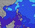 | 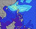 | 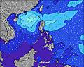 | 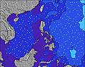 | 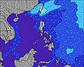 | 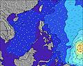 | 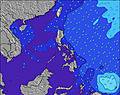 | |||||||||||||
Wave Height (m) Direction Period (s) | NNW 5 | NNW 6 | N 5 | NNW 5 | N 6 | W 7 | NNW 5 | N 4 | N 6 | N 6 | N 5 | N 5 | WSW 8 | WSW 9 | N 6 | N 6 | WSW 10 | NNE 14 | NNE 14 | NNE 14 |
Wave Graph | ||||||||||||||||||||
8 | 46 | 15 | 10 | 23 | 152 | 19 | 10 | 1 | 1 | 1 | 1 | 0 | 0 | 1 | 1 | 0 | 19 | 19 | 41 | |
Wind (km/h) | ||||||||||||||||||||
Wind State on-shore cross-onshore cross-shore cross-offshore off-shore glassy | cross-off | cross-off | cross | off | cross | cross-off | cross-off | cross | cross | cross-on | cross-off | cross | cross | cross-on | cross-on | cross-on | cross-on | cross-on | cross-on | cross-on |
High Tide | 1:09AM0.43m | 11:47AM0.57m | 1:35AM0.54m | 12:24PM0.44m | 2:13AM0.66m | 3:00AM0.78m | 3:55AM0.88m | 4:53AM0.98m | ||||||||||||
Low Tide | 7:05PM0.28m | 5:05AM0.39m | 6:45PM0.32m | 8:06AM0.39m | 6:15PM0.32m | 5:06PM0.28m | 1:48PM0.17m | 2:33PM0.07m | 3:19PM-0.00m | |||||||||||
— | — | 5:39 | — | — | 5:39 | — | — | 5:39 | — | — | 5:39 | — | — | 5:39 | — | — | 5:39 | — | — | |
6:30 | — | — | 6:30 | — | — | 6:29 | — | — | 6:29 | — | — | 6:28 | — | — | 6:28 | — | — | 6:27 | — | |
mm | 4 | 3 | — | 19 | 29 | 15 | 75 | 119 | 41 | 2 | — | 2 | 6 | 40 | 61 | 26 | 31 | 25 | 32 | 26 |
Temp °C | 27 | 27 | 28 | 26 | 27 | 27 | 25 | 26 | 27 | 28 | 27 | 28 | 27 | 27 | 27 | 27 | 28 | 27 | 28 | 28 |
Feels °C | 29 | 30 | 31 | 31 | 31 | 27 | 25 | 28 | 31 | 32 | 30 | 31 | 29 | 30 | 31 | 28 | 29 | 28 | 30 | 30 |
Swell 1 Height (m) Direction Period (s) | W 6 | NNW 6 | WSW 6 | WSW 7 | WSW 8 | WSW 8 | WSW 8 | WSW 8 | WSW 8 | WSW 8 | WSW 9 | WSW 8 | WSW 8 | — | N 6 | N 6 | — | NNE 14 | NNE 14 | NNE 14 |
20 | 46 | 78 | 196 | 199 | 150 | 150 | 149 | 212 | 267 | 459 | 361 | 370 | — | 1 | 1 | — | 19 | 19 | 41 | |
Swell 2 Height (m) Direction Period (s) | NNW 5 | WSW 6 | N 5 | NNW 5 | N 6 | NNW 5 | NNW 5 | N 4 | N 6 | N 6 | N 5 | N 5 | — | — | — | — | — | — | — | — |
8 | 33 | 15 | 10 | 23 | 20 | 19 | 10 | 1 | 1 | 1 | 1 | — | — | — | — | — | — | — | — | |
Swell 3 Height (m) Direction Period (s) | N 4 | — | — | — | — | — | — | — | N 6 | — | — | — | — | — | — | — | — | — | — | — |
1 | — | — | — | — | — | — | — | 1 | — | — | — | — | — | — | — | — | — | — | — | |
Wind waves Height (m) Direction Period (s) | — | SSE 4 | S 3 | — | — | W 7 | — | — | — | — | — | — | — | WSW 9 | WSW 10 | WSW 10 | WSW 10 | WSW 10 | WSW 10 | WSW 10 |
— | 19 | 6 | — | — | 152 | — | — | — | — | — | — | — | 781 | 1021 | 1467 | 2079 | 1847 | 2194 | 1853 | |
Nearest Offshore or Glassy | ||||||||||||||||||||
Distance (km) | 167 | 167 | 167 | 18 | 62 | 62 | 62 | 62 | 62 | 167 | 62 | 167 | 167 | 167 | 177 | 177 | 177 | 177 | 413 | 413 |
Best forecast wave conditions in West Luzon | ||||||||||||||||||||
Best forecast wave conditions in Philippines | ||||||||||||||||||||
Header Global | ||||||||||||||||||||
- Map Icons:
 Break
Break Live Wave Height (m)
 Live Wind Speed (km/h)
 Surf Rating (10 Max)
 Ocean Swells (m)
- Wind Speed (km/h)
Latest Updates


FREE! Surf-Forecast.com widget for your website
The surf report / weather widget below is available to embed on third party websites free of charge and provides a summary of our Darigayos surf forecast. Simply grab the html code snippet that we provide and paste it into your own site. You can choose your preferred language and metric/imperial units for the surf forecast feed to suit users of your site. Click here to get the code.
Information about the Darigayos Surf forecast
The above surf forecast table for Darigayos provides essential information for determining whether the surfing conditions will be good over the next 16 days. A general guide to surfing at Darigayos can be found by selecting the local surf guide option on the grey menu. Our Darigayos surf forecast is unique since it includes wave energy (power) that defines the real feel of the surf rather than just the height or the period. If you surf the same spot (Darigayos) regularly then make a mental note of the wave energy from the surf forecast table each time you go. Very soon you may start to choose your surf days based on the wave energy alone combined with our forecast of favourable offshore wind conditions. Our star ratings will help here and of course you will also find the usual wave height and period predictions on our surf forecasts as well as a full break down of the swell components under our advanced users option (to reveal that, click the little Einstein character under the tide times).
Further information to help with frequently asked questions about our surf forecast for Darigayos may be found under the help tab on the top menu and also by moving your mouse over the question marks on the surf forecast table itself. Please always bear in mind that the forecast is for near-shore open water and local factors at each surf break influence the actual breaking wave height, such as the beach / reef profile, water depths offshore and shelter.
Darigayos is 23 km (14 miles) from San Fernando. If you plan a holiday in West Luzon, look for hotels and other accommodation in San Fernando. San Fernando has rooms for a wide range of budgets as well as car hire and transport links.
 Nearest