

Surf Forecasts:

La Derecha surf forecast from 2 Aug 2026:
- Best quality surf: Saturday 8 Aug, 3PM (local time) - 10ft (3.0m), 8s period, SW swell with offshore winds.
- Most powerful swell: Sunday 9 Aug, 12AM (local time) - 11ft (3.5m), 9s period, SSW swell with 1,795 kJ wave energy.
- Next surfable swell (1★+): Monday 3 Aug, 6PM (local time) - 3.5ft (1.1m), 11s period with SSE swell.
Best Forecast Surf Conditions for La Derecha this week:
The surf forecast for La Derecha over the next 16 days: The first swell (rated 1 star or higher) is forecast to arrive on Monday (Aug 03) at 6PM. The primary swell is predicted to be 1.1m and 11s period with a secondary swell of 0.5m and 4s. Another secondary swell of 0.5m and 4s is also forecast. The wind is predicted to be glassy as the swell arrives.
The most powerful waves expected at La Derecha in the next 16 days are 3.5m 9s and forecast to arrive on Sunday (Aug 09) at 12AM. Winds are predicted to be cross-offshore at the time the swell arrives. The largest open ocean swell (not directed at the beach) is 2.5m 8s period and expected on Saturday (Aug 08) at 12PM.
| Wave Type | Time (-03) & Date | Wave Height & Period |
|---|---|---|
| Next good surf (1 star+) | 6PM (Mon 3rd Aug) | 3.5ft (1.1m) 11s |
| Best Surf | 3PM (Sat 8th Aug) | 10ft (3.0m) 8s |
| Most Powerful | 12AM (Sun 9th Aug) | 11ft (3.5m) 9s |
Table - best surf conditions forecast for La Derecha over the next 16 days.
The Lowdown
Alright, folks. Rusty here. Let’s talk about La Derecha. The first week is a real slow burn, but if you can wait, the second week has some fire.
The water is about 55°F, which is a touch warmer than usual for this time of year. But the surf? It’s sad. We’re looking at tiny, weak swell, mostly under 3 feet, and the wind is either cross-on or just messy. The combined wave energy is weak, hanging around 130. It’s that choppy, small-wave feeling that’s just not worth the paddle. Monday the 3rd sees a little bump in energy to 256 with a 4ft SSE swell, but the wind is onshore and the conditions are just marginal. Tuesday the 4th is similar with a 3ft SSE swell and cross-shore wind, leaving a slight chop. Honestly, the first few days are a wash.
Things get weird by Friday the 7th. The wind goes offshore and clean, but the swell is coming from the NE with a terrible, short period of just 5 seconds. The energy is a pathetic 61. You’ll have clean-looking water, but no push to ride. Saturday the 8th starts the same, tiny and clean, but hold onto your board... Saturday afternoon a massive 10ft SW swell slams in with a period of 8 seconds. The energy rockets to 1065. That’s big, powerful, and frankly, too big for La Derecha. It’s a warning. Sunday the 9th is even bigger, with an 12ft SSW swell and 1500 energy. Monday the 10th carries that energy at 1836 with 8ft of S swell. That’s a massive, dangerous amount of water. This is expert-only territory.
The real standout window opens on Tuesday the 11th of August. The massive swell drops to a much more manageable 5ft from the SSE, with a long, clean 12-second period. The wind is light and cross-off. The energy is still a solid 565. The forecast is calling for “very good surf conditions” in the morning. That is the day to circle. Long period groundswell like that can line up beautifully at a point break, giving you long, walled-up rides. The crowd profile says “sometimes,” so you might have a few others out, but with that quality, it’s worth it. The afternoon still looks good, too, with a 5ft swell and clean cross-shore winds.
The end of the second week has a couple of other interesting days. Friday the 14th of August has a 6ft ENE swell with a short 7-second period, but the wind is glassy in the morning. That’s a tricky one – the short period means a bit of a lumpy feel, but on a point, that glassy water could save the session. The energy is decent at 491. Saturday the 15th is smaller, around 4ft, with clean cross-off winds, but it’s just a more marginal offering.
Overall, the first week is a dud. Don’t fight it. The standout by a long shot is Tuesday the 11th of August. Get out there for the morning. That long period, clean swell, and light wind are a recipe for a classic day at La Derecha.
Rusty.
Short Range ForecastLight rain (total 7mm), mostly falling on Mon afternoon. Very mild (max 15°C on Tue afternoon, min 9°C on Sun morning). Wind will be generally light. | Days 4-6 Weather SummaryHeavy rain (total 32mm), heaviest during Thu night. Very mild (max 18°C on Thu night, min 8°C on Fri night). Winds increasing (calm on Wed night, fresh winds from the WSW by Fri morning). | ||||||||||||||||||||
Sunday 2 | Monday 3 | Tuesday 4 | Wednesday 5 | Thursday 6 | Friday 7 | Saturday 8 | |||||||||||||||
AM | PM | Night | AM | PM | Night | AM | PM | Night | AM | PM | Night | AM | PM | Night | AM | PM | Night | AM | PM | Night | |
Swell Height Map |  |  | 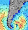 | 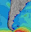 | 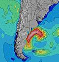 | 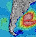 | 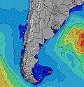 | ||||||||||||||
Wave Height (m) Direction Period (s) | ENE 9 | ENE 9 | S 7 | SSE 11 | SSE 11 | SSE 11 | SSE 10 | SSE 10 | SE 10 | SE 9 | SE 9 | SE 9 | SE 8 | SE 8 | E 6 | NE 5 | ENE 6 | E 7 | ENE 7 | SW 8 | SSW 9 |
Wave Graph | |||||||||||||||||||||
88 | 65 | 47 | 213 | 280 | 286 | 229 | 175 | 137 | 84 | 67 | 97 | 45 | 41 | 29 | 49 | 56 | 23 | 11 | 1059 | 1795 | |
Wind (km/h) | |||||||||||||||||||||
Wind State on-shore cross-onshore cross-shore cross-offshore off-shore glassy | cross-on | cross-on | cross-on | cross-on | on | cross-off | cross | cross-on | on | cross-on | cross-on | cross-on | cross-on | cross-on | cross-on | off | off | cross-off | off | off | cross-off |
High Tide | 9:42AM0.30m | 3:46PM0.22m | 9:59PM0.37m | 3:53AM0.21m | 4:27PM0.20m | 10:46PM0.36m | 4:48AM0.21m | 5:07PM0.18m | 11:34PM0.34m | 5:46AM0.21m | 5:47PM0.15m | 00:26AM0.32m | 6:51AM0.21m | 12:40PM0.43m | 6:24PM0.13m | 8:06AM0.22m | 1:33PM0.46m | 2:17AM0.28m | 2:30PM0.48m | ||
Low Tide | 12:59PM0.14m | 6:21PM0.15m | 6:48AM0.11m | 1:54PM0.13m | 7:04PM0.13m | 7:26AM0.13m | 2:52PM0.13m | 7:48PM0.10m | 3:08AM0.14m | 3:58PM0.13m | 8:34PM0.08m | 3:57AM0.13m | 5:12PM0.13m | 9:24PM0.06m | 4:50AM0.12m | 10:19PM0.04m | 5:45AM0.11m | 11:20PM0.03m | |||
7:28 | — | — | 7:28 | — | — | 7:26 | — | — | 7:26 | — | — | 7:26 | — | — | 7:24 | — | — | 7:24 | — | — | |
— | 5:55 | — | — | 5:55 | — | — | 5:57 | — | — | 5:58 | — | — | 5:59 | — | — | 5:59 | — | — | 6:00 | — | |
mm | — | — | — | — | 5 | 2 | — | — | — | — | — | — | — | — | 32 | — | — | — | — | — | — |
Temp °C | 11 | 13 | 11 | 13 | 14 | 14 | 14 | 15 | 13 | 15 | 15 | 14 | 15 | 16 | 18 | 12 | 13 | 9 | 12 | 10 | 9 |
Feels °C | 9 | 9 | 8 | 11 | 14 | 13 | 13 | 14 | 12 | 14 | 14 | 13 | 14 | 15 | 14 | 5 | 5 | 4 | 4 | 1 | -2 |
Swell 1 Height (m) Direction Period (s) | S 6 | S 6 | S 7 | SSE 11 | SSE 11 | SSE 11 | SSE 10 | SSE 10 | SE 10 | SE 9 | SE 9 | SE 9 | SE 8 | SE 8 | ESE 8 | ESE 7 | ENE 6 | E 7 | ENE 7 | ENE 8 | NE 8 |
41 | 51 | 47 | 213 | 280 | 286 | 229 | 175 | 137 | 84 | 67 | 97 | 45 | 41 | 25 | 5 | 56 | 23 | 11 | 6 | 3 | |
Swell 2 Height (m) Direction Period (s) | ENE 9 | ENE 9 | ENE 9 | ENE 9 | ENE 8 | E 5 | ENE 7 | ENE 7 | SE 6 | ESE 6 | SE 6 | ENE 7 | E 7 | ENE 6 | S 9 | S 8 | S 8 | — | — | — | — |
88 | 65 | 44 | 43 | 54 | 11 | 31 | 30 | 52 | 30 | 28 | 26 | 22 | 13 | 6 | 5 | 5 | — | — | — | — | |
Swell 3 Height (m) Direction Period (s) | S 11 | SSE 15 | SSE 13 | — | E 13 | NE 8 | — | S 12 | ENE 7 | ENE 7 | ENE 7 | S 9 | SSE 10 | S 10 | E 8 | SW 6 | SW 6 | — | — | — | — |
2 | 21 | 32 | — | 3 | 16 | — | 3 | 29 | 20 | 26 | 6 | 11 | 7 | 1 | 2 | 2 | — | — | — | — | |
Wind waves Height (m) Direction Period (s) | — | — | NE 4 | — | ENE 4 | — | S 5 | S 5 | — | — | — | — | — | SE 7 | E 6 | NE 5 | NW 2 | SW 7 | WSW 7 | SW 8 | SSW 9 |
— | — | 6 | — | 8 | — | 21 | 24 | — | — | — | — | — | 14 | 29 | 49 | 1 | 278 | 389 | 1059 | 1795 | |
Nearest Offshore or Glassy | |||||||||||||||||||||
Distance (km) | 2 | 36 | 2 | 2 | 8 | 0 | 82 | 85 | 9 | 2 | 36 | 8 | 2 | 8 | 501 | 612 | 673 | 2 | 46 | 612 | 82 |
Best forecast wave conditions in Uruguay - North | |||||||||||||||||||||
Best forecast wave conditions in Uruguay | |||||||||||||||||||||
Header Global | |||||||||||||||||||||
- Map Icons:
 Break
Break Live Wave Height (m)
 Live Wind Speed (km/h)
 Surf Rating (10 Max)
 Ocean Swells (m)
- Wind Speed (km/h)
Latest Updates


FREE! Surf-Forecast.com widget for your website
The surf report / weather widget below is available to embed on third party websites free of charge and provides a summary of our La Derecha surf forecast. Simply grab the html code snippet that we provide and paste it into your own site. You can choose your preferred language and metric/imperial units for the surf forecast feed to suit users of your site. Click here to get the code.
Information about the La Derecha Surf forecast
The above surf forecast table for La Derecha provides essential information for determining whether the surfing conditions will be good over the next 16 days. A general guide to surfing at La Derecha can be found by selecting the local surf guide option on the grey menu. Our La Derecha surf forecast is unique since it includes wave energy (power) that defines the real feel of the surf rather than just the height or the period. If you surf the same spot (La Derecha) regularly then make a mental note of the wave energy from the surf forecast table each time you go. Very soon you may start to choose your surf days based on the wave energy alone combined with our forecast of favourable offshore wind conditions. Our star ratings will help here and of course you will also find the usual wave height and period predictions on our surf forecasts as well as a full break down of the swell components under our advanced users option (to reveal that, click the little Einstein character under the tide times).
Further information to help with frequently asked questions about our surf forecast for La Derecha may be found under the help tab on the top menu and also by moving your mouse over the question marks on the surf forecast table itself. Please always bear in mind that the forecast is for near-shore open water and local factors at each surf break influence the actual breaking wave height, such as the beach / reef profile, water depths offshore and shelter.
La Derecha is 10 km (6 miles) from La Paloma. If you plan a holiday in Uruguay - North, look for hotels and other accommodation in La Paloma. La Paloma has rooms for a wide range of budgets as well as car hire and transport links.
 Nearest