

Surf Forecasts:

Punta Negra surf forecast from 24 Jul 2026:
- Best quality surf: Friday 24 Jul, 12PM (local time) - 1ft (0.3m), 13s period, SSE swell with cross-offshore winds.
- Most powerful swell: Thursday 30 Jul, 12AM (local time) - 3.5ft (1.0m), 12s period, S swell with 271 kJ wave energy.
- Next surfable swell (1★+): Friday 24 Jul, 12PM (local time) - 1ft (0.3m), 13s period with SSE swell.
Best Forecast Surf Conditions for Punta Negra this week:
The surf forecast for Punta Negra over the next 16 days: The first swell (rated 1 star or higher) is forecast to arrive on Friday (Jul 24) at 12PM. The primary swell is predicted to be 0.3m and 13s period with a secondary swell of 0.4m and 6s. Another secondary swell of 0.3m and 8s is also forecast. The wind is predicted to be cross-offshore as the swell arrives.
The most powerful waves expected at Punta Negra in the next 16 days are 1.0m 12s and forecast to arrive on Thursday (Jul 30) at 12AM. Winds are predicted to be cross-onshore at the time the swell arrives. The largest open ocean swell (not directed at the beach) is 0.3m 3s period and expected on Friday (Jul 24) at 3AM.
| Wave Type | Time (-03) & Date | Wave Height & Period |
|---|---|---|
| Next good surf (1 star+) | 12PM (Fri 24th Jul) | 1ft (0.3m) 13s |
| Best Surf | 12PM (Fri 24th Jul) | 1ft (0.3m) 13s |
| Most Powerful | 12AM (Thu 30th Jul) | 3.5ft (1.0m) 12s |
Table - best surf conditions forecast for Punta Negra over the next 16 days.
The Lowdown
Alright, Rusty here again, in feet and miles for the imperial crew.
The water temp is about 52°F, which is a tad warmer than average for this time of year, maybe a degree or so. Nothin’ drastic.
The next 16 days are a real mixed bag, and I’ll be straight with you – there’s a long stretch of dud days at the start. From Thursday 23rd July all the way through to the end of the month, it’s mostly tiny, choppy, and messy. The swell is under 2 feet, with short, weak periods. The wind is often cross-on or side-shore, and the combined energy is pitiful – mostly between 16 and 96 (weak energy). You’d be fightin’ chop for scraps. There’s a brief moment Friday 24th morning where it’s clean with a glassy 1-foot SSE groundswell at 13 seconds, but it’s so small it’s barely a ripple. Not worth paddlin’ out for.
The first week of August starts to perk up, but it’s still rough. On Sunday 2nd August, the swell jumps to about 5 feet from the SE, with a period of 9 seconds and combined energy of 412 (moderate). That’s a bit of size, but the wind is cross-on and the conditions are choppy. It’s not the clean, lined-up waves we want. Monday and Tuesday also have some size (4 to 5 feet) but the wind stays cross or cross-on, and the chop is a problem.
Now, here’s the standout. Wednesday 5th August is the real gem. The morning is glassy – wind from the ENE at just 3 mph, and the swell is a clean 4 feet from the E, period 10 seconds, with combined energy of 252 (moderate). That’s proper surfable, and the glassy conditions mean it’ll be smooth and clean. The afternoon stays glassy too, with a 3-foot E swell at 11 seconds. This is the best on offer. The break is a beach and reef setup, so with that E swell, it’ll be workin’. Crowds are possible sometimes, so get there early. It’s intermediate-friendly at that size – not too big for most, but not for beginners.
After that, Thursday 6th and Friday 7th August drop off again – small, choppy, and onshore. The window closes pretty quick.
So, bottom line: the first week is a write-off. The second week has a couple of bigger days but they’re blown out. Wednesday 5th August is the one to circle. Glassy, clean, and a solid 4 feet. That’s your best shot.
Rusty.
Short Range ForecastMostly dry. Very mild (max 17°C on Sat afternoon, min 10°C on Thu night). Wind will be generally light. | Days 5-7 Weather SummaryMostly dry. Very mild (max 19°C on Mon afternoon, min 7°C on Wed afternoon). Winds increasing (light winds from the NNW on Mon night, fresh winds from the SSE by Tue night). | ||||||||||||||||||
Friday 24 | Saturday 25 | Sunday 26 | Monday 27 | Tuesday 28 | Wednesday 29 | ||||||||||||||
Night | AM | PM | Night | AM | PM | Night | AM | PM | Night | AM | PM | Night | AM | PM | Night | AM | PM | Night | |
Swell Height Map |  | 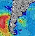 | 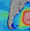 | 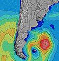 | 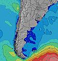 | 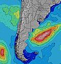 | 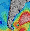 | ||||||||||||
Wave Height (m) Direction Period (s) | SSE 6 | S 9 | SSE 13 | S 14 | S 12 | S 12 | E 8 | S 13 | ESE 8 | E 8 | S 5 | SSW 6 | S 10 | S 9 | S 9 | S 6 | S 6 | S 12 | S 12 |
Wave Graph | |||||||||||||||||||
10 | 14 | 32 | 103 | 76 | 67 | 29 | 28 | 19 | 29 | 10 | 6 | 33 | 28 | 26 | 74 | 128 | 110 | 271 | |
Wind (km/h) | |||||||||||||||||||
Wind State on-shore cross-onshore cross-shore cross-offshore off-shore glassy | cross-off | cross-off | cross-off | off | cross | cross | cross-off | cross-off | cross-on | cross-on | cross | cross-off | off | on | on | on | on | on | cross-on |
High Tide | 5:53AM0.19m | 4:58PM0.27m | 6:29AM0.19m | 5:46PM0.27m | 7:06AM0.19m | 6:31PM0.28m | 7:42AM0.19m | 7:14PM0.27m | 8:15AM0.19m | 7:57PM0.27m | 8:44AM0.19m | 8:40PM0.26m | |||||||
Low Tide | 00:15AM0.07m | 8:55AM0.17m | 1:08AM0.08m | 9:35AM0.16m | 1:58AM0.08m | 10:18AM0.15m | 2:40AM0.09m | 11:04AM0.15m | 3:17AM0.09m | 3:49AM0.11m | 12:47PM0.14m | ||||||||
— | 7:41 | — | — | 7:39 | — | — | 7:39 | — | — | 7:39 | — | — | 7:37 | — | — | 7:37 | — | — | |
— | — | 5:52 | — | — | 5:53 | — | — | 5:54 | — | — | 5:54 | — | — | 5:55 | — | — | 5:57 | — | |
mm | — | — | — | — | — | — | — | — | — | — | — | — | — | — | — | — | — | — | — |
Temp °C | 10 | 13 | 15 | 14 | 14 | 17 | 14 | 15 | 14 | 10 | 15 | 19 | 17 | 13 | 12 | 10 | 8 | 8 | 7 |
Feels °C | 5 | 10 | 12 | 12 | 11 | 13 | 12 | 13 | 12 | 6 | 12 | 16 | 17 | 11 | 9 | 6 | 1 | 2 | 1 |
Swell 1 Height (m) Direction Period (s) | SSE 6 | ESE 6 | ESE 6 | S 14 | S 12 | SSE 12 | E 8 | ESE 8 | ESE 8 | S 4 | S 5 | ESE 4 | E 5 | S 9 | S 9 | E 7 | E 8 | S 12 | E 9 |
10 | 12 | 13 | 103 | 76 | 45 | 29 | 19 | 19 | 9 | 10 | 3 | 7 | 28 | 26 | 4 | 5 | 110 | 1 | |
Swell 2 Height (m) Direction Period (s) | S 9 | S 9 | SSE 13 | ESE 6 | ESE 6 | S 12 | S 11 | S 13 | S 11 | S 11 | E 8 | SSW 6 | S 10 | E 8 | E 7 | S 12 | S 15 | SSE 8 | E 8 |
6 | 14 | 32 | 12 | 6 | 67 | 21 | 28 | 10 | 9 | 10 | 6 | 33 | 10 | 10 | 3 | 4 | 22 | 6 | |
Swell 3 Height (m) Direction Period (s) | SE 9 | SSE 5 | S 8 | E 9 | — | — | S 15 | — | S 15 | S 14 | S 11 | E 8 | S 5 | — | — | — | NE 7 | E 8 | NE 7 |
3 | 3 | 11 | 1 | — | — | 4 | — | 4 | 4 | 9 | 4 | 5 | — | — | — | 2 | 5 | 2 | |
Wind waves Height (m) Direction Period (s) | E 3 | NE 3 | — | — | — | E 8 | — | — | SW 2 | E 8 | ENE 3 | — | E 5 | — | SSW 3 | S 6 | S 6 | S 6 | S 12 |
8 | 1 | — | — | — | 33 | — | — | 1 | 29 | 2 | — | 23 | — | 3 | 74 | 128 | 71 | 271 | |
Nearest Offshore or Glassy | |||||||||||||||||||
Distance (km) | 44 | 27 | 0 | 0 | 24 | 24 | 0 | 0 | 29 | 43 | 106 | 37 | 0 | 287 | 421 | 956 | 786 | 512 | 385 |
Best forecast wave conditions in Uruguay - South | |||||||||||||||||||
Best forecast wave conditions in Uruguay | |||||||||||||||||||
Header Global | |||||||||||||||||||
- Map Icons:
 Break
Break Live Wave Height (m)
 Live Wind Speed (km/h)
 Surf Rating (10 Max)
 Ocean Swells (m)
- Wind Speed (km/h)


FREE! Surf-Forecast.com widget for your website
The surf report / weather widget below is available to embed on third party websites free of charge and provides a summary of our Punta Negra surf forecast. Simply grab the html code snippet that we provide and paste it into your own site. You can choose your preferred language and metric/imperial units for the surf forecast feed to suit users of your site. Click here to get the code.
Information about the Punta Negra Surf forecast
The above surf forecast table for Punta Negra provides essential information for determining whether the surfing conditions will be good over the next 16 days. A general guide to surfing at Punta Negra can be found by selecting the local surf guide option on the grey menu. Our Punta Negra surf forecast is unique since it includes wave energy (power) that defines the real feel of the surf rather than just the height or the period. If you surf the same spot (Punta Negra) regularly then make a mental note of the wave energy from the surf forecast table each time you go. Very soon you may start to choose your surf days based on the wave energy alone combined with our forecast of favourable offshore wind conditions. Our star ratings will help here and of course you will also find the usual wave height and period predictions on our surf forecasts as well as a full break down of the swell components under our advanced users option (to reveal that, click the little Einstein character under the tide times).
Further information to help with frequently asked questions about our surf forecast for Punta Negra may be found under the help tab on the top menu and also by moving your mouse over the question marks on the surf forecast table itself. Please always bear in mind that the forecast is for near-shore open water and local factors at each surf break influence the actual breaking wave height, such as the beach / reef profile, water depths offshore and shelter.
 Nearest