

Surf Forecasts:

Santa Clara del Mar surf forecast from 8 Jul 2026:
- Best quality surf: Saturday 11 Jul, 3AM (local time) - 3ft (0.9m), 11s period, ESE swell with cross-offshore winds.
- Most powerful swell: Monday 13 Jul, 9PM (local time) - 5.5ft (1.7m), 9s period, SSW swell with 474 kJ wave energy.
- Next surfable swell (1★+): Wednesday 8 Jul, 9AM (local time) - 2.5ft (0.7m), 10s period with SE swell.
Best Forecast Surf Conditions for Santa Clara del Mar this week:
The surf forecast for Santa Clara del Mar over the next 16 days: The first swell (rated 1 star or higher) is forecast to arrive on Wednesday (Jul 08) at 9AM. The primary swell is predicted to be 0.7m and 10s period with a secondary swell of 0.3m and 6s. The wind is predicted to be offshore as the swell arrives.
The most powerful waves expected at Santa Clara del Mar in the next 16 days are 1.7m 9s and forecast to arrive on Monday (Jul 13) at 9PM. Winds are predicted to be cross-shore at the time the swell arrives. The largest open ocean swell (not directed at the beach) is 0.7m 4s period and expected on Saturday (Jul 11) at 9AM.
| Wave Type | Time (-03) & Date | Wave Height & Period |
|---|---|---|
| Next good surf (1 star+) | 9AM (Wed 8th Jul) | 2.5ft (0.7m) 10s |
| Best Surf | 3AM (Sat 11th Jul) | 3ft (0.9m) 11s |
| Most Powerful | 9PM (Mon 13th Jul) | 5.5ft (1.7m) 9s |
Table - best surf conditions forecast for Santa Clara del Mar over the next 16 days.
G’day, I’m Rusty. Let’s get straight into what’s happening at Santa Clara del Mar.
Alright, so right off the bat, Wednesday the 8th has surfable waves but nothing to write home about. We’ve got a tiny 2ft swell coming from the SE with a 10-second period, and the water temp is sitting at 50°, which is about normal for this time of year. The morning shows a light offshore NW wind at 9 mph, so it’ll be clean, but the combined energy is only moderate at best (107). It’s not worth getting too excited about.
Thursday the 9th is a write-off. We’ve got a bit more swell height on the afternoon session hitting 3ft from the ESE with a nice 12-second period, but the wind is cross-onshore from the SSE at 12 mph, making it choppy. The energy picks up to 191—still moderate—but the conditions are poor. Skip it.
Friday the 10th looks no better. The morning has clean glassy winds out of the east at 6 mph, with 3ft swell and energy jumping to 304, but it’s still poor surf conditions. The afternoon sees 5ft from the SE, but it’s cross-onshore and choppy again. No go.
Saturday the 11th is a mix. The morning has a tiny 2ft swell with a very long 15-second period from the ESE, but it’s a cross-shore wind, and the energy is moderate at 335. That long period groundswell will break straight at this point break, so it might not shape up well. The afternoon improves slightly with 2ft and offshore wind, but the energy is up at 352. It’s marginal at best.
Now, Sunday the 12th is starting to look like a standout. The morning is clear, with clean offshore wind from the west at 9 mph, 3ft swell from the ESE, and a 13-second period. The combined energy is moderate (267), but it’ll be clean and fun. This is the best session in the first week for sure—small but perfect.
Monday the 13th has a bit more size, with 5ft swell from the SSW, but the period drops to 9 seconds and it’s cross-offshore wind. Energy is strong (395), but it’s marginal due to a combination of shorter period and wind. Not a total write-off, but not clean.
Tuesday the 14th through Thursday the 16th are mostly poor or marginal, with small swell and onshore or cross-shore winds. The only bright spot in that stretch is Wednesday the 15th morning, with 4ft from the SSE and clean cross-offshore winds at 9 mph, energy at 280. It’s marginal, but clean.
Saturday the 18th is a real standout. Afternoon session brings 4ft from the east at 10 seconds, with cross-offshore wind from the southwest at 9 mph, and the combined energy jumps to a strong 527. That’s the best wave energy in the whole outlook, and with clean conditions, it could be excellent. This is the one to aim for.
Beyond that, Sunday the 19th through Monday the 20th drop off into poor conditions with onshore winds. Then Tuesday the 21st has another marginal session with 5ft from the ESE and clean offshore wind from the west at 16 mph, but that’s getting a bit big for beginners. Energy is strong (353). Wednesday the 22nd morning looks good again, with 4ft from the ESE, 10-second period, clean cross-offshore wind, and energy at 317.
The second week is patchy, but that Saturday the 18th afternoon is your best bet. If you’re a confident intermediate or better, Tuesday the 21st morning could also be fun, but keep an eye on the wind.
No real gaps of more than a few days here—there’s always something small or marginal on offer, but the quality is inconsistent.
Stay safe, keep an eye on the sets.
Rusty
Short Range ForecastLight rain (total 2mm), mostly falling on Fri night. Very mild (max 14°C on Wed afternoon, min 8°C on Thu afternoon). Wind will be generally light. | Days 4-6 Weather SummaryModerate rain (total 15mm), heaviest on Sat night. Very mild (max 13°C on Sat afternoon, min 7°C on Mon night). Wind will be generally light. | ||||||||||||||||||||
Wednesday 8 | Thursday 9 | Friday 10 | Saturday 11 | Sunday 12 | Monday 13 | Tuesday 14 | |||||||||||||||
AM | PM | Night | AM | PM | Night | AM | PM | Night | AM | PM | Night | AM | PM | Night | AM | PM | Night | AM | PM | Night | |
Swell Height Map |  |  | 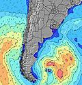 | 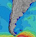 | 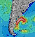 | 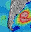 | 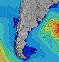 | ||||||||||||||
Wave Height (m) Direction Period (s) | SE 10 | ESE 9 | ESE 10 | ESE 10 | ESE 12 | ESE 11 | ESE 10 | SE 10 | ESE 10 | ESE 11 | ESE 14 | ESE 14 | ESE 13 | SE 13 | ESE 13 | SSW 9 | SSW 9 | S 9 | S 8 | S 8 | S 8 |
Wave Graph | |||||||||||||||||||||
98 | 58 | 94 | 86 | 161 | 164 | 123 | 377 | 184 | 128 | 180 | 303 | 225 | 175 | 156 | 301 | 307 | 225 | 142 | 132 | 111 | |
Wind (km/h) | |||||||||||||||||||||
Wind State on-shore cross-onshore cross-shore cross-offshore off-shore glassy | off | cross-off | off | cross-on | cross-on | cross-on | on | cross-on | cross-on | cross | cross-off | cross-off | off | cross-off | cross-off | cross-off | cross-off | cross-on | cross | cross | cross-off |
High Tide | 1:03PM0.91m | 1:39AM1.01m | 1:55PM1.00m | 2:44AM0.96m | 2:53PM1.10m | 3:57AM0.92m | 3:56PM1.19m | 5:09AM0.89m | 5:02PM1.29m | 6:15AM0.87m | 6:07PM1.38m | 7:15AM0.85m | 7:10PM1.44m | ||||||||
Low Tide | 8:17PM0.30m | 8:49AM0.38m | 9:13PM0.23m | 9:24AM0.42m | 10:13PM0.17m | 10:03AM0.44m | 11:19PM0.11m | 10:48AM0.45m | 00:29AM0.06m | 11:41AM0.44m | 1:42AM0.02m | 12:44PM0.41m | 2:50AM-0.00m | ||||||||
8:04 | — | — | 8:04 | — | — | 8:03 | — | — | 8:03 | — | — | 8:03 | — | — | 8:03 | — | — | 8:03 | — | — | |
— | 5:45 | — | — | 5:45 | — | — | 5:45 | — | — | 5:45 | — | — | 5:46 | — | — | 5:47 | — | — | 5:47 | — | |
mm | — | — | — | — | — | — | — | — | 2 | — | — | 14 | — | — | — | — | 1 | — | — | — | — |
Temp °C | 13 | 14 | 13 | 10 | 9 | 8 | 8 | 9 | 9 | 10 | 13 | 10 | 10 | 12 | 9 | 10 | 9 | 8 | 8 | 8 | 8 |
Feels °C | 8 | 9 | 10 | 7 | 5 | 3 | 5 | 5 | 6 | 6 | 9 | 8 | 5 | 7 | 4 | 4 | 5 | 4 | 4 | 3 | 3 |
Swell 1 Height (m) Direction Period (s) | SE 10 | ESE 9 | ESE 10 | ESE 10 | ESE 12 | ESE 11 | SE 6 | SE 10 | ESE 10 | ESE 7 | ESE 7 | ESE 14 | ESE 13 | SE 13 | ESE 13 | ESE 12 | ESE 12 | S 9 | S 8 | S 8 | S 8 |
98 | 58 | 94 | 86 | 161 | 164 | 77 | 377 | 184 | 86 | 70 | 303 | 225 | 175 | 147 | 94 | 93 | 225 | 142 | 132 | 111 | |
Swell 2 Height (m) Direction Period (s) | SW 6 | SSW 6 | SW 5 | S 15 | S 10 | S 9 | ESE 10 | S 9 | SSE 7 | ESE 11 | ESE 14 | SE 7 | SE 8 | SE 7 | SE 7 | — | E 6 | SE 11 | ESE 10 | ESE 11 | SE 10 |
5 | 4 | 1 | 4 | 2 | 6 | 123 | 2 | 68 | 121 | 180 | 34 | 28 | 19 | 8 | — | 1 | 58 | 73 | 44 | 52 | |
Swell 3 Height (m) Direction Period (s) | S 14 | S 14 | S 16 | S 11 | S 14 | — | SSW 6 | S 14 | ESE 16 | ESE 15 | ESE 11 | S 15 | S 13 | S 13 | — | — | — | — | E 7 | NE 8 | SSE 11 |
4 | 4 | 5 | 2 | 4 | — | 8 | 4 | 25 | 128 | 88 | 17 | 14 | 12 | — | — | — | — | 1 | 3 | 44 | |
Wind waves Height (m) Direction Period (s) | WNW 2 | — | — | — | SSE 4 | SE 5 | ESE 7 | — | — | N 4 | NE 4 | N 4 | WNW 3 | SW 6 | SW 7 | SSW 9 | SSW 9 | — | — | NE 2 | NE 4 |
1 | — | — | — | 24 | 45 | 96 | — | — | 13 | 14 | 10 | 2 | 38 | 156 | 301 | 307 | — | — | 1 | 14 | |
Nearest Offshore or Glassy | |||||||||||||||||||||
Distance (km) | 0 | 27 | 0 | 98 | 425 | 131 | 29 | 131 | 131 | 29 | 29 | 29 | 0 | 162 | 18 | 18 | 26 | 26 | 29 | 29 | 131 |
Best forecast wave conditions in Provincia de Buenos Aires | |||||||||||||||||||||
Best forecast wave conditions in Argentina | |||||||||||||||||||||
Header Global | |||||||||||||||||||||
- Map Icons:
 Break
Break Live Wave Height (m)
 Live Wind Speed (km/h)
 Surf Rating (10 Max)
 Ocean Swells (m)
- Wind Speed (km/h)


FREE! Surf-Forecast.com widget for your website
The surf report / weather widget below is available to embed on third party websites free of charge and provides a summary of our Santa Clara del Mar surf forecast. Simply grab the html code snippet that we provide and paste it into your own site. You can choose your preferred language and metric/imperial units for the surf forecast feed to suit users of your site. Click here to get the code.
Information about the Santa Clara del Mar Surf forecast
The above surf forecast table for Santa Clara del Mar provides essential information for determining whether the surfing conditions will be good over the next 16 days. A general guide to surfing at Santa Clara del Mar can be found by selecting the local surf guide option on the grey menu. Our Santa Clara del Mar surf forecast is unique since it includes wave energy (power) that defines the real feel of the surf rather than just the height or the period. If you surf the same spot (Santa Clara del Mar) regularly then make a mental note of the wave energy from the surf forecast table each time you go. Very soon you may start to choose your surf days based on the wave energy alone combined with our forecast of favourable offshore wind conditions. Our star ratings will help here and of course you will also find the usual wave height and period predictions on our surf forecasts as well as a full break down of the swell components under our advanced users option (to reveal that, click the little Einstein character under the tide times).
Further information to help with frequently asked questions about our surf forecast for Santa Clara del Mar may be found under the help tab on the top menu and also by moving your mouse over the question marks on the surf forecast table itself. Please always bear in mind that the forecast is for near-shore open water and local factors at each surf break influence the actual breaking wave height, such as the beach / reef profile, water depths offshore and shelter.
Are you planning a holiday in Provincia de Buenos Aires? If you are looking for accommodation near Santa Clara del Mar, camping, hotels and holiday cottages in Provincia de Buenos Aires, consider staying in Mar del Plata which is 18 km (11 miles) away. Alternatively, find information about places to stay and car hire in Villa Gesell which is 80 km (50 miles) away
 Nearest