

Surf Forecasts:

Santa Teresita surf forecast from 28 Jul 2026:
- Best quality surf: Saturday 1 Aug, 12AM (local time) - 4ft (1.2m), 8s period, ENE swell with cross-offshore winds.
- Most powerful swell: Monday 3 Aug, 3AM (local time) - 4ft (1.2m), 9s period, ESE swell with 237 kJ wave energy.
- Next surfable swell (1★+): Saturday 1 Aug, 12AM (local time) - 4ft (1.2m), 8s period with ENE swell.
Best Forecast Surf Conditions for Santa Teresita this week:
The surf forecast for Santa Teresita over the next 16 days: The first swell (rated 1 star or higher) is forecast to arrive on Saturday (Aug 01) at 12AM. The primary swell is predicted to be 1.2m and 8s period with a secondary swell of 0.2m and 9s. The wind is predicted to be cross-offshore as the swell arrives.
The most powerful waves expected at Santa Teresita in the next 16 days are 1.2m 9s and forecast to arrive on Monday (Aug 03) at 3AM. Winds are predicted to be onshore at the time the swell arrives. The largest open ocean swell (not directed at the beach) is 0.8m 5s period and expected on Sunday (Aug 02) at 12AM.
| Wave Type | Time (-03) & Date | Wave Height & Period |
|---|---|---|
| Next good surf (1 star+) | 12AM (Sat 1st Aug) | 4ft (1.2m) 8s |
| Best Surf | 12AM (Sat 1st Aug) | 4ft (1.2m) 8s |
| Most Powerful | 3AM (Mon 3rd Aug) | 4ft (1.2m) 9s |
Table - best surf conditions forecast for Santa Teresita over the next 16 days.
The Lowdown
Alright, Rusty here, checking in from the beach. We’ve got a 16-day window ahead, but I gotta be straight with you – it’s a tough one for this stretch. The forecast is pretty much a flat spell for the first week, so don't bother paddling out unless you just want a swim.
Looking at the whole run, the only real window of opportunity is a couple of days in the second week, but even then it’s nothing to write home about. The combined wave energy is weak for most of the period, with values like 71 and 36, only kicking up to moderate numbers later on. The winds are a real mixed bag, and the swell direction is often coming from the east or northeast, which isn't what this spot is tuned for.
Let’s start at Santa Teresita (Argentina). The first week, from now through the end of July, is a write-off. The water temp is about 50°F, which is a bit warmer than usual for this time of year, but that’s the only highlight. We’re looking at tiny swell, mostly under 3 ft, with short periods and onshore or cross-shore winds. The comment on the data is "poor surf conditions" across the board, and the scores are all zeros. There’s a bump on July 31st with some 5 ft swell from the northeast, but it’s a short-period 7 seconds and the wind is a messy cross-onshore, making it choppy and ugly. Not worth your time.
The first real chance comes on Saturday, August 1st. The wind finally swings offshore from the southwest, and we get a cleaner look at the waves. The swell is only 3 ft from the east, with a period of 9 seconds, and the combined energy reads 178 (moderate). The data calls it "surfable waves but very ordinary conditions," and the score is a measly 1 out of 10. It’s not great, but it’s the best we’ve seen. The offshore wind will make the surface clean, and for a beginner-level break, this might be a fun little session. The crowds are listed as "sometimes," so you might have a few others out there.
After that, it drops back off. The next sniff of anything decent is a full week later, on Monday, August 10th. The morning looks glassy with a light 3 ft, 11-second groundswell from the south-southeast (combined energy of 250). That’s a moderate, long-period swell that could bring some shape, but it’s a long way off, so don’t bank on it. The rest of that week is messy with onshore winds again.
So, if you’re desperate, the standouts are Saturday, August 1st for the cleanest conditions, and maybe Monday, August 10th for the best swell, but that one is a long-range call. The gap between decent surf is about a week, from August 2nd to the 9th. It’s a quiet period, and for this area, that’s not unusual.
Rusty.
Short Range ForecastMostly dry. Very mild (max 14°C on Mon night, min 9°C on Tue night). Wind will be generally light. | Days 5-7 Weather SummaryHeavy rain (total 30mm), heaviest during Fri night. Very mild (max 16°C on Fri night, min 8°C on Sat night). Winds decreasing (fresh winds from the NE on Thu night, light winds from the SW by Sat night). | |||||||||||||||||||
Mon 27 | Tuesday 28 | Wednesday 29 | Thursday 30 | Friday 31 | Saturday 1 | Sunday 2 | ||||||||||||||
PM | Night | AM | PM | Night | AM | PM | Night | AM | PM | Night | AM | PM | Night | AM | PM | Night | AM | PM | Night | |
Swell Height Map |  | 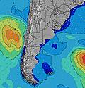 | 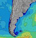 | 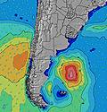 | 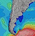 | 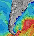 | 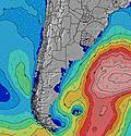 | |||||||||||||
Wave Height (m) Direction Period (s) | NE 5 | SSE 10 | E 6 | E 6 | ENE 7 | ENE 7 | S 8 | SSE 13 | SSE 12 | SSE 11 | NE 6 | NE 7 | ENE 7 | ENE 8 | E 9 | E 9 | E 10 | E 9 | E 9 | E 9 |
Wave Graph | ||||||||||||||||||||
31 | 33 | 18 | 20 | 15 | 18 | 30 | 35 | 81 | 47 | 172 | 220 | 224 | 172 | 173 | 142 | 94 | 64 | 108 | 217 | |
Wind (km/h) | ||||||||||||||||||||
Wind State on-shore cross-onshore cross-shore cross-offshore off-shore glassy | cross | off | cross-off | cross | cross-off | cross | cross | on | on | on | cross-on | cross-on | cross-on | cross-off | off | off | cross-off | cross-off | cross-on | on |
High Tide | 8:13PM1.03m | 8:42AM0.73m | 9:02PM1.06m | 9:20AM0.71m | 9:49PM1.09m | 9:57AM0.69m | 10:34PM1.12m | 10:35AM0.68m | 11:17PM1.13m | 11:13AM0.67m | 11:57PM1.13m | 11:53AM0.68m | 00:37AM1.11m | |||||||
Low Tide | 2:54AM0.28m | 2:17PM0.30m | 3:44AM0.28m | 3:01PM0.26m | 4:33AM0.29m | 3:44PM0.22m | 5:20AM0.28m | 4:28PM0.19m | 6:04AM0.28m | 5:12PM0.18m | 6:45AM0.27m | 5:58PM0.18m | ||||||||
— | — | 7:47 | — | — | 7:46 | — | — | 7:45 | — | — | 7:43 | — | — | 7:43 | — | — | 7:43 | — | — | |
5:58 | — | — | 5:59 | — | — | 6:00 | — | — | 6:00 | — | — | 6:00 | — | — | 6:01 | — | — | 6:02 | — | |
mm | — | — | — | — | — | — | — | — | — | — | — | — | 4 | 24 | 2 | — | — | — | — | — |
Temp °C | 13 | 14 | 12 | 13 | 10 | 10 | 11 | 9 | 11 | 11 | 11 | 12 | 15 | 16 | 14 | 14 | 11 | 8 | 8 | 8 |
Feels °C | 10 | 13 | 8 | 10 | 7 | 7 | 8 | 7 | 7 | 6 | 5 | 8 | 11 | 16 | 12 | 11 | 9 | 6 | 5 | 4 |
Swell 1 Height (m) Direction Period (s) | E 7 | ENE 5 | E 6 | E 6 | ENE 7 | ENE 7 | S 8 | SSE 8 | SSE 12 | SSE 11 | SSE 10 | SSE 10 | SSE 9 | ENE 8 | E 9 | E 9 | E 10 | E 9 | S 5 | SSE 10 |
10 | 16 | 18 | 20 | 15 | 18 | 30 | 23 | 81 | 47 | 20 | 18 | 16 | 172 | 173 | 142 | 94 | 64 | 4 | 52 | |
Swell 2 Height (m) Direction Period (s) | S 11 | SSE 10 | SSE 9 | S 9 | S 8 | SSE 8 | ENE 7 | SSE 13 | ENE 6 | S 7 | SSE 6 | E 7 | SE 7 | SSE 9 | S 8 | S 8 | S 5 | S 11 | S 9 | E 9 |
20 | 33 | 16 | 14 | 5 | 13 | 18 | 35 | 4 | 9 | 4 | 1 | 2 | 7 | 5 | 1 | 18 | 2 | 2 | 41 | |
Swell 3 Height (m) Direction Period (s) | ENE 7 | E 7 | E 9 | SE 12 | SSE 9 | S 4 | SE 14 | ENE 7 | E 8 | E 8 | — | — | — | — | — | — | S 12 | — | S 14 | S 5 |
10 | 9 | 2 | 6 | 8 | 4 | 8 | 11 | 5 | 5 | — | — | — | — | — | — | 3 | — | 4 | 2 | |
Wind waves Height (m) Direction Period (s) | NE 5 | — | S 3 | S 4 | SSE 4 | — | — | — | NE 2 | NE 3 | NE 6 | NE 7 | ENE 7 | — | S 4 | SSW 4 | S 5 | SSE 4 | E 9 | E 9 |
31 | — | 2 | 3 | 4 | — | — | — | 1 | 9 | 172 | 220 | 224 | — | 4 | 4 | 33 | 7 | 108 | 217 | |
Nearest Offshore or Glassy | ||||||||||||||||||||
Distance (km) | 190 | 43 | 162 | 897 | 162 | 162 | 162 | 43 | 176 | 287 | 1179 | 1023 | 189 | 0 | 0 | 0 | 318 | 176 | 287 | 287 |
Best forecast wave conditions in Provincia de Buenos Aires | ||||||||||||||||||||
Best forecast wave conditions in Argentina | ||||||||||||||||||||
Header Global | ||||||||||||||||||||
- Map Icons:
 Break
Break Live Wave Height (m)
 Live Wind Speed (km/h)
 Surf Rating (10 Max)
 Ocean Swells (m)
- Wind Speed (km/h)


FREE! Surf-Forecast.com widget for your website
The surf report / weather widget below is available to embed on third party websites free of charge and provides a summary of our Santa Teresita surf forecast. Simply grab the html code snippet that we provide and paste it into your own site. You can choose your preferred language and metric/imperial units for the surf forecast feed to suit users of your site. Click here to get the code.
Information about the Santa Teresita Surf forecast
The above surf forecast table for Santa Teresita provides essential information for determining whether the surfing conditions will be good over the next 16 days. A general guide to surfing at Santa Teresita can be found by selecting the local surf guide option on the grey menu. Our Santa Teresita surf forecast is unique since it includes wave energy (power) that defines the real feel of the surf rather than just the height or the period. If you surf the same spot (Santa Teresita) regularly then make a mental note of the wave energy from the surf forecast table each time you go. Very soon you may start to choose your surf days based on the wave energy alone combined with our forecast of favourable offshore wind conditions. Our star ratings will help here and of course you will also find the usual wave height and period predictions on our surf forecasts as well as a full break down of the swell components under our advanced users option (to reveal that, click the little Einstein character under the tide times).
Further information to help with frequently asked questions about our surf forecast for Santa Teresita may be found under the help tab on the top menu and also by moving your mouse over the question marks on the surf forecast table itself. Please always bear in mind that the forecast is for near-shore open water and local factors at each surf break influence the actual breaking wave height, such as the beach / reef profile, water depths offshore and shelter.
 Nearest