

Surf Forecasts:

Cardiel (Mar del Plata) surf forecast from 2 Aug 2026:
- Best quality surf: Saturday 8 Aug, 12PM (local time) - 8ft (2.4m), 10s period, SSW swell with cross-offshore winds.
- Most powerful swell: Sunday 9 Aug, 12AM (local time) - 11ft (3.5m), 10s period, SW swell with 2,652 kJ wave energy.
- Next surfable swell (1★+): Sunday 2 Aug, 9AM (local time) - 2ft (0.6m), 10s period with E swell.
Best Forecast Surf Conditions for Cardiel (Mar del Plata) this week:
The surf forecast for Cardiel (Mar del Plata) over the next 16 days: The first swell (rated 1 star or higher) is forecast to arrive on Sunday (Aug 02) at 9AM. The primary swell is predicted to be 0.6m and 10s period with a secondary swell of 0.5m and 6s. The wind is predicted to be cross-offshore as the swell arrives.
The most powerful waves expected at Cardiel (Mar del Plata) in the next 16 days are 3.5m 10s and forecast to arrive on Sunday (Aug 09) at 12AM. Winds are predicted to be offshore at the time the swell arrives. The largest open ocean swell (not directed at the beach) is 1.4m 5s period and expected on Friday (Aug 07) at 6PM.
| Wave Type | Time (-03) & Date | Wave Height & Period |
|---|---|---|
| Next good surf (1 star+) | 9AM (Sun 2nd Aug) | 2ft (0.6m) 10s |
| Best Surf | 12PM (Sat 8th Aug) | 8ft (2.4m) 10s |
| Most Powerful | 12AM (Sun 9th Aug) | 11ft (3.5m) 10s |
Table - best surf conditions forecast for Cardiel (Mar del Plata) over the next 16 days.
The Lowdown
Alright, I’m Rusty, and here’s the outlook for you in feet, miles per hour, and Fahrenheit.
The 16-day window is a mixed bag for Cardiel (Mar del Plata). The water temperature is about 51°F, which is a notable 4°F warmer than usual for this time of year – so the water feels a bit milder than average. We’ve got a slow start, but a couple of windows of opportunity pop up, especially around Monday afternoon and into the middle of next week. The standout conditions look more promising for experienced surfers during the second week.
Sunday morning, August 2, is just a teaser. You’ve got small 2ft swell from the east at 10 seconds, but the combined energy is weak (129). The wind is a gentle cross-offshore from the north, so it’s clean, but very ordinary. Not worth rushing for.
Monday, August 3, starts to show some life. The morning has 4ft from the SSE at 10 seconds – decent energy (342) – but the wind is a light cross from the NNE, just okay. The real highlight comes Monday afternoon: 4ft from the SSE with a slightly longer 11-second period, and combined energy bumps up to 379. The wind goes glassy from the northwest. That’s clean, workable surf, and the best on offer for the first few days.
Tuesday, August 4, morning is clean too, with 3ft from the SE at 10 seconds (222 energy), and a light cross-off from the WSW. It’s a good session for a beginner or a longboard. Afternoon gets messy with cross-shore wind.
Wednesday, August 5, is small again – 2ft from the SE – and the energy drops below 100. Clean but tiny.
Thursday and Friday, August 6 and 7, are poor. The swell is either tiny or short-period junk, and the wind gets strong. Friday morning has 4ft but from the ENE at a pitiful 6 seconds, with a strong 28 mph cross-offshore wind – that’s just messy, more kite-surfing territory than paddle-surfing.
Saturday, August 8, sees a big jump in size. The swell hits 6ft from the SSW at 10 seconds, with solid energy (663), but the wind is a near-gale 31 mph offshore from the WNW. It’s too difficult to paddle into comfortably. By afternoon, it’s 8ft from the SSW (1281 energy) – way too big for this break, and only for experts. Same story Sunday, August 9: 7ft to 8ft from the south, huge energy (1495–1691), but those powerful offshore winds (22 mph) and overhead waves mean it’s strictly for the pros.
Monday, August 10, is still big – 7ft from the south at 11 seconds – but with a fresh cross-offshore wind, it’s a marginal call. The energy is still very high (1745), so it’s a powerful, tricky day.
Now, the true standout of the whole forecast: Tuesday, August 11, morning. You’ve got 6ft from the SSW at 10 seconds, with massive energy (1207), and a gentle 9 mph cross-offshore wind from the WSW. The water is clean, the swell is strong but not crazy, and it’s excellent for experienced surfers. This is the best session on offer – a proper South swell hitting the exposed break, and the wind is cooperating. Afternoon gets a bit cross-shore, so hit it early.
From Wednesday, August 12, onwards, the quality drops off. The wind goes onshore or cross-shore from the east-northeast, and the swell stays around 4ft from the SSE, but it’s choppy and lumpy. Thursday, August 13, is even worse with fresh cross-shore winds. The final weekend, August 15–17, sees small, weak energy (under 200) and mostly poor conditions, with only a glassy moment on Monday morning, August 17, with 3ft from the east. That’s surfable but very ordinary.
So, if you’re ready for a challenge, aim for August 11 morning – that’s the real deal. The rest is mostly small, windy, or too big for comfort.
Rusty
Short Range ForecastMostly dry. Very mild (max 15°C on Tue morning, min 7°C on Sun morning). Wind will be generally light. | Days 4-6 Weather SummaryModerate rain (total 17mm), heaviest on Thu night. Very mild (max 16°C on Wed afternoon, min 7°C on Fri night). Winds increasing (light winds from the N on Wed afternoon, strong winds from the WNW by Fri night). | ||||||||||||||||||||
Sunday 2 | Monday 3 | Tuesday 4 | Wednesday 5 | Thursday 6 | Friday 7 | Saturday 8 | |||||||||||||||
AM | PM | Night | AM | PM | Night | AM | PM | Night | AM | PM | Night | AM | PM | Night | AM | PM | Night | AM | PM | Night | |
Swell Height Map |  |  | 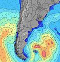 | 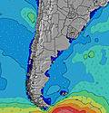 | 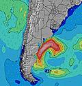 | 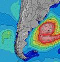 | 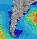 | ||||||||||||||
Wave Height (m) Direction Period (s) | E 10 | E 10 | SSE 11 | SSE 10 | SSE 11 | SE 11 | SE 10 | SE 10 | SE 10 | SE 9 | SE 9 | SE 9 | SE 9 | SE 8 | E 7 | ENE 6 | E 6 | SW 8 | SSW 10 | SSW 10 | SW 10 |
Wave Graph | |||||||||||||||||||||
71 | 51 | 303 | 316 | 352 | 328 | 204 | 163 | 113 | 68 | 53 | 29 | 20 | 11 | 8 | 100 | 38 | 341 | 653 | 1276 | 2652 | |
Wind (km/h) | |||||||||||||||||||||
Wind State on-shore cross-onshore cross-shore cross-offshore off-shore glassy | cross-off | cross | cross-off | cross | glassy | off | cross-off | cross | cross-off | cross-off | cross-off | cross | cross | cross | off | cross-off | cross-off | off | off | cross-off | off |
High Tide | 9:42AM0.99m | 9:48PM1.60m | 10:19AM1.05m | 10:29PM1.56m | 11:00AM1.12m | 11:14PM1.48m | 11:45AM1.20m | 00:05AM1.38m | 12:35PM1.29m | 1:04AM1.26m | 1:30PM1.38m | 2:12AM1.15m | 2:30PM1.47m | ||||||||
Low Tide | 3:56PM0.62m | 5:33AM0.40m | 4:42PM0.61m | 6:08AM0.43m | 5:33PM0.59m | 6:41AM0.48m | 6:31PM0.57m | 7:13AM0.55m | 7:35PM0.54m | 7:43AM0.61m | 8:49PM0.50m | 8:09AM0.67m | 10:10PM0.43m | ||||||||
7:50 | — | — | 7:48 | — | — | 7:48 | — | — | 7:47 | — | — | 7:46 | — | — | 7:45 | — | — | 7:43 | — | — | |
— | 6:02 | — | — | 6:04 | — | — | 6:04 | — | — | 6:05 | — | — | 6:06 | — | — | 6:07 | — | — | 6:07 | — | |
mm | — | — | — | — | — | — | — | — | — | — | — | — | — | — | 17 | — | — | — | 4 | — | — |
Temp °C | 9 | 10 | 10 | 11 | 12 | 14 | 15 | 15 | 13 | 13 | 16 | 13 | 12 | 13 | 14 | 9 | 11 | 9 | 6 | 9 | 6 |
Feels °C | 4 | 7 | 7 | 10 | 12 | 12 | 13 | 13 | 9 | 11 | 15 | 12 | 8 | 10 | 10 | -1 | 2 | 2 | -5 | 0 | -1 |
Swell 1 Height (m) Direction Period (s) | E 10 | E 10 | SSE 11 | SSE 10 | SSE 11 | SE 11 | SE 10 | SE 10 | SE 10 | SE 9 | SE 9 | SE 9 | ENE 7 | ENE 7 | E 7 | E 6 | E 6 | E 7 | SSW 10 | E 8 | S 11 |
71 | 46 | 303 | 316 | 352 | 328 | 204 | 163 | 113 | 68 | 53 | 29 | 17 | 10 | 8 | 69 | 38 | 16 | 653 | 5 | 1086 | |
Swell 2 Height (m) Direction Period (s) | S 6 | S 7 | ENE 4 | ENE 9 | ENE 9 | ENE 9 | ENE 9 | ENE 8 | ENE 8 | ENE 7 | ENE 7 | ENE 7 | SE 9 | SE 8 | SSW 6 | S 8 | S 7 | — | E 8 | — | SSE 11 |
22 | 24 | 11 | 26 | 25 | 15 | 15 | 13 | 12 | 11 | 18 | 17 | 20 | 11 | 4 | 6 | 4 | — | 10 | — | 154 | |
Swell 3 Height (m) Direction Period (s) | SSE 14 | SSE 12 | E 9 | — | S 10 | S 10 | S 12 | S 11 | SW 6 | S 12 | N 3 | S 10 | SSW 6 | SSW 6 | S 8 | SW 6 | — | — | — | — | — |
36 | 51 | 27 | — | 2 | 2 | 3 | 2 | 1 | 3 | 1 | 2 | 8 | 4 | 6 | 1 | — | — | — | — | — | |
Wind waves Height (m) Direction Period (s) | — | NE 3 | NE 4 | — | — | — | — | — | NNE 2 | NNW 2 | — | SSW 5 | — | — | ENE 4 | ENE 6 | WSW 3 | SW 8 | W 4 | SSW 10 | SW 10 |
— | 2 | 16 | — | — | — | — | — | 1 | 1 | — | 2 | — | — | 5 | 100 | 5 | 341 | 15 | 1276 | 2652 | |
Nearest Offshore or Glassy | |||||||||||||||||||||
Distance (km) | 0 | 14 | 0 | 8 | 0 | 0 | 0 | 14 | 0 | 0 | 0 | 8 | 14 | 476 | 17 | 1098 | 1159 | 400 | 443 | 1098 | 568 |
Best forecast wave conditions in Provincia de Buenos Aires | |||||||||||||||||||||
Best forecast wave conditions in Argentina | |||||||||||||||||||||
Header Global | |||||||||||||||||||||
- Map Icons:
 Break
Break Live Wave Height (m)
 Live Wind Speed (km/h)
 Surf Rating (10 Max)
 Ocean Swells (m)
- Wind Speed (km/h)
Latest Updates


FREE! Surf-Forecast.com widget for your website
The surf report / weather widget below is available to embed on third party websites free of charge and provides a summary of our Cardiel (Mar del Plata) surf forecast. Simply grab the html code snippet that we provide and paste it into your own site. You can choose your preferred language and metric/imperial units for the surf forecast feed to suit users of your site. Click here to get the code.
Information about the Cardiel (Mar del Plata) Surf forecast
The above surf forecast table for Cardiel (Mar del Plata) provides essential information for determining whether the surfing conditions will be good over the next 16 days. A general guide to surfing at Cardiel (Mar del Plata) can be found by selecting the local surf guide option on the grey menu. Our Cardiel (Mar del Plata) surf forecast is unique since it includes wave energy (power) that defines the real feel of the surf rather than just the height or the period. If you surf the same spot (Cardiel (Mar del Plata)) regularly then make a mental note of the wave energy from the surf forecast table each time you go. Very soon you may start to choose your surf days based on the wave energy alone combined with our forecast of favourable offshore wind conditions. Our star ratings will help here and of course you will also find the usual wave height and period predictions on our surf forecasts as well as a full break down of the swell components under our advanced users option (to reveal that, click the little Einstein character under the tide times).
Further information to help with frequently asked questions about our surf forecast for Cardiel (Mar del Plata) may be found under the help tab on the top menu and also by moving your mouse over the question marks on the surf forecast table itself. Please always bear in mind that the forecast is for near-shore open water and local factors at each surf break influence the actual breaking wave height, such as the beach / reef profile, water depths offshore and shelter.
Are you planning a holiday in Provincia de Buenos Aires? If you are looking for accommodation near Cardiel (Mar del Plata), camping, hotels and holiday cottages in Provincia de Buenos Aires, consider staying in Mar del Plata which is 4 km (2 miles) away. Alternatively, find information about places to stay and car hire in Villa Gesell which is 94 km (58 miles) away
 Nearest