

Surf Forecasts:

LHermitage Left surf forecast from 2 Aug 2026:
- Best quality surf: Tuesday 4 Aug, 1AM (local time) - 2ft (0.6m), 10s period, NE swell with glassy winds.
- Most powerful swell: Monday 3 Aug, 10PM (local time) - 2.5ft (0.7m), 10s period, NE swell with 102 kJ wave energy.
- Next surfable swell (1★+): Tuesday 4 Aug, 1AM (local time) - 2ft (0.6m), 10s period with NE swell.
Best Forecast Surf Conditions for LHermitage Left this week:
The surf forecast for LHermitage Left over the next 16 days: The first swell (rated 1 star or higher) is forecast to arrive on Tuesday (Aug 04) at 1AM. The primary swell is predicted to be 0.6m and 10s period. The wind is predicted to be glassy as the swell arrives.
The most powerful waves expected at LHermitage Left in the next 16 days are 0.7m 10s and forecast to arrive on Monday (Aug 03) at 10PM. Winds are predicted to be cross-onshore at the time the swell arrives. The largest open ocean swell (not directed at the beach) is 1.3m 14s period and expected on Monday (Aug 03) at 1AM.
| Wave Type | Time (+04) & Date | Wave Height & Period |
|---|---|---|
| Next good surf (1 star+) | 1AM (Tue 4th Aug) | 2ft (0.6m) 10s |
| Best Surf | 1AM (Tue 4th Aug) | 2ft (0.6m) 10s |
| Most Powerful | 10PM (Mon 3rd Aug) | 2.5ft (0.7m) 10s |
Table - best surf conditions forecast for LHermitage Left over the next 16 days.
The Lowdown
Imperial
Alright mates, Rusty here. It’s gonna be a quiet one out at L’Hermitage Left on Reunion. Truth is, there’s nothing worth wetting your wetsuit for across most of the 16-day window. The first real suggestion of surf doesn’t even show up until the final day, and even then, it’s nothing special.
The water temp is 77°, which is a touch warmer than usual for this time of year (anomaly of 3°). Feels nice, but won’t save a flat spell.
You’re looking at a big blank gap from August 2nd right through to August 17th morning. We get these tiny pulses – around 1ft to 2ft from the NE – but the combined swell energy is weak, almost always below 100 (mostly between 20 and 70). The period is short too, 6 to 8 seconds, so it’s just poor quality, gutless stuff. Winds are light and variable, with a few glassy mornings on the 3rd, 7th, and 9th, but there’s no swell to work with. Save your energy.
The only thing that shows up is on Monday, August 17th afternoon. A jump to 5ft from the SE with a short 6-second period, and moderate energy (152). But the wave comment still says “poor surf conditions,” and the wind is light cross-shore. L’Hermitage Left is a reef that’s inconsistent anyway, so it’s a long shot. If anything breaks, it’ll be for experts only, and crowds can pop up sometimes.
Honestly, this stretch looks better for a swim or maybe a kite if the wind shifts. No standout windows. Forecasts might change, but for now, the board stays on the rack.
Rusty.
Short Range ForecastSome drizzle, heaviest during Mon night. Warm (max 24°C on Sun afternoon, min 23°C on Sun night). Wind will be generally light. | Days 5-7 Weather SummaryLight rain (total 3mm), mostly falling on Wed night. Warm (max 24°C on Wed afternoon, min 22°C on Wed night). Wind will be generally light. | |||||||||||||||||||
Sun 2 | Monday 3 | Tuesday 4 | Wednesday 5 | Thursday 6 | Friday 7 | Saturday 8 | ||||||||||||||
PM | Night | AM | PM | Night | AM | PM | Night | AM | PM | Night | AM | PM | Night | AM | PM | Night | AM | PM | Night | |
Swell Height Map |  | 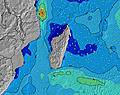 | 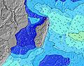 | 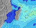 | 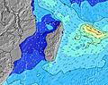 | 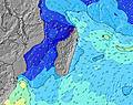 | 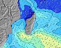 | |||||||||||||
Wave Height (m) Direction Period (s) | SSW 16 | E 10 | NE 6 | NE 6 | NE 10 | NE 10 | NE 6 | NE 10 | NE 10 | NE 6 | NE 6 | NE 8 | SW 13 | NE 8 | NE 8 | NE 7 | NE 8 | NE 11 | NE 6 | NE 11 |
Wave Graph | ||||||||||||||||||||
0 | 47 | 28 | 27 | 69 | 69 | 21 | 68 | 61 | 20 | 22 | 31 | 0 | 23 | 41 | 44 | 45 | 72 | 25 | 43 | |
Wind (km/h) | ||||||||||||||||||||
Wind State on-shore cross-onshore cross-shore cross-offshore off-shore glassy | cross | cross-off | glassy | cross-on | glassy | cross-on | cross-off | cross-off | cross | cross-on | glassy | cross-on | on | cross-on | glassy | glassy | glassy | cross-on | cross | cross |
High Tide | 3:00AM0.53m | 3:39PM0.52m | 3:37AM0.48m | 4:14PM0.50m | 4:25AM0.43m | 4:58PM0.47m | 5:43AM0.37m | 6:08PM0.43m | 8:41AM0.35m | 8:10PM0.42m | 10:46AM0.40m | 9:54PM0.45m | ||||||||
Low Tide | 9:04PM0.18m | 9:19AM0.12m | 9:42PM0.19m | 9:50AM0.16m | 10:30PM0.20m | 10:28AM0.20m | 11:42PM0.22m | 11:27AM0.26m | 1:48AM0.21m | 1:53PM0.30m | 3:42AM0.16m | 4:00PM0.27m | ||||||||
— | — | 6:48 | — | — | 6:48 | — | — | 6:48 | — | — | 6:48 | — | — | 6:47 | — | — | 6:47 | — | — | |
6:00 | — | — | 6:00 | — | — | 6:00 | — | — | 6:00 | — | — | 6:01 | — | — | 6:01 | — | — | 6:01 | — | |
mm | — | — | — | — | 1 | — | — | — | — | — | 1 | — | — | 1 | — | 1 | — | — | 1 | 1 |
Temp °C | 24 | 24 | 24 | 24 | 23 | 24 | 24 | 23 | 24 | 24 | 23 | 24 | 23 | 23 | 23 | 23 | 23 | 23 | 23 | 22 |
Feels °C | 25 | 26 | 27 | 26 | 25 | 24 | 25 | 25 | 25 | 25 | 25 | 24 | 23 | 24 | 25 | 26 | 25 | 24 | 24 | 24 |
Swell 1 Height (m) Direction Period (s) | SSW 16 | SW 14 | SW 14 | SW 13 | SW 13 | SW 13 | S 13 | S 12 | SW 15 | SW 15 | SW 14 | SW 13 | SW 13 | SW 13 | SW 12 | SW 12 | SW 20 | SW 18 | SW 16 | SW 16 |
1225 | 667 | 557 | 444 | 246 | 161 | 219 | 106 | 229 | 318 | 284 | 261 | 253 | 245 | 175 | 149 | 552 | 719 | 669 | 612 | |
Swell 2 Height (m) Direction Period (s) | SE 8 | SSW 19 | SSW 18 | S 16 | NE 10 | S 13 | NE 6 | NE 10 | S 12 | NE 6 | NE 6 | NE 8 | SSE 10 | NE 8 | NE 8 | SW 22 | SW 12 | NE 11 | NE 6 | S 6 |
54 | 379 | 408 | 257 | 69 | 128 | 21 | 68 | 100 | 20 | 22 | 31 | 18 | 23 | 41 | 121 | 118 | 72 | 25 | 18 | |
Swell 3 Height (m) Direction Period (s) | S 22 | E 10 | NE 6 | NE 6 | S 15 | NE 10 | SW 12 | SW 16 | NE 10 | S 11 | SSE 11 | SSE 6 | S 16 | S 10 | SSW 15 | SSE 6 | NE 8 | SW 12 | SSW 11 | NE 11 |
85 | 47 | 28 | 27 | 155 | 69 | 73 | 127 | 61 | 64 | 39 | 8 | 5 | 17 | 73 | 13 | 45 | 69 | 47 | 43 | |
Wind waves Height (m) Direction Period (s) | — | — | — | — | — | — | SE 9 | — | — | — | — | — | NE 3 | — | — | NE 7 | SE 6 | — | — | — |
— | — | — | — | — | — | 88 | — | — | — | — | — | 14 | — | — | 44 | 80 | — | — | — | |
Nearest Offshore or Glassy | ||||||||||||||||||||
Distance (km) | 16 | 2 | 2 | 7 | 0 | 2 | 3 | 0 | 11 | 6 | 2 | 4 | 4 | 2 | 2 | 2 | 2 | 2 | 2 | 2 |
Best forecast wave conditions in Réunion Island | ||||||||||||||||||||
Best forecast wave conditions in Reunion | ||||||||||||||||||||
Header Global | ||||||||||||||||||||
- Map Icons:
 Break
Break Live Wave Height (m)
 Live Wind Speed (km/h)
 Surf Rating (10 Max)
 Ocean Swells (m)
- Wind Speed (km/h)
Latest Updates


FREE! Surf-Forecast.com widget for your website
The surf report / weather widget below is available to embed on third party websites free of charge and provides a summary of our LHermitage Left surf forecast. Simply grab the html code snippet that we provide and paste it into your own site. You can choose your preferred language and metric/imperial units for the surf forecast feed to suit users of your site. Click here to get the code.
Information about the LHermitage Left Surf forecast
The above surf forecast table for LHermitage Left provides essential information for determining whether the surfing conditions will be good over the next 16 days. A general guide to surfing at LHermitage Left can be found by selecting the local surf guide option on the grey menu. Our LHermitage Left surf forecast is unique since it includes wave energy (power) that defines the real feel of the surf rather than just the height or the period. If you surf the same spot (LHermitage Left) regularly then make a mental note of the wave energy from the surf forecast table each time you go. Very soon you may start to choose your surf days based on the wave energy alone combined with our forecast of favourable offshore wind conditions. Our star ratings will help here and of course you will also find the usual wave height and period predictions on our surf forecasts as well as a full break down of the swell components under our advanced users option (to reveal that, click the little Einstein character under the tide times).
Further information to help with frequently asked questions about our surf forecast for LHermitage Left may be found under the help tab on the top menu and also by moving your mouse over the question marks on the surf forecast table itself. Please always bear in mind that the forecast is for near-shore open water and local factors at each surf break influence the actual breaking wave height, such as the beach / reef profile, water depths offshore and shelter.
LHermitage Left is 8 km (5 miles) from Saint-Paul. If you plan a holiday in Réunion Island, look for hotels and other accommodation in Saint-Paul. Saint-Paul has rooms for a wide range of budgets as well as car hire and transport links.
 Nearest