

Surf Forecasts:

Ixtapa Island surf forecast from 3 Aug 2026:
- Best quality surf: Thursday 6 Aug, 9PM (local time) - 2.5ft (0.7m), 18s period, SSW swell with cross-offshore winds.
- Most powerful swell: Saturday 8 Aug, 3AM (local time) - 4ft (1.2m), 16s period, SSW swell with 724 kJ wave energy.
- Next surfable swell (1★+): Monday 3 Aug, 12AM (local time) - 3ft (0.9m), 13s period with SSW swell.
Best Forecast Surf Conditions for Ixtapa Island this week:
The surf forecast for Ixtapa Island over the next 16 days: The first swell (rated 1 star or higher) is forecast to arrive on Monday (Aug 03) at 12AM. The primary swell is predicted to be 0.9m and 13s period. The wind is predicted to be cross-offshore as the swell arrives.
The most powerful waves expected at Ixtapa Island in the next 16 days are 1.2m 16s and forecast to arrive on Saturday (Aug 08) at 3AM. Winds are predicted to be cross-offshore at the time the swell arrives. The largest open ocean swell (not directed at the beach) is 0.5m 6s period and expected on Monday (Aug 03) at 12AM.
| Wave Type | Time (CST) & Date | Wave Height & Period |
|---|---|---|
| Next good surf (1 star+) | 12AM (Mon 3rd Aug) | 3ft (0.9m) 13s |
| Best Surf | 9PM (Thu 6th Aug) | 2.5ft (0.7m) 18s |
| Most Powerful | 3AM (Sat 8th Aug) | 4ft (1.2m) 16s |
Table - best surf conditions forecast for Ixtapa Island over the next 16 days.
The Lowdown
Alright, Rusty here. Let’s take a look at what’s on the menu for Ixtapa Island.
We’ve got a classic setup ahead: a reef break that’s a bit inconsistent, but when it lines up, it can be a gem. The water is a touch warmer than normal for this time of year, sitting at 89°, which is a nice bonus for the skin.
The first few days are a bit of a tease. Sunday afternoon is a no-go with cross-on wind and poor conditions. Monday morning, August 3rd, however, looks like a sneaky good window. The wind goes glassy, and we’ve got a clean 3 ft SSW swell with a 14-second period – that’s proper groundswell energy. The combined energy is moderate (300). It’s not big, but it’ll be clean and fun for a log or a mid-length. The real standout, though, starts building from Friday, August 7th. That morning we’ve got glassy conditions, a 3 ft SSW swell at 18 seconds, and the energy jumps to 813 (strong). That’s the kind of pulse that gets the reef working. The next few mornings keep delivering: Saturday, August 8th, with a clean 4 ft SSW swell at 16 seconds, and Sunday, August 9th, with a clean 4 ft SSW swell at 14 seconds. The consistency is there for the mornings, but the afternoons get wrecked by onshore winds, so be an early bird.
The best session on offer is without doubt Friday, August 14th. The morning brings a 5 ft SSW swell, 18-second period, glassy conditions, and the combined energy hits 1320 (strong). That’s a standout day for experienced surfers. The reef will have some proper lines, and the long period will make for clean, powerful waves. Crowds are possible, so be ready to share the peak.
There’s a slight gap in the action after the first week, but the second week still holds some promise. Monday, August 17th, has a glassy morning with 3 ft SW swell and 14-second period – energy is moderate (601). It’s not the standout, but it’s a solid option for a relaxed session.
Rusty, signing off.
Short Range ForecastModerate rain (total 13mm), heaviest on Tue morning. Warm (max 31°C on Sun afternoon, min 27°C on Tue night). Wind will be generally light. | Days 5-7 Weather SummaryModerate rain (total 13mm), heaviest on Wed night. Warm (max 31°C on Wed afternoon, min 26°C on Wed night). Wind will be generally light. | |||||||||||||||||||
Sun 2 | Monday 3 | Tuesday 4 | Wednesday 5 | Thursday 6 | Friday 7 | Saturday 8 | ||||||||||||||
PM | Night | AM | PM | Night | AM | PM | Night | AM | PM | Night | AM | PM | Night | AM | PM | Night | AM | PM | Night | |
Swell Height Map |  |  |  | 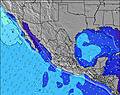 | 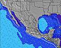 | 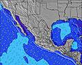 | 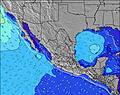 | |||||||||||||
Wave Height (m) Direction Period (s) | SSW 12 | SSW 13 | SSW 14 | SSW 13 | SSW 13 | SSW 12 | SSW 12 | SSW 12 | SW 15 | SW 14 | SW 14 | SW 13 | SSW 18 | SSW 18 | SSW 18 | SSW 16 | SSW 16 | SSW 16 | SSW 15 | SSW 14 |
Wave Graph | ||||||||||||||||||||
125 | 265 | 232 | 96 | 154 | 101 | 85 | 94 | 134 | 130 | 121 | 212 | 216 | 214 | 582 | 559 | 627 | 589 | 530 | 508 | |
Wind (km/h) | ||||||||||||||||||||
Wind State on-shore cross-onshore cross-shore cross-offshore off-shore glassy | cross-on | cross-off | glassy | on | glassy | cross | glassy | cross-off | glassy | on | glassy | glassy | cross-on | off | glassy | on | cross-off | cross-off | cross-on | cross-off |
High Tide | 7:54PM0.51m | 8:58AM0.55m | 7:45PM0.47m | 8:51AM0.62m | 7:20PM0.44m | 8:55AM0.69m | 6:52PM0.44m | 9:07AM0.74m | 6:50PM0.47m | 9:25AM0.78m | 7:08PM0.51m | 9:48AM0.80m | 7:35PM0.56m | |||||||
Low Tide | 2:20AM0.33m | 3:09PM0.41m | 1:33AM0.30m | 3:21PM0.40m | 1:19AM0.23m | 3:24PM0.41m | 1:25AM0.14m | 3:24PM0.42m | 1:44AM0.05m | 3:27PM0.44m | 2:11AM-0.03m | 3:36PM0.45m | 2:43AM-0.08m | |||||||
— | — | 6:24 | — | — | 6:26 | — | — | 6:26 | — | — | 6:26 | — | — | 6:26 | — | — | 6:26 | — | — | |
7:19 | — | — | 7:19 | — | — | 7:17 | — | — | 7:17 | — | — | 7:16 | — | — | 7:16 | — | — | 7:15 | — | |
mm | — | 2 | 1 | — | 1 | 6 | 3 | — | — | — | 6 | — | — | 4 | — | 1 | 2 | — | — | — |
Temp °C | 31 | 30 | 30 | 31 | 29 | 30 | 30 | 29 | 30 | 31 | 29 | 30 | 31 | 28 | 30 | 30 | 28 | 30 | 30 | 28 |
Feels °C | 35 | 35 | 34 | 35 | 35 | 34 | 36 | 34 | 34 | 35 | 34 | 33 | 34 | 33 | 33 | 32 | 32 | 33 | 33 | 32 |
Swell 1 Height (m) Direction Period (s) | W 6 | SSW 13 | SSW 14 | SSW 13 | SSW 13 | S 8 | S 8 | S 8 | S 9 | S 9 | S 8 | SW 13 | SW 13 | SW 13 | SSW 18 | SSW 16 | SSW 16 | SSW 16 | SSW 15 | SSW 14 |
22 | 265 | 232 | 96 | 154 | 44 | 45 | 48 | 76 | 76 | 69 | 212 | 208 | 196 | 582 | 559 | 627 | 589 | 530 | 508 | |
Swell 2 Height (m) Direction Period (s) | SSW 12 | W 6 | W 5 | SW 13 | S 11 | SSW 12 | SSW 12 | SSW 12 | SW 15 | SW 14 | SW 14 | S 8 | S 8 | S 8 | SW 12 | SSE 8 | SSE 8 | SSE 8 | SSE 8 | SSE 8 |
125 | 19 | 12 | 57 | 61 | 101 | 85 | 94 | 134 | 130 | 121 | 69 | 69 | 49 | 181 | 67 | 94 | 53 | 68 | 68 | |
Swell 3 Height (m) Direction Period (s) | SW 13 | SW 18 | SW 13 | W 5 | SW 16 | W 5 | W 5 | SW 15 | SSW 12 | SSW 11 | SSW 11 | SW 19 | SSW 18 | SSW 18 | SSE 8 | SW 12 | SW 12 | SW 12 | SW 11 | SW 11 |
87 | 79 | 56 | 12 | 91 | 7 | 7 | 76 | 55 | 24 | 47 | 94 | 216 | 214 | 50 | 116 | 144 | 114 | 43 | 59 | |
Wind waves Height (m) Direction Period (s) | — | — | — | — | — | — | — | — | — | — | — | — | — | — | — | — | — | — | — | W 4 |
— | — | — | — | — | — | — | — | — | — | — | — | — | — | — | — | — | — | — | 12 | |
Nearest Offshore or Glassy | ||||||||||||||||||||
Distance (km) | 791 | 0 | 0 | 1036 | 0 | 2 | 0 | 0 | 0 | 528 | 0 | 0 | 286 | 0 | 0 | 529 | 0 | 0 | 215 | 0 |
Best forecast wave conditions in Guerrero | ||||||||||||||||||||
Best forecast wave conditions in Mexico | ||||||||||||||||||||
Header Global | ||||||||||||||||||||
- Map Icons:
 Break
Break Live Wave Height (m)
 Live Wind Speed (km/h)
 Surf Rating (10 Max)
 Ocean Swells (m)
- Wind Speed (km/h)
Latest Updates


FREE! Surf-Forecast.com widget for your website
The surf report / weather widget below is available to embed on third party websites free of charge and provides a summary of our Ixtapa Island surf forecast. Simply grab the html code snippet that we provide and paste it into your own site. You can choose your preferred language and metric/imperial units for the surf forecast feed to suit users of your site. Click here to get the code.
Information about the Ixtapa Island Surf forecast
The above surf forecast table for Ixtapa Island provides essential information for determining whether the surfing conditions will be good over the next 16 days. A general guide to surfing at Ixtapa Island can be found by selecting the local surf guide option on the grey menu. Our Ixtapa Island surf forecast is unique since it includes wave energy (power) that defines the real feel of the surf rather than just the height or the period. If you surf the same spot (Ixtapa Island) regularly then make a mental note of the wave energy from the surf forecast table each time you go. Very soon you may start to choose your surf days based on the wave energy alone combined with our forecast of favourable offshore wind conditions. Our star ratings will help here and of course you will also find the usual wave height and period predictions on our surf forecasts as well as a full break down of the swell components under our advanced users option (to reveal that, click the little Einstein character under the tide times).
Further information to help with frequently asked questions about our surf forecast for Ixtapa Island may be found under the help tab on the top menu and also by moving your mouse over the question marks on the surf forecast table itself. Please always bear in mind that the forecast is for near-shore open water and local factors at each surf break influence the actual breaking wave height, such as the beach / reef profile, water depths offshore and shelter.
Ixtapa Island is 9 km (6 miles) from Zihuatanejo. If you plan a holiday in Guerrero, look for hotels and other accommodation in Zihuatanejo. Zihuatanejo has rooms for a wide range of budgets as well as car hire and transport links.
 Nearest