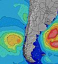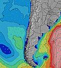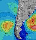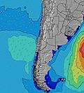
- Forecast
- Maps
- Live
- Weather State
- Spot Information
Surf Forecasts:
Isla Santa Maria surfForecast / Antofagasta / Chile
Forecast update in hr min s Forecast update imminent
Isla Santa Maria surf forecast is for near shore open water. Breaking waves will often be smaller at less exposed spots.
Today's Isla Santa Maria sea temperature is
17.7° C
(Which is slightly cooler than normal)How big are the waves at Isla Santa Maria today?
The current surf forecast for Isla Santa Maria at 8PM is: 0.7m 16s primary swell from a Southwest direction and 0.9m 12s secondary swell from a Southwest direction (forecast issued at 01:00pm May 14). An open ocean swell of 0.9m 5s is not directed at the surf break. The wind direction is predicted to be cross-offshore.
| Time (-04) & Date | Wave Height | Wave Period |
|---|---|---|
| Morning (14 May) | 3.5ft (1.1m) | 13s |
| Afternoon (14 May) | 3.5ft (1.0m) | 13s |
| Evening (14 May) | 2.5ft (0.7m) | 16s |
Table - waves today at Isla Santa Maria. (Swell directed towards the surf break)
Updates in hr min s Forecast update imminent
Short Range ForecastMostly dry. Very mild (max 17°C on Fri morning, min 15°C on Thu afternoon). Wind will be generally light. | ||||||||||||||||||||||||
Thu 14 | Friday 15 | Saturday 16 | Sun 17 | |||||||||||||||||||||
11 AM | 2 PM | 5 PM | 8 PM | 11 PM | 2 AM | 5 AM | 8 AM | 11 AM | 2 PM | 5 PM | 8 PM | 11 PM | 2 AM | 5 AM | 8 AM | 11 AM | 2 PM | 5 PM | 8 PM | 11 PM | 2 AM | 5 AM | 8 AM | |
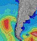
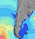
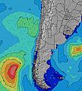
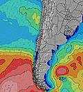
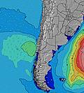
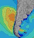
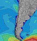
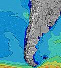
Swell Height Map | ||||||||||||||||||||||||
SW 13 | SW 13 | SW 13 | SW 16 | SW 15 | SW 15 | SW 15 | SW 14 | SW 14 | SW 14 | SW 13 | SW 13 | SW 13 | SW 13 | SW 13 | SW 13 | SW 12 | SW 16 | SW 16 | SSW 9 | SW 16 | SSW 16 | SSW 17 | SSW 18 | |
386 | 286 | 479 | 254 | 326 | 606 | 940 | 590 | 573 | 518 | 503 | 690 | 488 | 380 | 535 | 269 | 252 | 271 | 268 | 264 | 371 | 441 | 807 | 943 | |
Wind (km/h) | ||||||||||||||||||||||||
cross-off | cross | cross-off | cross-off | cross-off | cross-off | cross-off | cross-off | cross-on | cross | cross-off | cross-off | cross-off | cross | glassy | glassy | cross | cross | cross | cross-off | cross-off | cross-off | cross-off | cross-off | |
High Tide | 7:21PM0.89m | 8:01AM1.16m | 8:12PM0.86m | 8:44AM1.26m | 9:03PM0.82m | |||||||||||||||||||
Low Tide | 1:37PM0.22m | 1:29AM0.07m | 2:30PM0.13m | 2:07AM0.05m | 3:22PM0.06m | 2:49AM0.05m | ||||||||||||||||||
— | — | — | — | — | — | 7:09 | — | — | — | — | — | — | — | 7:09 | — | — | — | — | — | — | — | 7:09 | — | |
— | — | 6:07 | — | — | — | — | — | — | — | 6:07 | — | — | — | — | — | — | — | 6:07 | — | — | — | — | 6:07 | |
— | — | — | — | — | — | — | — | — | — | — | — | — | — | — | — | — | — | — | — | — | — | — | — | |
Temp °C | 16 | 16 | 15 | 15 | 15 | 16 | 16 | 15 | 17 | 17 | 16 | 15 | 15 | 15 | 15 | 15 | 16 | 17 | 16 | 15 | 15 | 15 | 15 | 15 |
15 | 13 | 12 | 11 | 11 | 13 | 14 | 14 | 17 | 17 | 15 | 14 | 15 | 15 | 15 | 16 | 15 | 16 | 14 | 14 | 14 | 13 | 14 | 14 | |
Swell 1 Height (m) Direction Period (s) | SW 13 | SW 13 | SW 13 | SW 12 | SW 12 | SW 15 | SW 15 | SW 14 | SW 14 | SW 14 | SW 13 | SW 13 | SW 13 | SW 13 | SW 13 | SW 13 | SW 12 | SSW 7 | SSW 8 | SSW 9 | SSW 9 | SSW 9 | SSW 9 | SSW 9 |
386 | 286 | 479 | 248 | 203 | 606 | 940 | 590 | 573 | 518 | 503 | 690 | 488 | 380 | 535 | 269 | 252 | 96 | 161 | 233 | 264 | 378 | 431 | 441 | |
Swell 2 Height (m) Direction Period (s) | SSW 6 | SW 16 | SW 16 | SW 16 | SW 15 | NW 13 | NW 12 | SSW 5 | SSW 5 | NW 12 | SSW 5 | NW 12 | SSW 5 | SSW 5 | SW 18 | SSW 7 | SSW 7 | SW 12 | SW 16 | SW 16 | SW 16 | SSW 16 | SSW 17 | SSW 18 |
43 | 165 | 254 | 254 | 326 | 44 | 40 | 39 | 46 | 23 | 32 | 23 | 24 | 19 | 154 | 40 | 61 | 175 | 268 | 264 | 371 | 441 | 807 | 943 | |
Swell 3 Height (m) Direction Period (s) | NW 13 | NW 13 | NW 13 | NW 13 | NW 13 | W 19 | SW 21 | NW 12 | NW 12 | SSW 20 | NW 12 | SSW 19 | SW 18 | SW 18 | NW 12 | SW 18 | SSW 17 | SW 16 | SW 12 | SW 12 | SSW 20 | SSW 20 | NW 16 | SW 15 |
44 | 44 | 44 | 44 | 44 | 7 | 18 | 23 | 23 | 37 | 23 | 36 | 82 | 81 | 39 | 152 | 193 | 271 | 175 | 149 | 336 | 336 | 41 | 54 | |
Wind waves Height (m) Direction Period (s) | — | SSW 5 | SSW 5 | SSW 5 | SSW 5 | SSW 5 | SSW 5 | — | — | SSW 5 | — | — | — | — | — | — | — | — | — | — | — | — | — | — |
— | 42 | 32 | 40 | 37 | 39 | 51 | — | — | 46 | — | — | — | — | — | — | — | — | — | — | — | — | — | — | |
Nearest Offshore or Glassy | ||||||||||||||||||||||||
Distance (km) | 0 | 360 | 360 | 360 | 360 | 61 | 61 | 0 | 184 | 39 | 0 | 0 | 0 | 18 | 0 | 0 | 184 | 184 | 277 | 0 | 0 | 0 | 0 | 0 |
Best forecast wave conditions in Antofagasta | ||||||||||||||||||||||||
Best forecast wave conditions in Chile | ||||||||||||||||||||||||
Header Global | ||||||||||||||||||||||||
- Map Icons:
Break
Live Wave Height (m)
Live Wind Speed (km/h)
Surf Rating (10 Max)
Ocean Swells (m)
Wind Speed (km/h)


