

Surf Forecasts:

Cupula surf forecast from 13 Jul 2026:
- Best quality surf: Monday 13 Jul, 11PM (local time) - 3.5ft (1.0m), 18s period, WSW swell with glassy winds.
- Most powerful swell: Tuesday 14 Jul, 2PM (local time) - 5ft (1.5m), 14s period, WSW swell with 883 kJ wave energy.
- Next surfable swell (1★+): Monday 13 Jul, 11PM (local time) - 3.5ft (1.0m), 18s period with WSW swell.
Best Forecast Surf Conditions for Cupula this week:
The surf forecast for Cupula over the next 16 days: The first swell (rated 1 star or higher) is forecast to arrive on Monday (Jul 13) at 11PM. The primary swell is predicted to be 1.0m and 18s period with a secondary swell of 0.7m and 12s. The wind is predicted to be glassy as the swell arrives.
The most powerful waves expected at Cupula in the next 16 days are 1.5m 14s and forecast to arrive on Tuesday (Jul 14) at 2PM. Winds are predicted to be cross-onshore at the time the swell arrives.
| Wave Type | Time (-04) & Date | Wave Height & Period |
|---|---|---|
| Next good surf (1 star+) | 11PM (Mon 13th Jul) | 3.5ft (1.0m) 18s |
| Best Surf | 11PM (Mon 13th Jul) | 3.5ft (1.0m) 18s |
| Most Powerful | 2PM (Tue 14th Jul) | 5ft (1.5m) 14s |
Table - best surf conditions forecast for Cupula over the next 16 days.
The Lowdown
Hey, Rusty here with the outlook for Cupula.
Over the next couple of weeks we’ve got a mix of clean windows and periods where the wind messes things up. The standout is definitely Wednesday afternoon, July 15. That afternoon delivers 4.6ft of southwest swell with a 13-second period – solid groundswell – and glassy conditions. Dead calm, no wind ripples, absolute clean lines on the reef and point. Water temp is 61.9°, about average for this time of year, with an anomaly of +1.1°. Combined energy is moderate at 697. Crowds can show up sometimes, so you might have company, but the quality makes it worth it.
Thursday morning July 16 stays glassy with 3.6ft southwest swell, 12-second period, energy 382 – smaller but still clean. That afternoon is glassy too. Then Sunday afternoon July 19 goes glassy again with 4.3ft southwest, 12 seconds, energy 491 – another fun window.
The start of the period, Monday July 13 afternoon, is marginal: 2.6ft on a west-southwest swell, 20-second period (very long period, so the reef setup at Cupula should handle it okay), but cross winds and only 6.2 mph – not terrible but not worth rushing. Tuesday July 14 has 4.3ft and 4.9ft but cross-on and cross winds. Wednesday morning July 15 is still cross-on before the glass-off.
From July 20 through July 26 the surf goes quiet and messy.
Short Range ForecastMostly dry. Very mild (max 17°C on Tue afternoon, min 13°C on Mon night). Wind will be generally light. | Days 5-7 Weather SummaryMostly dry. Warm (max 20°C on Sat morning, min 16°C on Thu night). Wind will be generally light. | ||||||||||||||||||||
Mon 13 | Tuesday 14 | Wednesday 15 | Thursday 16 | Friday 17 | Saturday 18 | Sunday 19 | |||||||||||||||
PM | Night | AM | PM | Night | AM | PM | Night | AM | PM | Night | AM | PM | Night | AM | PM | Night | AM | PM | Night | AM | |
Swell Height Map |  |  |  | 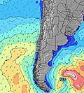 | 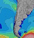 | 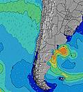 | 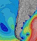 | 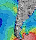 | |||||||||||||
Wave Height (m) Direction Period (s) | WSW 20 | WSW 16 | WSW 15 | WSW 14 | WSW 13 | SW 13 | SW 13 | SW 13 | SW 12 | SW 12 | SW 12 | SW 12 | WSW 11 | WSW 10 | WSW 10 | WSW 10 | WSW 11 | WSW 12 | WSW 12 | WSW 11 | WSW 11 |
Wave Graph | |||||||||||||||||||||
485 | 808 | 752 | 845 | 772 | 503 | 680 | 520 | 367 | 272 | 110 | 75 | 379 | 326 | 250 | 250 | 560 | 593 | 415 | 439 | 485 | |
Wind (km/h) | |||||||||||||||||||||
Wind State on-shore cross-onshore cross-shore cross-offshore off-shore glassy | cross | glassy | cross-on | cross | cross-on | cross-on | glassy | glassy | glassy | glassy | glassy | cross-on | cross | glassy | glassy | cross-on | cross | cross | glassy | cross | cross |
High Tide | 8:49PM0.70m | 9:10AM1.39m | 9:43PM0.74m | 10:00AM1.42m | 10:34PM0.78m | 10:48AM1.40m | 11:24PM0.82m | 11:34AM1.33m | 00:15AM0.86m | 12:20PM1.23m | 1:06AM0.89m | 1:05PM1.09m | 1:59AM0.91m | 1:53PM0.95m | |||||||
Low Tide | 3:15PM0.04m | 2:21AM0.06m | 4:05PM-0.02m | 3:15AM0.03m | 4:51PM-0.05m | 4:07AM0.03m | 5:36PM-0.05m | 5:00AM0.06m | 6:19PM-0.03m | 5:54AM0.12m | 7:01PM0.01m | 6:50AM0.20m | 7:43PM0.07m | 7:52AM0.28m | |||||||
— | — | 7:22 | — | — | 7:22 | — | — | 7:22 | — | — | 7:22 | — | — | 7:22 | — | — | 7:22 | — | — | 7:22 | |
6:10 | — | — | 6:10 | — | — | 6:12 | — | — | 6:12 | — | — | 6:12 | — | — | 6:13 | — | — | 6:13 | — | 6:14 | |
mm | — | — | — | — | — | — | — | — | — | — | — | — | — | — | — | — | — | — | — | — | — |
Temp °C | 16 | 14 | 16 | 17 | 16 | 17 | 17 | 17 | 17 | 18 | 17 | 18 | 17 | 18 | 20 | 19 | 20 | 20 | 19 | 18 | 19 |
Feels °C | 15 | 14 | 16 | 16 | 15 | 16 | 16 | 17 | 17 | 17 | 17 | 17 | 16 | 17 | 19 | 17 | 18 | 18 | 18 | 19 | 17 |
Swell 1 Height (m) Direction Period (s) | SSW 13 | WSW 16 | WSW 15 | WSW 14 | WSW 13 | SW 13 | SW 13 | SW 13 | SW 12 | SW 12 | SW 12 | WSW 9 | WSW 11 | WSW 10 | WSW 10 | WSW 10 | WSW 11 | WSW 12 | WSW 12 | WSW 11 | WSW 11 |
222 | 808 | 752 | 845 | 772 | 503 | 680 | 520 | 367 | 272 | 110 | 49 | 379 | 326 | 250 | 250 | 560 | 593 | 415 | 439 | 485 | |
Swell 2 Height (m) Direction Period (s) | WSW 20 | SSW 14 | SSW 14 | WSW 8 | — | WSW 12 | WNW 13 | WNW 13 | W 10 | W 10 | W 9 | SW 12 | SW 16 | SW 15 | SW 14 | SSW 13 | SSW 14 | SSW 13 | SW 12 | SW 12 | SW 11 |
485 | 127 | 161 | 13 | — | 256 | 17 | 17 | 8 | 17 | 40 | 75 | 65 | 106 | 93 | 116 | 73 | 114 | 71 | 69 | 63 | |
Swell 3 Height (m) Direction Period (s) | WSW 9 | SSW 12 | WSW 8 | WNW 14 | — | NW 13 | — | — | NW 13 | NW 12 | NW 12 | SW 17 | WNW 12 | SW 11 | SW 11 | WSW 13 | SSW 12 | NW 11 | NW 11 | NW 11 | W 23 |
26 | 55 | 28 | 19 | — | 7 | — | — | 7 | 6 | 6 | 46 | 14 | 31 | 31 | 35 | 14 | 5 | 5 | 5 | 10 | |
Wind waves Height (m) Direction Period (s) | — | — | — | — | — | — | — | — | — | — | — | — | — | — | — | — | — | — | — | — | — |
— | — | — | — | — | — | — | — | — | — | — | — | — | — | — | — | — | — | — | — | — | |
Nearest Offshore or Glassy | |||||||||||||||||||||
Distance (km) | 270 | 0 | 36 | 48 | 4 | 168 | 0 | 0 | 0 | 0 | 0 | 4 | 7 | 0 | 0 | 90 | 13 | 13 | 0 | 39 | 395 |
Best forecast wave conditions in Antofagasta | |||||||||||||||||||||
Best forecast wave conditions in Chile | |||||||||||||||||||||
Header Global | |||||||||||||||||||||
- Map Icons:
 Break
Break Live Wave Height (m)
 Live Wind Speed (km/h)
 Surf Rating (10 Max)
 Ocean Swells (m)
- Wind Speed (km/h)


FREE! Surf-Forecast.com widget for your website
The surf report / weather widget below is available to embed on third party websites free of charge and provides a summary of our Cupula surf forecast. Simply grab the html code snippet that we provide and paste it into your own site. You can choose your preferred language and metric/imperial units for the surf forecast feed to suit users of your site. Click here to get the code.
Information about the Cupula Surf forecast
The above surf forecast table for Cupula provides essential information for determining whether the surfing conditions will be good over the next 16 days. A general guide to surfing at Cupula can be found by selecting the local surf guide option on the grey menu. Our Cupula surf forecast is unique since it includes wave energy (power) that defines the real feel of the surf rather than just the height or the period. If you surf the same spot (Cupula) regularly then make a mental note of the wave energy from the surf forecast table each time you go. Very soon you may start to choose your surf days based on the wave energy alone combined with our forecast of favourable offshore wind conditions. Our star ratings will help here and of course you will also find the usual wave height and period predictions on our surf forecasts as well as a full break down of the swell components under our advanced users option (to reveal that, click the little Einstein character under the tide times).
Further information to help with frequently asked questions about our surf forecast for Cupula may be found under the help tab on the top menu and also by moving your mouse over the question marks on the surf forecast table itself. Please always bear in mind that the forecast is for near-shore open water and local factors at each surf break influence the actual breaking wave height, such as the beach / reef profile, water depths offshore and shelter.
Are you planning a holiday in Antofagasta? If you are looking for accommodation near Cupula, camping, hotels and holiday cottages in Antofagasta, consider staying in Antofagasta which is 13 km (8 miles) away. Alternatively, find information about places to stay and car hire in Mejillones which is 72 km (45 miles) away
 Nearest