

Surf Forecasts:

Hornitos surf forecast from 3 Aug 2026:
- Best quality surf: Wednesday 5 Aug, 5AM (local time) - 5ft (1.5m), 12s period, SW swell with glassy winds.
- Most powerful swell: Thursday 6 Aug, 11AM (local time) - 5ft (1.5m), 16s period, SW swell with 1,115 kJ wave energy.
- Next surfable swell (1★+): Monday 3 Aug, 2AM (local time) - 3ft (0.9m), 9s period with WSW swell.
Best Forecast Surf Conditions for Hornitos this week:
The surf forecast for Hornitos over the next 16 days: The first swell (rated 1 star or higher) is forecast to arrive on Monday (Aug 03) at 2AM. The primary swell is predicted to be 0.9m and 9s period with a secondary swell of 0.5m and 12s. The wind is predicted to be glassy as the swell arrives.
The most powerful waves expected at Hornitos in the next 16 days are 1.5m 16s and forecast to arrive on Thursday (Aug 06) at 11AM. Winds are predicted to be onshore at the time the swell arrives.
| Wave Type | Time (-04) & Date | Wave Height & Period |
|---|---|---|
| Next good surf (1 star+) | 2AM (Mon 3rd Aug) | 3ft (0.9m) 9s |
| Best Surf | 5AM (Wed 5th Aug) | 5ft (1.5m) 12s |
| Most Powerful | 11AM (Thu 6th Aug) | 5ft (1.5m) 16s |
Table - best surf conditions forecast for Hornitos over the next 16 days.
The Lowdown
Alright, grab a coffee and listen up. This is a pretty specific look at Hornitos. We’ve got a bit of a slow start, but the second half of the week and the weekend after that are where the magic is hiding.
Right now, Monday 3rd, the swell is about 4 ft from the SW with a solid 12-second period. The energy is moderate (443), but the wind is straight onshore and the conditions are marginal. Not worth getting wet for. That continues through Tuesday and Wednesday morning with similar SW swell holding around 5 ft to 5 ft, but the wind is always either onshore or cross-onshore, keeping things messy.
Then we get a little window. Wednesday afternoon, 5th August, the wind drops to glassy. The swell is still 5 ft from the SW, 12-second period, and the energy is moderate (604). The report says "expect good surf conditions." That’s our first real chance for a clean wave. The water temp is about average for the time of year, so nothing wild there.
Thursday 6th sees a spike in swell energy (1120) with a 5 ft SW groundswell running on a 16-second period - that’s proper long-period groundswell. The morning is blown out by onshore wind, but that afternoon the wind is light cross-onshore. The energy is still high (826). For a SW swell, Hornitos is fairly exposed, so it’ll be handling that energy. That long period (16s) means the sets will have some real push, but it might be a bit straight for the beach break setup. The crowd is only sometimes an issue here, so it won’t be a zoo.
Friday 7th through Sunday 9th is a write-off. The wind is up around 9-15 mph, cross-onshore, and the energy is moderate but the conditions are "poor" or "marginal". The swell is 5 ft with a short, choppy 10-second period. That’s a no-go.
Now, Monday 10th August is a standout if you’re an expert. The swell jumps to 7 ft in the morning and 7 ft in the afternoon from the SW, with energy through the roof (1566 and 1415). That’s strong wave energy. But the wind is cross-onshore and cross-shore, 9-12 mph, creating a cross-chop. For a beach/reef setup, this is going to be heavy, messy, and only for the very experienced. If you’re a kiter, this might be your playground.
The next true highlight is Friday afternoon, 14th August. We get a 3 ft SW swell with a 15-second period, and the wind goes glassy. The energy is light (385), but the report says "expect good surf conditions." That’s a clean, small-wave day for a log or a funboard.
Saturday afternoon, 15th August, is the same story: 3 ft SW, 14-second period, glassy wind. A perfect little clean-up session. The energy is a bit lower (320), but the conditions are spotless.
Then Sunday 16th and Monday 17th see a slight bump in swell to 4 ft with a 15-second period and moderate energy (740). The wind is onshore or cross-onshore, so it’s marginal again. Not a total loss, but those Friday and Saturday afternoons are the real winners.
To sum it up: the best on offer is a tie between Wednesday afternoon, 5th August for the clean glassy conditions on a 5 ft SW swell, and the Friday and Saturday afternoons of 14th and 15th August for the tiny, clean, glassy waves. The 10th of August has the size but the wind is a mess. Get on those glassy windows.
- Rusty
Short Range ForecastMostly dry. Warm (max 22°C on Mon afternoon, min 17°C on Sun night). Wind will be generally light. | Days 5-7 Weather SummaryMostly dry. Warm (max 21°C on Thu afternoon, min 16°C on Fri night). Wind will be generally light. | ||||||||||||||||||
Monday 3 | Tuesday 4 | Wednesday 5 | Thursday 6 | Friday 7 | Saturday 8 | ||||||||||||||
Night | AM | PM | Night | AM | PM | Night | AM | PM | Night | AM | PM | Night | AM | PM | Night | AM | PM | Night | |
Swell Height Map |  |  |  |  | 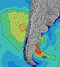 | 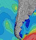 | 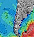 | ||||||||||||
Wave Height (m) Direction Period (s) | WSW 9 | SW 12 | SW 12 | SW 12 | SW 12 | SW 12 | SW 12 | SW 12 | SW 12 | SW 12 | SW 16 | SW 14 | SW 14 | SW 13 | SW 13 | SW 9 | SW 10 | SW 10 | SW 9 |
Wave Graph | |||||||||||||||||||
141 | 341 | 590 | 635 | 614 | 614 | 635 | 522 | 514 | 400 | 1115 | 821 | 736 | 451 | 663 | 257 | 399 | 465 | 375 | |
Wind (km/h) | |||||||||||||||||||
Wind State on-shore cross-onshore cross-shore cross-offshore off-shore glassy | glassy | on | cross-on | glassy | cross-on | cross-on | glassy | on | glassy | glassy | on | cross-on | glassy | cross-on | cross-on | cross | cross-on | cross-on | cross |
High Tide | 00:18AM0.82m | 12:11PM0.99m | 00:58AM0.86m | 12:47PM0.90m | 1:45AM0.89m | 1:32PM0.79m | 2:42AM0.92m | 2:31PM0.69m | 3:49AM0.96m | 3:53PM0.61m | 5:02AM1.03m | 5:25PM0.58m | |||||||
Low Tide | 5:58AM0.26m | 6:43PM0.13m | 6:48AM0.30m | 7:15PM0.16m | 7:49AM0.35m | 7:53PM0.19m | 9:08AM0.37m | 8:43PM0.22m | 10:44AM0.35m | 9:48PM0.23m | 12:12PM0.28m | 11:02PM0.22m | |||||||
— | 7:13 | — | — | 7:13 | — | — | 7:13 | — | — | 7:11 | — | — | 7:11 | — | — | 7:11 | — | — | |
6:20 | — | 6:20 | — | — | 6:21 | — | — | 6:21 | — | — | 6:22 | — | — | 6:22 | — | — | 6:22 | — | |
mm | — | — | — | — | — | — | — | — | — | — | — | — | — | — | — | — | — | — | — |
Temp °C | 21 | 21 | 22 | 20 | 20 | 21 | 18 | 22 | 22 | 20 | 20 | 21 | 19 | 21 | 21 | 18 | 20 | 20 | 17 |
Feels °C | 20 | 20 | 22 | 21 | 20 | 21 | 19 | 21 | 22 | 21 | 20 | 21 | 20 | 19 | 19 | 17 | 18 | 18 | 15 |
Swell 1 Height (m) Direction Period (s) | WSW 9 | SW 12 | SW 12 | SW 12 | SW 12 | SW 12 | SW 12 | SW 12 | SW 12 | SW 12 | SW 16 | SW 14 | SW 14 | SW 13 | SW 13 | SW 9 | SW 10 | SW 10 | SW 9 |
141 | 341 | 590 | 635 | 614 | 614 | 635 | 522 | 514 | 400 | 1115 | 821 | 736 | 451 | 663 | 257 | 399 | 465 | 375 | |
Swell 2 Height (m) Direction Period (s) | SSW 12 | SW 8 | SSW 12 | NW 12 | NW 12 | NW 12 | SW 20 | SW 19 | SW 18 | SW 17 | NW 12 | NW 11 | NW 11 | SW 7 | NW 10 | SW 13 | SW 12 | SW 16 | SW 15 |
82 | 88 | 13 | 6 | 5 | 6 | 16 | 95 | 84 | 241 | 5 | 5 | 5 | 44 | 4 | 161 | 23 | 90 | 136 | |
Swell 3 Height (m) Direction Period (s) | WSW 13 | SSW 12 | NW 12 | — | — | — | NW 12 | NW 12 | NW 12 | NW 12 | — | — | — | NW 11 | — | SW 18 | SW 16 | W 24 | SW 11 |
69 | 14 | 6 | — | — | — | 5 | 5 | 6 | 5 | — | — | — | 5 | — | 12 | 42 | 11 | 64 | |
Wind waves Height (m) Direction Period (s) | — | — | — | — | — | — | — | — | — | — | — | — | — | — | — | — | — | — | — |
— | — | — | — | — | — | — | — | — | — | — | — | — | — | — | — | — | — | — | |
Nearest Offshore or Glassy | |||||||||||||||||||
Distance (km) | 0 | 61 | 127 | 0 | 127 | 78 | 0 | 127 | 0 | 0 | 61 | 221 | 0 | 127 | 302 | 221 | 305 | 305 | 221 |
Best forecast wave conditions in Antofagasta | |||||||||||||||||||
Best forecast wave conditions in Chile | |||||||||||||||||||
Header Global | |||||||||||||||||||
- Map Icons:
 Break
Break Live Wave Height (m)
 Live Wind Speed (km/h)
 Surf Rating (10 Max)
 Ocean Swells (m)
- Wind Speed (km/h)
Latest Updates


FREE! Surf-Forecast.com widget for your website
The surf report / weather widget below is available to embed on third party websites free of charge and provides a summary of our Hornitos surf forecast. Simply grab the html code snippet that we provide and paste it into your own site. You can choose your preferred language and metric/imperial units for the surf forecast feed to suit users of your site. Click here to get the code.
Information about the Hornitos Surf forecast
The above surf forecast table for Hornitos provides essential information for determining whether the surfing conditions will be good over the next 16 days. A general guide to surfing at Hornitos can be found by selecting the local surf guide option on the grey menu. Our Hornitos surf forecast is unique since it includes wave energy (power) that defines the real feel of the surf rather than just the height or the period. If you surf the same spot (Hornitos) regularly then make a mental note of the wave energy from the surf forecast table each time you go. Very soon you may start to choose your surf days based on the wave energy alone combined with our forecast of favourable offshore wind conditions. Our star ratings will help here and of course you will also find the usual wave height and period predictions on our surf forecasts as well as a full break down of the swell components under our advanced users option (to reveal that, click the little Einstein character under the tide times).
Further information to help with frequently asked questions about our surf forecast for Hornitos may be found under the help tab on the top menu and also by moving your mouse over the question marks on the surf forecast table itself. Please always bear in mind that the forecast is for near-shore open water and local factors at each surf break influence the actual breaking wave height, such as the beach / reef profile, water depths offshore and shelter.
Hornitos is 22 km (14 miles) from the city of Mejillones. If you plan a holiday in Antofagasta, look for hotels and other accommodation in Mejillones. Mejillones has rooms for a wide range of budgets as well as car hire and transport links.
 Nearest