

Surf Forecasts:

Budeo surf forecast from 28 Jul 2026:
- Best quality surf: Wednesday 29 Jul, 11PM (local time) - 4.5ft (1.3m), 12s period, WSW swell with glassy winds.
- Most powerful swell: Tuesday 28 Jul, 5PM (local time) - 6ft (1.9m), 14s period, SW swell with 1,292 kJ wave energy.
- Next surfable swell (1★+): Wednesday 29 Jul, 11PM (local time) - 4.5ft (1.3m), 12s period with WSW swell.
Best Forecast Surf Conditions for Budeo this week:
The surf forecast for Budeo over the next 16 days: The first swell (rated 1 star or higher) is forecast to arrive on Wednesday (Jul 29) at 11PM. The primary swell is predicted to be 1.3m and 12s period. The wind is predicted to be glassy as the swell arrives.
The most powerful waves expected at Budeo in the next 16 days are 1.9m 14s and forecast to arrive on Tuesday (Jul 28) at 5PM. Winds are predicted to be cross-shore at the time the swell arrives.
| Wave Type | Time (-04) & Date | Wave Height & Period |
|---|---|---|
| Next good surf (1 star+) | 11PM (Wed 29th Jul) | 4.5ft (1.3m) 12s |
| Best Surf | 11PM (Wed 29th Jul) | 4.5ft (1.3m) 12s |
| Most Powerful | 5PM (Tue 28th Jul) | 6ft (1.9m) 14s |
Table - best surf conditions forecast for Budeo over the next 16 days.
The Lowdown
Alright folks, Rusty here. Let’s have a look at what’s on the cards for Budeo. It’s going to be a bit of a mixed bag with a slow start, but there’s a real flash of quality hiding in the second week if you’ve got the patience.
This first week is a bit of a grind. We’ve got swell rolling in, but the wind just won’t play nice. From Tuesday, 28 July, right through the end of the month, the surf is there but it’s messy. Swell heights are hanging around 3 ft to 6 ft from the WSW and SW, with periods around 12 to 14 seconds, so there’s some decent groundswell energy in the water (combined energy hitting 1163 on Tuesday morning). But it’s mostly a cross-on or cross-off wind, and the reports are calling it marginal or poor. The water is a balmy 66°, which is much warmer than normal for this time of year, so you won’t need a thick wetsuit, but the surface is chopped up. Wednesday and Thursday (29th and 30th July) are more of the same – light cross-onshore winds, small wind ripples, and the swell drops a bit. Not really worth paddling out for.
The first week of August continues the same story. Friday, 31 July, through to Wednesday, 5 August, sees swell heights from 3 ft to 5 ft, but the wind stays stubbornly cross-onshore. The energy is weak to moderate (between 125 and 777), and the wave comment is either “poor” or “marginal”. It’s a real dry spell.
Now, hold onto your board, because Thursday, 6 August, is the standout. The morning shapes up with a clean 6 ft SW groundswell (a very long 16-second period) and glassy conditions with a light WNW breeze at just 3 mph. The combined energy is a strong 1499, and the report says “excellent surf conditions for experienced surfers.” That 6 ft is pushing into the bigger range, so it’s not for beginners, but for anyone with some experience, this is the pick of the entire 16-day window. The SW swell is right on the money for Budeo’s optimum direction. The afternoon hangs on to the same size, but the wind shifts onshore, so get out there early.
Friday, 7 August, and Saturday, 8 August, keep the goods coming with consistent 6 ft to 7 ft SW swell (14-second period). The energy stays strong (1249 to 1812), but the wind is a bit more variable – cross-on or onshore. Still very surfable, especially for the crew who can handle the size. Sunday, 9 August, holds around 6 ft, but the wind goes back to a light cross-onshore, so it’s less clean.
The following week (10 to 12 August) fades out. Swell drops to 5 ft and then down to 3 ft, periods shorten, and the wind stays cross-onshore. The energy falls away, and we’re back to poor conditions. It’s a classic case of a slow first week, a killer few days around the 6th to 8th, and then a tapering off. If you can only pick one session, make it Thursday, 6 August, at dawn.
Rusty.
Short Range ForecastMostly dry. Warm (max 22°C on Wed morning, min 15°C on Thu night). Wind will be generally light. | Days 4-6 Weather SummaryMostly dry. Warm (max 23°C on Sat morning, min 16°C on Fri morning). Wind will be generally light. | ||||||||||||||||||||
Tuesday 28 | Wednesday 29 | Thursday 30 | Friday 31 | Saturday 1 | Sunday 2 | Monday 3 | |||||||||||||||
AM | PM | Night | AM | PM | Night | AM | PM | Night | AM | PM | Night | AM | PM | Night | AM | PM | Night | AM | PM | Night | |
Swell Height Map |  |  | 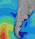 | 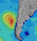 | 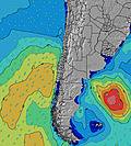 | 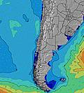 | 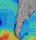 | ||||||||||||||
Wave Height (m) Direction Period (s) | WSW 14 | SW 14 | SW 13 | SW 13 | SW 12 | WSW 12 | WSW 12 | WSW 13 | WSW 12 | WSW 12 | SW 11 | SW 11 | SW 10 | SW 10 | SW 9 | SSW 13 | SSW 12 | SW 7 | SW 7 | SW 8 | SW 10 |
Wave Graph | |||||||||||||||||||||
1142 | 1292 | 951 | 382 | 587 | 472 | 390 | 346 | 177 | 177 | 273 | 415 | 292 | 286 | 198 | 277 | 184 | 121 | 102 | 108 | 420 | |
Wind (km/h) | |||||||||||||||||||||
Wind State on-shore cross-onshore cross-shore cross-offshore off-shore glassy | cross-on | cross | cross | cross-on | cross-on | glassy | cross-on | on | on | cross-on | cross-on | cross-off | cross-on | cross-on | glassy | cross-on | cross-on | cross | cross-on | cross-on | cross |
High Tide | 9:03AM1.33m | 9:32PM1.00m | 9:33AM1.35m | 10:11PM1.02m | 10:03AM1.36m | 10:49PM1.04m | 10:33AM1.35m | 11:24PM1.05m | 11:03AM1.34m | 00:00AM1.05m | 11:35AM1.30m | 00:37AM1.06m | 12:09PM1.25m | 1:18AM1.07m | |||||||
Low Tide | 3:42PM0.34m | 3:06AM0.42m | 4:14PM0.28m | 3:42AM0.44m | 4:45PM0.24m | 4:16AM0.46m | 5:16PM0.22m | 4:50AM0.48m | 5:47PM0.22m | 5:25AM0.50m | 6:20PM0.23m | 6:04AM0.53m | 6:54PM0.25m | ||||||||
7:18 | — | — | 7:18 | — | — | 7:16 | — | — | 7:16 | — | — | 7:16 | — | — | 7:16 | — | — | 7:15 | — | — | |
— | 6:16 | — | — | 6:17 | — | — | 6:17 | — | — | 6:19 | — | — | 6:19 | — | — | 6:19 | — | — | 6:20 | — | |
mm | — | — | — | — | — | — | — | — | — | — | — | — | — | — | — | — | — | — | — | — | — |
Temp °C | 19 | 19 | 19 | 22 | 22 | 19 | 20 | 20 | 19 | 19 | 20 | 20 | 23 | 22 | 17 | 20 | 19 | 17 | 21 | 20 | 18 |
Feels °C | 18 | 18 | 18 | 21 | 22 | 19 | 19 | 19 | 19 | 18 | 18 | 18 | 21 | 20 | 17 | 19 | 17 | 15 | 19 | 18 | 17 |
Swell 1 Height (m) Direction Period (s) | WSW 14 | SW 14 | SW 13 | SW 11 | SW 12 | WSW 12 | WSW 12 | WSW 13 | WSW 12 | WSW 12 | SW 11 | SW 11 | SW 10 | SW 10 | SW 9 | WSW 10 | SW 7 | SW 7 | SW 7 | SW 8 | SW 10 |
1142 | 1292 | 951 | 334 | 587 | 472 | 390 | 346 | 177 | 177 | 273 | 415 | 292 | 286 | 198 | 183 | 119 | 121 | 102 | 108 | 420 | |
Swell 2 Height (m) Direction Period (s) | WNW 14 | WNW 14 | NW 15 | SW 13 | NW 14 | SSW 10 | SSW 10 | SSW 9 | SSW 8 | SSW 8 | SSW 8 | WSW 16 | SW 16 | WSW 15 | SW 13 | SSW 13 | SSW 12 | SSW 12 | WSW 9 | WSW 12 | NW 13 |
21 | 20 | 8 | 382 | 8 | 10 | 9 | 8 | 7 | 6 | 6 | 26 | 65 | 45 | 132 | 277 | 184 | 77 | 46 | 96 | 6 | |
Swell 3 Height (m) Direction Period (s) | — | — | — | NW 14 | — | W 13 | W 13 | W 13 | W 13 | SW 18 | WSW 18 | W 13 | SW 16 | SW 15 | WSW 14 | WSW 14 | WSW 13 | WSW 9 | WSW 12 | WSW 9 | SW 19 |
— | — | — | 8 | — | 3 | 3 | 14 | 3 | 12 | 31 | 13 | 10 | 35 | 82 | 73 | 116 | 34 | 58 | 25 | 15 | |
Wind waves Height (m) Direction Period (s) | — | — | — | — | — | — | — | — | — | — | — | — | — | — | — | — | — | — | — | — | — |
— | — | — | — | — | — | — | — | — | — | — | — | — | — | — | — | — | — | — | — | — | |
Nearest Offshore or Glassy | |||||||||||||||||||||
Distance (km) | 198 | 293 | 13 | 71 | 28 | 0 | 149 | 149 | 198 | 376 | 373 | 0 | 198 | 149 | 0 | 376 | 295 | 71 | 376 | 376 | 13 |
Best forecast wave conditions in Antofagasta | |||||||||||||||||||||
Best forecast wave conditions in Chile | |||||||||||||||||||||
Header Global | |||||||||||||||||||||
- Map Icons:
 Break
Break Live Wave Height (m)
 Live Wind Speed (km/h)
 Surf Rating (10 Max)
 Ocean Swells (m)
- Wind Speed (km/h)


FREE! Surf-Forecast.com widget for your website
The surf report / weather widget below is available to embed on third party websites free of charge and provides a summary of our Budeo surf forecast. Simply grab the html code snippet that we provide and paste it into your own site. You can choose your preferred language and metric/imperial units for the surf forecast feed to suit users of your site. Click here to get the code.
Information about the Budeo Surf forecast
The above surf forecast table for Budeo provides essential information for determining whether the surfing conditions will be good over the next 16 days. A general guide to surfing at Budeo can be found by selecting the local surf guide option on the grey menu. Our Budeo surf forecast is unique since it includes wave energy (power) that defines the real feel of the surf rather than just the height or the period. If you surf the same spot (Budeo) regularly then make a mental note of the wave energy from the surf forecast table each time you go. Very soon you may start to choose your surf days based on the wave energy alone combined with our forecast of favourable offshore wind conditions. Our star ratings will help here and of course you will also find the usual wave height and period predictions on our surf forecasts as well as a full break down of the swell components under our advanced users option (to reveal that, click the little Einstein character under the tide times).
Further information to help with frequently asked questions about our surf forecast for Budeo may be found under the help tab on the top menu and also by moving your mouse over the question marks on the surf forecast table itself. Please always bear in mind that the forecast is for near-shore open water and local factors at each surf break influence the actual breaking wave height, such as the beach / reef profile, water depths offshore and shelter.
Are you planning a holiday in Antofagasta? If you are looking for accommodation near Budeo, camping, hotels and holiday cottages in Antofagasta, consider staying in Antofagasta which is 9 km (6 miles) away. Alternatively, find information about places to stay and car hire in Mejillones which is 54 km (34 miles) away
 Nearest