

Surf Forecasts:

Coastal Bend Area surf forecast from 1 Aug 2026:
- Best quality surf: Sunday 2 Aug, 10AM (local time) - 2.5ft (0.8m), 5s period, SSE swell with cross-offshore winds.
- Most powerful swell: Sunday 2 Aug, 1AM (local time) - 4ft (1.2m), 5s period, SSE swell with 78 kJ wave energy.
- Next surfable swell (1★+): Sunday 2 Aug, 10AM (local time) - 2.5ft (0.8m), 5s period with SSE swell.
Best Forecast Surf Conditions for Coastal Bend Area this week:
The surf forecast for Coastal Bend Area over the next 16 days: The first swell (rated 1 star or higher) is forecast to arrive on Sunday (Aug 02) at 10AM. The primary swell is predicted to be 0.8m and 5s period with a secondary swell of 0.6m and 6s. The wind is predicted to be cross-offshore as the swell arrives.
The most powerful waves expected at Coastal Bend Area in the next 16 days are 1.2m 5s and forecast to arrive on Sunday (Aug 02) at 1AM. Winds are predicted to be cross-onshore at the time the swell arrives.
| Wave Type | Time (CDT) & Date | Wave Height & Period |
|---|---|---|
| Next good surf (1 star+) | 10AM (Sun 2nd Aug) | 2.5ft (0.8m) 5s |
| Best Surf | 10AM (Sun 2nd Aug) | 2.5ft (0.8m) 5s |
| Most Powerful | 1AM (Sun 2nd Aug) | 4ft (1.2m) 5s |
Table - best surf conditions forecast for Coastal Bend Area over the next 16 days.
The Lowdown
Grab a coffee, friend, because this 16-day forecast for the Coastal Bend Area is a tough one to swallow. Right now, the Gulf is flat and lethargic, and the wind is working against us for the first week. The water temp is sitting at 85° which is a touch above average for this time of year, so at least it’s a warm bath for the soul.
We kick off on Friday, July 31st, with a weak 3ft SSE windswell at a pathetic 5-second period. The combined energy is a measly 32, and with a 9 mph cross-onshore breeze, it’s just messy and poor. That’s the story for the whole first week, nothing but onshore and cross-onshore winds, keeping the sea choppy and the waves small and crumbly. It’s a total write-off. There’s a tiny window on Sunday morning, August 2nd, where the wind goes light and cross-off from the west, cleaning up a 3ft SSE swell. The energy jumps to 59, and the waves are surfable, but “very ordinary” is the best we can say. It’s a desperate session for the die-hards.
The second week is more of the same. The swell stays small, mostly between 2ft and 4ft, and the wind just refuses to cooperate. It’s a solid 10 days of onshore or cross-onshore slop, with moderate to fresh breezes keeping the surface lumpy. The period stays short, never getting past 6 seconds, so there’s no real push. On Monday, August 10th, we see a tiny bump to 4ft SSE swell with a 6-second period, but the energy hits 92 – still weak – and with a 16 mph cross-onshore wind, it’s just bumpy and frustrating. For an area that’s fairly consistent, this is a brutal blank run. The breaks are exposed beach/jetties, so with the wind and poor quality, it’s looking more like a kite-surfing setup than a paddling one.
The truth is, there isn’t a single standout session in this entire 16-day window. The best you can hope for is a mediocre, onshore, knee-high wave. I’d say save your energy, stay home, and wait for a better forecast. This is one of those stretches where the ocean just isn’t feeling it.
Rusty.
Short Range ForecastMostly dry. Warm (max 30°C on Sun afternoon, min 28°C on Fri morning). Mainly fresh winds. | Days 4-6 Weather SummaryMostly dry. Warm (max 29°C on Mon morning, min 28°C on Mon morning). Mainly fresh winds. | ||||||||||||||||||||
Friday 31 | Saturday 1 | Sunday 2 | Monday 3 | Tuesday 4 | Wednesday 5 | Thursday 6 | |||||||||||||||
AM | PM | Night | AM | PM | Night | AM | PM | Night | AM | PM | Night | AM | PM | Night | AM | PM | Night | AM | PM | Night | |
Swell Height Map | 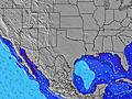 | 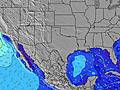 | 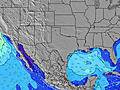 | 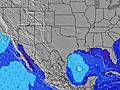 | 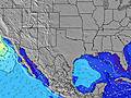 | 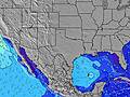 | 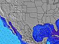 | ||||||||||||||
Wave Height (m) Direction Period (s) | SSE 5 | SSE 5 | SSE 5 | SSE 5 | SSE 5 | SSE 5 | SSE 5 | S 5 | SSE 5 | SSE 5 | SSE 5 | SSE 5 | SE 6 | SSE 5 | SSE 5 | SSE 5 | SE 5 | SE 5 | SE 5 | SE 6 | SE 7 |
Wave Graph | |||||||||||||||||||||
28 | 21 | 39 | 36 | 30 | 78 | 31 | 24 | 35 | 25 | 21 | 78 | 30 | 32 | 39 | 33 | 13 | 35 | 34 | 30 | 63 | |
Wind (km/h) | |||||||||||||||||||||
Wind State on-shore cross-onshore cross-shore cross-offshore off-shore glassy | on | cross-on | cross-on | cross-on | cross-on | cross-on | cross-off | cross-on | cross-on | cross | cross-on | cross-on | cross-on | on | cross-on | cross-on | on | on | cross-on | on | on |
High Tide | 3:03PM0.41m | 6:47AM0.43m | 4:12PM0.39m | 6:45AM0.42m | 5:28PM0.37m | 6:43AM0.41m | 7:02PM0.36m | 6:39AM0.42m | 9:23PM0.36m | 6:31AM0.43m | 6:10AM0.45m | ||||||||||
Low Tide | 11:39AM0.39m | 11:03PM0.16m | 12:09PM0.35m | 11:29PM0.20m | 12:38PM0.31m | 11:53PM0.24m | 1:15PM0.27m | 00:16AM0.29m | 2:00PM0.23m | 00:29AM0.35m | 2:53PM0.18m | 3:56PM0.12m | |||||||||
6:48 | — | — | 6:48 | — | — | 6:50 | — | — | 6:50 | — | — | 6:50 | — | — | 6:52 | — | — | 6:52 | — | — | |
— | 8:17 | — | — | 8:16 | — | — | 8:15 | — | — | 8:15 | — | — | 8:15 | — | — | 8:14 | — | — | 8:13 | — | |
mm | — | — | — | — | — | — | — | — | — | — | — | — | — | — | — | — | — | — | 1 | — | — |
Temp °C | 29 | 28 | 28 | 28 | 29 | 28 | 29 | 30 | 29 | 29 | 29 | 28 | 29 | 29 | 29 | 29 | 29 | 29 | 28 | 29 | 28 |
Feels °C | 32 | 29 | 29 | 31 | 31 | 27 | 34 | 32 | 31 | 31 | 29 | 28 | 31 | 31 | 31 | 32 | 31 | 30 | 30 | 31 | 28 |
Swell 1 Height (m) Direction Period (s) | SE 7 | SE 7 | SE 7 | SSE 5 | — | — | SSE 5 | SE 9 | SE 10 | SSE 5 | ESE 9 | SE 9 | SE 6 | ESE 9 | SE 8 | SSE 5 | SSE 5 | — | SE 5 | SE 6 | — |
2 | 2 | 2 | 36 | — | — | 31 | 3 | 4 | 25 | 8 | 3 | 30 | 7 | 3 | 33 | 9 | — | 34 | 30 | — | |
Swell 2 Height (m) Direction Period (s) | SE 7 | — | — | — | — | — | SE 6 | SE 9 | SE 7 | ESE 9 | — | — | SE 9 | ESE 9 | — | SE 8 | SE 8 | — | — | — | — |
2 | — | — | — | — | — | 25 | 3 | 2 | 8 | — | — | 3 | 8 | — | 3 | 3 | — | — | — | — | |
Swell 3 Height (m) Direction Period (s) | — | — | — | — | — | — | SE 9 | ESE 9 | — | ESE 9 | — | — | ESE 9 | — | — | — | SE 8 | — | — | — | — |
— | — | — | — | — | — | 3 | 8 | — | 8 | — | — | 8 | — | — | — | 3 | — | — | — | — | |
Wind waves Height (m) Direction Period (s) | SSE 5 | SSE 5 | SSE 5 | — | SSE 5 | SSE 5 | — | S 5 | SSE 5 | — | SSE 5 | SSE 5 | S 5 | SSE 5 | SSE 5 | S 5 | SE 5 | SE 5 | — | — | SE 7 |
28 | 21 | 39 | — | 30 | 78 | — | 24 | 35 | — | 21 | 78 | 18 | 32 | 39 | 13 | 13 | 35 | — | — | 63 | |
Nearest Offshore or Glassy | |||||||||||||||||||||
Distance (km) | 1085 | 1186 | 1007 | 1085 | 1330 | 1080 | 0 | 1186 | 937 | 985 | 1259 | 1080 | 1085 | 1532 | 1080 | 1085 | 1186 | 1080 | 1085 | 1188 | 1080 |
Best forecast wave conditions in Texas | |||||||||||||||||||||
Best forecast wave conditions in United States | |||||||||||||||||||||
Header Global | |||||||||||||||||||||
- Map Icons:
 Break
Break Live Wave Height (m)
 Live Wind Speed (km/h)
 Surf Rating (10 Max)
 Ocean Swells (m)
- Wind Speed (km/h)
Latest Updates


FREE! Surf-Forecast.com widget for your website
The surf report / weather widget below is available to embed on third party websites free of charge and provides a summary of our Coastal Bend Area surf forecast. Simply grab the html code snippet that we provide and paste it into your own site. You can choose your preferred language and metric/imperial units for the surf forecast feed to suit users of your site. Click here to get the code.
Information about the Coastal Bend Area Surf forecast
The above surf forecast table for Coastal Bend Area provides essential information for determining whether the surfing conditions will be good over the next 16 days. A general guide to surfing at Coastal Bend Area can be found by selecting the local surf guide option on the grey menu. Our Coastal Bend Area surf forecast is unique since it includes wave energy (power) that defines the real feel of the surf rather than just the height or the period. If you surf the same spot (Coastal Bend Area) regularly then make a mental note of the wave energy from the surf forecast table each time you go. Very soon you may start to choose your surf days based on the wave energy alone combined with our forecast of favourable offshore wind conditions. Our star ratings will help here and of course you will also find the usual wave height and period predictions on our surf forecasts as well as a full break down of the swell components under our advanced users option (to reveal that, click the little Einstein character under the tide times).
Further information to help with frequently asked questions about our surf forecast for Coastal Bend Area may be found under the help tab on the top menu and also by moving your mouse over the question marks on the surf forecast table itself. Please always bear in mind that the forecast is for near-shore open water and local factors at each surf break influence the actual breaking wave height, such as the beach / reef profile, water depths offshore and shelter.
Coastal Bend Area is 17 km (11 miles) from Rockport - Arkansas County. If you plan a vacation in Texas, look for hotels and other accommodation in Rockport - Arkansas County. Rockport - Arkansas County has rooms for a wide range of budgets as well as car hire and transport links.
 Nearest