

Surf Forecasts:

Club del la Playa surf forecast from 3 Aug 2026:
- Best quality surf: Tuesday 4 Aug, 9PM (local time) - 2ft (0.6m), 10s period, SE swell with cross-offshore winds.
- Most powerful swell: Friday 7 Aug, 3PM (local time) - 8ft (2.5m), 14s period, S swell with 2,440 kJ wave energy.
- Next surfable swell (1★+): Tuesday 4 Aug, 9PM (local time) - 2ft (0.6m), 10s period with SE swell.
Best Forecast Surf Conditions for Club del la Playa this week:
The surf forecast for Club del la Playa over the next 16 days: The first swell (rated 1 star or higher) is forecast to arrive on Tuesday (Aug 04) at 9PM. The primary swell is predicted to be 0.6m and 10s period with a secondary swell of 0.7m and 6s. Another secondary swell of 0.7m and 6s is also forecast. The wind is predicted to be cross-offshore as the swell arrives.
The most powerful waves expected at Club del la Playa in the next 16 days are 2.5m 14s and forecast to arrive on Friday (Aug 07) at 3PM. Winds are predicted to be cross-offshore at the time the swell arrives. The largest open ocean swell (not directed at the beach) is 1.2m 5s period and expected on Saturday (Aug 08) at 3AM.
| Wave Type | Time (-03) & Date | Wave Height & Period |
|---|---|---|
| Next good surf (1 star+) | 9PM (Tue 4th Aug) | 2ft (0.6m) 10s |
| Best Surf | 9PM (Tue 4th Aug) | 2ft (0.6m) 10s |
| Most Powerful | 3PM (Fri 7th Aug) | 8ft (2.5m) 14s |
Table - best surf conditions forecast for Club del la Playa over the next 16 days.
The Lowdown
Alright folks, Rusty here. Let’s take a look at what’s on offer for the next couple of weeks.
We’re looking at Club del la Playa, a beach and point setup that’s consistent and exposed to the south. It’s a mixed bag, with a long stretch of flat, weak conditions to start, then a big spike of energy that comes with a lot of wind. The water’s sitting at 55°F, which is a touch warmer than normal for this time of year.
The first few days are a write-off. Monday the 3rd and Tuesday the 4th have small 3ft swell, but the wind is all over the place – cross, cross-on, and a little cross-off. The energy is weak (160 and 123), and the conditions are ordinary. Wednesday the 5th is a little better with a 2ft swell and a light cross-off breeze, but it’s still tiny. The energy is only 84. Thursday the 6th drops even further. This is a long stretch of nothing worth paddling for.
Then things get interesting but messy. Friday the 7th sees a big jump in size – 10ft on the morning from the SW, but the wind is a nasty 28 mph cross-shore, making it a total mess. The energy is massive (1407), but you won’t want to be out there. The afternoon cleans up a bit with a 8ft swell from the south and a 14-second period, with a cross-off breeze. That’s a long-period groundswell, so it’ll have plenty of energy (2911) and good shape, but at that size, it’s for experts only. The point at Club del la Playa might handle it, but it’s a beast.
Saturday the 8th is the best of the bunch. The swell drops to a still-chunky 6ft from the SSE, with a 14-second period too. The wind is a clean cross-off from the WNW at 16 mph. The energy is still strong (1115). This is the standout morning. The waves will have good power, long lines, and it’ll be clean. It’s a solid intermediate level, and it’s the best we’ll see. The afternoon gets smaller and choppier, so get on it early.
Sunday the 9th and Monday the 10th are a write-off again. The wind swings cross-on and onshore, and the swell gets short and messy. Tuesday the 11th through to Wednesday the 12th is more of the same – onshore wind and choppy, poor conditions.
There is a glimmer at the end. Thursday the 13th has a 4ft SSE swell with a light cross-off breeze from the NE, and the energy is moderate (233). It’s clean, but it’s a long way out. The wind stays glassy on Friday the 14th morning, but the swell is only 3ft. After that, it’s small and choppy again through the weekend and into the next week.
To be honest, the only real standout is Saturday morning, the 8th of August. The swell is solid, the period is long, and the wind is clean. The rest of the 16-day window is either too small, too windy, or too rough. If you’re an expert, that Friday afternoon might be worth a look, but it’s a handful.
Rusty out.
Short Range ForecastLight rain (total 5mm), mostly falling on Mon night. Very mild (max 15°C on Wed morning, min 11°C on Mon morning). Wind will be generally light. | Days 4-6 Weather SummaryModerate rain (total 17mm), heaviest on Thu afternoon. Warm (max 20°C on Thu afternoon, min 8°C on Fri night). Winds decreasing (near gales from the WSW on Thu night, light winds from the WSW by Sat afternoon). | ||||||||||||||||||||
Monday 3 | Tuesday 4 | Wednesday 5 | Thursday 6 | Friday 7 | Saturday 8 | Sunday 9 | |||||||||||||||
AM | PM | Night | AM | PM | Night | AM | PM | Night | AM | PM | Night | AM | PM | Night | AM | PM | Night | AM | PM | Night | |
Swell Height Map |  |  | 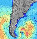 | 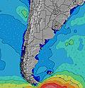 | 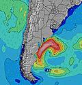 | 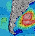 | 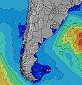 | ||||||||||||||
Wave Height (m) Direction Period (s) | S 11 | SSE 11 | SSE 11 | SSE 11 | SE 10 | SE 10 | SE 9 | SE 9 | SE 9 | SE 8 | SE 8 | WSW 7 | SW 9 | S 14 | S 13 | SSE 14 | SSE 13 | SSE 12 | SW 7 | S 12 | SW 6 |
Wave Graph | |||||||||||||||||||||
160 | 161 | 183 | 146 | 104 | 77 | 52 | 40 | 28 | 25 | 10 | 762 | 1407 | 2440 | 1121 | 1090 | 724 | 392 | 449 | 341 | 315 | |
Wind (km/h) | |||||||||||||||||||||
Wind State on-shore cross-onshore cross-shore cross-offshore off-shore glassy | cross-off | cross | cross-on | cross-on | cross-on | cross-off | cross-off | cross-off | cross-off | cross-off | off | cross | cross | cross-off | cross-off | cross-off | cross | cross | cross-on | cross-on | cross-on |
High Tide | 10:41AM0.27m | 11:23PM0.24m | 4:41AM0.20m | 00:14AM0.22m | 5:39AM0.21m | 12:08PM0.32m | 1:08AM0.21m | 6:41AM0.20m | 1:00PM0.34m | 2:08AM0.19m | 7:52AM0.19m | 1:58PM0.36m | 3:11AM0.18m | 3:02PM0.37m | 4:14AM0.18m | 4:10PM0.38m | |||||
Low Tide | 7:12PM0.07m | 7:30AM0.16m | 7:59PM0.05m | 3:05AM0.17m | 8:49PM0.03m | 3:50AM0.17m | 9:42PM0.02m | 4:43AM0.16m | 10:40PM0.01m | 5:49AM0.15m | 11:42PM0.01m | 7:07AM0.14m | 00:46AM0.02m | ||||||||
7:31 | — | — | 7:31 | — | — | 7:30 | — | — | 7:28 | — | — | 7:28 | — | — | 7:26 | — | — | 7:26 | — | — | |
— | 5:59 | — | — | 5:59 | — | — | 6:00 | — | — | 6:00 | — | — | 6:00 | — | — | 6:01 | — | — | 6:02 | — | |
mm | — | 1 | 2 | — | — | — | 1 | 1 | — | — | 16 | 1 | — | — | — | — | — | — | — | — | — |
Temp °C | 13 | 14 | 14 | 14 | 14 | 13 | 15 | 15 | 15 | 18 | 20 | 12 | 10 | 12 | 11 | 12 | 13 | 10 | 9 | 9 | 9 |
Feels °C | 10 | 11 | 13 | 12 | 11 | 11 | 15 | 14 | 14 | 16 | 18 | 3 | -1 | 2 | 3 | 6 | 8 | 5 | 1 | 2 | 3 |
Swell 1 Height (m) Direction Period (s) | S 11 | SSE 11 | SSE 11 | SSE 11 | SE 10 | SE 6 | SE 6 | SE 9 | SE 9 | SE 8 | SE 8 | E 6 | — | S 14 | S 13 | SSE 14 | SSE 13 | SSE 12 | SSE 12 | S 12 | SSE 11 |
160 | 161 | 183 | 146 | 104 | 32 | 32 | 40 | 28 | 25 | 10 | 3 | — | 2440 | 1121 | 1090 | 724 | 392 | 271 | 341 | 128 | |
Swell 2 Height (m) Direction Period (s) | ENE 9 | ENE 9 | ENE 8 | ENE 8 | ENE 7 | SE 10 | SE 9 | ENE 7 | ENE 7 | ENE 7 | S 9 | SE 8 | — | — | — | WSW 6 | — | E 10 | E 10 | E 10 | E 9 |
25 | 8 | 7 | 6 | 5 | 77 | 52 | 15 | 9 | 9 | 2 | 3 | — | — | — | 25 | — | 2 | 2 | 2 | 2 | |
Swell 3 Height (m) Direction Period (s) | — | — | — | — | — | ENE 7 | ENE 7 | — | S 8 | ESE 6 | S 7 | S 9 | — | — | — | — | — | — | — | — | — |
— | — | — | — | — | 16 | 9 | — | 1 | 3 | 1 | 1 | — | — | — | — | — | — | — | — | — | |
Wind waves Height (m) Direction Period (s) | ENE 9 | ENE 3 | ESE 3 | SSE 4 | SSE 5 | SE 6 | — | ESE 6 | ESE 6 | E 4 | ENE 4 | WSW 7 | SW 9 | WSW 7 | W 6 | W 5 | W 5 | SW 6 | SW 7 | SW 6 | SW 6 |
31 | 3 | 5 | 9 | 19 | 32 | — | 22 | 18 | 8 | 31 | 762 | 1407 | 471 | 116 | 29 | 34 | 138 | 449 | 222 | 315 | |
Nearest Offshore or Glassy | |||||||||||||||||||||
Distance (km) | 0 | 105 | 18 | 111 | 433 | 0 | 0 | 0 | 7 | 105 | 286 | 645 | 149 | 676 | 64 | 18 | 23 | 18 | 69 | 240 | 18 |
Best forecast wave conditions in Uruguay - South | |||||||||||||||||||||
Best forecast wave conditions in Uruguay | |||||||||||||||||||||
Header Global | |||||||||||||||||||||
- Map Icons:
 Break
Break Live Wave Height (m)
 Live Wind Speed (km/h)
 Surf Rating (10 Max)
 Ocean Swells (m)
- Wind Speed (km/h)
Latest Updates


FREE! Surf-Forecast.com widget for your website
The surf report / weather widget below is available to embed on third party websites free of charge and provides a summary of our Club del la Playa surf forecast. Simply grab the html code snippet that we provide and paste it into your own site. You can choose your preferred language and metric/imperial units for the surf forecast feed to suit users of your site. Click here to get the code.
Information about the Club del la Playa Surf forecast
The above surf forecast table for Club del la Playa provides essential information for determining whether the surfing conditions will be good over the next 16 days. A general guide to surfing at Club del la Playa can be found by selecting the local surf guide option on the grey menu. Our Club del la Playa surf forecast is unique since it includes wave energy (power) that defines the real feel of the surf rather than just the height or the period. If you surf the same spot (Club del la Playa) regularly then make a mental note of the wave energy from the surf forecast table each time you go. Very soon you may start to choose your surf days based on the wave energy alone combined with our forecast of favourable offshore wind conditions. Our star ratings will help here and of course you will also find the usual wave height and period predictions on our surf forecasts as well as a full break down of the swell components under our advanced users option (to reveal that, click the little Einstein character under the tide times).
Further information to help with frequently asked questions about our surf forecast for Club del la Playa may be found under the help tab on the top menu and also by moving your mouse over the question marks on the surf forecast table itself. Please always bear in mind that the forecast is for near-shore open water and local factors at each surf break influence the actual breaking wave height, such as the beach / reef profile, water depths offshore and shelter.
Are you planning a holiday in Uruguay - South? If you are looking for accommodation near Club del la Playa, camping, hotels and holiday cottages in Uruguay - South, consider staying in Maldonado which is 15 km (9 miles) away. Other places in and around Uruguay - South where you can find information about places to rent, and car hire include San Carlos which is 16 km (10 miles) away, Rocha, La Paloma and Minas.
 Nearest