

Surf Forecasts:

Chabela (Playas de villamil) surf forecast from 20 Jul 2026:
- Best quality surf: Sunday 26 Jul, 7AM (local time) - 3ft (0.9m), 17s period, WSW swell with glassy winds.
- Most powerful swell: Monday 27 Jul, 10AM (local time) - 3.5ft (1.1m), 18s period, WSW swell with 768 kJ wave energy.
- Next surfable swell (1★+): Sunday 26 Jul, 7AM (local time) - 3ft (0.9m), 17s period with WSW swell.
Best Forecast Surf Conditions for Chabela (Playas de villamil) this week:
The surf forecast for Chabela (Playas de villamil) over the next 16 days: The first swell (rated 1 star or higher) is forecast to arrive on Sunday (Jul 26) at 7AM. The primary swell is predicted to be 0.9m and 17s period with a secondary swell of 0.6m and 5s. The wind is predicted to be glassy as the swell arrives.
The most powerful waves expected at Chabela (Playas de villamil) in the next 16 days are 1.1m 18s and forecast to arrive on Monday (Jul 27) at 10AM. Winds are predicted to be cross-onshore at the time the swell arrives.
| Wave Type | Time (-05) & Date | Wave Height & Period |
|---|---|---|
| Next good surf (1 star+) | 7AM (Sun 26th Jul) | 3ft (0.9m) 17s |
| Best Surf | 7AM (Sun 26th Jul) | 3ft (0.9m) 17s |
| Most Powerful | 10AM (Mon 27th Jul) | 3.5ft (1.1m) 18s |
Table - best surf conditions forecast for Chabela (Playas de villamil) over the next 16 days.
The Lowdown
Alright folks, Rusty here. Let’s break it down. We’ve got a bit of a flat spell on the cards for the next week and a half, with only a flicker of hope towards the end of the month.
The only spot on the radar is Chabela, a point break in Playas de Villamil that’s fairly consistent and a good one for beginners. The water is sitting at a warm 82°, which is far warmer than normal for this time of year – you’ll be in boardies for sure.
For the first few days, from Monday the 20th right through to Thursday the 24th, it’s pretty grim. Swell is tiny, under 3ft, and the wind is mostly onshore or cross-onshore from the SW and W, chopping everything up. The wave energy is weak to moderate at best, ranging from 163 to 551. Honestly, it’s not worth paddling out for. The reports are all “poor surf conditions” – just leave the board in the shed.
Friday the 24th morning shows a slight glimmer with a 2ft swell from the WSW at 21 seconds, and the combined energy nudging up to 551, but it’s still rated marginal at best. The wind is light cross-onshore. That’s still a pass from me.
Saturday the 25th morning is the first real standout in the whole 16-day window. We’ve got a 3ft swell from the WSW, period at 19 seconds, and the energy is decent at 504. More importantly, the wind is light and variable from the SW, swinging onshore. That early session could be glassy and clean. The break is exposed to the SW swell, which matches the optimum direction. It’s a beginner-friendly spot, so it won’t be too heavy.
Sunday the 26th morning stays similar – 3ft swell at 17 seconds, energy at 475, and light WNW wind. It’s still clean, but the wind does shift cross-onshore later. The standout remains Saturday morning.
Then we hit a bit of a lag. Monday the 27th morning shows a 4ft swell at 18 seconds with energy climbing to 818, but the wind is cross-onshore and builds through the day. Tuesday the 28th morning has a 4ft swell at 16 seconds, energy at 970, but again, wind is onshore. Nobody wants to fight that.
The rest of the period into early August sees the swell dropping back under 3ft, with persistent cross-onshore wind and energy dropping to the 150-450 range. Nothing to write home about.
So, the real pick of the fortnight is the Saturday morning, 25th July, at Chabela. Light winds, clean 3ft groundswell, and a good spot for a relaxed paddle. Don’t expect much else.
Rusty.
Short Range ForecastMostly dry. Warm (max 25°C on Tue morning, min 23°C on Mon night). Wind will be generally light. | Days 4-6 Weather SummaryLight rain (total 2mm), mostly falling on Sat afternoon. Warm (max 25°C on Thu morning, min 23°C on Thu night). Wind will be generally light. | ||||||||||||||||||||
Monday 20 | Tuesday 21 | Wednesday 22 | Thursday 23 | Friday 24 | Saturday 25 | Sunday 26 | |||||||||||||||
AM | PM | Night | AM | PM | Night | AM | PM | Night | AM | PM | Night | AM | PM | Night | AM | PM | Night | AM | PM | Night | |
Swell Height Map | 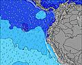 | 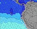 | 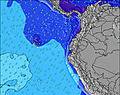 | 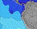 | 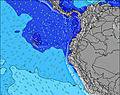 | 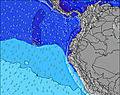 | 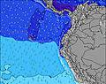 | ||||||||||||||
Wave Height (m) Direction Period (s) | SW 14 | SW 14 | WSW 13 | WSW 13 | WSW 12 | SW 7 | WSW 12 | WSW 11 | WSW 11 | SW 11 | WSW 24 | WSW 24 | WSW 21 | WSW 21 | WSW 20 | WSW 19 | WSW 19 | WSW 18 | WSW 17 | WSW 16 | WSW 20 |
Wave Graph | |||||||||||||||||||||
208 | 211 | 154 | 149 | 136 | 144 | 93 | 85 | 79 | 66 | 218 | 217 | 404 | 305 | 256 | 428 | 322 | 395 | 432 | 387 | 336 | |
Wind (km/h) | |||||||||||||||||||||
Wind State on-shore cross-onshore cross-shore cross-offshore off-shore glassy | on | on | on | cross-on | cross-on | cross-on | cross-on | cross-on | on | cross-on | cross-on | cross-on | cross-on | cross-on | on | on | cross-on | on | cross-on | cross-on | on |
High Tide | 9:12PM1.78m | 9:31AM1.94m | 10:09PM1.68m | 10:19AM1.81m | 11:10PM1.61m | 11:13AM1.70m | 00:16AM1.57m | 12:12PM1.64m | 1:20AM1.58m | 1:12PM1.63m | 2:17AM1.63m | 2:07PM1.66m | 3:06AM1.71m | ||||||||
Low Tide | 3:08PM0.43m | 3:13AM0.54m | 3:57PM0.50m | 4:04AM0.68m | 4:50PM0.55m | 5:01AM0.79m | 5:49PM0.58m | 6:07AM0.85m | 6:50PM0.58m | 7:14AM0.85m | 7:48PM0.54m | 8:15AM0.81m | 8:40PM0.47m | ||||||||
6:28 | — | — | 6:28 | — | — | 6:28 | — | — | 6:28 | — | — | 6:28 | — | — | 6:28 | — | — | 6:28 | — | — | |
— | 6:27 | — | — | 6:27 | — | — | 6:27 | — | — | 6:27 | — | — | 6:27 | — | — | 6:27 | — | — | 6:27 | — | |
mm | — | — | — | — | — | — | — | — | — | — | — | — | — | — | — | — | 1 | 1 | — | — | — |
Temp °C | 24 | 24 | 24 | 25 | 24 | 24 | 25 | 25 | 24 | 25 | 25 | 24 | 24 | 24 | 23 | 25 | 25 | 24 | 25 | 25 | 24 |
Feels °C | 25 | 24 | 26 | 26 | 23 | 25 | 25 | 25 | 25 | 26 | 24 | 25 | 26 | 25 | 25 | 27 | 26 | 26 | 26 | 25 | 24 |
Swell 1 Height (m) Direction Period (s) | SW 14 | SW 14 | WSW 13 | WSW 13 | WSW 12 | SW 7 | SW 6 | WSW 11 | SW 5 | SW 6 | SW 11 | SW 11 | SW 11 | SW 11 | WSW 20 | WSW 19 | WSW 19 | WSW 18 | WSW 17 | WSW 16 | SW 5 |
208 | 211 | 154 | 149 | 136 | 144 | 56 | 85 | 32 | 40 | 57 | 117 | 97 | 101 | 256 | 428 | 322 | 395 | 432 | 387 | 35 | |
Swell 2 Height (m) Direction Period (s) | W 21 | W 21 | W 20 | SW 5 | W 19 | WSW 12 | WSW 12 | W 18 | WSW 11 | SW 11 | WSW 24 | WSW 24 | WSW 21 | WSW 21 | WSW 11 | SW 11 | WSW 11 | SW 11 | SW 5 | WSW 20 | WSW 15 |
8 | 8 | 31 | 16 | 30 | 94 | 93 | 26 | 79 | 57 | 218 | 217 | 404 | 305 | 85 | 55 | 76 | 29 | 14 | 336 | 249 | |
Swell 3 Height (m) Direction Period (s) | — | W 21 | W 20 | W 20 | W 21 | W 18 | W 18 | SW 19 | W 18 | WSW 26 | W 16 | W 16 | WSW 16 | WSW 16 | W 16 | WSW 14 | SW 15 | WSW 22 | SW 11 | W 14 | WSW 20 |
— | 34 | 31 | 31 | 9 | 26 | 26 | 15 | 24 | 66 | 21 | 21 | 50 | 48 | 19 | 21 | 8 | 91 | 29 | 16 | 336 | |
Wind waves Height (m) Direction Period (s) | SW 4 | SW 4 | SW 5 | — | WSW 5 | — | — | WSW 6 | — | — | SW 6 | WSW 4 | — | WSW 4 | — | — | WSW 4 | SW 4 | — | WSW 3 | — |
9 | 14 | 25 | — | 17 | — | — | 47 | — | — | 32 | 6 | — | 4 | — | — | 3 | 10 | — | 8 | — | |
Nearest Offshore or Glassy | |||||||||||||||||||||
Distance (km) | 70 | 1099 | 70 | 73 | 1052 | 73 | 73 | 1106 | 73 | 73 | 1099 | 73 | 73 | 73 | 70 | 70 | 73 | 70 | 65 | 821 | 119 |
Best forecast wave conditions in Guayas | |||||||||||||||||||||
Best forecast wave conditions in Ecuador | |||||||||||||||||||||
Header Global | |||||||||||||||||||||
- Map Icons:
 Break
Break Live Wave Height (m)
 Live Wind Speed (km/h)
 Surf Rating (10 Max)
 Ocean Swells (m)
- Wind Speed (km/h)


FREE! Surf-Forecast.com widget for your website
The surf report / weather widget below is available to embed on third party websites free of charge and provides a summary of our Chabela (Playas de villamil) surf forecast. Simply grab the html code snippet that we provide and paste it into your own site. You can choose your preferred language and metric/imperial units for the surf forecast feed to suit users of your site. Click here to get the code.
Information about the Chabela (Playas de villamil) Surf forecast
The above surf forecast table for Chabela (Playas de villamil) provides essential information for determining whether the surfing conditions will be good over the next 16 days. A general guide to surfing at Chabela (Playas de villamil) can be found by selecting the local surf guide option on the grey menu. Our Chabela (Playas de villamil) surf forecast is unique since it includes wave energy (power) that defines the real feel of the surf rather than just the height or the period. If you surf the same spot (Chabela (Playas de villamil)) regularly then make a mental note of the wave energy from the surf forecast table each time you go. Very soon you may start to choose your surf days based on the wave energy alone combined with our forecast of favourable offshore wind conditions. Our star ratings will help here and of course you will also find the usual wave height and period predictions on our surf forecasts as well as a full break down of the swell components under our advanced users option (to reveal that, click the little Einstein character under the tide times).
Further information to help with frequently asked questions about our surf forecast for Chabela (Playas de villamil) may be found under the help tab on the top menu and also by moving your mouse over the question marks on the surf forecast table itself. Please always bear in mind that the forecast is for near-shore open water and local factors at each surf break influence the actual breaking wave height, such as the beach / reef profile, water depths offshore and shelter.
 Nearest