

Surf Forecasts:

Hellesto surf forecast from 31 Jul 2026:
- Best quality surf: Wednesday 5 Aug, 8AM (local time) - 2.5ft (0.7m), 7s period, NW swell with cross-offshore winds.
- Most powerful swell: Sunday 2 Aug, 2AM (local time) - 4.5ft (1.4m), 7s period, W swell with 171 kJ wave energy.
- Next surfable swell (1★+): Wednesday 5 Aug, 8AM (local time) - 2.5ft (0.7m), 7s period with NW swell.
Best Forecast Surf Conditions for Hellesto this week:
The surf forecast for Hellesto over the next 16 days: The first swell (rated 1 star or higher) is forecast to arrive on Wednesday (Aug 05) at 8AM. The primary swell is predicted to be 0.7m and 7s period. The wind is predicted to be cross-offshore as the swell arrives.
The most powerful waves expected at Hellesto in the next 16 days are 1.4m 7s and forecast to arrive on Sunday (Aug 02) at 2AM. Winds are predicted to be cross-onshore at the time the swell arrives. The largest open ocean swell (not directed at the beach) is 0.5m 4s period and expected on Saturday (Aug 01) at 11AM.
| Wave Type | Time (CEST) & Date | Wave Height & Period |
|---|---|---|
| Next good surf (1 star+) | 8AM (Wed 5th Aug) | 2.5ft (0.7m) 7s |
| Best Surf | 8AM (Wed 5th Aug) | 2.5ft (0.7m) 7s |
| Most Powerful | 2AM (Sun 2nd Aug) | 4.5ft (1.4m) 7s |
Table - best surf conditions forecast for Hellesto over the next 16 days.
The Lowdown
Alright folks, Rusty here. Let’s get into it. Hellesto’s looking at a pretty grim run over the next couple of weeks. There’s a big dry spell for the first ten days or so, so don’t bother rushing down there just yet.
We start off Friday morning, July 31st, with a tiny 2 ft swell from the SW, but the wind is onshore and it’s just poor. That sets the tone for a while. The combined energy is weak, only 43, and the water is sitting at 56°F, which is a whopping 4°F colder than usual for this time of year. That’s a notable chill.
Through the first week of August, it’s a real struggle. The swell stays small, mostly under 3 ft, and when it is there, the wind is almost always cross-onshore or onshore. There’s a brief moment on Wednesday morning, August 5th, with a tiny 2 ft NW swell and a light cross-offshore breeze from the ENE, making it surfable but very ordinary. It’s barely a blip. The energy is low, around 40, and it’s not enough to get excited about.
The pattern of poor surf and choppy conditions continues right through to the weekend of August 8th-9th. Swell stays under 4 ft, and the wind is either howling from the NW or cross-onshore, just making a mess of things. The combined energy on Sunday afternoon, August 9th, does hit 108, but with a 4 ft W swell and strong onshore winds, it’s not a paddle surfer’s friend. Looks more like a kiteboarding setup than anything else.
The real change, and the only standout in this whole outlook, comes on Tuesday, August 11th. The morning session shows a 4 ft NW swell with a 7-second period, but the wind shifts to a light SSE breeze, turning cross-offshore. The combined energy is moderate at 239, and the forecast says "expect good surf conditions." That’s the best call in the whole 16-day window. The swell direction (NW) is right on the money for Hellesto’s optimum. The light offshore wind will keep the lines clean, even if it’s a bit of a medium-period swell. This is the one to aim for if you can get out.
After that, the forecast drops back into mediocrity. By Wednesday, August 12th, the wind is still cross-offshore but much stronger, and the swell drops. It’s a long gap after that, with nothing but small, choppy, or onshore swell for the rest of the run into the middle of August.
So, bottom line: a long, quiet stretch. The best bet is Tuesday morning, August 11th. For the rest, you’re better off waiting for a change in the charts.
Rusty.
Short Range ForecastModerate rain (total 11mm), heaviest on Sat night. Very mild (max 14°C on Sat morning, min 12°C on Sat night). Wind will be generally light. | Days 4-6 Weather SummarySome drizzle, heaviest during Wed morning. Very mild (max 16°C on Tue night, min 11°C on Mon night). Wind will be generally light. | ||||||||||||||||||||
Friday 31 | Saturday 1 | Sunday 2 | Monday 3 | Tuesday 4 | Wednesday 5 | Thursday 6 | |||||||||||||||
AM | PM | Night | AM | PM | Night | AM | PM | Night | AM | PM | Night | AM | PM | Night | AM | PM | Night | AM | PM | Night | |
Swell Height Map | 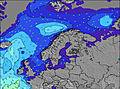 | 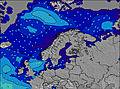 | 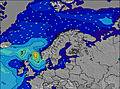 | 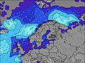 | 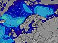 | 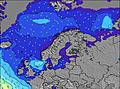 | 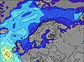 | ||||||||||||||
Wave Height (m) Direction Period (s) | SW 6 | WSW 6 | W 6 | W 6 | W 5 | W 7 | WSW 6 | W 6 | WNW 8 | NW 10 | W 6 | NW 8 | NW 8 | NW 8 | NW 6 | NW 6 | NW 4 | NW 5 | NW 6 | NW 4 | NW 4 |
Wave Graph | |||||||||||||||||||||
30 | 85 | 49 | 36 | 53 | 171 | 69 | 77 | 43 | 44 | 38 | 69 | 31 | 14 | 26 | 40 | 29 | 22 | 24 | 36 | 24 | |
Wind (km/h) | |||||||||||||||||||||
Wind State on-shore cross-onshore cross-shore cross-offshore off-shore glassy | on | cross-on | cross-on | cross-off | cross-on | cross-on | on | cross-on | on | on | cross-on | cross | cross | cross-on | glassy | cross-off | cross | cross-on | cross-on | cross-on | cross-on |
High Tide | 12:49PM0.28m | 1:08AM0.34m | 1:26PM0.29m | 1:42AM0.35m | 2:02PM0.29m | 2:16AM0.35m | 2:38PM0.29m | 2:50AM0.34m | 3:13PM0.28m | 3:24AM0.32m | 3:49PM0.27m | 4:01AM0.30m | 4:28PM0.26m | 4:45AM0.28m | |||||||
Low Tide | 6:22PM0.04m | 7:07AM0.04m | 6:50PM0.03m | 7:32AM0.03m | 7:22PM0.03m | 8:02AM0.02m | 7:58PM0.03m | 8:36AM0.02m | 8:36PM0.04m | 9:15AM0.03m | 9:20PM0.05m | 10:00AM0.05m | 10:10PM0.06m | ||||||||
5:22 | — | — | 5:24 | — | — | 5:26 | — | — | 5:28 | — | — | 5:31 | — | — | 5:33 | — | — | 5:35 | — | — | |
— | — | 10:04 | — | — | 10:01 | — | — | 9:59 | — | — | 9:57 | — | — | 9:54 | — | — | 9:52 | — | — | 9:50 | |
mm | 1 | — | 2 | 1 | 1 | 5 | 1 | — | — | — | — | — | — | — | — | 1 | — | — | — | 1 | — |
Temp °C | 13 | 13 | 13 | 14 | 14 | 13 | 13 | 13 | 13 | 12 | 13 | 13 | 13 | 15 | 16 | 14 | 15 | 14 | 13 | 13 | 13 |
Feels °C | 9 | 9 | 10 | 10 | 10 | 9 | 9 | 8 | 9 | 8 | 8 | 8 | 9 | 11 | 15 | 13 | 14 | 13 | 10 | 5 | 3 |
Swell 1 Height (m) Direction Period (s) | SW 6 | WSW 6 | W 6 | W 6 | NW 8 | W 7 | WNW 7 | W 10 | WNW 8 | W 6 | W 6 | NW 8 | NW 8 | NW 8 | NW 6 | S 6 | S 6 | — | S 5 | S 6 | W 11 |
30 | 85 | 49 | 36 | 39 | 171 | 36 | 2 | 43 | 24 | 38 | 69 | 31 | 14 | 26 | 1 | 1 | — | 1 | 1 | 2 | |
Swell 2 Height (m) Direction Period (s) | W 8 | W 8 | SW 6 | — | S 4 | — | — | — | SW 5 | NW 10 | NW 9 | W 10 | — | W 9 | W 9 | — | — | — | W 10 | W 10 | S 6 |
5 | 1 | 15 | — | 3 | — | — | — | 16 | 44 | 29 | 2 | — | 2 | 2 | — | — | — | 2 | 2 | 1 | |
Swell 3 Height (m) Direction Period (s) | NW 6 | W 8 | S 4 | — | — | — | — | — | W 9 | WNW 8 | — | — | — | — | W 9 | — | — | — | S 7 | — | — |
2 | 5 | 2 | — | — | — | — | — | 2 | 13 | — | — | — | — | 2 | — | — | — | 1 | — | — | |
Wind waves Height (m) Direction Period (s) | WNW 4 | — | — | SSW 4 | W 5 | W 6 | WSW 6 | W 6 | W 6 | — | — | — | — | — | — | NW 6 | NW 4 | NW 5 | NW 6 | NW 4 | NW 4 |
6 | — | — | 10 | 53 | 114 | 69 | 77 | 34 | — | — | — | — | — | — | 40 | 29 | 22 | 24 | 36 | 24 | |
Nearest Offshore or Glassy | |||||||||||||||||||||
Distance (km) | 890 | 503 | 595 | 1201 | 1216 | 518 | 595 | 689 | 460 | 346 | 456 | 510 | 587 | 565 | 3 | 0 | 578 | 265 | 595 | 1216 | 625 |
Best forecast wave conditions in South and West Norway | |||||||||||||||||||||
Best forecast wave conditions in Norway | |||||||||||||||||||||
Header Global | |||||||||||||||||||||
- Map Icons:
 Break
Break Live Wave Height (m)
 Live Wind Speed (km/h)
 Surf Rating (10 Max)
 Ocean Swells (m)
- Wind Speed (km/h)
Latest Updates


FREE! Surf-Forecast.com widget for your website
The surf report / weather widget below is available to embed on third party websites free of charge and provides a summary of our Hellesto surf forecast. Simply grab the html code snippet that we provide and paste it into your own site. You can choose your preferred language and metric/imperial units for the surf forecast feed to suit users of your site. Click here to get the code.
Information about the Hellesto Surf forecast
The above surf forecast table for Hellesto provides essential information for determining whether the surfing conditions will be good over the next 16 days. A general guide to surfing at Hellesto can be found by selecting the local surf guide option on the grey menu. Our Hellesto surf forecast is unique since it includes wave energy (power) that defines the real feel of the surf rather than just the height or the period. If you surf the same spot (Hellesto) regularly then make a mental note of the wave energy from the surf forecast table each time you go. Very soon you may start to choose your surf days based on the wave energy alone combined with our forecast of favourable offshore wind conditions. Our star ratings will help here and of course you will also find the usual wave height and period predictions on our surf forecasts as well as a full break down of the swell components under our advanced users option (to reveal that, click the little Einstein character under the tide times).
Further information to help with frequently asked questions about our surf forecast for Hellesto may be found under the help tab on the top menu and also by moving your mouse over the question marks on the surf forecast table itself. Please always bear in mind that the forecast is for near-shore open water and local factors at each surf break influence the actual breaking wave height, such as the beach / reef profile, water depths offshore and shelter.
Are you planning a holiday in South and West Norway? If you are looking for accommodation near Hellesto, camping, hotels and holiday cottages in South and West Norway, consider staying in Sandnes which is 10 km (6 miles) away. Other places in and around South and West Norway where you can find information about places to rent, and car hire include Tananger which is 10 km (6 miles) away, Stavanger, Randaberg and Tau.
 Nearest