

Surf Forecasts:

Zepotonengo surf forecast from 2 Aug 2026:
- Best quality surf: Thursday 6 Aug, 9PM (local time) - 2.5ft (0.7m), 18s period, SSW swell with glassy winds.
- Most powerful swell: Saturday 8 Aug, 12PM (local time) - 4.5ft (1.3m), 15s period, SSW swell with 721 kJ wave energy.
- Next surfable swell (1★+): Sunday 2 Aug, 9PM (local time) - 2ft (0.6m), 14s period with SW swell.
Best Forecast Surf Conditions for Zepotonengo this week:
The surf forecast for Zepotonengo over the next 16 days: The first swell (rated 1 star or higher) is forecast to arrive on Sunday (Aug 02) at 9PM. The primary swell is predicted to be 0.6m and 14s period with a secondary swell of 0.7m and 8s. Another secondary swell of 0.6m and 12s is also forecast. Another secondary swell of 0.6m and 4s is also forecast. The wind is predicted to be cross-offshore as the swell arrives.
The most powerful waves expected at Zepotonengo in the next 16 days are 1.3m 15s and forecast to arrive on Saturday (Aug 08) at 12PM. Winds are predicted to be cross-onshore at the time the swell arrives. The largest open ocean swell (not directed at the beach) is 0.5m 4s period and expected on Monday (Aug 03) at 6AM.
| Wave Type | Time (CST) & Date | Wave Height & Period |
|---|---|---|
| Next good surf (1 star+) | 9PM (Sun 2nd Aug) | 2ft (0.6m) 14s |
| Best Surf | 9PM (Thu 6th Aug) | 2.5ft (0.7m) 18s |
| Most Powerful | 12PM (Sat 8th Aug) | 4.5ft (1.3m) 15s |
Table - best surf conditions forecast for Zepotonengo over the next 16 days.
The Lowdown
Alright folks, Rusty here. Let’s have a look at what’s on offer at Zepotonengo for the next couple of weeks.
We’re starting off with a good run of surf. The first real green light is this Sunday morning, August 2nd. The swell is small, around 3ft from the SSW, but with a clean 12-second period and a cross-off WNW breeze at 3 mph, it’ll be tidy. The water is a touch warmer than normal at 87°, which is nice. The combined wave energy is moderate (304). This is a beginner-friendly spot and it’s fairly consistent, so it’s a good place to get the board wet, though crowds are possible here.
Monday morning, August 3rd, is a standout. The swell bumps up to 3ft from the SSW, but the period stretches to a very long 16 seconds – that’s proper groundswell energy. The wind is glassy (0 mph from the NNW). The combined energy jumps to 490 (moderate). This is a long-period swell, so at a beach setup it might throw a bit straight, but for a beginner-friendly spot, the clean conditions will make it super fun.
The run of clean mornings continues through Tuesday and Wednesday, with glassy conditions and small, clean swell. Nothing huge, but consistent.
Now, the real gem appears on Friday morning, August 7th. We’ve got 3ft of swell from the SSW, but the period is a very long 18 seconds, driving a combined energy of 696 (strong). The wind is glassy from the west at 3 mph. This is going to be special. Expect excellent, clean waves with real push.
The next morning, Saturday August 8th, is also a top pick. The swell picks up to 4ft from the SSW, 16-second period, and glassy conditions with combined energy at 753 (strong). That’s the best combo of size and cleanliness in the whole run.
We then have a solid week of smaller, but still fun, morning sessions with glassy or cross-off winds, until we hit the big one. On Friday morning, August 14th, we get a 4ft SSW groundswell with an 18-second period and glassy wind. The combined energy hits 1225 (very strong). This is excellent for experienced surfers – the size is getting up there, so it’s not for the groms. The long period will make it powerful, and the glassy conditions will make it a dream.
The following Saturday morning, August 15th, and Sunday morning, August 16th, offer more very good conditions with 4ft to 4ft SSW swell, 16-second periods, and glassy wind. The energy is still strong (922 and 721).
Finally, Monday morning, August 17th, wraps it up with another glassy morning, 4ft from the SW, 16-second period, and combined energy of 844 (strong).
Overall, don’t sleep on the mornings. The afternoons get a bit messy with cross-on wind, so dawn patrol is the call. The absolute best of the lot is Friday August 14th morning for the experienced crew, and Saturday August 8th morning for everyone else. The water is a touch warmer than normal right now, which is a nice bonus.
Rusty.
Short Range ForecastModerate rain (total 13mm), heaviest on Sun night. Warm (max 31°C on Sun morning, min 26°C on Sun night). Wind will be generally light. | Days 4-6 Weather SummaryLight rain (total 4mm), mostly falling on Thu night. Warm (max 31°C on Wed morning, min 25°C on Thu night). Wind will be generally light. | ||||||||||||||||||||
Sunday 2 | Monday 3 | Tuesday 4 | Wednesday 5 | Thursday 6 | Friday 7 | Saturday 8 | |||||||||||||||
AM | PM | Night | AM | PM | Night | AM | PM | Night | AM | PM | Night | AM | PM | Night | AM | PM | Night | AM | PM | Night | |
Swell Height Map |  |  |  | 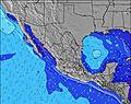 | 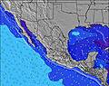 | 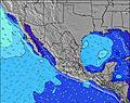 | 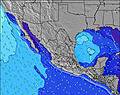 | ||||||||||||||
Wave Height (m) Direction Period (s) | SSW 12 | SW 14 | SW 13 | SSW 16 | SW 13 | SSW 13 | SSW 13 | SW 15 | S 9 | SW 15 | SW 14 | SW 14 | SW 13 | SW 13 | SSW 18 | SSW 18 | SSW 17 | SSW 16 | SSW 16 | SSW 15 | SSW 14 |
Wave Graph | |||||||||||||||||||||
158 | 123 | 113 | 382 | 164 | 98 | 111 | 107 | 76 | 104 | 103 | 164 | 111 | 212 | 214 | 395 | 481 | 532 | 612 | 584 | 437 | |
Wind (km/h) | |||||||||||||||||||||
Wind State on-shore cross-onshore cross-shore cross-offshore off-shore glassy | cross-off | cross | cross-off | glassy | cross-on | cross-off | glassy | cross-on | off | glassy | on | off | glassy | cross-on | off | glassy | cross-on | cross-off | glassy | cross-on | cross-off |
High Tide | 5:21PM0.96m | 5:58AM1.00m | 5:58PM0.92m | 6:38AM1.06m | 6:35PM0.89m | 7:19AM1.11m | 7:15PM0.85m | 8:04AM1.14m | 7:58PM0.82m | 8:53AM1.16m | 8:47PM0.80m | 9:47AM1.17m | 9:42PM0.78m | ||||||||
Low Tide | 11:16AM0.24m | 11:35PM0.14m | 12:03PM0.24m | 00:07AM0.12m | 12:49PM0.23m | 00:42AM0.09m | 1:36PM0.23m | 1:21AM0.06m | 2:25PM0.24m | 2:04AM0.04m | 3:18PM0.24m | 2:53AM0.03m | 4:16PM0.25m | ||||||||
6:09 | — | — | 6:09 | — | — | 6:09 | — | — | 6:09 | — | — | 6:09 | — | — | 6:09 | — | — | 6:09 | — | — | |
— | 6:57 | — | — | 6:57 | — | — | 6:55 | — | — | 6:55 | — | — | 6:54 | — | — | 6:54 | — | — | 6:53 | — | |
mm | — | — | 8 | — | 1 | — | — | — | 4 | — | 1 | — | — | — | 3 | — | — | — | — | 1 | 4 |
Temp °C | 31 | 31 | 28 | 31 | 31 | 29 | 31 | 31 | 29 | 31 | 31 | 28 | 30 | 30 | 28 | 30 | 31 | 28 | 30 | 30 | 27 |
Feels °C | 33 | 33 | 32 | 34 | 34 | 33 | 34 | 33 | 33 | 34 | 34 | 32 | 32 | 32 | 32 | 32 | 33 | 31 | 32 | 32 | 32 |
Swell 1 Height (m) Direction Period (s) | SSW 12 | SSW 12 | ESE 8 | SSW 16 | SW 13 | S 7 | S 8 | S 8 | S 9 | S 9 | S 8 | S 8 | S 8 | SW 13 | S 8 | SSW 18 | SSW 17 | SSW 16 | SSW 16 | SSW 15 | SSW 14 |
158 | 123 | 56 | 382 | 164 | 38 | 45 | 45 | 76 | 76 | 69 | 68 | 66 | 212 | 78 | 395 | 481 | 532 | 612 | 584 | 437 | |
Swell 2 Height (m) Direction Period (s) | SW 14 | SW 14 | SSW 12 | SW 13 | SE 7 | SSW 13 | SSW 13 | SW 15 | SSW 12 | SW 15 | SW 14 | SW 14 | SW 13 | S 8 | SW 13 | SW 13 | SW 12 | S 8 | SE 10 | SE 9 | SE 8 |
125 | 118 | 109 | 83 | 22 | 98 | 111 | 107 | 58 | 104 | 103 | 164 | 111 | 66 | 175 | 238 | 181 | 63 | 98 | 123 | 69 | |
Swell 3 Height (m) Direction Period (s) | ESE 7 | ESE 9 | SW 13 | SE 7 | S 11 | SW 12 | SW 12 | SW 12 | SW 15 | SW 12 | SW 12 | SW 20 | S 12 | SW 18 | SSW 18 | SSE 8 | SSE 8 | SW 12 | S 8 | S 9 | SW 11 |
19 | 34 | 113 | 25 | 37 | 53 | 50 | 51 | 76 | 36 | 34 | 97 | 26 | 159 | 214 | 63 | 37 | 114 | 43 | 16 | 58 | |
Wind waves Height (m) Direction Period (s) | W 4 | W 3 | W 4 | WNW 4 | W 8 | — | — | WSW 8 | WNW 7 | — | SSE 6 | WNW 6 | — | — | — | — | — | — | — | — | — |
2 | 5 | 8 | 6 | 18 | — | — | 13 | 9 | — | 4 | 3 | — | — | — | — | — | — | — | — | — | |
Nearest Offshore or Glassy | |||||||||||||||||||||
Distance (km) | 0 | 1172 | 0 | 0 | 1172 | 0 | 0 | 573 | 0 | 0 | 151 | 0 | 0 | 151 | 0 | 0 | 671 | 0 | 0 | 151 | 0 |
Best forecast wave conditions in Oaxaca | |||||||||||||||||||||
Best forecast wave conditions in Mexico | |||||||||||||||||||||
Header Global | |||||||||||||||||||||
- Map Icons:
 Break
Break Live Wave Height (m)
 Live Wind Speed (km/h)
 Surf Rating (10 Max)
 Ocean Swells (m)
- Wind Speed (km/h)
Latest Updates


FREE! Surf-Forecast.com widget for your website
The surf report / weather widget below is available to embed on third party websites free of charge and provides a summary of our Zepotonengo surf forecast. Simply grab the html code snippet that we provide and paste it into your own site. You can choose your preferred language and metric/imperial units for the surf forecast feed to suit users of your site. Click here to get the code.
Information about the Zepotonengo Surf forecast
The above surf forecast table for Zepotonengo provides essential information for determining whether the surfing conditions will be good over the next 16 days. A general guide to surfing at Zepotonengo can be found by selecting the local surf guide option on the grey menu. Our Zepotonengo surf forecast is unique since it includes wave energy (power) that defines the real feel of the surf rather than just the height or the period. If you surf the same spot (Zepotonengo) regularly then make a mental note of the wave energy from the surf forecast table each time you go. Very soon you may start to choose your surf days based on the wave energy alone combined with our forecast of favourable offshore wind conditions. Our star ratings will help here and of course you will also find the usual wave height and period predictions on our surf forecasts as well as a full break down of the swell components under our advanced users option (to reveal that, click the little Einstein character under the tide times).
Further information to help with frequently asked questions about our surf forecast for Zepotonengo may be found under the help tab on the top menu and also by moving your mouse over the question marks on the surf forecast table itself. Please always bear in mind that the forecast is for near-shore open water and local factors at each surf break influence the actual breaking wave height, such as the beach / reef profile, water depths offshore and shelter.
Are you planning a holiday in Oaxaca? If you are looking for accommodation near Zepotonengo, camping, hotels and holiday cottages in Oaxaca, consider staying in Puerto Escondido which is 34 km (21 miles) away. Other places in and around Oaxaca where you can find information about places to rent, and car hire include Nopala which is 60 km (37 miles) away and Miahuatlan de Porfirio Diaz, 71 km (44 miles) away.
 Nearest