

Surf Forecasts:

Zancudo surf forecast from 19 Jul 2026:
- Best quality surf: Friday 24 Jul, 9AM (local time) - 1.5ft (0.5m), 24s period, SSW swell with glassy winds.
- Most powerful swell: Saturday 25 Jul, 3AM (local time) - 2.5ft (0.8m), 21s period, SSW swell with 521 kJ wave energy.
- Next surfable swell (1★+): Sunday 19 Jul, 6PM (local time) - 2.5ft (0.8m), 13s period with S swell.
Best Forecast Surf Conditions for Zancudo this week:
The surf forecast for Zancudo over the next 16 days: The first swell (rated 1 star or higher) is forecast to arrive on Sunday (Jul 19) at 6PM. The primary swell is predicted to be 0.8m and 13s period with a secondary swell of 0.7m and 6s. Another secondary swell of 1.1m and 6s is also forecast. The wind is predicted to be glassy as the swell arrives.
The most powerful waves expected at Zancudo in the next 16 days are 0.8m 21s and forecast to arrive on Saturday (Jul 25) at 3AM. Winds are predicted to be cross-offshore at the time the swell arrives.
| Wave Type | Time (CST) & Date | Wave Height & Period |
|---|---|---|
| Next good surf (1 star+) | 6PM (Sun 19th Jul) | 2.5ft (0.8m) 13s |
| Best Surf | 9AM (Fri 24th Jul) | 1.5ft (0.5m) 24s |
| Most Powerful | 3AM (Sat 25th Jul) | 2.5ft (0.8m) 21s |
Table - best surf conditions forecast for Zancudo over the next 16 days.
The Lowdown
Alright folks, Rusty here. Let’s take a look at what’s happening at Zancudo over the next couple of weeks.
First off, we’ve got a bit of a slow start. The first few days are pretty ordinary, with wave heights barely scraping 3 ft and a lot of cross-onshore wind messing things up. The water is sitting at 86°, which is a touch warmer than normal for this time of year, so that’s a nice little bonus for the paddle out.
The real story starts to build around the Friday, July 24th morning. That’s when we get a little spike in energy – the combined energy hits 410 (moderate) – and the conditions turn glassy. The swell is from the SSW, running 2 ft, but with a very long period of 24 seconds. That’s proper groundswell, and at Zancudo, a point break, it’ll wrap in nicely. The wind is glassy, so it’s going to be clean. Not a big wave, but the quality will be there.
Then, the standout window opens up. Sunday, July 26th morning through to Tuesday, July 28th afternoon is your best bet. The swell holds steady at 2 ft to 3 ft from the SSW, with periods between 18 and 19 seconds. The combined energy climbs from 403 (moderate) up to 536 (strong) on the Tuesday morning. And the wind? Glassy or near-calm on those mornings. That’s pure, clean, long-period groundswell wrapping around the point. It’s a fairly consistent break, and while crowds can be a thing sometimes, the quality of these sessions will make it worth sharing the lineup.
For the beginners out there, the swell never gets above 3 ft, so it’s all very manageable. But that long period (over 15 seconds) means the sets will have some punch, and the gaps between them will be longer. Paddling out will be easier, but you’ll want to be ready for the ones that do come.
After that Tuesday peak, the energy slowly drops off through the end of July and into the first few days of August. The mornings remain glassy, but the swell fades to 2 ft and the period drops. It’s still surfable, but that magic window is the one to aim for.
So, to sum it up: the first week has a slow start, but the real gold is from July 26th to July 28th. That’s where the swell, the wind, and the energy all line up for the best ride of the forecast.
Rusty.
Short Range ForecastHeavy rain (total 73mm), heaviest during Sun night. Warm (max 31°C on Sun morning, min 23°C on Mon night). Wind will be generally light. | Days 4-6 Weather SummaryHeavy rain (total 34mm), heaviest during Fri night. Warm (max 27°C on Thu morning, min 23°C on Thu night). Wind will be generally light. | ||||||||||||||||||||
Sunday 19 | Monday 20 | Tuesday 21 | Wednesday 22 | Thursday 23 | Friday 24 | Saturday 25 | |||||||||||||||
AM | PM | Night | AM | PM | Night | AM | PM | Night | AM | PM | Night | AM | PM | Night | AM | PM | Night | AM | PM | Night | |
Swell Height Map |  |  |  | 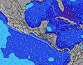 | 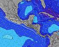 |  | 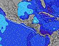 | ||||||||||||||
Wave Height (m) Direction Period (s) | S 12 | S 12 | S 13 | S 12 | S 12 | S 12 | S 12 | S 11 | S 11 | S 7 | SSW 7 | SSW 7 | SSW 7 | SSW 26 | SSW 7 | SSW 24 | SSW 24 | SSW 21 | SSW 21 | SSW 20 | SSW 19 |
Wave Graph | |||||||||||||||||||||
146 | 196 | 215 | 148 | 146 | 139 | 132 | 94 | 66 | 63 | 77 | 48 | 63 | 132 | 53 | 314 | 108 | 359 | 260 | 221 | 428 | |
Wind (km/h) | |||||||||||||||||||||
Wind State on-shore cross-onshore cross-shore cross-offshore off-shore glassy | cross-on | cross-on | cross-on | glassy | glassy | glassy | glassy | cross-on | glassy | glassy | glassy | glassy | glassy | glassy | glassy | glassy | cross-on | cross-off | cross-off | cross-off | cross-off |
High Tide | 6:33PM2.79m | 7:01AM2.94m | 7:22PM2.60m | 7:47AM2.77m | 8:14PM2.41m | 8:36AM2.60m | 9:10PM2.26m | 9:30AM2.46m | 10:13PM2.16m | 10:30AM2.38m | 11:19PM2.13m | 11:31AM2.36m | 00:21AM2.17m | ||||||||
Low Tide | 12:29PM0.37m | 00:42AM0.35m | 1:18PM0.50m | 1:28AM0.56m | 2:09PM0.64m | 2:17AM0.75m | 3:04PM0.75m | 3:11AM0.91m | 4:03PM0.83m | 4:11AM1.00m | 5:05PM0.84m | 5:15AM1.03m | 6:05PM0.80m | ||||||||
5:22 | — | — | 5:22 | — | — | 5:22 | — | — | 5:22 | — | — | 5:22 | — | — | 5:22 | — | — | 5:22 | — | — | |
— | 5:54 | — | — | 5:54 | — | — | 5:54 | — | — | 5:54 | — | — | 5:54 | — | — | 5:54 | — | — | 5:53 | — | |
mm | — | 10 | 25 | 3 | 5 | 3 | — | 6 | 21 | 4 | 1 | — | 1 | 4 | 5 | 1 | 2 | 16 | — | 1 | — |
Temp °C | 31 | 29 | 26 | 26 | 25 | 24 | 26 | 28 | 25 | 25 | 25 | 24 | 27 | 26 | 24 | 25 | 26 | 25 | 26 | 27 | 25 |
Feels °C | 34 | 33 | 31 | 31 | 29 | 29 | 30 | 32 | 30 | 30 | 30 | 28 | 32 | 30 | 28 | 29 | 29 | 30 | 29 | 30 | 30 |
Swell 1 Height (m) Direction Period (s) | SSW 6 | S 12 | S 13 | S 12 | S 12 | S 12 | S 12 | S 11 | S 7 | S 7 | SSW 7 | SSW 7 | SSW 7 | SSW 7 | SSW 7 | SSW 7 | SSW 7 | SSW 21 | SSW 8 | SSW 8 | SSW 19 |
40 | 196 | 215 | 148 | 146 | 139 | 132 | 94 | 48 | 61 | 77 | 48 | 63 | 65 | 53 | 67 | 54 | 359 | 47 | 47 | 428 | |
Swell 2 Height (m) Direction Period (s) | S 12 | SSW 6 | SSW 6 | SSW 6 | S 7 | SSW 7 | S 6 | S 7 | S 11 | S 11 | S 12 | S 11 | S 10 | SSW 13 | SSW 10 | SSW 24 | SSW 24 | SSW 7 | SSW 21 | SSW 20 | S 8 |
146 | 40 | 43 | 43 | 47 | 47 | 31 | 35 | 66 | 63 | 70 | 21 | 19 | 33 | 19 | 314 | 108 | 40 | 260 | 221 | 45 | |
Swell 3 Height (m) Direction Period (s) | S 15 | SSW 18 | SSW 18 | SW 16 | SW 16 | SW 15 | SW 15 | SW 14 | SW 13 | SW 13 | S 15 | SSW 12 | SSW 12 | SSW 26 | SSW 13 | SSW 12 | SSW 12 | SSW 11 | S 11 | S 11 | SSW 11 |
106 | 31 | 30 | 42 | 40 | 57 | 54 | 33 | 45 | 28 | 4 | 14 | 14 | 132 | 33 | 29 | 28 | 24 | 21 | 37 | 37 | |
Wind waves Height (m) Direction Period (s) | — | SW 6 | — | — | — | — | — | — | — | — | — | — | — | — | — | — | — | — | — | — | — |
— | 88 | — | — | — | — | — | — | — | — | — | — | — | — | — | — | — | — | — | — | — | |
Nearest Offshore or Glassy | |||||||||||||||||||||
Distance (km) | 19 | 146 | 99 | 0 | 0 | 0 | 0 | 10 | 0 | 0 | 0 | 17 | 17 | 0 | 19 | 0 | 19 | 0 | 0 | 0 | 0 |
Best forecast wave conditions in Golfo Dulce | |||||||||||||||||||||
Best forecast wave conditions in Costa Rica | |||||||||||||||||||||
Header Global | |||||||||||||||||||||
- Map Icons:
 Break
Break Live Wave Height (m)
 Live Wind Speed (km/h)
 Surf Rating (10 Max)
 Ocean Swells (m)
- Wind Speed (km/h)


FREE! Surf-Forecast.com widget for your website
The surf report / weather widget below is available to embed on third party websites free of charge and provides a summary of our Zancudo surf forecast. Simply grab the html code snippet that we provide and paste it into your own site. You can choose your preferred language and metric/imperial units for the surf forecast feed to suit users of your site. Click here to get the code.
Information about the Zancudo Surf forecast
The above surf forecast table for Zancudo provides essential information for determining whether the surfing conditions will be good over the next 16 days. A general guide to surfing at Zancudo can be found by selecting the local surf guide option on the grey menu. Our Zancudo surf forecast is unique since it includes wave energy (power) that defines the real feel of the surf rather than just the height or the period. If you surf the same spot (Zancudo) regularly then make a mental note of the wave energy from the surf forecast table each time you go. Very soon you may start to choose your surf days based on the wave energy alone combined with our forecast of favourable offshore wind conditions. Our star ratings will help here and of course you will also find the usual wave height and period predictions on our surf forecasts as well as a full break down of the swell components under our advanced users option (to reveal that, click the little Einstein character under the tide times).
Further information to help with frequently asked questions about our surf forecast for Zancudo may be found under the help tab on the top menu and also by moving your mouse over the question marks on the surf forecast table itself. Please always bear in mind that the forecast is for near-shore open water and local factors at each surf break influence the actual breaking wave height, such as the beach / reef profile, water depths offshore and shelter.
Are you planning a holiday in Golfo Dulce? If you are looking for accommodation near Zancudo, camping, hotels and holiday cottages in Golfo Dulce, consider staying in Golfito which is 14 km (9 miles) away. Other places in and around Golfo Dulce where you can find information about places to rent, and car hire include Puerto Armuelles which is 39 km (24 miles) away, La Concepcion, Pedregal and David.
 Nearest