

Surf Forecasts:

Dominical surf forecast from 1 Aug 2026:
- Best quality surf: Saturday 1 Aug, 6PM (local time) - 2ft (0.6m), 13s period, SW swell with glassy winds.
- Most powerful swell: Friday 7 Aug, 9AM (local time) - 3ft (0.9m), 13s period, SW swell with 253 kJ wave energy.
- Next surfable swell (1★+): Saturday 1 Aug, 6AM (local time) - 2ft (0.6m), 13s period with SW swell.
Best Forecast Surf Conditions for Dominical this week:
The surf forecast for Dominical over the next 16 days: The first swell (rated 1 star or higher) is forecast to arrive on Saturday (Aug 01) at 6AM. The primary swell is predicted to be 0.6m and 13s period with a secondary swell of 0.3m and 7s. The wind is predicted to be offshore as the swell arrives.
The most powerful waves expected at Dominical in the next 16 days are 0.9m 13s and forecast to arrive on Friday (Aug 07) at 9AM. Winds are predicted to be glassy at the time the swell arrives.
| Wave Type | Time (CST) & Date | Wave Height & Period |
|---|---|---|
| Next good surf (1 star+) | 6AM (Sat 1st Aug) | 2ft (0.6m) 13s |
| Best Surf | 6PM (Sat 1st Aug) | 2ft (0.6m) 13s |
| Most Powerful | 9AM (Fri 7th Aug) | 3ft (0.9m) 13s |
Table - best surf conditions forecast for Dominical over the next 16 days.
The Lowdown
G’day, Rusty here. Look, I’ll level with you—this stretch from the start of August through to the middle of the month is pretty flat and ordinary for Dominical. We’re talkin’ small, tired swells for days on end, with only a few windows where the conditions line up. Patience is gonna be your best mate.
The first real standout doesn’t pop up until Friday the 7th. That morning, we’ve got a clean 3ft swell from the southwest, with a period of 13 seconds and moderate energy (370). The wind is glassy out of the southwest, so the face will be smooth. This is your best bet for a proper session—consistent, clean, and just enough push for an advanced surfer to work with. The water temp is about average for this time of year, so no shocks there.
Before that, it’s a slog. From Saturday the 1st through to Thursday the 6th, the swell hovers around 1ft to 3ft, mostly from the southwest or west-southwest, with periods all over the shop. A few mornings are glassy, like Sunday the 2nd and Tuesday the 4th, but the energy is weak (mostly under 200). Monday afternoon the 3rd looks a bit better with calm winds and glassy conditions on a 2ft WSW swell, but it’s still small. The crowd factor is there—Dominical gets surfed sometimes, so don’t expect a solo mission.
After that Friday standout, the following week is more of the same: small, inconsistent swells. Saturday the 8th morning has a glassy 2ft swell from the southwest with a long 16-second period (energy 318), but those long-period groundswells tend to break a bit straight at beach breaks like Dominical—still rideable, but not the best shape. Sunday the 9th afternoon and Monday the 10th morning offer glassy or calm conditions on 2ft to 3ft SW swells, with moderate energy (around 275–283). Worth a paddle if you’re keen.
By the 15th and 16th, we see a bit more energy—Saturday the 15th morning has a 2ft SW swell with a 17-second period and strong energy (447), and Sunday the 16th morning has a 3ft SW swell with 15-second period and strong energy (393). Both are glassy, so the quality is there. These are promising but it’s a way out, so keep an eye on it.
Overall, the standout is Friday the 7th morning. After that, the 15th and 16th mornings are worth a look if the forecast holds. The rest is small, inconsistent, and only really for the die-hards who just want to get wet.
Rusty.
Short Range ForecastHeavy rain (total 41mm), heaviest during Mon afternoon. Warm (max 30°C on Sun morning, min 26°C on Sat night). Wind will be generally light. | Days 5-7 Weather SummaryHeavy rain (total 31mm), heaviest during Wed night. Warm (max 29°C on Tue morning, min 25°C on Wed night). Wind will be generally light. | ||||||||||||||||||
Saturday 1 | Sunday 2 | Monday 3 | Tuesday 4 | Wednesday 5 | Thursday 6 | ||||||||||||||
Night | AM | PM | Night | AM | PM | Night | AM | PM | Night | AM | PM | Night | AM | PM | Night | AM | PM | Night | |
Swell Height Map |  |  |  |  | 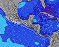 | 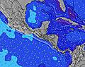 | 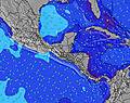 | ||||||||||||
Wave Height (m) Direction Period (s) | SW 13 | SW 13 | SW 13 | SW 12 | WSW 15 | SW 15 | SW 14 | SW 13 | WSW 13 | SW 13 | SSW 9 | SSW 9 | SSW 8 | SSW 8 | SW 12 | S 8 | SW 14 | SW 14 | SW 13 |
Wave Graph | |||||||||||||||||||
166 | 134 | 134 | 118 | 87 | 106 | 102 | 176 | 120 | 84 | 84 | 86 | 76 | 58 | 54 | 48 | 127 | 102 | 113 | |
Wind (km/h) | |||||||||||||||||||
Wind State on-shore cross-onshore cross-shore cross-offshore off-shore glassy | glassy | glassy | on | cross-off | glassy | on | glassy | on | glassy | glassy | glassy | glassy | glassy | glassy | cross-on | cross-off | cross | on | glassy |
High Tide | 4:28AM2.64m | 4:36PM2.60m | 5:02AM2.69m | 5:12PM2.56m | 5:37AM2.71m | 5:50PM2.50m | 6:14AM2.70m | 6:31PM2.42m | 6:55AM2.66m | 7:18PM2.32m | 7:43AM2.60m | 8:13PM2.23m | |||||||
Low Tide | 10:13PM0.31m | 10:32AM0.48m | 10:46PM0.32m | 11:09AM0.46m | 11:20PM0.35m | 11:48AM0.46m | 11:56PM0.40m | 12:29PM0.47m | 00:35AM0.47m | 1:15PM0.51m | 1:21AM0.55m | 2:09PM0.56m | 2:15AM0.64m | ||||||
— | 5:26 | — | — | 5:26 | — | — | 5:26 | — | — | 5:26 | — | — | 5:26 | — | — | 5:26 | — | — | |
— | — | 5:57 | — | — | 5:57 | — | — | 5:55 | — | — | 5:55 | — | — | 5:55 | — | — | 5:54 | — | |
mm | 5 | 1 | 6 | 6 | — | 8 | 3 | 1 | 11 | — | 1 | 4 | 9 | — | 2 | 14 | — | 1 | — |
Temp °C | 28 | 29 | 29 | 28 | 30 | 29 | 27 | 29 | 27 | 27 | 29 | 29 | 26 | 29 | 28 | 27 | 27 | 28 | 27 |
Feels °C | 33 | 34 | 34 | 33 | 34 | 34 | 33 | 34 | 33 | 32 | 33 | 34 | 30 | 33 | 32 | 32 | 31 | 32 | 32 |
Swell 1 Height (m) Direction Period (s) | SW 13 | SW 13 | SW 13 | SW 12 | SW 12 | SW 11 | SSW 8 | SW 13 | SSW 8 | SSW 8 | SSW 9 | SSW 9 | SSW 8 | SSW 8 | SSW 8 | S 8 | SSW 8 | S 8 | SW 13 |
166 | 134 | 134 | 118 | 68 | 63 | 44 | 176 | 58 | 80 | 84 | 86 | 76 | 58 | 54 | 48 | 48 | 30 | 113 | |
Swell 2 Height (m) Direction Period (s) | SSW 8 | SSW 7 | SSW 7 | SW 16 | SSW 7 | SSW 6 | SW 14 | SSW 8 | WSW 13 | SW 13 | SW 13 | SW 12 | SW 12 | SW 12 | SW 12 | SW 11 | SW 14 | SW 14 | S 7 |
11 | 10 | 9 | 66 | 17 | 23 | 102 | 55 | 120 | 84 | 78 | 74 | 72 | 52 | 50 | 31 | 127 | 102 | 28 | |
Swell 3 Height (m) Direction Period (s) | WNW 12 | WNW 11 | SW 16 | SSW 6 | WSW 15 | SW 15 | SSW 12 | WNW 10 | SW 11 | WSW 16 | WSW 16 | W 9 | SW 16 | WSW 15 | SW 15 | SSW 13 | WSW 6 | SW 12 | SSW 11 |
13 | 23 | 67 | 14 | 87 | 106 | 56 | 10 | 33 | 26 | 26 | 6 | 10 | 21 | 34 | 32 | 7 | 37 | 47 | |
Wind waves Height (m) Direction Period (s) | — | — | — | — | — | — | — | — | — | — | — | — | — | — | SW 6 | — | — | SW 6 | — |
— | — | — | — | — | — | — | — | — | — | — | — | — | — | 10 | — | — | 8 | — | |
Nearest Offshore or Glassy | |||||||||||||||||||
Distance (km) | 0 | 0 | 110 | 0 | 0 | 121 | 0 | 21 | 0 | 0 | 0 | 0 | 0 | 0 | 110 | 0 | 12 | 106 | 0 |
Best forecast wave conditions in Golfo de Nicoya | |||||||||||||||||||
Best forecast wave conditions in Costa Rica | |||||||||||||||||||
Header Global | |||||||||||||||||||
- Map Icons:
 Break
Break Live Wave Height (m)
 Live Wind Speed (km/h)
 Surf Rating (10 Max)
 Ocean Swells (m)
- Wind Speed (km/h)
Latest Updates


FREE! Surf-Forecast.com widget for your website
The surf report / weather widget below is available to embed on third party websites free of charge and provides a summary of our Dominical surf forecast. Simply grab the html code snippet that we provide and paste it into your own site. You can choose your preferred language and metric/imperial units for the surf forecast feed to suit users of your site. Click here to get the code.
Information about the Dominical Surf forecast
The above surf forecast table for Dominical provides essential information for determining whether the surfing conditions will be good over the next 16 days. A general guide to surfing at Dominical can be found by selecting the local surf guide option on the grey menu. Our Dominical surf forecast is unique since it includes wave energy (power) that defines the real feel of the surf rather than just the height or the period. If you surf the same spot (Dominical) regularly then make a mental note of the wave energy from the surf forecast table each time you go. Very soon you may start to choose your surf days based on the wave energy alone combined with our forecast of favourable offshore wind conditions. Our star ratings will help here and of course you will also find the usual wave height and period predictions on our surf forecasts as well as a full break down of the swell components under our advanced users option (to reveal that, click the little Einstein character under the tide times).
Further information to help with frequently asked questions about our surf forecast for Dominical may be found under the help tab on the top menu and also by moving your mouse over the question marks on the surf forecast table itself. Please always bear in mind that the forecast is for near-shore open water and local factors at each surf break influence the actual breaking wave height, such as the beach / reef profile, water depths offshore and shelter.
Are you planning a holiday in Golfo de Nicoya? If you are looking for accommodation near Dominical, camping, hotels and holiday cottages in Golfo de Nicoya, consider staying in San Isidro which is 23 km (14 miles) away. Other places in and around Golfo de Nicoya where you can find information about places to rent, and car hire include Quepos which is 42 km (26 miles) away, Paraiso, Cartago and Tejar.
 Nearest