

Surf Forecasts:

The Tree surf forecast from 3 Aug 2026:
- Best quality surf: Saturday 8 Aug, 6AM (local time) - 2.5ft (0.8m), 16s period, SSW swell with offshore winds.
- Most powerful swell: Saturday 8 Aug, 6PM (local time) - 3ft (0.9m), 15s period, SSW swell with 377 kJ wave energy.
- Next surfable swell (1★+): Monday 3 Aug, 9PM (local time) - 2ft (0.6m), 13s period with SW swell.
Best Forecast Surf Conditions for The Tree this week:
The surf forecast for The Tree over the next 16 days: The first swell (rated 1 star or higher) is forecast to arrive on Monday (Aug 03) at 9PM. The primary swell is predicted to be 0.6m and 13s period with a secondary swell of 0.9m and 8s. The wind is predicted to be glassy as the swell arrives.
The most powerful waves expected at The Tree in the next 16 days are 0.9m 15s and forecast to arrive on Saturday (Aug 08) at 6PM. Winds are predicted to be cross-shore at the time the swell arrives. The largest open ocean swell (not directed at the beach) is 0.3m 3s period and expected on Friday (Aug 07) at 3AM.
| Wave Type | Time (CST) & Date | Wave Height & Period |
|---|---|---|
| Next good surf (1 star+) | 9PM (Mon 3rd Aug) | 2ft (0.6m) 13s |
| Best Surf | 6AM (Sat 8th Aug) | 2.5ft (0.8m) 16s |
| Most Powerful | 6PM (Sat 8th Aug) | 3ft (0.9m) 15s |
Table - best surf conditions forecast for The Tree over the next 16 days.
The Lowdown
Alright, this is Rusty, and I’ve got the surf outlook for you for The Tree. It’s an advanced, fairly consistent spot that’s wide open to any SW swell. The water is running a touch warmer than normal for this time of year, sitting at 86°F – that’s a nice little anomaly to start with.
We’re looking at a decent run of swell through the next two weeks, but it’s a real mixed bag of conditions. The surf starts off small on Monday morning, with 2ft of SW swell. The early session is your best bet, with clean cross-off winds from the north. The combined energy is weak (275), so you’ll be hunting for the little ones. By the afternoon, the wind shifts onshore and it gets chopped. Tuesday morning is a standout early on: the wind goes totally glassy, and the swell bumps up to 3ft from the SSW. The energy is moderate (270) and the waves should be clean and fun. The afternoons on Tuesday and Wednesday are a write-off with cross-onshore winds.
Wednesday morning offers a small, glassy window with 3ft S swell, but at 8 seconds, the period is short, so the waves will be a bit weak and crumbly. Thursday is a complete loss with onshore wind and poor surf. Friday 7th August is a real highlight. The morning session sees 2ft SW swell, but it’s got a very long, powerful 18-second period. The energy is moderate (354), and with light cross-off winds, it’ll be clean. The Tree loves a long-period groundswell, so expect some nice, lined-up waves, though the size is small.
Now, if you can wait, Saturday 8th August is the one to circle. The morning is glassy with 3ft SSW swell, and the period is an excellent 16 seconds. The combined energy is strong (512), so there’s proper power in the water. The waves will be clean and chunky. This is the best on offer for the first week.
The following week has a few more promising mornings, but the standout is Friday 14th August. The morning is glassy, the swell is 3ft from the SW, and the period is a massive 19 seconds. The energy is very strong (845). This is a true groundswell, and while it’s not huge, the quality and power will be there for the advanced crew. Saturday 15th August is also a banger: glassy morning, 4ft SW swell with a 16-second period, and very strong energy (933). This is slightly bigger, so it’s more pushy, but still clean. Sunday 16th August keeps the run going with a glassy morning, 4ft SW swell, 15-second period, and strong energy (633).
Expect crowds at this spot, as it’s a known go-to. The long-period swells (over 15 seconds) will be breaking with long, clean lines, but as a reef/point, it handles that energy well. The afternoons are consistently trashed by onshore winds or storms, so mornings are your only window. Surfs up, get out there.
Rusty.
Short Range ForecastHeavy rain (total 41mm), heaviest during Wed night. Warm (max 29°C on Mon morning, min 25°C on Wed night). Wind will be generally light. | Days 4-6 Weather SummaryHeavy rain (total 31mm), heaviest during Thu morning. Warm (max 29°C on Fri afternoon, min 26°C on Thu morning). Wind will be generally light. | ||||||||||||||||||||
Monday 3 | Tuesday 4 | Wednesday 5 | Thursday 6 | Friday 7 | Saturday 8 | Sunday 9 | |||||||||||||||
AM | PM | Night | AM | PM | Night | AM | PM | Night | AM | PM | Night | AM | PM | Night | AM | PM | Night | AM | PM | Night | |
Swell Height Map |  |  |  | 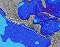 | 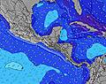 |  | 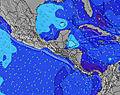 | ||||||||||||||
Wave Height (m) Direction Period (s) | SW 14 | SW 13 | SSW 9 | SSW 9 | SSW 9 | SW 12 | S 8 | SSW 8 | SSW 8 | SSW 8 | SSW 8 | SW 13 | SW 18 | SSW 17 | SW 16 | SSW 16 | SSW 15 | SSW 15 | SSW 14 | SW 14 | SW 13 |
Wave Graph | |||||||||||||||||||||
147 | 142 | 144 | 129 | 126 | 92 | 84 | 109 | 101 | 101 | 79 | 111 | 154 | 200 | 264 | 322 | 283 | 272 | 264 | 288 | 175 | |
Wind (km/h) | |||||||||||||||||||||
Wind State on-shore cross-onshore cross-shore cross-offshore off-shore glassy | cross-off | on | glassy | glassy | cross-on | glassy | glassy | cross-on | cross-off | cross-on | on | glassy | cross-off | on | glassy | glassy | cross-on | off | off | cross-on | off |
High Tide | 5:56PM2.46m | 6:20AM2.65m | 6:37PM2.38m | 7:01AM2.62m | 7:23PM2.28m | 7:48AM2.57m | 8:18PM2.19m | 8:45AM2.51m | 9:23PM2.12m | 9:52AM2.47m | 10:38PM2.13m | 11:05AM2.48m | 11:54PM2.22m | ||||||||
Low Tide | 11:54AM0.45m | 00:01AM0.38m | 12:35PM0.46m | 00:41AM0.45m | 1:21PM0.49m | 1:26AM0.53m | 2:14PM0.54m | 2:20AM0.61m | 3:17PM0.57m | 3:26AM0.67m | 4:28PM0.56m | 4:41AM0.68m | 5:40PM0.49m | ||||||||
5:28 | — | — | 5:28 | — | — | 5:28 | — | — | 5:28 | — | — | 5:28 | — | — | 5:28 | — | — | 5:28 | — | — | |
— | 6:00 | — | — | 5:59 | — | — | 5:59 | — | — | 5:59 | — | — | 5:59 | — | — | 5:58 | — | — | 5:58 | — | |
mm | — | 6 | 3 | — | 4 | 4 | — | 3 | 21 | 9 | 9 | 5 | — | 2 | 2 | — | 2 | 2 | — | 4 | 2 |
Temp °C | 29 | 29 | 28 | 29 | 29 | 28 | 29 | 29 | 27 | 27 | 27 | 26 | 28 | 29 | 27 | 28 | 28 | 27 | 29 | 29 | 28 |
Feels °C | 32 | 32 | 33 | 32 | 32 | 33 | 32 | 32 | 31 | 30 | 31 | 30 | 31 | 32 | 31 | 32 | 32 | 30 | 33 | 33 | 32 |
Swell 1 Height (m) Direction Period (s) | SSW 7 | SSW 7 | SSW 9 | SSW 9 | SSW 9 | S 8 | S 8 | SSW 8 | SSW 8 | SSW 8 | SSW 8 | S 10 | S 10 | S 9 | SW 16 | SSW 16 | SSW 15 | SSW 15 | SSW 14 | SW 14 | SW 13 |
71 | 54 | 144 | 129 | 126 | 90 | 84 | 109 | 101 | 101 | 79 | 96 | 92 | 76 | 264 | 322 | 283 | 272 | 264 | 288 | 175 | |
Swell 2 Height (m) Direction Period (s) | SW 14 | SW 13 | SW 13 | SW 13 | SW 12 | SW 12 | SW 12 | SW 12 | SW 11 | SSW 13 | SW 14 | SW 13 | SW 13 | SSW 17 | S 9 | S 9 | S 9 | S 9 | S 8 | S 10 | S 10 |
147 | 142 | 138 | 100 | 93 | 92 | 50 | 50 | 43 | 62 | 47 | 111 | 108 | 200 | 76 | 76 | 55 | 39 | 33 | 50 | 48 | |
Swell 3 Height (m) Direction Period (s) | SSW 12 | SSW 11 | SW 16 | SW 16 | SW 16 | WSW 6 | SW 15 | SW 15 | SW 15 | SW 14 | SSW 15 | SW 18 | SW 18 | SW 12 | SW 12 | SW 12 | SW 12 | SW 11 | SW 11 | SSW 18 | SW 16 |
57 | 23 | 41 | 41 | 10 | 4 | 33 | 34 | 34 | 52 | 42 | 83 | 154 | 75 | 92 | 114 | 67 | 43 | 30 | 30 | 67 | |
Wind waves Height (m) Direction Period (s) | — | — | — | — | — | — | — | — | — | — | — | NW 2 | — | — | — | — | — | — | — | — | — |
— | — | — | — | — | — | — | — | — | — | — | 1 | — | — | — | — | — | — | — | — | — | |
Nearest Offshore or Glassy | |||||||||||||||||||||
Distance (km) | 0 | 149 | 0 | 0 | 180 | 0 | 0 | 155 | 0 | 124 | 54 | 0 | 0 | 23 | 0 | 0 | 13 | 0 | 0 | 4 | 0 |
Best forecast wave conditions in Golfo de Nicoya | |||||||||||||||||||||
Best forecast wave conditions in Costa Rica | |||||||||||||||||||||
Header Global | |||||||||||||||||||||
- Map Icons:
 Break
Break Live Wave Height (m)
 Live Wind Speed (km/h)
 Surf Rating (10 Max)
 Ocean Swells (m)
- Wind Speed (km/h)
Latest Updates


FREE! Surf-Forecast.com widget for your website
The surf report / weather widget below is available to embed on third party websites free of charge and provides a summary of our The Tree surf forecast. Simply grab the html code snippet that we provide and paste it into your own site. You can choose your preferred language and metric/imperial units for the surf forecast feed to suit users of your site. Click here to get the code.
Information about the The Tree Surf forecast
The above surf forecast table for The Tree provides essential information for determining whether the surfing conditions will be good over the next 16 days. A general guide to surfing at The Tree can be found by selecting the local surf guide option on the grey menu. Our The Tree surf forecast is unique since it includes wave energy (power) that defines the real feel of the surf rather than just the height or the period. If you surf the same spot (The Tree) regularly then make a mental note of the wave energy from the surf forecast table each time you go. Very soon you may start to choose your surf days based on the wave energy alone combined with our forecast of favourable offshore wind conditions. Our star ratings will help here and of course you will also find the usual wave height and period predictions on our surf forecasts as well as a full break down of the swell components under our advanced users option (to reveal that, click the little Einstein character under the tide times).
Further information to help with frequently asked questions about our surf forecast for The Tree may be found under the help tab on the top menu and also by moving your mouse over the question marks on the surf forecast table itself. Please always bear in mind that the forecast is for near-shore open water and local factors at each surf break influence the actual breaking wave height, such as the beach / reef profile, water depths offshore and shelter.
Are you planning a holiday in Golfo de Nicoya? If you are looking for accommodation near The Tree, camping, hotels and holiday cottages in Golfo de Nicoya, consider staying in Tejar which is 45 km (28 miles) away. Other places in and around Golfo de Nicoya where you can find information about places to rent, and car hire include San Rafael Abajo which is 45 km (28 miles) away, Esparza, Chacarita and Quepos.
 Nearest