

Surf Forecasts:

Jaco Beach surf forecast from 3 Aug 2026:
- Best quality surf: Sunday 2 Aug, 9PM (local time) - 2.5ft (0.7m), 14s period, SW swell with offshore winds.
- Most powerful swell: Saturday 8 Aug, 12PM (local time) - 3ft (0.9m), 16s period, SSW swell with 387 kJ wave energy.
- Next surfable swell (1★+): Sunday 2 Aug, 9PM (local time) - 2.5ft (0.7m), 14s period with SW swell.
Best Forecast Surf Conditions for Jaco Beach this week:
The surf forecast for Jaco Beach over the next 16 days: The first swell (rated 1 star or higher) is forecast to arrive on Sunday (Aug 02) at 9PM. The primary swell is predicted to be 0.7m and 14s period with a secondary swell of 0.6m and 7s. The wind is predicted to be offshore as the swell arrives.
The most powerful waves expected at Jaco Beach in the next 16 days are 0.9m 16s and forecast to arrive on Saturday (Aug 08) at 12PM. Winds are predicted to be onshore at the time the swell arrives.
| Wave Type | Time (CST) & Date | Wave Height & Period |
|---|---|---|
| Next good surf (1 star+) | 9PM (Sun 2nd Aug) | 2.5ft (0.7m) 14s |
| Best Surf | 9PM (Sun 2nd Aug) | 2.5ft (0.7m) 14s |
| Most Powerful | 12PM (Sat 8th Aug) | 3ft (0.9m) 16s |
Table - best surf conditions forecast for Jaco Beach over the next 16 days.
The Lowdown
Alright, Rusty here. Let’s have a look at what’s on the cards for the next couple of weeks.
Right off the bat, we’ve got some small but clean surf to start the week. Sunday morning at Jaco Beach is looking like a classic dawn patrol – a tiny 2 ft SW groundswell rolling in with a long 15-second period, and the wind is dead glassy from the north. The water is sitting at 86°, which is a touch warmer than normal for this time of year, so it’s a pleasant dip. The combined energy is weak (236) but the conditions are spotless. For a beginner-friendly spot that’s very consistent, this is a nice, gentle intro.
Monday morning keeps the same vibe: another 2 ft SW swell, glassy conditions, and light air. The energy is still low (259), but the quality is there for a clean, small-wave session. Afternoons get a bit sketchy with cross-onshore winds and the risk of thunderstorms, so the mornings are definitely the window.
Tuesday morning steps it up a touch – 3 ft of SSW swell, still glassy, and the period drops to 9 seconds. The energy is still moderate (299), but it’s clean and fun. By Wednesday, the swell dips and the wind turns cross-onshore, so the quality drops right off.
Thursday morning brings back that glassy goodness with a 3 ft S swell, though the period is short at 7 seconds. It’s clean, but the waves will be a bit weak and crumbly.
Now, there’s a bit of a lull in the afternoons through the first week – nothing worth recommending for the rest of the day.
The standout window starts on Friday, August 7th. The morning shows a 2 ft SW swell, but look at that period – 18 seconds! That’s very long-period groundswell, and with a light cross-offshore breeze, the waves will be clean and lined up. The energy is moderate (354), but that long period makes the most of what’s there. This is a classic reef/point setup kind of swell, so expect proper lines.
The next big one to circle is Thursday, August 13th. The morning brings a 4 ft S swell with an 11-second period, and it’s dead calm – glassy. The energy jumps to strong (530). This is the best quality swell of the run so far, and the conditions are perfect. The surf will be clean, punchy, and well-shaped. This is a genuine morning to be excited about.
Then, Friday, August 14th is the absolute peak of the forecast. The morning is again dead calm, with a 4 ft S swell at 12 seconds. The combined energy is very strong (976). That’s a lot of power for a beach break, but with the period being moderate, it won’t be too straight. This is a big, clean, powerful swell. For experienced surfers, this is the day. For beginners, 4 ft is right on the edge, so be careful.
The weekend of August 15th and 16th keeps the consistency going – 4 ft SW swells with long 15-16 second periods, and glassy mornings. The energy is strong (822-625). The quality is excellent, but the afternoons get messy with cross-shore winds.
Tuesday, August 17th wraps it up with a 3 ft SW swell, glassy morning, and strong energy (514). Another solid morning session.
So, to sum it up: the first few days are small and clean, but the real magic happens from August 13th through the 17th. The mornings are the ticket every time. If you can only pick one, make it Friday, August 14th – that morning is the best on offer.
Rusty
Short Range ForecastHeavy rain (total 23mm), heaviest during Tue night. Warm (max 29°C on Sun morning, min 26°C on Mon night). Wind will be generally light. | Days 4-6 Weather SummaryHeavy rain (total 38mm), heaviest during Wed night. Warm (max 29°C on Wed morning, min 25°C on Thu night). Wind will be generally light. | ||||||||||||||||||||
Sunday 2 | Monday 3 | Tuesday 4 | Wednesday 5 | Thursday 6 | Friday 7 | Saturday 8 | |||||||||||||||
AM | PM | Night | AM | PM | Night | AM | PM | Night | AM | PM | Night | AM | PM | Night | AM | PM | Night | AM | PM | Night | |
Swell Height Map |  |  |  | 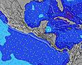 | 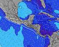 | 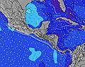 | 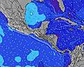 | ||||||||||||||
Wave Height (m) Direction Period (s) | SW 15 | SW 15 | SW 14 | SW 14 | SW 13 | SSW 8 | SSW 9 | SSW 8 | SSW 8 | S 8 | SSW 8 | SSW 8 | S 7 | SSW 8 | SW 13 | SW 18 | SSW 17 | SW 16 | SSW 16 | SSW 15 | SSW 14 |
Wave Graph | |||||||||||||||||||||
107 | 136 | 200 | 147 | 142 | 140 | 158 | 127 | 109 | 82 | 107 | 99 | 103 | 77 | 111 | 154 | 264 | 264 | 322 | 283 | 268 | |
Wind (km/h) | |||||||||||||||||||||
Wind State on-shore cross-onshore cross-shore cross-offshore off-shore glassy | glassy | cross-on | cross-off | glassy | cross-on | glassy | glassy | cross | glassy | cross-on | cross | cross-off | glassy | cross | cross | cross-off | cross | cross | cross | cross-on | glassy |
High Tide | 5:18PM2.52m | 5:43AM2.66m | 5:56PM2.46m | 6:20AM2.65m | 6:37PM2.38m | 7:01AM2.62m | 7:23PM2.28m | 7:48AM2.57m | 8:18PM2.19m | 8:45AM2.51m | 9:23PM2.12m | 9:52AM2.47m | 10:38PM2.13m | ||||||||
Low Tide | 11:15AM0.45m | 11:26PM0.33m | 11:54AM0.45m | 00:01AM0.38m | 12:35PM0.46m | 00:41AM0.45m | 1:21PM0.49m | 1:26AM0.53m | 2:14PM0.54m | 2:20AM0.61m | 3:17PM0.57m | 3:26AM0.67m | 4:28PM0.56m | ||||||||
5:28 | — | — | 5:28 | — | — | 5:28 | — | — | 5:28 | — | — | 5:28 | — | — | 5:28 | — | — | 5:28 | — | — | |
— | 6:00 | — | — | 6:00 | — | — | 6:00 | — | — | 5:59 | — | — | 5:59 | — | — | 5:59 | — | — | 5:58 | — | |
mm | — | 5 | — | 1 | 4 | — | — | 5 | 8 | — | 4 | 16 | 3 | 6 | 6 | — | 2 | 1 | — | 5 | 14 |
Temp °C | 29 | 29 | 27 | 29 | 29 | 27 | 29 | 29 | 28 | 29 | 28 | 27 | 27 | 27 | 26 | 28 | 28 | 27 | 29 | 28 | 27 |
Feels °C | 33 | 32 | 31 | 32 | 33 | 31 | 32 | 32 | 33 | 32 | 31 | 31 | 31 | 30 | 30 | 33 | 31 | 31 | 33 | 31 | 32 |
Swell 1 Height (m) Direction Period (s) | SSW 12 | S 6 | SW 14 | SSW 7 | SSW 7 | SSW 8 | SSW 9 | SSW 8 | SSW 8 | S 8 | SSW 8 | SSW 8 | S 7 | SSW 8 | S 10 | S 10 | SSW 17 | SW 16 | SSW 16 | SSW 15 | SSW 14 |
96 | 30 | 200 | 55 | 69 | 140 | 158 | 127 | 109 | 82 | 107 | 99 | 103 | 77 | 96 | 92 | 264 | 264 | 322 | 283 | 268 | |
Swell 2 Height (m) Direction Period (s) | S 7 | SW 15 | S 7 | SW 14 | SW 13 | SW 13 | SW 13 | SW 12 | SW 12 | SW 12 | SW 12 | SW 11 | SSW 14 | SW 14 | SW 13 | SW 13 | S 9 | SW 12 | SW 12 | S 9 | S 9 |
33 | 136 | 51 | 147 | 142 | 138 | 100 | 73 | 92 | 50 | 50 | 43 | 73 | 47 | 111 | 108 | 57 | 92 | 114 | 56 | 36 | |
Swell 3 Height (m) Direction Period (s) | SW 15 | SSW 12 | S 11 | SSW 12 | SSW 11 | SW 16 | SW 16 | SW 16 | WSW 16 | SW 6 | SW 15 | SW 15 | SW 14 | SSW 15 | WSW 6 | SW 18 | SW 12 | S 9 | S 9 | SW 12 | SW 11 |
107 | 94 | 21 | 57 | 23 | 41 | 41 | 10 | 25 | 10 | 34 | 34 | 52 | 42 | 15 | 154 | 75 | 56 | 52 | 68 | 43 | |
Wind waves Height (m) Direction Period (s) | — | — | — | — | — | — | — | — | — | — | — | — | — | — | — | — | — | — | — | — | — |
— | — | — | — | — | — | — | — | — | — | — | — | — | — | — | — | — | — | — | — | — | |
Nearest Offshore or Glassy | |||||||||||||||||||||
Distance (km) | 0 | 106 | 0 | 0 | 20 | 0 | 0 | 75 | 0 | 16 | 151 | 0 | 0 | 36 | 1 | 0 | 144 | 1 | 1 | 145 | 0 |
Best forecast wave conditions in Golfo de Nicoya | |||||||||||||||||||||
Best forecast wave conditions in Costa Rica | |||||||||||||||||||||
Header Global | |||||||||||||||||||||
- Map Icons:
 Break
Break Live Wave Height (m)
 Live Wind Speed (km/h)
 Surf Rating (10 Max)
 Ocean Swells (m)
- Wind Speed (km/h)
Latest Updates


FREE! Surf-Forecast.com widget for your website
The surf report / weather widget below is available to embed on third party websites free of charge and provides a summary of our Jaco Beach surf forecast. Simply grab the html code snippet that we provide and paste it into your own site. You can choose your preferred language and metric/imperial units for the surf forecast feed to suit users of your site. Click here to get the code.
Information about the Jaco Beach Surf forecast
The above surf forecast table for Jaco Beach provides essential information for determining whether the surfing conditions will be good over the next 16 days. A general guide to surfing at Jaco Beach can be found by selecting the local surf guide option on the grey menu. Our Jaco Beach surf forecast is unique since it includes wave energy (power) that defines the real feel of the surf rather than just the height or the period. If you surf the same spot (Jaco Beach) regularly then make a mental note of the wave energy from the surf forecast table each time you go. Very soon you may start to choose your surf days based on the wave energy alone combined with our forecast of favourable offshore wind conditions. Our star ratings will help here and of course you will also find the usual wave height and period predictions on our surf forecasts as well as a full break down of the swell components under our advanced users option (to reveal that, click the little Einstein character under the tide times).
Further information to help with frequently asked questions about our surf forecast for Jaco Beach may be found under the help tab on the top menu and also by moving your mouse over the question marks on the surf forecast table itself. Please always bear in mind that the forecast is for near-shore open water and local factors at each surf break influence the actual breaking wave height, such as the beach / reef profile, water depths offshore and shelter.
Are you planning a holiday in Golfo de Nicoya? If you are looking for accommodation near Jaco Beach, camping, hotels and holiday cottages in Golfo de Nicoya, consider staying in Esparza which is 43 km (27 miles) away. Other places in and around Golfo de Nicoya where you can find information about places to rent, and car hire include San Rafael Abajo which is 45 km (28 miles) away, Tejar, Chacarita and Puntarenas.
 Nearest