

Surf Forecasts:

Urirama surf forecast from 3 Aug 2026:
- Most powerful swell: Saturday 8 Aug, 8PM (local time) - 0.5ft (0.1m), 9s period, NE swell with 3 kJ wave energy.
Best Forecast Surf Conditions for Urirama this week:
The most powerful waves expected at Urirama in the next 16 days are 0.1m 9s and forecast to arrive on Saturday (Aug 08) at 8PM. Winds are predicted to be cross-onshore at the time the swell arrives. The largest open ocean swell (not directed at the beach) is 2.5m 7s period and expected on Thursday (Aug 06) at 11PM.
| Wave Type | Time (AST) & Date | Wave Height & Period |
|---|---|---|
| Next good surf (1 star+) | - | - |
| Best Surf | - | - |
| Most Powerful | 8PM (Sat 8th Aug) | 0.5ft (0.1m) 9s |
Table - best surf conditions forecast for Urirama over the next 16 days.
The Lowdown
Right, mate, Rusty here. Let’s have a look at what’s cookin’ for your local stretch.
Straight up, I gotta be honest with you – the next 16 days look like a write-off for any decent surf. We’re looking at a long, flat spell with no real swell on the cards. The first proper chance of a wave doesn’t show up until late in the piece, and even then, it’s barely a whisper.
For the first week and a half, from Monday the 3rd of August right through to Monday the 17th of August, it’s pretty much all poor surf conditions. You’ll be staring at a flat ocean, with a strong and persistent cross-onshore wind blowing from the east at 25 to 28 mph, sometimes even stronger. It’s messy, it’s blown out, and there’s nothing to ride. The combined wave energy sits at zero (0) for most of that stretch, so there’s no arguing with the data.
The only glimmer of anything comes on the 14th of August, a Friday. Both morning and afternoon see a tiny 0.3 ft swell from the north, with a long period of 14 seconds. The combined energy is a paltry 4, so it’s barely a ripple. The problem is, the wind is still howling from the east-northeast at 31 mph, described as a near gale and blown out. It’s not surfable.
Then on Monday the 17th of August, we get another tiny pulse: 0.3 ft from the north, and then north-east, with periods of 10 seconds. Again, the combined energy is only 2 to 4, and the wind is still a strong cross-onshore at 25-28 mph. It’s just not worth paddling out for.
The water temperature at Urirama is sitting at 83°F, which is about average for this time of year, nothing special there.
So what’s the call? Urirama is a beach and reef setup, exposed to the swell, but there’s no swell to expose it to. The wind is relentless and onshore, making a mess of things. Honestly, if you’re desperate for a session, you might be better off looking at kite surfing in this stuff, because for a paddle surfer, it’s a total blank. There’s no standout here, no hidden gem. Forecasts can change, but right now, this is a solid two-week holiday from surfing.
Rusty.
Short Range ForecastMostly dry. Warm (max 27°C on Mon morning, min 27°C on Mon morning). Mainly strong winds. | Days 4-6 Weather SummaryMostly dry. Warm (max 27°C on Thu morning, min 26°C on Fri night). Mainly strong winds. | ||||||||||||||||||||
Monday 3 | Tuesday 4 | Wednesday 5 | Thursday 6 | Friday 7 | Saturday 8 | Sunday 9 | |||||||||||||||
AM | PM | Night | AM | PM | Night | AM | PM | Night | AM | PM | Night | AM | PM | Night | AM | PM | Night | AM | PM | Night | |
Swell Height Map |  |  | 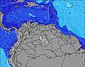 | 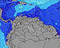 | 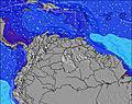 | 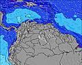 |  | ||||||||||||||
Wave Height (m) Direction Period (s) | E 7 | E 7 | E 8 | E 8 | E 8 | E 7 | E 7 | E 7 | E 7 | E 7 | E 7 | E 8 | E 8 | E 8 | E 7 | E 7 | N 9 | E 7 | E 7 | E 7 | ENE 8 |
Wave Graph | |||||||||||||||||||||
0 | 0 | 0 | 0 | 0 | 0 | 0 | 0 | 0 | 0 | 0 | 0 | 0 | 0 | 0 | 0 | 2 | 0 | 0 | 0 | 0 | |
Wind (km/h) | |||||||||||||||||||||
Wind State on-shore cross-onshore cross-shore cross-offshore off-shore glassy | cross-on | cross-on | cross-on | cross-on | cross-on | cross-on | cross-on | cross-on | cross-on | cross-on | cross-on | cross-on | cross-on | cross-on | cross-on | cross-on | cross-on | cross-on | cross-on | cross-on | cross-on |
High Tide | 5:52PM0.26m | 00:40AM0.18m | 6:20PM0.30m | 6:29AM0.12m | 6:56PM0.33m | 7:49AM0.09m | 7:36PM0.35m | 8:59AM0.06m | 8:21PM0.38m | 10:11AM0.05m | 9:08PM0.40m | 9:56PM0.41m | |||||||||
Low Tide | 9:40AM0.11m | 11:36PM0.18m | 9:53AM0.10m | 4:38AM0.12m | 10:10AM0.09m | 4:53AM0.07m | 10:31AM0.07m | 5:21AM0.03m | 5:54AM0.01m | 6:29AM-0.01m | |||||||||||
6:26 | — | — | 6:26 | — | — | 6:26 | — | — | 6:26 | — | — | 6:26 | — | — | 6:26 | — | — | 6:26 | — | — | |
— | 7:05 | — | — | 7:05 | — | — | 7:05 | — | — | 7:04 | — | — | 7:04 | — | — | 7:02 | — | — | 7:02 | — | |
mm | — | — | — | — | — | — | — | — | — | — | — | — | — | — | — | — | — | — | — | — | — |
Temp °C | 27 | 27 | 27 | 27 | 27 | 27 | 27 | 27 | 27 | 27 | 27 | 27 | 27 | 27 | 27 | 27 | 27 | 27 | 27 | 27 | 27 |
Feels °C | 26 | 25 | 24 | 25 | 25 | 25 | 26 | 26 | 25 | 25 | 25 | 24 | 25 | 25 | 25 | 25 | 24 | 25 | 25 | 25 | 25 |
Swell 1 Height (m) Direction Period (s) | — | — | — | — | — | — | — | — | — | — | — | — | — | — | — | — | N 9 | — | — | — | — |
— | — | — | — | — | — | — | — | — | — | — | — | — | — | — | — | 2 | — | — | — | — | |
Swell 2 Height (m) Direction Period (s) | — | — | — | — | — | — | — | — | — | — | — | — | — | — | — | — | — | — | — | — | — |
— | — | — | — | — | — | — | — | — | — | — | — | — | — | — | — | — | — | — | — | — | |
Swell 3 Height (m) Direction Period (s) | — | — | — | — | — | — | — | — | — | — | — | — | — | — | — | — | — | — | — | — | — |
— | — | — | — | — | — | — | — | — | — | — | — | — | — | — | — | — | — | — | — | — | |
Wind waves Height (m) Direction Period (s) | E 7 | E 7 | E 8 | E 8 | E 8 | E 7 | E 7 | E 7 | E 7 | E 7 | E 7 | E 8 | E 8 | E 8 | E 7 | E 7 | E 7 | E 7 | E 7 | E 7 | ENE 8 |
478 | 478 | 653 | 609 | 544 | 572 | 437 | 374 | 508 | 553 | 569 | 747 | 708 | 535 | 483 | 445 | 376 | 474 | 483 | 416 | 611 | |
Nearest Offshore or Glassy | |||||||||||||||||||||
Distance (km) | 397 | 397 | 293 | 397 | 397 | 293 | 397 | 397 | 307 | 397 | 397 | 307 | 397 | 708 | 310 | 397 | 397 | 307 | 397 | 397 | 293 |
Best forecast wave conditions in Aruba | |||||||||||||||||||||
Best forecast wave conditions in Aruba | |||||||||||||||||||||
Header Global | |||||||||||||||||||||
- Map Icons:
 Break
Break Live Wave Height (m)
 Live Wind Speed (km/h)
 Surf Rating (10 Max)
 Ocean Swells (m)
- Wind Speed (km/h)
Latest Updates


FREE! Surf-Forecast.com widget for your website
The surf report / weather widget below is available to embed on third party websites free of charge and provides a summary of our Urirama surf forecast. Simply grab the html code snippet that we provide and paste it into your own site. You can choose your preferred language and metric/imperial units for the surf forecast feed to suit users of your site. Click here to get the code.
Information about the Urirama Surf forecast
The above surf forecast table for Urirama provides essential information for determining whether the surfing conditions will be good over the next 16 days. A general guide to surfing at Urirama can be found by selecting the local surf guide option on the grey menu. Our Urirama surf forecast is unique since it includes wave energy (power) that defines the real feel of the surf rather than just the height or the period. If you surf the same spot (Urirama) regularly then make a mental note of the wave energy from the surf forecast table each time you go. Very soon you may start to choose your surf days based on the wave energy alone combined with our forecast of favourable offshore wind conditions. Our star ratings will help here and of course you will also find the usual wave height and period predictions on our surf forecasts as well as a full break down of the swell components under our advanced users option (to reveal that, click the little Einstein character under the tide times).
Further information to help with frequently asked questions about our surf forecast for Urirama may be found under the help tab on the top menu and also by moving your mouse over the question marks on the surf forecast table itself. Please always bear in mind that the forecast is for near-shore open water and local factors at each surf break influence the actual breaking wave height, such as the beach / reef profile, water depths offshore and shelter.
 Nearest