

Surf Forecasts:

Short Range ForecastMostly dry. Warm (max 28°C on Wed night, min 27°C on Wed morning). Mainly strong winds. | ||||||||||||||||||||||||
Wednesday 29 | Thursday 30 | Friday 31 | ||||||||||||||||||||||
2 AM | 5 AM | 8 AM | 11 AM | 2 PM | 5 PM | 8 PM | 11 PM | 2 AM | 5 AM | 8 AM | 11 AM | 2 PM | 5 PM | 8 PM | 11 PM | 2 AM | 5 AM | 8 AM | 11 AM | 2 PM | 5 PM | 8 PM | 11 PM | |
Swell Height Map |  | 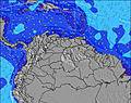 | 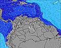 |  | 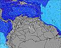 | 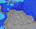 |  |  |  | |||||||||||||||
Wave Height (m) Direction Period (s) | E 6 | E 6 | E 6 | E 6 | E 6 | E 7 | ENE 7 | ENE 7 | E 7 | E 7 | E 8 | E 8 | E 8 | E 8 | ENE 8 | ENE 8 | ENE 8 | E 8 | E 8 | E 8 | E 8 | E 8 | ENE 8 | E 8 |
Wave Graph | ||||||||||||||||||||||||
171 | 177 | 0 | 0 | 0 | 0 | 0 | 0 | 0 | 0 | 0 | 0 | 0 | 0 | 0 | 0 | 0 | 0 | 0 | 0 | 0 | 0 | 0 | 0 | |
Wind (km/h) | ||||||||||||||||||||||||
Wind State on-shore cross-onshore cross-shore cross-offshore off-shore glassy | cross-on | cross-on | cross-on | cross-on | cross-on | cross-on | cross-on | cross-on | cross-on | cross-on | cross-on | cross-on | cross-on | cross-on | cross-on | cross-on | cross-on | cross-on | cross-on | cross-on | cross-on | cross-on | cross-on | cross-on |
High Tide | 11:49PM0.35m | 00:24AM0.34m | 00:56AM0.33m | |||||||||||||||||||||
Low Tide | 9:12AM0.04m | 9:34AM0.06m | 9:44AM0.08m | |||||||||||||||||||||
— | 6:24 | — | — | — | — | — | — | — | 6:24 | — | — | — | — | — | — | — | 6:26 | — | — | — | — | — | — | |
— | — | — | — | — | 7:07 | — | — | — | — | — | — | — | 7:07 | — | — | — | — | — | — | — | 7:06 | — | — | |
mm | — | — | — | — | — | — | — | — | — | — | — | — | — | — | — | — | — | — | — | — | — | — | — | — |
Temp °C | 27 | 27 | 27 | 27 | 27 | 27 | 27 | 27 | 27 | 28 | 27 | 27 | 27 | 27 | 27 | 27 | 27 | 27 | 27 | 27 | 27 | 27 | 27 | 27 |
Feels °C | 27 | 27 | 26 | 26 | 26 | 25 | 25 | 25 | 25 | 26 | 24 | 24 | 24 | 24 | 23 | 23 | 24 | 24 | 24 | 24 | 24 | 24 | 24 | 25 |
Swell 1 Height (m) Direction Period (s) | — | — | — | — | — | — | — | — | — | — | — | — | — | — | — | — | — | — | — | — | — | — | — | — |
— | — | — | — | — | — | — | — | — | — | — | — | — | — | — | — | — | — | — | — | — | — | — | — | |
Swell 2 Height (m) Direction Period (s) | — | — | — | — | — | — | — | — | — | — | — | — | — | — | — | — | — | — | — | — | — | — | — | — |
— | — | — | — | — | — | — | — | — | — | — | — | — | — | — | — | — | — | — | — | — | — | — | — | |
Swell 3 Height (m) Direction Period (s) | — | — | — | — | — | — | — | — | — | — | — | — | — | — | — | — | — | — | — | — | — | — | — | — |
— | — | — | — | — | — | — | — | — | — | — | — | — | — | — | — | — | — | — | — | — | — | — | — | |
Wind waves Height (m) Direction Period (s) | E 6 | E 6 | E 6 | E 6 | E 6 | E 7 | ENE 7 | ENE 7 | E 7 | E 7 | E 8 | E 8 | E 8 | E 8 | ENE 8 | ENE 8 | ENE 8 | E 8 | E 8 | E 8 | E 8 | E 8 | ENE 8 | E 8 |
171 | 177 | 214 | 247 | 272 | 326 | 385 | 435 | 524 | 670 | 763 | 796 | 880 | 935 | 1081 | 1156 | 1156 | 1264 | 1198 | 1093 | 1006 | 845 | 773 | 784 | |
Nearest Offshore or Glassy | ||||||||||||||||||||||||
Distance (km) | 338 | 338 | 293 | 605 | 761 | 420 | 328 | 307 | 293 | 293 | 293 | 328 | 397 | 397 | 397 | 315 | 307 | 293 | 293 | 397 | 397 | 397 | 328 | 307 |
Best forecast wave conditions in Aruba | ||||||||||||||||||||||||
Best forecast wave conditions in Aruba | ||||||||||||||||||||||||
Header Global | ||||||||||||||||||||||||
- Map Icons:
 Break
Break Live Wave Height (m)
 Live Wind Speed (km/h)
 Surf Rating (10 Max)
 Ocean Swells (m)
- Wind Speed (km/h)


FREE! Surf-Forecast.com widget for your website
The surf report / weather widget below is available to embed on third party websites free of charge and provides a summary of our Urirama surf forecast. Simply grab the html code snippet that we provide and paste it into your own site. You can choose your preferred language and metric/imperial units for the surf forecast feed to suit users of your site. Click here to get the code.
 Nearest