

Surf Forecasts:

Tivives surf forecast from 3 Aug 2026:
- Best quality surf: Friday 7 Aug, 9PM (local time) - 1.5ft (0.5m), 16s period, SSW swell with glassy winds.
- Most powerful swell: Saturday 8 Aug, 3PM (local time) - 2.5ft (0.8m), 15s period, SSW swell with 259 kJ wave energy.
- Next surfable swell (1★+): Monday 3 Aug, 9AM (local time) - 1.5ft (0.4m), 13s period with SSW swell.
Best Forecast Surf Conditions for Tivives this week:
The surf forecast for Tivives over the next 16 days: The first swell (rated 1 star or higher) is forecast to arrive on Monday (Aug 03) at 9AM. The primary swell is predicted to be 0.4m and 13s period with a secondary swell of 0.7m and 7s. The wind is predicted to be glassy as the swell arrives.
The most powerful waves expected at Tivives in the next 16 days are 0.8m 15s and forecast to arrive on Saturday (Aug 08) at 3PM. Winds are predicted to be cross-onshore at the time the swell arrives.
| Wave Type | Time (CST) & Date | Wave Height & Period |
|---|---|---|
| Next good surf (1 star+) | 9AM (Mon 3rd Aug) | 1.5ft (0.4m) 13s |
| Best Surf | 9PM (Fri 7th Aug) | 1.5ft (0.5m) 16s |
| Most Powerful | 3PM (Sat 8th Aug) | 2.5ft (0.8m) 15s |
Table - best surf conditions forecast for Tivives over the next 16 days.
The Lowdown
Alright folks, Rusty here. Let’s have a look at what’s cookin’ for this stretch of coast.
The forecast only has one spot on the radar, and it’s a bit of a mixed bag for the next couple of weeks. We’re looking at a very long run of small, mostly ordinary surf, but there is a light at the end of the tunnel for those who can wait.
We start off with a long quiet spell. From Monday, August 3rd, right through to the end of the first week, the waves are tiny. You’ll see ankle to knee-high stuff, mostly 1ft to 3ft. The swell direction hangs around SSW, but the periods are all over the place, from a short 8 seconds to a longer 17 seconds. The real issue is the lack of any real push. The combined swell energy is weak, sitting in the 100 to 250 range. The mornings are clean with glassy conditions, but the afternoons get chopped up by sea breezes. It’s surfable, but barely. Water temp is 86°, which is a touch warmer than normal for this time of year.
The second week is more of the same, with a few slightly better windows. The mornings of August 14th, 15th, and 16th are the ones to circle on the calendar. On Friday the 14th, we’ve got a 2ft swell from the SW with a very long period of 19 seconds. The combined energy jumps up to 393 (moderate), and the wind is light and clean. That long period will make for some nice lines, but at a beach break it might close out a bit. Still, the glassy conditions will make it worth a paddle.
Saturday the 15th morning is similar, with a 3ft SSW swell (17 sec period) and a massive jump in energy to 496 (moderate). The wind is glassy, and it’s looking like the best of the bunch. The Sunday the 16th morning also has clean, glassy conditions with a 2ft SW swell at 15 seconds and energy at 350 (moderate). These three mornings are the real standouts.
The spot is Tivives. It’s an intermediate break, but it’s inconsistent, so don’t expect it to be pumping every day. The best swell direction is from the SW, which lines up with the bigger pulses we see. Crowds are possible on the better days, so get in early.
Overall, the first week is a write-off unless you’re desperate for a float. The best on offer is definitely the Saturday the 15th morning, with clean glass, a decent 3ft groundswell, and solid energy. The Friday the 14th and Sunday the 16th mornings are your backup chances.
Rusty.
Short Range ForecastHeavy rain (total 24mm), heaviest during Wed night. Warm (max 30°C on Mon morning, min 26°C on Mon night). Wind will be generally light. | Days 4-6 Weather SummaryHeavy rain (total 29mm), heaviest during Thu afternoon. Warm (max 30°C on Fri morning, min 25°C on Thu night). Wind will be generally light. | ||||||||||||||||||||
Monday 3 | Tuesday 4 | Wednesday 5 | Thursday 6 | Friday 7 | Saturday 8 | Sunday 9 | |||||||||||||||
AM | PM | Night | AM | PM | Night | AM | PM | Night | AM | PM | Night | AM | PM | Night | AM | PM | Night | AM | PM | Night | |
Swell Height Map |  |  |  | 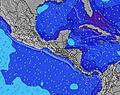 | 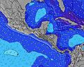 |  | 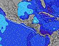 | ||||||||||||||
Wave Height (m) Direction Period (s) | SSW 13 | S 8 | SSW 8 | S 9 | S 9 | S 8 | S 8 | S 8 | S 8 | S 8 | S 11 | S 10 | S 10 | SSW 17 | SSW 16 | SSW 16 | SSW 15 | SSW 15 | SSW 14 | SSW 14 | SSW 13 |
Wave Graph | |||||||||||||||||||||
70 | 55 | 87 | 99 | 96 | 69 | 64 | 84 | 60 | 63 | 160 | 106 | 71 | 119 | 147 | 144 | 259 | 188 | 163 | 115 | 98 | |
Wind (km/h) | |||||||||||||||||||||
Wind State on-shore cross-onshore cross-shore cross-offshore off-shore glassy | glassy | cross-on | glassy | glassy | cross-on | glassy | glassy | cross-on | glassy | cross-on | cross-on | glassy | cross-off | glassy | cross-off | cross-off | cross-on | cross-off | cross-off | glassy | off |
High Tide | 6:06PM2.53m | 6:29AM2.73m | 6:47PM2.45m | 7:11AM2.70m | 7:33PM2.35m | 7:58AM2.64m | 8:28PM2.26m | 8:55AM2.58m | 9:33PM2.19m | 10:02AM2.53m | 10:48PM2.19m | 11:15AM2.55m | 00:04AM2.29m | ||||||||
Low Tide | 12:04PM0.45m | 00:11AM0.39m | 12:45PM0.47m | 00:51AM0.46m | 1:31PM0.50m | 1:36AM0.54m | 2:24PM0.55m | 2:30AM0.62m | 3:26PM0.58m | 3:36AM0.69m | 4:37PM0.58m | 4:51AM0.69m | 5:49PM0.50m | ||||||||
5:28 | — | — | 5:28 | — | — | 5:28 | — | — | 5:28 | — | — | 5:28 | — | — | 5:28 | — | — | 5:28 | — | — | |
— | 6:00 | — | — | 6:00 | — | — | 6:00 | — | — | 6:00 | — | — | 5:59 | — | — | 5:59 | — | — | 5:59 | — | |
mm | — | 3 | 1 | — | 4 | 1 | — | 4 | 11 | 7 | 10 | 5 | — | 4 | 1 | — | 2 | — | — | 2 | — |
Temp °C | 30 | 29 | 28 | 30 | 30 | 28 | 30 | 30 | 27 | 28 | 26 | 26 | 30 | 30 | 27 | 29 | 29 | 26 | 30 | 30 | 27 |
Feels °C | 33 | 32 | 33 | 32 | 33 | 33 | 33 | 33 | 31 | 31 | 30 | 30 | 33 | 34 | 32 | 33 | 33 | 29 | 33 | 34 | 31 |
Swell 1 Height (m) Direction Period (s) | S 7 | S 8 | SSW 8 | S 9 | S 9 | S 8 | S 8 | S 8 | S 8 | S 8 | S 11 | S 10 | S 10 | S 10 | S 9 | SSW 16 | SSW 15 | SSW 15 | SSW 14 | SSW 14 | SSW 13 |
54 | 55 | 87 | 99 | 96 | 69 | 64 | 84 | 60 | 60 | 160 | 106 | 71 | 70 | 56 | 144 | 259 | 188 | 163 | 115 | 98 | |
Swell 2 Height (m) Direction Period (s) | SSW 13 | SSW 11 | SW 13 | SSW 13 | SSW 12 | SSW 13 | S 13 | S 14 | SSW 12 | S 11 | SSW 14 | SSW 13 | SSW 13 | SSW 17 | SSW 16 | S 9 | S 9 | S 9 | S 9 | S 9 | S 10 |
70 | 25 | 27 | 31 | 29 | 31 | 32 | 37 | 29 | 63 | 70 | 60 | 68 | 119 | 147 | 56 | 38 | 37 | 23 | 24 | 30 | |
Swell 3 Height (m) Direction Period (s) | SW 18 | SSW 16 | SSW 13 | SW 12 | SW 13 | SW 12 | SW 12 | SSW 12 | S 14 | SW 14 | SW 19 | SSW 18 | SSW 18 | SSW 12 | SSW 12 | SSW 12 | SW 6 | S 11 | S 11 | S 11 | SW 16 |
12 | 24 | 17 | 6 | 6 | 6 | 6 | 14 | 15 | 8 | 15 | 64 | 61 | 61 | 57 | 56 | 1 | 2 | 2 | 9 | 10 | |
Wind waves Height (m) Direction Period (s) | — | — | — | — | SSW 2 | — | — | — | — | — | — | NW 2 | — | — | — | — | — | — | — | — | — |
— | — | — | — | 1 | — | — | — | — | — | — | 1 | — | — | — | — | — | — | — | — | — | |
Nearest Offshore or Glassy | |||||||||||||||||||||
Distance (km) | 0 | 128 | 0 | 0 | 150 | 0 | 0 | 133 | 0 | 107 | 80 | 0 | 0 | 0 | 0 | 0 | 42 | 0 | 0 | 0 | 0 |
Best forecast wave conditions in Golfo de Nicoya | |||||||||||||||||||||
Best forecast wave conditions in Costa Rica | |||||||||||||||||||||
Header Global | |||||||||||||||||||||
- Map Icons:
 Break
Break Live Wave Height (m)
 Live Wind Speed (km/h)
 Surf Rating (10 Max)
 Ocean Swells (m)
- Wind Speed (km/h)
Latest Updates


FREE! Surf-Forecast.com widget for your website
The surf report / weather widget below is available to embed on third party websites free of charge and provides a summary of our Tivives surf forecast. Simply grab the html code snippet that we provide and paste it into your own site. You can choose your preferred language and metric/imperial units for the surf forecast feed to suit users of your site. Click here to get the code.
Information about the Tivives Surf forecast
The above surf forecast table for Tivives provides essential information for determining whether the surfing conditions will be good over the next 16 days. A general guide to surfing at Tivives can be found by selecting the local surf guide option on the grey menu. Our Tivives surf forecast is unique since it includes wave energy (power) that defines the real feel of the surf rather than just the height or the period. If you surf the same spot (Tivives) regularly then make a mental note of the wave energy from the surf forecast table each time you go. Very soon you may start to choose your surf days based on the wave energy alone combined with our forecast of favourable offshore wind conditions. Our star ratings will help here and of course you will also find the usual wave height and period predictions on our surf forecasts as well as a full break down of the swell components under our advanced users option (to reveal that, click the little Einstein character under the tide times).
Further information to help with frequently asked questions about our surf forecast for Tivives may be found under the help tab on the top menu and also by moving your mouse over the question marks on the surf forecast table itself. Please always bear in mind that the forecast is for near-shore open water and local factors at each surf break influence the actual breaking wave height, such as the beach / reef profile, water depths offshore and shelter.
Tivives is 15 km (9 miles) from Esparza. If you plan a holiday in Golfo de Nicoya, look for hotels and other accommodation in Esparza. Esparza has rooms for a wide range of budgets as well as car hire and transport links.
 Nearest