

Surf Forecasts:

Boca Barranca surf forecast from 23 Jul 2026:
- Best quality surf: Saturday 25 Jul, 12AM (local time) - 2.5ft (0.7m), 21s period, SSW swell with glassy winds.
- Most powerful swell: Tuesday 28 Jul, 3AM (local time) - 3.5ft (1.0m), 18s period, SSW swell with 637 kJ wave energy.
- Next surfable swell (1★+): Thursday 23 Jul, 6AM (local time) - 1.5ft (0.4m), 11s period with SSW swell.
Best Forecast Surf Conditions for Boca Barranca this week:
The surf forecast for Boca Barranca over the next 16 days: The first swell (rated 1 star or higher) is forecast to arrive on Thursday (Jul 23) at 6AM. The primary swell is predicted to be 0.4m and 11s period with a secondary swell of 0.5m and 6s. The wind is predicted to be cross-offshore as the swell arrives.
The most powerful waves expected at Boca Barranca in the next 16 days are 1.0m 18s and forecast to arrive on Tuesday (Jul 28) at 3AM. Winds are predicted to be glassy at the time the swell arrives.
| Wave Type | Time (CST) & Date | Wave Height & Period |
|---|---|---|
| Next good surf (1 star+) | 6AM (Thu 23rd Jul) | 1.5ft (0.4m) 11s |
| Best Surf | 12AM (Sat 25th Jul) | 2.5ft (0.7m) 21s |
| Most Powerful | 3AM (Tue 28th Jul) | 3.5ft (1.0m) 18s |
Table - best surf conditions forecast for Boca Barranca over the next 16 days.
The Lowdown
Alright crew, Rusty here. Let’s break down what’s happening at Boca Barranca for the next couple of weeks.
It’s a slow start, no doubt. We’ve got a lot of small, weak to moderate energy swells, but a few windows of glassy wind that could make things fun. The best days look like Saturday, July 25th, and Tuesday, July 28th, when the conditions really line up.
The wave energy is moderate to moderate-strong on the best days, with combined energy figures hitting 403 and 704. Swell is coming from the SSW, which is the sweet spot for this point. Water temp is about what you’d expect for this time of year.
Thursday and Friday, July 23rd and 24th, are poor. Small swell, weak energy, and the wind is mostly cross or cross-onshore. Not worth paddling out.
Saturday morning, July 25th, is where it starts to look interesting. The wind goes glassy, and we’ve got a clean 0.6m swell from the SSW with a long 21-second period. That’s proper groundswell, and with a combined energy of 403, it’s got some push. This is a point break, so that long period will wrap in nicely. Just remember, this spot is inconsistent, so it’s a bit of a wildcard, but it’s the best early option.
Sunday morning, July 26th, is a bit messy with cross-onshore wind, but the afternoon shows a solid 0.8m swell with 502 energy and cross-off wind. Clean conditions, but the energy is building.
Tuesday morning, July 28th, is the real standout. Glassy conditions, 1.0m swell from the SSW, period at 18 seconds, and a combined energy of 704. That’s a solid, moderate-strong pulse of groundswell. For a point, that’s a proper session. Wind is glass, so it’ll be clean. Crowds are “sometimes,” so you might see a few others out, but it won’t be packed.
After that, the swell drops off. We get a few glassy mornings (July 31st, August 2nd, August 4th), but the swell is down to 0.5m to 0.7m, and energy levels are weak, under 200. It’s surfable, but nothing special. The longer period swells in the second week (like August 7th with 18 seconds) are there, but with only 0.4m of height, it just doesn’t have the juice.
So, the first week has a couple of very nice windows. If you can get out on the 28th, that’s your best bet.
Rusty.
Short Range ForecastModerate rain (total 10mm), heaviest on Wed night. Warm (max 30°C on Sat morning, min 23°C on Thu night). Wind will be generally light. | Days 5-7 Weather SummaryModerate rain (total 11mm), heaviest on Tue afternoon. Warm (max 30°C on Sun morning, min 25°C on Sat night). Wind will be generally light. | ||||||||||||||||||
Thursday 23 | Friday 24 | Saturday 25 | Sunday 26 | Monday 27 | Tuesday 28 | ||||||||||||||
Night | AM | PM | Night | AM | PM | Night | AM | PM | Night | AM | PM | Night | AM | PM | Night | AM | PM | Night | |
Swell Height Map |  |  |  |  | 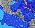 | 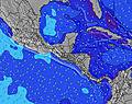 | 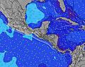 | ||||||||||||
Wave Height (m) Direction Period (s) | S 11 | SSW 10 | SSW 7 | SSW 7 | SSW 24 | SW 24 | SSW 21 | SSW 21 | SSW 20 | SSW 19 | SSW 19 | SSW 18 | SSW 17 | SSW 19 | SSW 19 | SSW 18 | SSW 18 | SSW 17 | SSW 16 |
Wave Graph | |||||||||||||||||||
86 | 36 | 55 | 76 | 217 | 141 | 404 | 302 | 232 | 480 | 325 | 399 | 475 | 630 | 465 | 534 | 637 | 522 | 452 | |
Wind (km/h) | |||||||||||||||||||
Wind State on-shore cross-onshore cross-shore cross-offshore off-shore glassy | glassy | cross-off | cross | cross-off | cross-on | cross | glassy | glassy | cross-on | cross-off | cross-on | cross-off | cross-off | cross-on | cross | glassy | glassy | cross | cross-off |
High Tide | 9:36PM2.06m | 9:58AM2.27m | 10:37PM1.96m | 10:56AM2.20m | 11:41PM1.92m | 11:56AM2.18m | 00:43AM1.95m | 12:53PM2.22m | 1:37AM2.03m | 1:44PM2.29m | 2:24AM2.14m | 2:29PM2.38m | |||||||
Low Tide | 3:37AM0.78m | 4:30PM0.74m | 4:35AM0.88m | 5:32PM0.75m | 5:37AM0.91m | 6:31PM0.72m | 6:37AM0.88m | 7:24PM0.65m | 7:31AM0.82m | 8:11PM0.55m | 8:19AM0.73m | 8:53PM0.46m | |||||||
— | 5:26 | — | — | 5:26 | — | — | 5:26 | — | — | 5:26 | — | — | 5:26 | — | — | 5:28 | — | — | |
— | — | 6:02 | — | — | 6:02 | — | — | 6:02 | — | — | 6:02 | — | — | 6:02 | — | — | 6:01 | — | |
mm | 3 | — | — | — | — | 2 | 3 | — | 2 | — | — | 3 | 1 | — | 2 | 1 | — | 4 | 13 |
Temp °C | 26 | 29 | 29 | 25 | 29 | 27 | 26 | 30 | 30 | 26 | 30 | 29 | 26 | 30 | 30 | 27 | 29 | 28 | 25 |
Feels °C | 30 | 30 | 31 | 26 | 30 | 29 | 29 | 34 | 33 | 30 | 33 | 33 | 29 | 32 | 33 | 31 | 31 | 30 | 28 |
Swell 1 Height (m) Direction Period (s) | S 11 | S 6 | SSW 7 | SSW 7 | SSW 7 | S 7 | SSW 21 | S 11 | S 8 | SSW 19 | SSW 19 | SSW 18 | SSW 17 | SSW 19 | SSW 19 | SSW 18 | SSW 18 | SSW 17 | SSW 16 |
86 | 20 | 55 | 76 | 54 | 36 | 404 | 86 | 32 | 480 | 325 | 399 | 475 | 630 | 465 | 534 | 637 | 522 | 452 | |
Swell 2 Height (m) Direction Period (s) | SW 12 | SSW 10 | SSW 13 | SSW 13 | SSW 24 | SW 7 | S 7 | SSW 21 | SSW 20 | SSW 8 | S 8 | S 10 | S 10 | S 10 | S 10 | S 9 | S 9 | S 9 | S 6 |
23 | 36 | 34 | 34 | 217 | 27 | 25 | 302 | 232 | 47 | 31 | 98 | 71 | 70 | 48 | 42 | 41 | 39 | 39 | |
Swell 3 Height (m) Direction Period (s) | SW 19 | SSW 12 | S 10 | SSW 18 | SW 8 | SW 24 | SW 8 | SW 8 | SSW 11 | SSW 11 | S 10 | SW 11 | SSW 22 | S 13 | SW 15 | S 13 | SSW 12 | SSW 12 | S 11 |
15 | 15 | 18 | 30 | 15 | 141 | 20 | 15 | 40 | 40 | 52 | 5 | 45 | 29 | 109 | 28 | 26 | 27 | 21 | |
Wind waves Height (m) Direction Period (s) | — | — | — | NW 3 | — | — | — | — | — | — | — | — | — | — | — | — | — | — | — |
— | — | — | 1 | — | — | — | — | — | — | — | — | — | — | — | — | — | — | — | |
Nearest Offshore or Glassy | |||||||||||||||||||
Distance (km) | 0 | 0 | 1 | 0 | 12 | 6 | 0 | 0 | 120 | 0 | 41 | 0 | 0 | 4 | 107 | 0 | 0 | 42 | 0 |
Best forecast wave conditions in Golfo de Nicoya | |||||||||||||||||||
Best forecast wave conditions in Costa Rica | |||||||||||||||||||
Header Global | |||||||||||||||||||
- Map Icons:
 Break
Break Live Wave Height (m)
 Live Wind Speed (km/h)
 Surf Rating (10 Max)
 Ocean Swells (m)
- Wind Speed (km/h)


FREE! Surf-Forecast.com widget for your website
The surf report / weather widget below is available to embed on third party websites free of charge and provides a summary of our Boca Barranca surf forecast. Simply grab the html code snippet that we provide and paste it into your own site. You can choose your preferred language and metric/imperial units for the surf forecast feed to suit users of your site. Click here to get the code.
Information about the Boca Barranca Surf forecast
The above surf forecast table for Boca Barranca provides essential information for determining whether the surfing conditions will be good over the next 16 days. A general guide to surfing at Boca Barranca can be found by selecting the local surf guide option on the grey menu. Our Boca Barranca surf forecast is unique since it includes wave energy (power) that defines the real feel of the surf rather than just the height or the period. If you surf the same spot (Boca Barranca) regularly then make a mental note of the wave energy from the surf forecast table each time you go. Very soon you may start to choose your surf days based on the wave energy alone combined with our forecast of favourable offshore wind conditions. Our star ratings will help here and of course you will also find the usual wave height and period predictions on our surf forecasts as well as a full break down of the swell components under our advanced users option (to reveal that, click the little Einstein character under the tide times).
Further information to help with frequently asked questions about our surf forecast for Boca Barranca may be found under the help tab on the top menu and also by moving your mouse over the question marks on the surf forecast table itself. Please always bear in mind that the forecast is for near-shore open water and local factors at each surf break influence the actual breaking wave height, such as the beach / reef profile, water depths offshore and shelter.
Boca Barranca is 5 km (3 miles) from Chacarita. If you plan a holiday in Golfo de Nicoya, look for hotels and other accommodation in Chacarita. Chacarita has rooms for a wide range of budgets as well as car hire and transport links.
 Nearest