

Surf Forecasts:

Sultans surf forecast from 19 Jul 2026:
- Best quality surf: Tuesday 21 Jul, 8AM (local time) - 2.5ft (0.7m), 14s period, SSW swell with glassy winds.
- Most powerful swell: Sunday 26 Jul, 8AM (local time) - 4ft (1.2m), 10s period, SE swell with 312 kJ wave energy.
- Next surfable swell (1★+): Tuesday 21 Jul, 8AM (local time) - 2.5ft (0.7m), 14s period with SSW swell.
Best Forecast Surf Conditions for Sultans this week:
The surf forecast for Sultans over the next 16 days: The first swell (rated 1 star or higher) is forecast to arrive on Tuesday (Jul 21) at 8AM. The primary swell is predicted to be 0.7m and 14s period with a secondary swell of 0.9m and 9s. The wind is predicted to be glassy as the swell arrives.
The most powerful waves expected at Sultans in the next 16 days are 0.9m 13s and forecast to arrive on Sunday (Jul 26) at 8AM. Winds are predicted to be cross-shore at the time the swell arrives. The largest open ocean swell (not directed at the beach) is 1.1m 9s period and expected on Sunday (Jul 19) at 8AM.
| Wave Type | Time (+05) & Date | Wave Height & Period |
|---|---|---|
| Next good surf (1 star+) | 8AM (Tue 21st Jul) | 2.5ft (0.7m) 14s |
| Best Surf | 8AM (Tue 21st Jul) | 2.5ft (0.7m) 14s |
| Most Powerful | 8AM (Sun 26th Jul) | 4ft (1.2m) 10s |
Table - best surf conditions forecast for Sultans over the next 16 days.
The Lowdown
G’day, Rusty here. Look, I’ll be straight with you – the next couple of weeks are a mixed bag at Sultans. We’ve got some clean windows, but plenty of choppy, cross-onshore junk to wade through too. The overall pattern is a slow build from small, weak swells into a serious pulse of energy later on, but the wind is the real story – it’s going to be a fight to find the clean moments.
The first few days are pretty average. Sunday the 19th is small, with a 2ft SSW swell and a 12-second period, but the wind is a cross-on or cross-shore breeze, so it’s choppy and messy. The combined energy is weak to moderate (171–241). Not much to get excited about.
Monday the 20th and Tuesday the 21st are similar – small 2ft to 3ft SSW swell, light winds but mostly cross-on or cross-shore, keeping the surface lumpy. Energy is still moderate (205–323). The one bright spot: Tuesday morning has a brief window of offshore wind from the SSW, but the swell is still tiny at 3ft.
Wednesday the 22nd and Thursday the 23rd look better. The swell drops to 4ft from the SSE, but the wind swings to a light cross-offshore from the NW and WNW. That’s the key – the surface goes clean. The period is short, 8 to 9 seconds, so it’s a bit weak and crumbly, but the energy is moderate (188–296). For a few sessions, it’ll be fun small waves with no crowd stress.
Friday the 24th is the real standout. Morning sees a 4ft SSE swell with a 9-second period, and the combined energy jumps to 410 – solid moderate. The wind is a light cross-offshore from the WNW, so the surface is clean. This is the best of the first week. Late afternoon stays clean with a 4ft SSE swell, but the wind picks up a touch.
The weekend of the 25th and 26th gets lumpy again. Saturday the 25th has a 3ft to 4ft swell, but the wind is a moderate cross-offshore, 20 km/h, which keeps it clean but bumpy. The energy is moderate to strong (409–448). Sunday the 26th has a bigger 5ft SE swell and the energy climbs to 571–623, but the wind is cross-shore, so there’s a slight chop on the face.
From Monday the 27th through to Wednesday the 29th, it’s back to poor conditions. Cross-onshore wind from the SW and WSW, 15–20 km/h, making the surface choppy and ugly. Swell sits around 4ft to 5ft from the SE and SSW, but the wind ruins it. The energy is moderate to strong (315–744). Not worth your time.
Now, here’s where it gets interesting. Thursday the 30th and Friday the 31st see a big, long-period groundswell from the SSW and SW, with periods of 16–17 seconds and even 19 seconds on the 1st of August. The combined energy jumps to 891–1259 – strong. The swell height is 4ft to 5ft, and the wind is a gentle to moderate cross-shore from the W, so the surface has a slight chop but is mostly clean. The crowd at Sultans can be often, so expect company. This is a long-period swell, so it’ll be better on a point or reef setup – and Sultans is a reef, so it’s well-suited. The waves will have more shape and energy, but the sets will be spaced out.
The real standout is the 1st of August. The swell jumps to 6ft from the SSW with a 19-second period – that’s very long period groundswell, proper energy. The combined energy is a massive 2660, which is very strong. The wind is a gentle cross-shore from the WSW, so the surface is only slightly bumpy. This is for experts only – at 6ft, it’s too big for beginners. The long period means it’ll peel nicely on the reef, but the sets will be few and far between. A proper session for the experienced crew.
The 2nd and 3rd of August fade out, with the wind turning cross-onshore again, chopping up a 4ft to 4ft SSW swell. The energy is still strong (956–1235), but the surface is messy.
So, my pick of the period: Friday the 24th of July for the clean, small-wave fun, and Saturday the 1st of August for the big, powerful groundswell (but only if you’re confident in the lineup). The water temperature is about average for the time of year, and the reef at Sultans handles the longer-period swell well.
Rusty.
Short Range ForecastLight rain (total 2mm), mostly falling on Sun night. Warm (max 28°C on Sun morning, min 27°C on Sun morning). Wind will be generally light. | Days 4-6 Weather SummaryMostly dry. Warm (max 28°C on Wed afternoon, min 27°C on Wed morning). Wind will be generally light. | ||||||||||||||||||||
Sunday 19 | Monday 20 | Tuesday 21 | Wednesday 22 | Thursday 23 | Friday 24 | Saturday 25 | |||||||||||||||
AM | PM | Night | AM | PM | Night | AM | PM | Night | AM | PM | Night | AM | PM | Night | AM | PM | Night | AM | PM | Night | |
Swell Height Map | 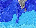 |  | 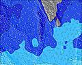 | 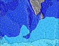 | 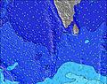 | 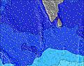 | 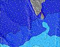 | ||||||||||||||
Wave Height (m) Direction Period (s) | SSE 8 | SSW 12 | SSW 12 | SSE 8 | SSW 16 | SSE 9 | SSW 14 | SSW 14 | SSW 13 | SSE 8 | SSE 8 | SSE 8 | SSE 8 | SSE 9 | SW 15 | SSE 9 | SSE 9 | SSE 9 | SSW 13 | SE 10 | SE 10 |
Wave Graph | |||||||||||||||||||||
99 | 147 | 113 | 113 | 223 | 154 | 183 | 220 | 151 | 137 | 143 | 173 | 143 | 141 | 171 | 227 | 193 | 146 | 227 | 273 | 273 | |
Wind (km/h) | |||||||||||||||||||||
Wind State on-shore cross-onshore cross-shore cross-offshore off-shore glassy | cross-on | cross-on | cross-on | cross-on | cross | cross-on | glassy | cross | cross | cross-off | cross-off | cross-off | cross-off | cross | cross-off | cross-off | cross-off | cross-off | cross | cross | cross-on |
High Tide | 3:59PM0.89m | 4:53AM0.74m | 4:24PM0.82m | 5:44AM0.71m | 4:46PM0.75m | 6:44AM0.67m | 5:03PM0.67m | 8:12AM0.64m | 5:03PM0.60m | 10:11AM0.65m | 11:29AM0.70m | 9:32PM0.47m | |||||||||
Low Tide | 9:41AM0.27m | 10:28PM0.15m | 10:17AM0.36m | 11:02PM0.16m | 10:53AM0.43m | 11:38PM0.19m | 11:37AM0.50m | 00:21AM0.22m | 12:52PM0.55m | 1:21AM0.25m | 2:55AM0.26m | 7:08PM0.46m | 4:24AM0.23m | ||||||||
6:01 | — | — | 6:01 | — | — | 6:01 | — | — | 6:01 | — | — | 6:01 | — | — | 6:01 | — | — | 6:01 | — | — | |
— | 6:22 | — | — | 6:22 | — | — | 6:22 | — | — | 6:22 | — | — | 6:22 | — | — | 6:22 | — | — | 6:21 | — | |
mm | — | — | 1 | 1 | — | — | — | — | — | — | — | — | — | — | — | — | — | — | — | — | — |
Temp °C | 28 | 28 | 28 | 27 | 28 | 28 | 28 | 28 | 28 | 27 | 28 | 28 | 28 | 28 | 28 | 28 | 28 | 28 | 28 | 28 | 28 |
Feels °C | 31 | 31 | 31 | 29 | 30 | 31 | 32 | 32 | 31 | 31 | 32 | 31 | 31 | 32 | 32 | 32 | 32 | 31 | 30 | 30 | 30 |
Swell 1 Height (m) Direction Period (s) | WNW 9 | WNW 10 | WNW 9 | WNW 9 | WNW 9 | SSE 9 | SSE 9 | SSE 8 | SSE 8 | SSE 8 | SSE 8 | SSE 8 | SSE 8 | SSE 9 | S 10 | SSE 9 | SSE 9 | SSE 9 | SSE 9 | SE 10 | SE 10 |
188 | 214 | 201 | 143 | 111 | 154 | 116 | 103 | 137 | 137 | 143 | 173 | 143 | 141 | 113 | 227 | 193 | 146 | 221 | 273 | 273 | |
Swell 2 Height (m) Direction Period (s) | SSE 8 | SSE 8 | SSE 8 | SSE 8 | SSE 8 | WNW 8 | WNW 8 | SSW 14 | WNW 10 | WNW 9 | WNW 8 | WNW 8 | WNW 8 | SW 15 | SE 10 | SW 13 | SW 13 | SW 13 | SSW 13 | NW 10 | NW 10 |
99 | 94 | 82 | 111 | 113 | 101 | 76 | 220 | 85 | 92 | 80 | 54 | 40 | 112 | 110 | 183 | 183 | 136 | 227 | 117 | 117 | |
Swell 3 Height (m) Direction Period (s) | SSW 12 | SSW 12 | SSW 12 | SSW 12 | SSW 16 | SSW 11 | SSW 14 | WNW 8 | SSW 13 | SSW 12 | SSW 12 | SSW 12 | SW 16 | WNW 8 | SW 15 | NW 7 | NW 7 | ESE 9 | NW 10 | SSW 15 | SSW 14 |
90 | 147 | 113 | 113 | 223 | 73 | 183 | 58 | 151 | 57 | 82 | 55 | 124 | 34 | 171 | 25 | 23 | 49 | 98 | 167 | 210 | |
Wind waves Height (m) Direction Period (s) | — | — | — | — | SW 3 | — | — | — | — | — | — | — | — | — | — | — | WNW 3 | — | W 3 | — | — |
— | — | — | — | 2 | — | — | — | — | — | — | — | — | — | — | — | 1 | — | 1 | — | — | |
Nearest Offshore or Glassy | |||||||||||||||||||||
Distance (km) | 2 | 2 | 11 | 2 | 2 | 2 | 0 | 2 | 1 | 0 | 0 | 0 | 0 | 1 | 0 | 0 | 0 | 0 | 1 | 2 | 9 |
Best forecast wave conditions in North Male Atoll | |||||||||||||||||||||
Best forecast wave conditions in Maldives | |||||||||||||||||||||
Header Global | |||||||||||||||||||||
- Map Icons:
 Break
Break Live Wave Height (m)
 Live Wind Speed (km/h)
 Surf Rating (10 Max)
 Ocean Swells (m)
- Wind Speed (km/h)


FREE! Surf-Forecast.com widget for your website
The surf report / weather widget below is available to embed on third party websites free of charge and provides a summary of our Sultans surf forecast. Simply grab the html code snippet that we provide and paste it into your own site. You can choose your preferred language and metric/imperial units for the surf forecast feed to suit users of your site. Click here to get the code.
Information about the Sultans Surf forecast
The above surf forecast table for Sultans provides essential information for determining whether the surfing conditions will be good over the next 16 days. A general guide to surfing at Sultans can be found by selecting the local surf guide option on the grey menu. Our Sultans surf forecast is unique since it includes wave energy (power) that defines the real feel of the surf rather than just the height or the period. If you surf the same spot (Sultans) regularly then make a mental note of the wave energy from the surf forecast table each time you go. Very soon you may start to choose your surf days based on the wave energy alone combined with our forecast of favourable offshore wind conditions. Our star ratings will help here and of course you will also find the usual wave height and period predictions on our surf forecasts as well as a full break down of the swell components under our advanced users option (to reveal that, click the little Einstein character under the tide times).
Further information to help with frequently asked questions about our surf forecast for Sultans may be found under the help tab on the top menu and also by moving your mouse over the question marks on the surf forecast table itself. Please always bear in mind that the forecast is for near-shore open water and local factors at each surf break influence the actual breaking wave height, such as the beach / reef profile, water depths offshore and shelter.
Are you planning a holiday in North Male Atoll? If you are looking for accommodation near Sultans, camping, hotels and holiday cottages in North Male Atoll, consider staying in Male which is 42 km (26 miles) away.
 Nearest